Category:Lake County, Oregon
Sari la navigare
Sari la căutare
Counties of Oregon: Baker · Benton · Clackamas · Clatsop · Columbia · Coos · Crook · Curry · Deschutes · Douglas · Gilliam · Grant · Harney · Hood River · Jackson · Jefferson · Josephine · Klamath · Lake · Lane · Lincoln · Linn · Malheur · Marion · Morrow · Multnomah · Polk · Sherman · Tillamook · Umatilla · Union · Wallowa · Wasco · Washington · Wheeler · Yamhill
comitat din Statele Unite ale Americii   | |||||
| Încarcă multimedia | |||||
| Este un/o | |||||
|---|---|---|---|---|---|
| Numit(ă) după | |||||
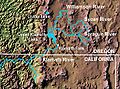
| Locul actual | Oregon, SUA | ||||
| Capitală | |||||
| Înființare |
| ||||
| Populație |
| ||||
| Suprafață |
| ||||
| Diferit(ă) de |
| ||||
| site oficial | |||||
 | |||||
Subcategorii
Această categorie conține următoarele 44 de subcategorii, dintr-un total de 44.
A
- Abert Rim (1 P, 39 F)
B
C
- Christmas Valley, Oregon (9 F)
- Cowboy Dinner Tree (4 F)
- Crack in the Ground (26 F)
D
- Derrick Cave (6 F)
- Devils Garden Volcanic Field (3 F)
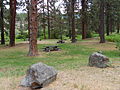
- Duncan Reservoir Campground (43 F)
F
- Fossil Lake (Oregon) (27 F)
G
- Gearhart Mountain Wilderness (6 F)
- Glass Butte (3 F)
- Goose Lake (California-Oregon) (16 F)
H
- Hager Mountain Lookout (1 F)
- Hart Lake (Oregon) (5 F)
- Hole-in-the-Ground (6 F)
L
- Lake Abert (41 F)
M
- Maps of Lake County, Oregon (13 F)
N
O
- Old Perpetual Geyser (3 F)
P
- Plush, Oregon (6 F)
S
- Scenic images of Lake County, Oregon (100 F)
- Silver Lake, Oregon (31 F)
- Spaulding Wilderness Study Area (39 F)
- Summer Lake Hot Springs (26 F)
- Summer Lake, Oregon (20 F)
V
- Valley Falls, Oregon (11 F)
Fișiere media din categoria „Lake County, Oregon”
Următoarele 148 fișiere se află în această categorie, dintr-un total de 148.
-
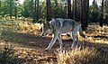 101322 gearhart wolf odfw 6.5x4 (52827376166).jpg 2.000x1.183; 2,56 MB
-
 151208 Silver Lake wolf (23996545119).jpg 1.987x1.356; 1,03 MB
-
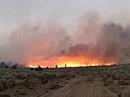
 2017-07-12 Forest fire in Lake County 01.jpg 2.592x1.944; 1,01 MB
-
 2017-07-12 Forest fire in Lake County 02.jpg 2.592x1.944; 843 KB
-
 2017-07-12 Forest fire in Lake County 03.jpg 2.592x1.944; 908 KB
-
 2017-07-12 Forest fire in Lake County 04.jpg 2.592x1.944; 999 KB
-
 2017-07-12 Forest fire in Lake County 05.jpg 2.592x1.944; 1,25 MB
-
 2017-07-12 Forest fire in Lake County 06.jpg 2.592x1.944; 956 KB
-
 2017-07-12 Forest fire in Lake County 07.jpg 2.592x1.944; 916 KB
-
 2017-07-12 Forest fire in Lake County 08.jpg 2.592x1.944; 1,07 MB
-
 2017-07-12 Forest fire in Lake County 09.jpg 2.592x1.944; 960 KB
-
 2017-07-12 Forest fire in Lake County 10.jpg 2.592x1.944; 1,01 MB
-
 2017-07-12 Lake County 01.jpg 2.592x1.944; 1.006 KB
-
 2017-07-12 Lake County 02.jpg 2.592x1.944; 842 KB
-
 2017-07-12 Lake County 03.jpg 2.592x1.944; 906 KB
-
 2017-07-12 Lake County 04.jpg 2.592x1.944; 967 KB
-
 2017-07-12 Lake County 05.jpg 2.592x1.944; 941 KB
-
 2017-07-13 Lake County along U.S. 395 02.jpg 3.648x2.736; 2,36 MB
-
 2017-07-13 Lake County along U.S. 395.jpg 3.648x2.736; 2,34 MB
-
 395 South of Burns (6024175867).jpg 3.648x2.736; 1,95 MB
-

-
-
 Adel school.jpg 4.288x2.848; 3,92 MB
-
 Adel store.jpg 4.223x2.796; 3,19 MB
-
 Alkali Lake dry sink, Lake County, Oregon.JPG 4.608x3.456; 3,79 MB
-
 Alkali Lake sign, Lake County, Oregon.JPG 4.608x3.456; 3,58 MB
-
 Alkali Lake State Airport - OR - 1994 - USGS.jpg 432x658; 100 KB
-
 Alkali lake tree.jpg 576x441; 331 KB
-

-
 Ana River habitat, Summer Lake, Oregon.jpg 500x375; 138 KB
-
 Ana River near Summer Lake, Oregon.jpg 500x375; 111 KB
-
 Antelope1.jpg 2.000x1.209; 456 KB
-
 Baled hay, ZX Ranch, near Paisley, Oregon (3387108335).jpg 4.032x2.509; 1,11 MB
-
 Bernard Daly and Oregon map with Lake County highlighted.jpg 1.328x1.024; 165 KB
-
 Booth SSC Oregon 1.jpg 3.000x4.000; 3,84 MB
-
 Booth SSC Oregon 2.jpg 3.974x2.652; 3,65 MB
-
 Cabin Lake Bird Blind.jpg 232x156; 10 KB
-
 California Quail near Lakeview, Oregon.jpg 936x613; 55 KB
-
 Canadian Geese near Lakeview, Oregon.jpg 940x623; 54 KB
-
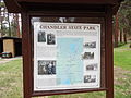 Chandler State Park Sign, Oregon.JPG 4.608x3.456; 3,59 MB
-
 Chandler State Park, Oregon.JPG 4.608x3.456; 3,66 MB
-
 China Hat Road near Lakeview Oregon (14183224171).jpg 640x480; 51 KB
-
 Cinder Butte Fire, Oregon, 5 Aug 2017.jpg 620x465; 22 KB
-
 Crack in the ground Christmas Valley (LJ) - panoramio.jpg 1.350x917; 303 KB
-
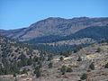 Crane Mountain, Lake County, Oregon.jpg 1.000x750; 134 KB
-
 Crane Mountain, Oregon (North Slope).jpg 1.000x750; 50 KB
-
 Crooked creek, Lakeview, Oregon Nov 2017.jpg 3.264x1.836; 1,81 MB
-
 Cultural Site in Lake County, Oregon (13992714887).jpg 2.332x1.555; 869 KB
-
 David Lawson Shirk, 1872.jpg 335x535; 45 KB
-
 David Schor at Warner Canyon.jpg 600x757; 310 KB
-
 Day 40- Lonely road (8457747757).jpg 3.872x2.592; 5,68 MB
-
 Day 47- Small pond near the pass north of Summer Lake, Oregon (8479443680).jpg 3.872x2.592; 5,65 MB
-
 DevilsGarden LeeSiebert 088054.jpg 640x430; 46 KB
-
 Drake Peak, Fremont National Forest, Oregon, 2015.jpg 4.608x3.456; 3,7 MB
-
 Drews Creek, Fremont National Forest, Oregon.jpg 640x390; 51 KB
-
 Drilling post holes (22846681993).jpg 5.472x3.648; 6,09 MB
-
 Drilling post holes (23391329071).jpg 5.472x3.648; 6,46 MB
-
 DSCN7274 dohertyslide e 300.jpg 300x211; 55 KB
-
 Five Corners, Lake County, Oregon, 2016.jpg 4.608x3.456; 3,81 MB
-
 Flight from YVR to Las Vegas - Southern Oregon - Summer Lake (15651181671).jpg 2.121x1.414; 1,95 MB
-
 Fort Rock IMG 7672 (36696399414).jpg 5.472x3.648; 8,72 MB
-
 Fort Rock IMG 7673 (37148340570).jpg 5.472x3.648; 9,67 MB
-
 Fort Rock IMG 7680 (36696421774).jpg 5.472x3.648; 8,68 MB
-
 Fort Rock IMG 7681 (36696429224).jpg 5.472x3.648; 9,13 MB
-
 Fort Rock IMG 7682 (36696436614).jpg 3.648x5.472; 8,09 MB
-
 Fort Rock IMG 7683 (36696439864).jpg 5.472x3.648; 7,46 MB
-
 Fort Rock IMG 7684 (37406033201).jpg 5.472x3.648; 6,88 MB
-
 Fort Rock IMG 7685 (37406036271).jpg 5.472x3.648; 6,88 MB
-
 Fort Rock IMG 7686 (37406039661).jpg 5.472x3.648; 7,2 MB
-
 Fort Rock IMG 7687 (37358132096).jpg 5.472x3.648; 7,84 MB
-
 Fort Rock IMG 7688 (37358134406).jpg 5.472x3.648; 7,54 MB
-
 Fort Rock IMG 7689 (37358136506).jpg 5.472x3.648; 6,57 MB
-
 Fort Rock IMG 7690 (37358139146).jpg 5.472x3.648; 7,13 MB
-
 Fort Rock IMG 7691 (37148393420).jpg 5.472x3.648; 7,23 MB
-
 Fort Rock IMG 7692 (37148396410).jpg 5.472x3.648; 17,18 MB
-
 Fort Rock IMG 7694 (37374803642).jpg 5.472x3.648; 7 MB
-
 Fort Rock IMG 7695 (37374808142).jpg 5.472x3.648; 6,97 MB
-
 Fort Rock IMG 7696 (37374812792).jpg 5.472x3.648; 6,87 MB
-
 Fort Rock IMG 7697 (37374818072).jpg 5.472x3.648; 6,6 MB
-
 Fort Rock IMG 7698 (37406088201).jpg 5.472x3.648; 7,28 MB
-
 Fort Warner, Lake County, Oregon, 1873.jpg 640x461; 54 KB
-
 Fossil Lake landscape, Lake County, Oregon.JPG 4.608x3.456; 3,71 MB
-
 Fossil Lake sign, Lake County, Oregon.JPG 4.608x3.456; 3,61 MB
-
 FourCraters LeeSiebert 088048.jpg 640x430; 48 KB
-
 Glass Buttes Obsidian, Lake County, Oregon (USFS).jpg 480x350; 41 KB
-
 Glass Buttes, Lake County, Oregon (USFS).jpg 327x209; 31 KB
-

-

-

-
 Goose Lake Valley, Oregon.PNG 425x517; 37 KB
-
 Hager Mountain and Thompson Reservoir, Oregon (1291599434).jpg 1.600x1.200; 149 KB
-
 Hager Mountain, Fremont NF, Oregon.jpg 586x389; 97 KB
-
 Historic Barn outside Paisley-Fremont Winema (24856986773).jpg 4.314x2.823; 1,95 MB
-
 Hot springs near Lakeview, Oregon (6468797403).jpg 2.000x1.577; 371 KB
-
 Icicles In Winter (127473287).jpeg 1.360x2.048; 1,16 MB
-
 J BAR RANCH BARN BY PAISLEY OREGON-FREMONT WINEMA (25483723025).jpg 4.368x2.912; 3,91 MB
-
 Lake County 4-H sheep club meeting (5857888957).jpg 2.000x1.311; 204 KB
-
 Lake County Drum and Bugle Corp, May 22, 1949 (5833620165).jpg 2.000x1.593; 601 KB
-
 Lake County Examiner, 20 December 1900.jpg 1.336x2.000; 1,42 MB
-
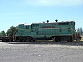 Lake County Railroad Engine, Lakeview, Oregon.JPG 4.608x3.456; 3,71 MB
-
 Lake County, Oregon ESA14973478.jpeg 1.920x1.621; 2,11 MB
-
 Lake County, Oregon ESA14973478.tiff 8.429x7.118; 205,42 MB
-
 Lakeview Disposal Cell - top looking north - NRC 2017 visit.png 872x724; 678 KB
-
 Lakeview Disposal Cell east slope NRC 2017 visit.png 896x790; 1,18 MB
-
 Lakeview Disposal Cell Marker SMK2 - NRC 2017 visit.png 846x756; 1,26 MB
-
 Lakeview Oregon uranium yellowcake map - DOE Factsheet.png 1.380x964; 2,78 MB
-
 Lofton Reservoir.JPG 4.288x3.216; 2,49 MB
-
 Lost Forest (Ponderosa Pine), Lakeview BLM, Oregon.jpg 511x680; 117 KB
-
 Lumber Area near Summer Lake, Oregon (1290735409).jpg 1.600x1.200; 144 KB
-
 Lumber Industry in Southern Oregon (1290734795).jpg 1.600x1.200; 194 KB
-
 Mars Hand Lens Imager Test Photo.jpg 1.600x1.200; 403 KB
-

-
 Near Lakeview, Oregon (3885005116).jpg 2.272x1.704; 763 KB
-
 ObsidianOregon.jpg 870x870; 89 KB
-
 Old Perpetual geyser.jpg 380x336; 23 KB
-
 Old store - New Pine Creek Oregon.jpg 3.997x2.685; 3,05 MB
-
 Oregon Outback Scenic Byway map.jpg 590x473; 123 KB
-
 Peter Creek Allotment North of Fort Rock (13992070117).jpg 3.072x2.304; 2,51 MB
-
 Plaque at Goose Lake State Park, Oregon.JPG 3.456x4.608; 7,87 MB
-
 Political orientations in Lake County, Oregon (2009).gif 388x288; 5 KB
-
 Red-tailed Hawk near Lakeview, Oregon (14156174676).jpg 4.288x2.848; 7,55 MB
-
 Reub Long (Sep 1966).jpg 3.600x2.414; 1,83 MB
-
 Sign in Squaw Ridge Lava Bed Wilderness Study Area (36165464665).jpg 4.161x2.790; 4,52 MB
-
 Small pond near the pass north of Summer Lake, Oregon I (8479439372).jpg 3.872x2.592; 4,91 MB
-
 Small pond near the pass north of Summer Lake, Oregon II (8478348823).jpg 3.872x2.592; 5,39 MB
-
 Snow Geese at Summer Lake Wildlife Area, Oregon.jpg 200x150; 28 KB
-
 Spencer Creek Area near Lakeview, Oregon (14156179136).jpg 2.448x3.264; 2,72 MB
-
 Squaw Ridge Lava Field LeeSiebert 088052.jpg 640x430; 52 KB
-
 Summer Lake Habitat Enhancement, 2009.jpg 300x217; 21 KB
-
 Summer Lake Wildlife Area sign.jpg 321x450; 30 KB
-
 Summer Lake Wildlife Refuge, Oregon (ducks & egret).jpg 450x321; 92 KB
-
 Sycan Marsh.jpg 2.454x1.563; 1,47 MB
-

-
 Thompson Reservoir, Oregon - panoramio.jpg 2.552x1.912; 1,66 MB
-
 Trees near Summer Lake, Oregon (13992696468) (cropped).jpg 2.540x2.032; 8,85 MB
-
 Trees near Summer Lake, Oregon (13992696468).jpg 4.912x7.360; 41,89 MB
-
 USA Lake, Oregon age pyramid.svg 520x600; 7 KB
-
 View from Hager Mountain, Fremont NF, Oregon.jpg 587x389; 88 KB
-
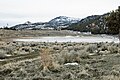
 Warner Lakes, Lake County, Oregon.jpg 775x512; 89 KB
-
 Warner Valley pano.jpg 12.140x1.872; 3,43 MB
-
 Warner Valley, Oregon.PNG 428x317; 11 KB
-
 Warner Wetlands, Lake County, Oregon, 2008.jpg 506x761; 61 KB
-
 WarnerCanyon.JPG 2.592x1.944; 1,6 MB
-
 Westside store, Lake County, Oregon, 2016.jpg 3.791x2.685; 2,12 MB
-
 William L. Tentsch, Lake County, ca. 1919 (5687465253).jpg 1.000x552; 102 KB
-
 Wpdms shdrlfi020l sprague river.jpg 300x222; 45 KB
-
 ZX Ranch Complex-Fremont Winema (25188118350).jpg 3.486x2.026; 1,61 MB
-
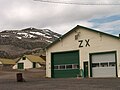 ZX Ranch, Paisley, Oregon (2849271032).jpg 2.552x1.912; 1,8 MB
.jpg)
.jpg)


.jpg)
_along_Co_Hwy_3-14_enroute_tyo_Adel_Oreg_-_%22Whitetail%22%3F%3F_(13843554135).jpg)


_(13843566023).jpg)


.jpg)


.jpg)

_-_panoramio.jpg)

.jpg)

.jpg)


.jpg)
.jpg)


.jpg)
.jpg)


.jpg)
.jpg)
.jpg)
.jpg)
.jpg)
.jpg)
.jpg)
.jpg)
.jpg)
.jpg)
.jpg)
.jpg)
.jpg)
.jpg)
.jpg)
.jpg)
.jpg)
.jpg)
.jpg)
.jpg)
.jpg)


.jpg)
.jpg)
_(lakDA0108).jpg)
_(lakDA0112).jpg)
_(lakD0078).jpg)

.jpg)

.jpg)
.jpg)
.jpeg)
.jpg)
.jpg)
.jpg)


,_Lakeview_BLM,_Oregon.jpg)
.jpg)
.jpg)

.jpg)


.jpg)

.gif)
.jpg)
.jpg)
.jpg)
.jpg)
.jpg)

.jpg)


.jpg)

.jpg)

_(cropped).jpg)
.jpg)


.jpg)

.jpg)
.jpg)
_of_September_04,_1902,_Page_1.jpg)