Category:Lake Erie
Aller à la navigation
Aller à la recherche
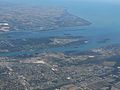
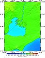
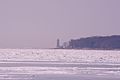
lac d'Amérique du Nord   Le lac Érié gelé, vu de Cleveland.  Lake Erie, taken from the International Space Station   Den Erieséi an déi aner Grouss Séien. | |||||
| Téléverser des médias | |||||
| Nature de l’élément | |||||
|---|---|---|---|---|---|
| Partie de | |||||
| Lieu |
| ||||
| Largeur |
| ||||
| Longueur |
| ||||
| Superficie |
| ||||
| Altitude |
| ||||
| Alimentation |
| ||||
| Émissaire du lac | |||||
| Bassin versant | |||||
| Pays souverain sur le bassin versant | |||||
 | |||||
Sous-catégories
Cette catégorie comprend 29 sous-catégories, dont les 29 ci-dessous.
*
A
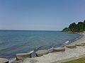
- Aerial photographs of Lake Erie (97 F)
- Algal blooms in Lake Erie (235 F)
- Lake Erie in art (19 F)
B
F
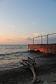
- Frozen Lake Erie (87 F)
G
H
I
L
- Lake Lundy (4 F)
M
- Lake Maumee (7 F)
N
P
R
S
- Satellite pictures of Lake Erie (63 F)
T
W
- Lake Whittlesey (5 F)
Média dans la catégorie « Lake Erie »
Cette catégorie comprend 139 fichiers, dont les 139 ci-dessous.
-
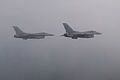
 180th FW flies training sortie 150625-F-FY748-287.jpg 7 360 × 4 912 ; 5,23 Mio
-
 180th FW trains in Michigan 150625-F-FY748-215.jpg 4 950 × 3 300 ; 2,28 Mio
-
 A night scene on Lake Erie. - DPLA - ef63701201b3d1eb10ad6a62e5f2c85b (page 1).jpg 3 296 × 2 080 ; 1,37 Mio
-
 A night scene on Lake Erie. - DPLA - ef63701201b3d1eb10ad6a62e5f2c85b (page 2).jpg 3 296 × 2 080 ; 568 kio
-
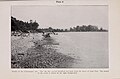 Annual report of the Regents - New York State Museum. (1908) (18745594993).jpg 4 048 × 2 667 ; 997 kio
-
 Boats on Lake Erie (27550827764).jpg 6 000 × 4 000 ; 9,46 Mio
-
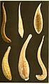
 Bulletin of the Bureau of Fisheries (1905) (14762985941) Glossiphonia complanata.jpg 1 190 × 443 ; 114 kio
-
 Bulletin of the Bureau of Fisheries (1905) (14762985941).jpg 1 668 × 2 856 ; 520 kio
-
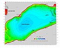 Central Erie Basin.jpg 2 374 × 1 923 ; 2,32 Mio
-
 Central portion of Lake Erie (north).jpg 1 401 × 1 800 ; 1,24 Mio
-
 Central portion of Lake Erie (south).jpg 1 420 × 1 800 ; 1,34 Mio
-
 Coast Guard rescues 3 after yacht capsizes in Lake Erie (Image 1 of 2) 160516-G-ZZ999-001.jpg 5 344 × 3 006 ; 5,87 Mio
-
 Coast Guard rescues 3 from capsized yacht in Lake Erie (Image 1 of 2) 160516-G-ZZ999-002.jpg 5 344 × 3 006 ; 5,47 Mio
-
 Coast of Lake Erie, west of Port Maitland and the mouth of the Grand River.jpg 1 572 × 645 ; 986 kio
-
 David M. Roderick Wildlife Reserve (Revisited) (1) (9062419107).jpg 5 184 × 2 950 ; 8,38 Mio
-
 David M. Roderick Wildlife Reserve (Revisited) (2) (9062428931).jpg 5 184 × 3 247 ; 10,55 Mio
-
 David M. Roderick Wildlife Reserve (Revisited) (3) (9064675480).jpg 5 184 × 3 456 ; 18,15 Mio
-
 David M. Roderick Wildlife Reserve (Revisited) (5) (9064632046).jpg 5 184 × 3 456 ; 13,94 Mio
-

-
 Detroit River Draining Into Lake Erie, Grosse Ile Township, Michigan (21515707659).jpg 4 000 × 3 000 ; 3,81 Mio
-
 Detroit River Draining Into Lake Erie, Michigan (21515756299).jpg 4 000 × 3 000 ; 7,07 Mio
-
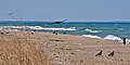
 Drift wood on the Beach - panoramio.jpg 3 264 × 2 448 ; 1,55 Mio
-
 Dsc (242795981).jpeg 2 048 × 1 365 ; 863 kio
-
 Eastern Erie Basin, Long Point.jpg 1 824 × 1 273 ; 2,03 Mio
-
 Eastern portion of Lake Erie, where the Grand River and Welland Canal empty into it..jpg 1 401 × 1 800 ; 1,36 Mio
-
 Eastern tip of Lake Erie, near Buffalo, NY, and the source of the Niagara River.jpg 1 401 × 1 800 ; 1,72 Mio
-
 En route to Isle of Lake Erie - DPLA - e5a1f0ce10bd251121d49499e83a0942 (page 1).jpg 4 190 × 2 783 ; 4,04 Mio
-
 Erie on Lake Erie 1831.jpg 1 392 × 872 ; 308 kio
-

-
 Eutrophication in Lake Erie.jpg 1 605 × 1 217 ; 710 kio
-
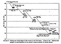
 Fig 9 Falling and rising stages of waters in Erie Basin.jpg 884 × 632 ; 72 kio
-
 Flagship Niagara - 2016.jpg 5 184 × 2 912 ; 3,38 Mio
-
 FMIB 32587 Carp Fishery of Lake Erie.jpeg 750 × 491 ; 213 kio
-
 FMIB 34008 Lifting the Pot of a Pound-Net, Lake Erie.jpeg 1 568 × 1 015 ; 179 kio
-
 FMIB 34034 Stake-Boat and Crew Off Marblehead, Lake Erie, Driving Stakes for Pound-Net.jpeg 1 582 × 1 159 ; 239 kio
-
 FMIB 34044 Type of Lake Erie Fishermen's Seine-Shed and Tarring-Box.jpeg 1 086 × 648 ; 121 kio
-
 FMIB 34057 Lake Erie Pound-Nets.jpeg 1 599 × 1 012 ; 201 kio
-
 FMIB 34065 Type of Lake Erie Fishermen's Summer House.jpeg 916 × 736 ; 89 kio
-
 FMIB 34567 Improved Pound-Net of Lake Erie.jpeg 628 × 272 ; 26 kio
-
 FMIB 36229 Approaching Storm on Lake Erie.jpeg 981 × 515 ; 91 kio
-
 FMIB 40667 Sand Beach Vegetation.jpeg 414 × 406 ; 29 kio
-
 FMIB 40674 Waves Washing the Shore.jpeg 798 × 985 ; 247 kio
-
 FMIB 45967 Fisheries of the Great Lakes.jpeg 2 023 × 1 140 ; 347 kio
-
 Frozen Lake Erie winter 2007 - panoramio.jpg 2 048 × 1 536 ; 397 kio
-
 Glacial Lake beaches of the Lake Erie Basin.JPG 871 × 631 ; 68 kio
-
 Great Lakes and St Lawrence River.jpg 2 990 × 1 263 ; 2,49 Mio
-
-
 Huntington Beach (37333804570).jpg 6 000 × 4 000 ; 14,92 Mio
-
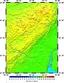
 ISS053-E-255678.jpg 5 568 × 3 712 ; 7,31 Mio
-
 Lake At Dusk (222750845).jpeg 2 048 × 3 072 ; 1,02 Mio
-
 Lake Erie - panoramio (1).jpg 2 048 × 1 536 ; 641 kio
-
 Lake Erie - panoramio (4).jpg 3 264 × 2 448 ; 1,72 Mio
-
 Lake Erie - panoramio.jpg 2 048 × 1 536 ; 734 kio
-
 Lake Erie Coastal Ohio Trail - Flock of Birds on Lake Erie - NARA - 7719866.jpg 2 277 × 3 225 ; 1,81 Mio
-
 Lake Erie food web.pdf 1 650 × 1 275, 2 pages ; 748 kio
-
 Lake Erie from Headlands Park 4-19-15 - panoramio.jpg 3 264 × 2 448 ; 4,14 Mio
-
 Lake Erie from Headlands Park April 2016 - panoramio.jpg 2 048 × 1 536 ; 587 kio
-
 Lake Erie from Lake Rd. 5-3-15 - panoramio.jpg 3 264 × 2 448 ; 4,75 Mio
-
 Lake Erie in June 2012 - panoramio.jpg 2 048 × 1 520 ; 745 kio
-
 Lake Erie Panoramic View June 2016 - panoramio.jpg 3 686 × 853 ; 1,23 Mio
-
 Lake Erie Panoramic View May 2016 - panoramio.jpg 3 763 × 836 ; 767 kio
-
 Lake Erie Shore Line - panoramio.jpg 3 264 × 2 448 ; 1,53 Mio
-
 Lake Erie Sky - panoramio.jpg 1 600 × 1 200 ; 308 kio
-
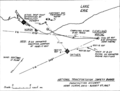 Lake Erie skydiving disaster map NTSB.png 1 185 × 896 ; 121 kio
-
 Lake Erie Sundown3 - Flickr - dbuckle2695.jpg 2 382 × 2 382 ; 2,46 Mio
-
 Lake Erie sunset - panoramio.jpg 2 118 × 1 606 ; 812 kio
-
 Lake Erie.jpg 640 × 447 ; 74 kio
-
 Lake St Clair, and the northern part of Point Pelee, NOAA.jpg 1 401 × 1 800 ; 1,32 Mio
-
 Let it snow (Satellite image).jpg 10 980 × 15 613 ; 44,38 Mio
-
 Lighthouse on lake Erie (5619132098).jpg 4 288 × 2 848 ; 5,26 Mio
-
 Line7133 (25152922307).jpg 1 800 × 900 ; 358 kio
-
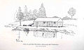
 Locksley Park Hamburg New York (49802374).jpeg 626 × 468 ; 67 kio
-
 Lonesome grave on Lake Erie.jpg 1 499 × 999 ; 546 kio
-
 Long Point spit, Presqu'ile spit, and the Lake Erie ridges between them.jpg 1 537 × 2 161 ; 607 kio
-
 LRAUV 3G ESP Research 2021.jpg 4 032 × 3 024 ; 1,47 Mio
-
 Michigan, NW of Lake Erie, NOAA.jpg 1 401 × 1 800 ; 1,58 Mio
-
 N2-201-9992.jpg 2 200 × 1 461 ; 599 kio
-
 Neah Bay Operation Coal Shovel DVIDS1089843.jpg 5 360 × 3 560 ; 1,8 Mio
-
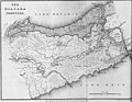 Niagara Frontier - 1818 from a collection at Brock U.jpg 3 000 × 2 333 ; 2,67 Mio
-
 Niagara map.jpg 2 205 × 1 319 ; 522 kio
-

-

-
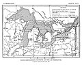 Plate 15 Glacial Lakes Algonquin and Iroquois, Lake Erie, and Champlain Sea.jpg 1 467 × 1 160 ; 421 kio
-
 Point Pelee NP Tip 2014.jpg 4 288 × 2 848 ; 11,21 Mio
-
 Point Pelee NP TurkeyVultures 2014.jpg 4 183 × 2 103 ; 4,76 Mio
-
 Polk's Indianapolis (Marion County, Ind.) city directory, 1887 (1887) (14781762552).jpg 3 600 × 2 356 ; 2,22 Mio
-
 Port Security Unit 309 responds to boat fire DVIDS1123308.jpg 1 024 × 765 ; 240 kio
-
 Presque Isle State Park - panoramio (2).jpg 3 264 × 2 402 ; 1,46 Mio
-
 PSM V32 D389 Sun spot curves and lake erie water level 1769 1838.jpg 2 186 × 1 239 ; 380 kio
-
 PSM V32 D390 Sun spots temperature rainfall and lake levels 1834 1887.jpg 2 218 × 1 377 ; 579 kio
-
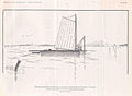
 Rhodes Bantam sailing on Presque Isle Bay in Erie, PA (1967).jpg 530 × 724 ; 144 kio
-
 River Raisin, Monroe, Michigan (21711894871).jpg 4 000 × 3 000 ; 3,52 Mio
-
 Sandusky basin.jpg 1 426 × 1 832 ; 1,67 Mio
-
 Seagulls at Lake Shore Park - panoramio.jpg 4 032 × 3 022 ; 2,64 Mio
-
 Sloop Vencedor.png 3 940 × 3 147 ; 8,29 Mio
-
 SNY0681.jpg 1 616 × 1 080 ; 471 kio
-
 Steamship General Anthony Wayne.jpg 600 × 389 ; 41 kio
-
 Stump on the shore line. - panoramio.jpg 3 264 × 2 448 ; 2,03 Mio
-
 Sunset in Conneaut, Ohio - panoramio.jpg 4 032 × 3 022 ; 1,85 Mio
-
 Sunset over the Great Lake Erie, Dunkirk, NY 02.jpg 3 264 × 2 448 ; 1,69 Mio
-
 The United Empire loyalist settlement at Long Point, Lake Erie (IA taskunitedempireloya00rich).pdf 962 × 1 429, 152 pages ; 5,84 Mio
-
 The American annual of photography (1919) (14596098248).jpg 2 752 × 2 068 ; 1,03 Mio
-
 The Beautiful Water of Lake Erie.jpg 2 304 × 4 096 ; 4,22 Mio
-
 The Gulls on Lake Erie - panoramio.jpg 3 264 × 2 448 ; 1,25 Mio
-
-

-
 The tip of Ontario's Long Point, the Long Point Escarpment and the Dunkirk Escarpment.jpg 1 686 × 1 194 ; 1,82 Mio
-
 Toledo N-PREP full scale exercise 140813-G-XA025-001.jpg 3 419 × 2 412 ; 4,87 Mio
-
 Toledo N-PREP full scale exercise 140813-G-XA025-003.jpg 4 256 × 2 576 ; 6,46 Mio
-
 Toledo N-PREP full scale exercise 140813-G-XA025-007.jpg 3 113 × 2 537 ; 4,39 Mio
-
 Toledo N-PREP full scale exercise 140813-G-XA025-012.jpg 4 275 × 3 224 ; 5,55 Mio
-
 Toledo N-PREP full scale exercise 140813-G-XA025-014.jpg 4 323 × 3 264 ; 8,04 Mio
-
 Toledo N-PREP full-scale exercise 140812-G-XA025-002.jpg 4 928 × 3 264 ; 8,6 Mio
-
 Toledo N-PREP full-scale exercise 140813-G-XA025-004.jpg 4 700 × 3 039 ; 6,67 Mio
-
 Toledo N-PREP full-scale exercise 140813-G-XA025-005.jpg 3 783 × 2 372 ; 5,36 Mio
-
 Toledo N-PREP full-scale exercise 140813-G-XA025-008.jpg 4 160 × 2 359 ; 5,85 Mio
-
 Toledo N-PREP full-scale exercise 140813-G-XA025-009.jpg 3 618 × 2 891 ; 6,6 Mio
-
 Toledo N-PREP full-scale exercise 140813-G-XA025-011.jpg 3 461 × 2 638 ; 4,68 Mio
-
 Toledo N-PREP full-scale exercise 140813-G-XA025-013.jpg 4 928 × 3 264 ; 7,69 Mio
-
 Toledo N-PREP full-scale exercise 140813-G-XA025-016.jpg 3 455 × 2 956 ; 1,7 Mio
-
 Toledo N-PREP full-scale exercise 140813-G-XA025-017.jpg 4 519 × 2 644 ; 7,36 Mio
-
 Toledo N-PREP full-scale exercise 140813-G-XA025-018.jpg 4 692 × 2 237 ; 6,69 Mio
-
 Toledo N-PREP full-scale exercise 140813-G-XA025-019.jpg 3 434 × 3 129 ; 6,11 Mio
-
 Toledo N-PREP full-scale exercise 140813-G-XA025-021.jpg 4 444 × 2 632 ; 1,7 Mio
-
 USCGC Bristol Bay Operation Fall Retrieve 121127-G-AW789-010.jpg 2 784 × 1 848 ; 2,21 Mio
-
 USCGC Bristol Bay Operation Fall Retrieve 121127-G-AW789-015.jpg 2 784 × 1 848 ; 2,2 Mio
-
 USCGC Bristol Bay Operation Fall Retrieve 121127-G-AW789-017.jpg 2 724 × 1 763 ; 3,11 Mio
-
 USCGC Bristol Bay Operation Fall Retrieve 121127-G-AW789-018.jpg 2 784 × 1 848 ; 1,98 Mio
-
 USCGC Bristol Bay removes NOAA buoy 121126-G-AW789-065.jpg 1 848 × 2 784 ; 1,61 Mio
-
 USCGC Bristol Bay removes NOAA buoy 121126-G-AW789-069.jpg 2 784 × 1 848 ; 2,02 Mio
-

-

-
 USGS topographic map, Michigan, Wyandotte quadrangle (278613), 1906, 1-62500.jpg 2 415 × 2 948 ; 1,38 Mio
-
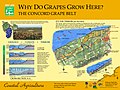
 Vineyard and Lake Erie - panoramio.jpg 4 000 × 3 000 ; 5,1 Mio
-
 Walnut Beach Panoramic View June 2016 - panoramio.jpg 16 382 × 3 882 ; 19,68 Mio
-
 Water Intake Crib, Lake Erie, Ontario, Canada (5618073712).jpg 2 761 × 1 567 ; 1,88 Mio
-
 West end of Lake Erie.jpg 1 420 × 1 800 ; 1,77 Mio
-
 Winter Beach - panoramio (1).jpg 3 264 × 2 448 ; 3,81 Mio
-
 WLA nyhistorical Keg with stand from Erie Canal celebration.jpg 2 000 × 2 288 ; 824 kio


.jpg)
.jpg)
_(18745594993).jpg)
.jpg)
_(14762985941).jpg)

.jpg)
.jpg)
_160516-G-ZZ999-001.jpg)
_160516-G-ZZ999-002.jpg)
_(1)_(9062419107).jpg)
_(2)_(9062428931).jpg)
_(3)_(9064675480).jpg)
_(5)_(9064632046).jpg)
_(cropped_to_Celeron_Island).jpg)
.jpg)
.jpg)

.jpeg)


.jpg)


.jpg)

.jpeg)
.jpg)
.jpg)


.jpg)
.jpg)
.jpg)
.jpeg)


_city_directory,_1887_(1887)_(14781762552).jpg)

.jpg)


.jpg)
.jpg)


_(14596098248).jpg)


_(14738300546).jpg)


,_1906,_1-62500_(cropped_to_Fox_and_Powder_House_Islands).jpg)
,_1906,_1-62500_(cropped_to_Stony_Island).jpg)
,_1906,_1-62500.jpg)

.jpg)

.jpg)

_(14762985941)_Glossiphonia_complanata.jpg)
_(14762985941)_(cropped).jpg)