Category:Lake Mead National Recreation Area
Hopp til navigering
Hopp til søk
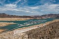
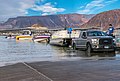
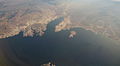
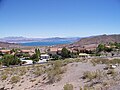
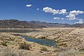
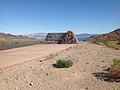
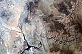
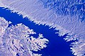
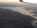
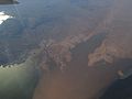
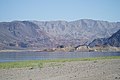
English: Lake Mead National Recreation Area — in and around Lake Mead.
- Located in the Mojave Desert - in Arizona and Nevada.
protected area in Clark County, Nevada and Mohave County, Arizona in the United States  | |||||
| Last opp mediefiler | |||||
| Forekomst av | |||||
|---|---|---|---|---|---|
| Oppkalt etter | |||||
| Plassering | |||||
| Turistkontor | |||||
| Operatør | |||||
| IUCN kategori | |||||
| Dato for etablering, fremstilling e.l. |
| ||||
| Areal |
| ||||
| Høyde over havet |
| ||||
| offisielt nettsted | |||||
 | |||||
- More public domain images of Lake Mead can be found at: Category: Lake Mead;
and the United States Geological Survey website: [1].
- More public domain images of Lake Mead can be found at: Category: Lake Mead;
Underkategorier
Denne kategorien har følgende 30 underkategorier, av totalt 30.
*
A
- Anniversary Narrows (10 filer)
B
- Bitter Spring Valley (3 filer)
- Bonelli Bay (5 filer)
C
D
E
F
- Flora of Lake Mead National Recreation Area (51 filer)
G
- Grand Wash, Lake Mead (tom)
- Grapevine Mesa (13 filer)
H
- Hiller Mountains (1 fil)
I
- Ironman 70.3 World Championship 2013 (9 filer)
L
M
- Maps of Lake Mead National Recreation Area (47 filer)
- Elwood Mead (6 filer)
P
- Pearce Ferry, Lake Mead (10 filer)
- Photographs by Lake Mead NRA Public Affairs (25 filer)
R
S
T
- Temple Bar Marina (9 filer)
- Temple Bar, Lake Mead (4 filer)
W
Sider i kategorien «Lake Mead National Recreation Area»
Denne kategorien inneholder kun følgende side.
Filer i kategorien «Lake Mead National Recreation Area»
Følgende 200 filer er i denne kategorien, av totalt 245.
(forrige side) (neste side)-

-
 Alan Bible Botanical Garden.jpg 4 032 × 3 024; 5,34 MB
-
 An elevated view of Callville Bay Marina (634ad444-b419-46d9-b4a9-5d2cb6a9b3cb).jpg 4 434 × 2 955; 3,72 MB
-
 At-lake-mead-recreation-area-nevada 25674523003 o.jpg 1 280 × 960; 676 KB
-
 Beach Area at Willow Beach (0f5a7668-c962-4515-a260-8f8d67de631f).jpg 5 173 × 3 451; 17,53 MB
-
 Beach at Cottonwood Cove (55d1b7f3-2c9f-4e09-a73a-f1e1699b5385).jpg 4 288 × 2 848; 2,3 MB
-
 Blue Point Spring (e0b7cb4f-1190-40c8-81b8-fabc56240a43).jpg 3 888 × 5 184; 7,91 MB
-
 Boaters using Hemenway Harbor launch ramp (b05ae97d-f988-49d5-bbb5-2c3b76c61314).jpg 5 323 × 3 591; 2,17 MB
-
 Bonelli Bay, Lake Mead National Recreation Area, East of Las Vegas, Nevada (15830857829).jpg 4 000 × 3 000; 3,03 MB
-
 Bonelli Bay, Lake Mead National Recreation Area, East of Las Vegas, Nevada (16014931741).jpg 4 000 × 2 190; 1,37 MB
-
 Bonelli Bay, Near Eastern Terminus of Lake Mead, Arizona (6780622383).jpg 3 960 × 2 855; 5,34 MB
-
 Boulder Beach Lake Mead NV.jpg 1 920 × 1 080; 2,13 MB
-
 Lake Mead from Boulder City Nevada.jpg 800 × 600; 116 KB
-
 Boulder City, View of Lake Mead.jpg 1 600 × 1 200; 695 KB
-
 Boulder Dam 3 Millionth Cubic Yard of Concrete (cb36737e-6f94-4352-883c-0083cc042c56).jpg 9 269 × 6 397; 12,49 MB
-
 Boulder Habor Launch Ramp (f30ae860-a896-4b07-aa92-33e1a05810a1).jpg 5 964 × 3 976; 2,69 MB
-
 Bowl of Fire in the Muddy Mountains Wilderness Area (8982443342).jpg 1 600 × 1 066; 2,38 MB
-
 Callville Bay Marina (cac8f27d-b591-49ca-896f-d028880c0830).jpg 5 184 × 3 456; 6,48 MB
-

-
 Close up of flowing water (5b3af23d-d520-43a5-a972-e1a8e892f0ac).jpg 5 184 × 3 888; 5,47 MB
-
 Close up of water flowing over rocks (95b5fb73-7d0b-42bd-a9bb-e46b2391dae9).jpg 3 888 × 5 184; 5,88 MB
-
 Comet Neowise over Lake Mead (1a4d5876-0177-40ca-8536-ea69d5ac132b).jpg 8 241 × 5 169; 8,82 MB
-
 Comet Neowise over Lake Mead (6c9acdcf-320e-47de-a8c3-1fcb5ab88b86).jpg 5 351 × 7 200; 10,94 MB
-
 Cottonwood Cove (d12ecd1c-0672-4c89-87fc-57a435e2cb91).jpg 4 288 × 2 464; 1,28 MB
-
 Cottonwood Cove Cafe (05d1281b-74d5-42b7-aa83-230ef4012ed9).jpg 1 509 × 2 000; 511 KB
-
 Cottonwood Cove Marina (32794a94-ccb0-47b6-92cb-3676d1bedf44).jpg 5 184 × 3 456; 6,93 MB
-
 Cottonwood Cove Marina (c50ab623-d4af-4b89-8083-5f51beca343c).jpg 5 184 × 3 456; 10,64 MB
-

-
 Cottonwood Cove Motel at sunrise (d57f112c-3d91-425a-a66b-b9a6ae4ff68c).jpg 3 886 × 2 559; 1,35 MB
-
 Cottonwood Cove on Lake Mohave at Lake Mead NRA.jpg 4 288 × 2 848; 9,55 MB
-
 Cottonwood Cove Swim Beach (64b9171b-8d4a-43ee-93d8-60bfee03d8b9).jpg 4 960 × 3 016; 3,24 MB
-
 Cove and trees at South Cove (b684b12d-ca0c-4a24-b08c-f864c7390056).jpg 5 184 × 3 456; 7,02 MB
-
 Cove at Echo Bay (640b344f-67d1-4607-a74b-f892189daff9).jpg 5 184 × 3 456; 5,41 MB
-
 Cove at South Cove (77817c46-1008-4def-b824-371f4216a32f).jpg 5 184 × 3 456; 7,67 MB
-

-
 Day of the Dead (8142856053) (2).jpg 4 288 × 2 848; 4,94 MB
-
 Day of the Dead (8142856825).jpg 4 288 × 2 848; 4,11 MB
-
 Day of the Dead (8142859673).jpg 4 288 × 2 848; 5,29 MB
-
 Day of the Dead (8142863745).jpg 4 288 × 2 848; 5,06 MB
-
 Death Valley, CA 2 015 - Flickr - GregTheBusker.jpg 1 600 × 1 200; 239 KB
-
 Death Valley, CA 2 018 - Flickr - GregTheBusker.jpg 1 600 × 1 200; 285 KB
-
 Desierto en California colorado y nevada.jpg 2 592 × 1 936; 2,11 MB
-
 Downstream Face of Dam (214c06cd-56a3-4893-85ad-4dadcdb036f8).jpg 1 600 × 1 280; 751 KB
-
 Dry Cracked Mud (4957b8b2-f52c-43b0-acc2-ead42cf6f03b).jpg 5 472 × 3 648; 10,94 MB
-
 Echo Bay Launch Ramp (97955924-c912-40e9-bc81-04223a6034e2).jpg 5 184 × 3 456; 9,23 MB
-
 Elevated view of Blue Point Spring (2dd6e4d0-570f-47ad-b2dc-2c1c314d46a5).jpg 5 184 × 3 888; 8,88 MB
-
 Elevated view of Blue Point Spring (40f5fc8f-c538-4847-acc3-8ade3192882e).jpg 5 184 × 3 888; 10,59 MB
-
 Elevated view of Blue Point Spring (d2ed481f-92e0-491b-a760-f9765320191c).jpg 5 184 × 3 888; 9,73 MB
-
 Elevated view of Blue Point Spring (de059f1e-d7d1-4497-b68f-423c3fb78a64).jpg 5 184 × 3 888; 9,63 MB
-

-

-
 Fishing (8982522738).jpg 4 288 × 2 848; 7,44 MB
-
 Fishing at Government Point Cove (f1866a68-2ed8-4e6d-80ba-7e09ad716160).jpg 5 184 × 3 888; 6,54 MB
-

-
 Geology of Muddy Mountains Wilderness (a7116112-1717-4fc2-b181-e385c77f3ec8).jpg 4 953 × 3 715; 9,56 MB
-
 Government Point Cove (10a6520b-4866-44d7-9c4c-e923f3d4d536).jpg 5 184 × 3 888; 9,22 MB
-
 Government Point Cove (32822b60-298e-41c6-af4b-e9ca32857933).jpg 5 184 × 3 888; 8,32 MB
-
 Government Point Cove (6fe6ff38-947a-4aaa-a677-f5d3b7923260).jpg 5 184 × 3 888; 8,03 MB
-
 Government Point Cove (f2e0c914-225d-4c3b-a846-8b0f38a31d87).jpg 5 184 × 3 888; 9,18 MB
-
 Government Point Cove (fc52a385-7dd0-43ac-9eea-6e089eb1ebf5).jpg 5 184 × 3 888; 8,08 MB
-
 Grand Canyon area of Arizona by Sally Ride EarthKAM.jpg 4 312 × 2 868; 6,62 MB
-
 Grand Canyon, United States (Unsplash 05nPKZbBArI).jpg 6 000 × 4 000; 8,75 MB
-
 Grapevine Canyon (15023728224).jpg 4 992 × 3 328; 2,69 MB
-
 Grapevine Canyon (15023733774).jpg 1 664 × 2 496; 4,31 MB
-
 Gypsum Wash 1.jpg 2 400 × 1 600; 774 KB
-
 Gypsum Wash 2.jpg 2 400 × 1 600; 719 KB
-
 Gypsum Wash from Northshore Drive 1.jpg 2 400 × 1 600; 668 KB
-
 Hamblin-Cleopatra Volc sat image.gif 828 × 1 044; 661 KB
-
 Hazy Sunrise at Lake Mead (aa59e2e8-94b1-485a-9e13-8a5f2c89463c).jpg 24 353 × 4 257; 10,62 MB
-
 Hazy Sunrise at Lake Mead (d81cf2b5-1769-499d-a1ab-841e7ed8283e).jpg 5 184 × 3 605; 5,6 MB
-
 Hemenway Harbor Fishing Pier (b9f80144-a5cc-440a-8f48-ea3809ab63eb).jpg 4 728 × 2 848; 2,91 MB
-
 Hemenway Harbor Fishing Pier (f8e380fe-5911-44ff-9a94-11e6f8857148).jpg 3 864 × 2 464; 2,34 MB
-
 HFCA 1607 NPS Employees, Search And Rescue 166 U.jpg (401954f709404697b1625c248286c05b).jpg 7 736 × 5 128; 2,66 MB
-
 Hiking (8982521338).jpg 2 496 × 1 664; 4,51 MB
-
 Homestake Nevada mine shafts.JPG 2 048 × 1 536; 708 KB
-
 Inside Lake Mead National Park (3467671705).jpg 2 784 × 1 856; 1 009 KB
-
 Inside Lake Mead National Park (3468495262).jpg 2 784 × 1 856; 748 KB
-
 Kayakin' on Colorado River.jpg 2 272 × 1 704; 1,29 MB
-
 Kayaking Near Boulder Harbor (1979f5a6-9fd5-47f9-9393-7d560e79dcc6).jpg 5 184 × 3 888; 7,23 MB
-
 Kayaking Near Boulder Harbor (5ef81582-9e7e-462a-ac19-55983c1e05db).jpg 5 184 × 3 888; 5,56 MB
-
 Kayaking through the Black Canyon Wilderness Area (8981324889).jpg 1 500 × 996; 1,68 MB
-
 Kayaks at Hoover Dam (108e42ac-37e6-4de1-a889-dcef5ecd048a).jpg 5 184 × 3 888; 7,1 MB
-
 Kayaks at Hoover Dam (2936ab0c-95d8-44a5-9667-170cbe8da469).jpg 6 000 × 4 004; 7,66 MB
-
 Kayaks at Hoover Dam (4d7d9a75-bca0-4ee2-8eef-646a049eb704).jpg 6 000 × 4 004; 8,7 MB
-
 Kayaks at Hoover Dam (90b6198e-4bb7-44c3-8ea0-b85762043fdc).jpg 5 184 × 3 888; 6,59 MB
-
 Kayaks at Hoover Dam (9221bed3-3569-4fe7-bb54-204092805164).jpg 4 238 × 3 178; 4,71 MB
-
 Kayaks at Hoover Dam (bb3e350a-a77b-4ab8-8646-436b411cef03).jpg 6 000 × 4 500; 8,15 MB
-
 Kayaks at Hoover Dam (f3e80ee7-a4b5-452a-83d4-be25adbe8fae).jpg 6 000 × 4 500; 9,68 MB
-
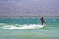 Kiteboarding at Six Mile Cove (a1b71ed4-c11e-420d-a410-f76f90646ba0).jpg 5 185 × 3 457; 6,17 MB
-
 Kiteboarding at Six Mile Cove (ba6e1809-c0d3-4492-acba-9b8c9900726b).jpg 3 424 × 5 136; 5,25 MB
-
 Kiteboarding at Six Mile Cove (ce4c94dc-d414-4c55-b7c3-a4c851a66de5).jpg 5 265 × 3 510; 13,18 MB
-
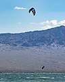 Kiteboarding on Lake Mohave (26498700-39ad-4590-bcb4-3fa469ebb344).jpg 2 904 × 3 632; 5,58 MB
-
 Kiteboarding on Lake Mohave (bd1204c1-ad43-4ed9-9ddb-a818a9f09d7d).jpg 5 068 × 3 269; 5,02 MB
-
 Lake Mead & Boulder City.jpg 4 368 × 2 912; 8,46 MB
-
 Lake Mead 0059.jpg 600 × 442; 31 KB
-
 Lake Mead 0068.jpg 600 × 408; 44 KB
-
 Lake Mead 3 July 2022.jpg 5 505 × 4 588; 4,78 MB
-
 Lake Mead 6 July 2000.jpg 5 505 × 4 588; 4,31 MB
-
 Lake Mead and Valley of Fire State Park.jpg 2 466 × 1 272; 497 KB
-
 Lake Mead behind Hoover Dam in Sugarloaf Mnt1.jpg 310 × 121; 7 KB
-
 Lake Mead Bitter Spring Valley 1.jpg 2 400 × 1 600; 784 KB
-
 Lake Mead boaters.jpg 600 × 433; 29 KB
-
 Lake Mead City, Lake Mead National Recreation Area, Nevada-Arizona (15991111166).jpg 4 000 × 3 000; 2,31 MB
-
 Lake Mead forticationhill.jpg 1 181 × 549; 148 KB
-
 Lake Mead from Gypsum Wash 1.jpg 2 000 × 1 333; 509 KB
-
 Lake Mead from Virgin Peak 1.jpg 1 800 × 1 200; 369 KB
-
 Lake Mead from Virgin Peak 2.jpg 2 400 × 1 600; 671 KB
-
 Lake Mead July 2007.jpg 3 072 × 2 304; 1,08 MB
-
 Lake Mead Las Vegas Bay 1.jpg 2 400 × 1 600; 523 KB
-
 Lake Mead Nat. Recreation Area, S of the Hoover Dam, Ariz….Pano 1 (7334038726).jpg 2 121 × 1 414; 2,91 MB
-
 Lake Mead Nat. Recreation Area, S of the Hoover Dam, Ariz….Panorama-3 (7334039824).jpg 2 121 × 1 414; 2,1 MB
-
 Lake Mead National Recreation Area - panoramio.jpg 1 600 × 407; 122 KB
-
 Lake Mead National Recreation Area Headquarters (1a372c55-219e-44ca-a3d6-fc093b495069).jpg 4 723 × 3 149; 4,05 MB
-
 Lake Mead National Recreation Area Headquarters (4a3bd409-833a-4bbf-ae74-ceca908de021).jpg 4 488 × 3 366; 3,42 MB
-
 Lake Mead National Recreation Area Headquarters (6fe07a05-0686-4bf3-af2f-b64ea8a964e9).jpg 4 962 × 3 722; 5,02 MB
-
 Lake Mead National Recreation Area Headquarters (7813a4e9-29e4-4246-b077-cc045d853955).jpg 4 687 × 3 515; 4,64 MB
-
 Lake Mead National Recreation Area Headquarters (e0872f27-dc63-4f5e-97f7-abb71be2ddfd).jpg 5 066 × 3 800; 4,74 MB
-
 Lake Mead National Recreation Area Headquarters (fb295df9-f689-445d-8798-afaaa7ce2bd9).jpg 4 675 × 3 506; 3,83 MB
-
 Lake Mead National Recreation Area January 2011.jpg 1 600 × 424; 111 KB
-
 Lake Mead National Recreation Area LAME3544.jpg 3 072 × 2 048; 4,33 MB
-
 Lake Mead National Recreation Area LAME3644.jpg 2 048 × 3 072; 3,63 MB
-
 Lake Mead National Recreation Area, East of Las Vegas, Nevada (15394631774).jpg 4 000 × 3 000; 2,1 MB
-
 Lake Mead National Recreation Area, East of Las Vegas, Nevada (15394632154).jpg 4 000 × 3 000; 2,09 MB
-
 Lake Mead National Recreation Area, East of Las Vegas, Nevada (15829476178).jpg 4 000 × 3 000; 2,72 MB
-
 Lake Mead National Recreation Area, East of Las Vegas, Nevada (15829633620).jpg 4 000 × 3 000; 2,24 MB
-
 Lake Mead National Recreation Area, East of Las Vegas, Nevada (15830855459).jpg 4 000 × 3 000; 2,04 MB
-
 Lake Mead National Recreation Area, East of Las Vegas, Nevada (15991107646).jpg 4 000 × 3 000; 2,12 MB
-
 Lake Mead National Recreation Area, East of Las Vegas, Nevada (16014931331).jpg 4 000 × 3 000; 2,17 MB
-
 Lake Mead National Recreation Area, East of Las Vegas, Nevada (16016883805).jpg 4 000 × 3 000; 2,83 MB
-
 Lake Mead National Recreation Area, Nevada-Arizona (14311740309).jpg 4 000 × 3 000; 1,93 MB
-
 Lake Mead National Recreation Area, Nevada-Arizona (14311744428).jpg 4 000 × 3 000; 2,27 MB
-
 Lake Mead National Recreation Area, Nevada-Arizona (14311892737).jpg 4 000 × 3 000; 2,41 MB
-
 Lake Mead National Recreation Area, Nevada-Arizona (14494959671).jpg 4 000 × 3 000; 2,24 MB
-
 Lake Mead National Recreation Area, Nevada-Arizona (14497042734).jpg 4 000 × 3 000; 2,42 MB
-
 Lake Mead National Recreation Area, Nevada-Arizona (14498353805).jpg 3 000 × 4 000; 2,22 MB
-
 Lake Mead National Recreation Area, Nevada-Arizona (14518456953).jpg 4 000 × 3 000; 2,15 MB
-
 Lake Mead National Recreation Area, Nevada-Arizona (18193469642).jpg 4 000 × 3 000; 2,57 MB
-
 Lake Mead National Recreation Area, Nevada-Arizona (90024839).jpg 1 280 × 960; 72 KB
-
 Lake Mead National Recreation Area, Nevada-Arizona (90024858).jpg 1 280 × 960; 75 KB
-
 Lake Mead National Recreation Area, Nevada-Arizona (90024874).jpg 1 280 × 960; 77 KB
-
 Lake Mead National Recreation Area, Nevada-Arizona (90024897).jpg 1 280 × 960; 95 KB
-
 Lake Mead Nevada1.jpg 1 024 × 454; 160 KB
-
 Lake Mead Nevada10.jpg 1 024 × 768; 309 KB
-
 Lake Mead Recreation Area - panoramio.jpg 4 224 × 2 376; 3,8 MB
-
 Lake Mead Recreation Area dyeclan.com - panoramio.jpg 3 264 × 2 448; 3,47 MB
-
 Lake Mead Recreation Park - panoramio.jpg 4 224 × 2 376; 3,11 MB
-
 Lake mead satellite image.jpg 584 × 852; 87 KB
-
 Lake Mead virgincanyon.jpg 600 × 404; 81 KB
-
 Lake Mead, Arizona.jpg 3 456 × 5 184; 2,28 MB
-
 Lake Mead, NV, October 2008, Doris Hyeoma, Photographer - panoramio.jpg 3 008 × 2 000; 2,63 MB
-
 Lake mead.jpg 634 × 639; 160 KB
-
 LAKE wa262 (27473661801).jpg 482 × 336; 60 KB
-
 LAKE wa266 (27511331646).jpg 480 × 330; 68 KB
-
 LAKE wa269 (27511331666).jpg 478 × 335; 80 KB
-
 LakeMead-redstone.jpg 3 591 × 1 568; 643 KB
-
 LakeMeadBoatFire.jpg 689 × 457; 516 KB
-

-

-
 Launch Ramp at Cottonwood Cove (0b16931c-03f5-49c7-94fa-66a04bbd05d2).jpg 5 154 × 3 865; 4,34 MB
-
 Lava Butte from east 1.jpg 2 400 × 1 600; 633 KB
-
 Lava Butte from southeast 1.jpg 2 400 × 1 600; 656 KB
-
 Lava Butte from southeast 2.jpg 2 400 × 1 600; 644 KB
-
 Marinas at Hemenway Harbor (413e4ee4-cfa9-4a15-88f1-2b3d3e03b487).jpg 5 711 × 3 192; 2,54 MB
-
 Meadandcoloradoriver.jpg 720 × 480; 147 KB
-
 Mount Wilson AZ looking northeast 1.jpg 2 400 × 1 600; 520 KB
-
 Mountains near St. Thomas at sunset (9db129c7-000e-41d6-9d6c-f15983e3445e).jpg 5 472 × 3 648; 3,19 MB
-
 Muddy Mountains Wilderness Area (8981247941).jpg 1 600 × 990; 1,91 MB
-
 Muddy Peak from Northshore Drive 1.jpg 2 400 × 1 600; 753 KB
-
 Muddy Peak from Northshore Drive 2.jpg 2 560 × 1 707; 1,05 MB
-
 Muddy River Near St. Thomas (042d8b36-f51a-4b7e-891b-320b4224c3b4).jpg 3 648 × 5 472; 8,34 MB
-
 Muddy River Near St. Thomas (11562d45-b928-405b-8e38-57f42d62ecf7).jpg 3 648 × 5 472; 11,2 MB
-
 Muddy River Near St. Thomas (5d53675a-621b-4210-a892-b3b91255a0f3).jpg 3 648 × 5 472; 7,39 MB
-
 Muddy River Near St. Thomas (8ac273ee-e7fb-46a3-92f8-ef869975b072).jpg 5 472 × 3 648; 8,76 MB
-
 Muddy River Near St. Thomas (ec4b4d64-6b91-49c4-94b5-d09c212e430a).jpg 3 648 × 5 472; 8,4 MB
-
 Natural Texture in Mud (bd3ac059-64ed-4387-bab7-0b6030c0c314).jpg 5 472 × 3 648; 7,4 MB
-
 Natural Texture in Mud (f4420e90-b757-4b6a-afdb-71398a608c3f).jpg 3 648 × 5 472; 6,81 MB
-
 Natural Texture in Sand (deac132c-eadb-42c4-91c4-a06cbd3872b5).jpg 5 472 × 3 648; 10,11 MB
-
 Northshore Drive in Bitter Spring Valley 1.jpg 2 560 × 1 707; 933 KB
-
-
 Overton Arm of Lake Mead at Beginning of Moapa Valley, Nevada (98447005).jpg 1 600 × 1 200; 843 KB
-
 Overton Arm of Lake Mead with Valley of Fire State Park, Nevada (9179230255).jpg 4 000 × 3 000; 5,69 MB
-
 Overton Arm of Lake Mead with Valley of Fire State Park, Nevada (9181445484).jpg 4 000 × 3 000; 2,27 MB
-
 Pearce Ferry & upper Lake Mead.jpg 4 368 × 2 456; 8,23 MB
-

-
 PWC on Lake Mead (7c66668e-f777-471f-a1ce-5a38cedf6e96).jpg 4 348 × 2 899; 5,09 MB
-
 PWC on Lake Mead (df6f6f62-037b-4e6f-ab59-4b969025d1ac).jpg 5 003 × 3 752; 6,15 MB
-
 PWC Rider Near Boulder Harbor (64d9c1d4-3419-4a60-80fd-5d6c76aad3ad).jpg 3 619 × 2 413; 2,94 MB
-
 PWC Rider Near Boulder Harbor (9320e25e-d7f6-4e9b-80f9-c01c6a71e8ee).jpg 4 215 × 3 161; 4,2 MB
-
 PWC Riders Near Boulder Harbor (07f1ad10-2c01-4521-aeb7-0fec50d9d2be).jpg 5 184 × 3 888; 8,84 MB
-
 PWC Riders Near Boulder Harbor (d5393025-9a22-4e6b-85d7-82970f199751).jpg 5 128 × 3 846; 6,61 MB
-
 Red Rock Outcroppings Near Lake Mead National Recreation Area, Nevada (9179229627).jpg 4 000 × 3 000; 7,35 MB
-
 Redrocks in Lake Mead Recreation Area dyeclan.com - panoramio.jpg 3 264 × 2 448; 3,81 MB
-
 Remains of large tree at St. Thomas (7c092141-f9e7-4384-b879-6c6f1b4946ea).jpg 3 648 × 5 472; 5,96 MB
-
 Ripples in Calm Water at Lake Mead (e082fea3-1c90-4bf1-b543-00d8348e5c69).jpg 3 888 × 5 184; 5,27 MB
-
-
 Rogers Spring - Hot Spring in Clark County Nevada.jpg 750 × 1 000; 399 KB
-
 Running (8982516896).jpg 4 288 × 2 848; 2,31 MB
-
 Slalom Skiing on Lake Mead (3680f638-2eb1-4d2f-af3c-7b7f271b67a5).jpg 5 184 × 3 888; 7,93 MB
-
 Slalom Skiing on Lake Mead (78253add-cfaa-4665-8fd1-ffabc161d56c).jpg 4 289 × 2 859; 4,62 MB
-
 Slalom Skiing on Lake Mead (837174ec-2b9a-49d4-9d8b-2e7a3245e296).jpg 4 446 × 3 335; 5,84 MB


.jpg)

.jpg)
.jpg)
.jpg)
.jpg)
.jpg)
.jpg)
.jpg)


.jpg)
.jpg)
.jpg)
.jpg)
.jpg)
.jpg)
.jpg)
.jpg)
.jpg)
.jpg)
.jpg)
.jpg)
.jpg)
.jpg)
.jpg)
.jpg)
.jpg)
.jpg)
.jpg)
.jpg)
_(2).jpg)
.jpg)
.jpg)
.jpg)


.jpg)
.jpg)
.jpg)
.jpg)
.jpg)
.jpg)
.jpg)
.jpg)
.jpg)
.jpg)
.jpg)
.jpg)
.jpg)
.jpg)
.jpg)
.jpg)
.jpg)
.jpg)

.jpg)
.jpg)
.jpg)


.jpg)
.jpg)
.jpg)
.jpg)
.jpg)

.jpg)
.jpg)

.jpg)
.jpg)
.jpg)
.jpg)
.jpg)
.jpg)
.jpg)
.jpg)
.jpg)
.jpg)
.jpg)
.jpg)
.jpg)
.jpg)
.jpg)


.jpg)


.jpg)
.jpg)
.jpg)
.jpg)
.jpg)
.jpg)
.jpg)
.jpg)


.jpg)
.jpg)
.jpg)
.jpg)
.jpg)
.jpg)
.jpg)
.jpg)
.jpg)
.jpg)
.jpg)
.jpg)
.jpg)
.jpg)
.jpg)
.jpg)
.jpg)
.jpg)
.jpg)
.jpg)


.jpg)
.jpg)
.jpg)


.jpg)
.jpg)
.jpg)


.jpg)


.jpg)
.jpg)


.jpg)
.jpg)
.jpg)
.jpg)
.jpg)
.jpg)
.jpg)
.jpg)

.jpg)
.jpg)
.jpg)
.jpg)

.jpg)
.jpg)
.jpg)
.jpg)
.jpg)
.jpg)
.jpg)
.jpg)

.jpg)
.jpg)


.jpg)
.jpg)
.jpg)
.jpg)
.jpg)
Kategorier:
- Parks in Arizona
- Parks in Clark County, Nevada
- National recreation areas of the United States
- Arizona Strip
- Visitor attractions in Clark County, Nevada
- Locations along U.S. Route 93 in Nevada
- National Park Service in Nevada
- 1936 establishments in the United States
- Protected areas established in 1936
- IUCN Category V
- IUCN Protected areas of the United States
- Lakes of the Mojave Desert