Category:Land Hadeln
Zur Navigation springen
Zur Suche springen
historische Landschaft in Norddeutschland | |||||
| Medium hochladen | |||||
| Is en | |||||
|---|---|---|---|---|---|
| Oort vondaag | Neddersassen, Düütschland | ||||
 | |||||
English: Land Hadeln is not only a presentday Samtgemeinde (federally structrized rural municipality), but also a historical landscape that also comprised parts of the presentday city of Cuxhaven. In the east, the small river of Aue was the border between Land Hadeln and Land Kehdingen. Cadenberge, Altkehdingen (sic !) and Oppel(e)n, parts of the presentday Samtgemeinde, were no parts of historical Land Hadeln, but of the eastern neighbour Land Kehdingen.
Deutsch: Land Hadeln ist nicht nur der Name einer heutigen Samtgemeinde. Das Land Hadeln ist eine historische Landschaft und war jahrhundertelang ein halbautonomes bäuerliches Gemeindwesen. Im Westen gehören Teile des historischen Landes Hadeln heute zur Stadt Cuxhaven, im Osten gehörten alls Oste östlich der Aue, also Cadenberge, Altkehdingen (!) und Oppeln zum östlich benachbarten Land Kehdingen.
Ünnerkategorien
De Kategorie hett disse Ünnerkategorien, vun 7 Ünnerkategorien alltohoop:
Mediendatein in de Kategorie „Land Hadeln“
De Kategorie bargt disse Datein, vun 11 Datein alltohoop:
-
 Des Herzogthums Bremen nœrdliche Aemter.jpg 2.679 × 1.839; 3,94 MB
-
 Elbkarte-lorich-hadeln.png 532 × 377; 456 KB
-
 Landleben 1943 (RaBoe).jpg 800 × 551; 274 KB
-
 Locator Land Hadeln (1560).svg 3.821 × 3.455; 374 KB
-
 Reilly 295.jpg 1.260 × 897; 472 KB
-
 Schlittschuhlaufen Wettern 1940 (RaBoe).jpg 800 × 498; 327 KB
-
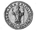
 Siegel Land Hadeln 1.jpg 302 × 239; 24 KB
-
 Siegel Land Hadeln 2.jpg 435 × 366; 57 KB
-
 Wappen Lappe.jpg 687 × 416; 126 KB
-
 Warningsacker 2020.jpg 1.778 × 889; 494 KB
-
 Warningsacker.jpg 800 × 573; 96 KB


.jpg)
.svg)

.jpg)


