Category:Liverpool
Jump to navigation
Jump to search
| Object location | | View all coordinates using: OpenStreetMap |
|---|
| Authority control |
This category is about media of any type related to Liverpool
city in Merseyside, England, United Kingdom    | |||||
| Upload media | |||||
| Instance of | |||||
|---|---|---|---|---|---|
| Location |
| ||||
| Located in or next to body of water | |||||
| Head of government |
| ||||
| Inception |
| ||||
| Population |
| ||||
| Area |
| ||||
| Elevation above sea level |
| ||||
| Different from | |||||
| official website | |||||
 | |||||

Subcategories
This category has the following 32 subcategories, out of 32 total.
!
- Valued images of Liverpool (707 F)
- Quality images of Liverpool (261 F)
?
B
C
- City Central BID (10 F)
E
F
G
H
K
L
M
- Montages of Liverpool (5 F)
N
P
- Postmarks of Liverpool (5 F)
R
S
T
V
- Videos from Liverpool (24 F)
W
- Western Approaches Tactical Unit (26 F)
- Wheelie bins in Liverpool (2 F)
Media in category "Liverpool"
The following 200 files are in this category, out of 4,321 total.
(previous page) (next page)-
 "Arklow Brook" passing the Albert Dock - geograph.org.uk - 5460115.jpg 1,024 × 768; 159 KB
-
 "Street art", Ducie St, Liverpool - geograph.org.uk - 5151265.jpg 4,608 × 3,456; 4.09 MB
-
 "Street art", Ducie St, Liverpool - geograph.org.uk - 5151274.jpg 4,608 × 3,456; 3.99 MB
-
 "Street art", Ducie St, Liverpool - geograph.org.uk - 5151276.jpg 4,608 × 3,456; 3.94 MB
-
 "The Three Graces", Liverpool Pier Head - geograph.org.uk - 4866613.jpg 2,048 × 1,536; 998 KB
-
 "This is your God. Money", Philharmonic Hall, Liverpool - geograph.org.uk - 5098579.jpg 3,648 × 3,648; 1.03 MB
-
 "We all live in a yellow submarine" - geograph.org.uk - 4228087.jpg 640 × 480; 52 KB
-
 "Welcome to Stanley Park" - geograph.org.uk - 4959243.jpg 480 × 640; 148 KB
-
 'For You', Liverpool Cathedral - geograph.org.uk - 4582890.jpg 640 × 427; 357 KB
-
-
 'White Cottage' Church Road North - geograph.org.uk - 6118308.jpg 640 × 480; 82 KB
-

-
 1-27 Egerton Street, Liverpool - geograph.org.uk - 5026577.jpg 640 × 479; 184 KB
-
 1-9 Parliament Place - geograph.org.uk - 5054858.jpg 558 × 640; 240 KB
-
 102 High St - geograph.org.uk - 6118327.jpg 640 × 480; 82 KB
-
 103 Regiment Royal Artillery TA in Liverpool - geograph.org.uk - 2897094.jpg 3,296 × 2,472; 1.93 MB
-
 142-172 Chatham Street, Liverpool - geograph.org.uk - 5053999.jpg 640 × 521; 203 KB
-
 15-37 Marmaduke Street, Liverpool - geograph.org.uk - 5054805.jpg 640 × 489; 164 KB
-
 151-155 Duke Street, Liverpool (2) - geograph.org.uk - 5028848.jpg 640 × 529; 218 KB
-
 151-163 Bedford Street South, Liverpool - geograph.org.uk - 5028899.jpg 640 × 574; 267 KB
-
 156-158 Bedford Street South, Liverpool - geograph.org.uk - 5028893.jpg 640 × 485; 218 KB
-
 17-24 Falkner Square, Liverpool - geograph.org.uk - 5027747.jpg 640 × 484; 172 KB
-
 19-21 Ash Terrace, Deysbrook Lane - geograph.org.uk - 5715329.jpg 640 × 480; 59 KB
-
 190-194 Grove Street, Liverpool - geograph.org.uk - 5023641.jpg 640 × 517; 205 KB
-
-
 1½ Milepost on the Leeds-Liverpool Canal - geograph.org.uk - 5500626.jpg 768 × 1,024; 205 KB
-
 20200119 Liverpool twilight.jpg 1,440 × 1,080; 786 KB
-
 21-33 Clarence Street, Liverpool - geograph.org.uk - 5029102.jpg 640 × 503; 179 KB
-
 29-31 Catharine Street, Liverpool - geograph.org.uk - 5026278.jpg 572 × 640; 230 KB
-
 3-23 Catharine Street, Liverpool - geograph.org.uk - 5026281.jpg 640 × 563; 252 KB
-
 3-4 Great George Place, Liverpool - geograph.org.uk - 5054832.jpg 599 × 640; 164 KB
-
 3-7 North View, Liverpool - geograph.org.uk - 5054689.jpg 640 × 514; 207 KB
-
 30 James Street - Liverpool - geograph.org.uk - 5724821.jpg 2,359 × 2,653; 2.33 MB
-
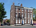
 33 Rodney Street, Liverpool - geograph.org.uk - 5056356.jpg 539 × 640; 225 KB
-
 34-50 Percy Street, Liverpool - geograph.org.uk - 5028633.jpg 640 × 482; 184 KB
-
 35-49 Rodney Street, Liverpool - geograph.org.uk - 5056371.jpg 640 × 474; 171 KB
-
 36 Upper Parliament Street, Liverpool - geograph.org.uk - 5054613.jpg 640 × 528; 171 KB
-
 38-40 Catharine Street, Liverpool - geograph.org.uk - 5026253.jpg 640 × 489; 203 KB
-
 39-43 Knight Street, Liverpool - geograph.org.uk - 5028917.jpg 474 × 640; 198 KB
-
 4-16 Canning Street, Liverpool - geograph.org.uk - 5023835.jpg 640 × 533; 169 KB
-
 40-50 Upper Parliament Street, Liverpool - geograph.org.uk - 5054619.jpg 640 × 471; 165 KB
-
 44-52 Catharine Street, Liverpool - geograph.org.uk - 5026232.jpg 640 × 491; 179 KB
-
 45-55 Canning Street, Liverpool - geograph.org.uk - 5023721.jpg 640 × 533; 177 KB
-
 47-65 Catharine Street, Liverpool - geograph.org.uk - 5026271.jpg 640 × 508; 193 KB
-
 5-17 Hope Place, Liverpool - geograph.org.uk - 5028452.jpg 640 × 487; 214 KB
-
 50 Brunswick Street and Wellington Buildings - geograph.org.uk - 5734184.jpg 2,931 × 2,336; 1.74 MB
-
 51-55 Dale Street - geograph.org.uk - 5734329.jpg 2,863 × 3,742; 2.68 MB
-
 51-75 Rodney Street, Liverpool (2) - geograph.org.uk - 5056415.jpg 640 × 550; 232 KB
-
 52 Canning Street, Liverpool - geograph.org.uk - 5026086.jpg 485 × 640; 194 KB
-
 57-69 Regent Road, Liverpool - geograph.org.uk - 5063836.jpg 640 × 595; 193 KB
-
 58-68 Upper Parliament Street, Liverpool - geograph.org.uk - 5054624.jpg 640 × 542; 206 KB
-
 59-63 Blundell Street, Liverpool - geograph.org.uk - 5063696.jpg 640 × 502; 191 KB
-
 62 Rodney Street, Liverpool - geograph.org.uk - 5055329.jpg 542 × 640; 236 KB
-
 70 Mount Pleasant, Liverpool - geograph.org.uk - 5051821.jpg 640 × 516; 147 KB
-
 70-74 Upper Parliament Street, Liverpool - geograph.org.uk - 5054630.jpg 640 × 573; 191 KB
-
 73-95 Mount Pleasant, Liverpool - geograph.org.uk - 5051791.jpg 640 × 531; 179 KB
-
 75 Duke Street, Liverpool (2) - geograph.org.uk - 5028842.jpg 492 × 640; 159 KB
-

-
 79-93 Canning Street, Liverpool - geograph.org.uk - 5023710.jpg 640 × 572; 252 KB
-

-

-

-
 A busy junction on the A5063 - geograph.org.uk - 1288616.jpg 640 × 480; 62 KB
-
 A commemorative stone - geograph.org.uk - 3251331.jpg 4,216 × 2,940; 7.46 MB
-
 A corner of the Liverpool Football Club stadium, Anfield - geograph.org.uk - 5541890.jpg 2,000 × 1,342; 607 KB
-

-
 A flock of taxis^ - geograph.org.uk - 5394191.jpg 4,128 × 2,322; 3.54 MB
-

-
 A footpath linking with the Liverpool Loopline - geograph.org.uk - 4045814.jpg 4,592 × 3,056; 7.22 MB
-
 A hidden liver bird off Chapel Street, Liverpool - geograph.org.uk - 3586671.jpg 682 × 1,024; 139 KB
-
 A less familiar part of the famous Liverpool waterfront - geograph.org.uk - 1917440.jpg 4,592 × 3,056; 3.43 MB
-
 A lightship in Canning Dock, Liverpool - geograph.org.uk - 4685597.jpg 1,600 × 1,067; 241 KB
-
 A Liver Bird - geograph.org.uk - 5724745.jpg 3,456 × 4,608; 3.23 MB
-
 A Liver Bird - geograph.org.uk - 5724811.jpg 3,072 × 4,608; 5.89 MB
-
-
 A lonely tree by the East Lancashire Road - geograph.org.uk - 3144885.jpg 3,913 × 1,748; 1.36 MB
-
 A muddy path by a Silver Birch in Childwall woods - geograph.org.uk - 4266436.jpg 3,056 × 4,235; 7.95 MB
-
 A pedestrian route continues Ingrow Road - geograph.org.uk - 4298364.jpg 4,284 × 2,850; 7.86 MB
-
 A plane taking off from Liverpool John Lennon Airport - geograph.org.uk - 3252525.jpg 4,243 × 2,522; 5.18 MB
-
 A silhouette of St George's Church, Everton - geograph.org.uk - 5457359.jpg 1,024 × 768; 191 KB
-
 A skip by the Mann Island Building - geograph.org.uk - 4241364.jpg 640 × 480; 394 KB
-
 A tangle in the Alder plantation - geograph.org.uk - 2862695.jpg 4,592 × 3,056; 6.18 MB
-
 A tributary of the River Alt - geograph.org.uk - 4254302.jpg 4,592 × 3,056; 6.3 MB
-
 A Tribute to Howard Kendall - geograph.org.uk - 4724049.jpg 3,072 × 4,608; 2.83 MB
-
 A very high tide at the Pier Head, Liverpool - geograph.org.uk - 4760510.jpg 1,007 × 705; 135 KB
-
 A view of Liverpool - geograph.org.uk - 5817834.jpg 3,094 × 2,321; 1.33 MB
-
 A view of Liverpool from across the river - geograph.org.uk - 5478713.jpg 4,162 × 2,530; 5.87 MB
-
 A view of West Derby Golf Course from Yew Tree Lane - geograph.org.uk - 4254158.jpg 2,787 × 4,187; 7.13 MB
-
 A well disguised pole - geograph.org.uk - 5600562.jpg 1,024 × 768; 402 KB
-
 A wind turbine - geograph.org.uk - 1917509.jpg 4,592 × 3,056; 3.87 MB
-

-
 A windy walk - geograph.org.uk - 4298451.jpg 2,855 × 3,868; 7.92 MB
-
 A5047, Edge Lane - geograph.org.uk - 4956155.jpg 640 × 427; 369 KB
-
 A5080 at Broad Green - geograph.org.uk - 4956162.jpg 640 × 480; 464 KB
-
 A561 - geograph.org.uk - 4937015.jpg 640 × 426; 67 KB
-
 A561 - geograph.org.uk - 4937024.jpg 640 × 426; 82 KB
-
 A561 - geograph.org.uk - 4944164.jpg 640 × 345; 48 KB
-
 A561, Speke Rd - geograph.org.uk - 4937016.jpg 640 × 426; 57 KB
-
 A561, Speke Rd - geograph.org.uk - 4937021.jpg 640 × 426; 55 KB
-
 A562 near Liverpool - geograph.org.uk - 2976470.jpg 640 × 482; 69 KB
-
 A567 towards Liverpool - geograph.org.uk - 2681625.jpg 1,600 × 1,200; 229 KB
-
 A57 at Huyton-with-Roby - geograph.org.uk - 3466142.jpg 3,482 × 2,706; 1.75 MB
-
 A59 from William Brown Street - geograph.org.uk - 5380459.jpg 640 × 427; 202 KB
-
 A59 Scotland Road in Liverpool - geograph.org.uk - 5147966.jpg 800 × 630; 113 KB
-
 A59 towards the Wallasey Tunnel - geograph.org.uk - 5147972.jpg 800 × 525; 96 KB
-
 A59 Walton Road in Liverpool - geograph.org.uk - 5147943.jpg 800 × 493; 87 KB
-
 Abandoned development, Liverpool - geograph.org.uk - 2855404.jpg 768 × 1,024; 104 KB
-
 Abercromby Square - geograph.org.uk - 5645378.jpg 1,024 × 683; 366 KB
-
 Abercromby Square, Liverpool.jpg 4,624 × 3,468; 6.05 MB
-
 Abraham, Our Father in Faith - geograph.org.uk - 5886540.jpg 600 × 800; 679 KB
-
 Abstract Liverpool street view, Old Hall Street - geograph.org.uk - 5012765.jpg 1,578 × 1,052; 479 KB
-
 Access from NCN62 to Altham Road - geograph.org.uk - 5598644.jpg 1,024 × 768; 236 KB
-
 Access road and poplar trees - geograph.org.uk - 6134928.jpg 6,000 × 4,000; 5.02 MB
-
 Access to Trans Pennine Trail Loop Line - geograph.org.uk - 6143994.jpg 800 × 518; 125 KB
-
 Accumulator Tower and Chimney - Stanley Dock - geograph.org.uk - 5724768.jpg 3,072 × 4,608; 4.31 MB
-

-
 Ackers Hall Avenue - geograph.org.uk - 4254085.jpg 4,203 × 2,902; 7.78 MB
-
 Acrefield Road, Woolton (B5171) - geograph.org.uk - 2856195.jpg 640 × 480; 107 KB
-
 Acrefield Road, Woolton - geograph.org.uk - 2473890.jpg 640 × 480; 113 KB
-
 Across Albert Dock - geograph.org.uk - 5885252.jpg 1,024 × 683; 494 KB
-
 Across Canning Dock - geograph.org.uk - 5885198.jpg 1,024 × 683; 410 KB
-
 Across the Mersey - geograph.org.uk - 4457342.jpg 640 × 481; 295 KB
-
 Across the Mersey to Liverpool - geograph.org.uk - 5609580.jpg 800 × 600; 76 KB
-
 Across William Brown Street - geograph.org.uk - 5380456.jpg 640 × 427; 215 KB
-
 Adams Vets - geograph.org.uk - 4946539.jpg 640 × 480; 80 KB
-
 Adelaide Road from Edge Lane, Liverpool - geograph.org.uk - 6210439.jpg 1,600 × 1,065; 412 KB
-
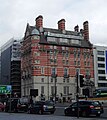
 Admiral St Police Station, Liverpool - geograph.org.uk - 1928677.jpg 3,296 × 2,472; 1.91 MB
-
 Adom House, Garston - geograph.org.uk - 5520250.jpg 1,024 × 768; 139 KB
-
 Aerial view of Liverpool waterfront 2.jpg 1,215 × 911; 309 KB
-
 Aerial view of Liverpool waterfront.jpg 683 × 911; 188 KB
-
 Africa Oye Festival Sefton Park main stage - geograph.org.uk - 4569802.jpg 4,600 × 3,446; 6.42 MB
-

-

-
 Aigburth Hall Avenue - geograph.org.uk - 2855983.jpg 640 × 480; 103 KB
-
 Aigburth Hall Avenue at South Sudley Road, Liverpool - geograph.org.uk - 6193283.jpg 1,600 × 1,065; 583 KB
-
 Aigburth Hall Avenue, Liverpool - geograph.org.uk - 6193278.jpg 1,600 × 1,065; 769 KB
-
 Aigburth Hall Avenue, Liverpool - geograph.org.uk - 6193281.jpg 1,600 × 1,065; 750 KB
-
 Aigburth Hall Avenue, Liverpool - geograph.org.uk - 6194479.jpg 1,600 × 1,065; 656 KB
-
 Aigburth Hall Avenue, Liverpool - geograph.org.uk - 6194482.jpg 1,600 × 1,065; 785 KB
-
 Aigburth railway station - geograph.org.uk - 5520548.jpg 768 × 1,024; 188 KB
-
 Aigburth Road - geograph.org.uk - 6099636.jpg 6,000 × 4,000; 4.27 MB
-
 Aigburth Road at Alwyn Street, Liverpool - geograph.org.uk - 6200247.jpg 1,600 × 1,065; 565 KB
-
 Aigburth Road at Kildonan Road, Liverpool - geograph.org.uk - 6198110.jpg 1,600 × 1,065; 430 KB
-
 Aigburth Road at Stratford Road, Liverpool - geograph.org.uk - 6194486.jpg 1,600 × 1,065; 738 KB
-
 Aigburth Road, Liverpool - geograph.org.uk - 6194483.jpg 1,600 × 1,065; 568 KB
-
 Aigburth Road, Liverpool - geograph.org.uk - 6194485.jpg 1,600 × 1,065; 749 KB
-
 Aigburth Road, Liverpool - geograph.org.uk - 6194490.jpg 1,600 × 1,065; 726 KB
-
 Aigburth Road, Liverpool - geograph.org.uk - 6194491.jpg 1,600 × 1,065; 634 KB
-
 Aigburth Road, Liverpool - geograph.org.uk - 6194502.jpg 1,600 × 1,065; 678 KB
-
 Aigburth Road, Liverpool - geograph.org.uk - 6194505.jpg 1,600 × 1,065; 652 KB
-
 Aigburth Road, Liverpool - geograph.org.uk - 6194515.jpg 1,600 × 1,065; 848 KB
-
 Aigburth Road, Liverpool - geograph.org.uk - 6194519.jpg 1,600 × 1,065; 647 KB
-
 Aigburth Road, Liverpool - geograph.org.uk - 6194524.jpg 1,600 × 1,065; 850 KB
-
 Aigburth Road, Liverpool - geograph.org.uk - 6198132.jpg 1,600 × 1,065; 547 KB
-
 Aigburth Road, Liverpool - geograph.org.uk - 6198361.jpg 1,600 × 1,065; 739 KB
-
 Aigburth Road, Liverpool - geograph.org.uk - 6199264.jpg 1,600 × 1,065; 701 KB
-
 Aigburth Road, Liverpool - geograph.org.uk - 6199267.jpg 1,600 × 1,065; 581 KB
-
 Aigburth Road, Liverpool - geograph.org.uk - 6199362.jpg 1,600 × 1,065; 467 KB
-
 Aigburth Road, Liverpool - geograph.org.uk - 6199370.jpg 1,600 × 1,065; 505 KB
-
 Aigburth Road, Liverpool - geograph.org.uk - 6199379.jpg 1,600 × 1,065; 538 KB
-
 Aigburth Road, Liverpool - geograph.org.uk - 6200244.jpg 1,600 × 1,065; 552 KB
-
 Aigburth station - geograph.org.uk - 6092506.jpg 1,600 × 1,200; 616 KB
-
 Aintree Community Fire Station - geograph.org.uk - 6143997.jpg 800 × 496; 87 KB
-

-
 Aintree Lodge - geograph.org.uk - 2262380.jpg 1,600 × 1,198; 452 KB
-
 Aintree University Hospital - geograph.org.uk - 4946548.jpg 640 × 480; 82 KB
-
 Aintree University Hospital - geograph.org.uk - 5395883.jpg 640 × 480; 63 KB
-
 Air shaft, Upper Pitt Street, Liverpool - geograph.org.uk - 5063702.jpg 546 × 640; 200 KB
-
 Air Traffic Control Tower at Oglet - geograph.org.uk - 4985495.jpg 481 × 640; 420 KB
-
 Airport light gantry in the Mersey - geograph.org.uk - 5226517.jpg 1,600 × 1,200; 865 KB
-
 Albert Dock - geograph.org.uk - 5582540.jpg 1,024 × 683; 316 KB
-
 Albert Dock - geograph.org.uk - 5645917.jpg 1,024 × 683; 375 KB
-
 Albert Dock - geograph.org.uk - 5727386.jpg 4,032 × 3,024; 2.72 MB
-
 Albert Dock - geograph.org.uk - 5727387.jpg 4,032 × 3,024; 2.6 MB
-
 Albert Dock - geograph.org.uk - 5727388.jpg 4,032 × 3,024; 2.23 MB
-
 Albert Dock - geograph.org.uk - 5727390.jpg 4,032 × 3,024; 2.56 MB
-
 Albert Dock - geograph.org.uk - 5840281.jpg 1,024 × 683; 164 KB
-
 Albert Dock - geograph.org.uk - 6092472.jpg 1,600 × 1,200; 541 KB
-
 Albert Dock - geograph.org.uk - 6150891.jpg 2,400 × 1,350; 2.05 MB
-
 Albert Dock - geograph.org.uk - 6220207.jpg 5,184 × 3,456; 4.28 MB
-
 Albert Dock - Liverpool - geograph.org.uk - 4533385.jpg 4,608 × 2,914; 3.16 MB
-
 Albert Dock - Liverpool - geograph.org.uk - 5724777.jpg 3,615 × 2,295; 2.64 MB
-
 Albert Dock - Liverpool - geograph.org.uk - 5724781.jpg 4,362 × 2,851; 3.01 MB
-
 Albert Dock - Liverpool - geograph.org.uk - 5724783.jpg 4,424 × 2,843; 4.91 MB
-
 Albert Dock and the 'Three Graces' - geograph.org.uk - 5743697.jpg 640 × 480; 67 KB
-
 Albert Dock and the Merseyside Maritime Museum - geograph.org.uk - 5727385.jpg 4,032 × 3,024; 3.17 MB
-
 Albert Dock and the Merseyside Maritime Museum - geograph.org.uk - 5727389.jpg 4,032 × 3,024; 3.07 MB
-
 Albert Dock buildings - geograph.org.uk - 4685523.jpg 1,600 × 1,067; 321 KB
-
 Albert Dock drummer - geograph.org.uk - 5088821.jpg 3,511 × 3,108; 2.61 MB
-

-

-
 Albert Dock, Liverpool - geograph.org.uk - 4433861.jpg 1,568 × 2,090; 622 KB
-
 Albert Dock, Liverpool - geograph.org.uk - 4685510.jpg 1,600 × 1,067; 292 KB
-
 Albert Dock, Liverpool - geograph.org.uk - 4866653.jpg 2,048 × 1,536; 1.11 MB
-
 Albert Dock, Liverpool - geograph.org.uk - 5058554.jpg 640 × 446; 106 KB
-
 Albert Dock, Liverpool - geograph.org.uk - 5540382.jpg 2,000 × 1,478; 723 KB
-
 Albert Dock, Liverpool - geograph.org.uk - 5540388.jpg 2,000 × 1,500; 805 KB
-
 Albert Dock, Liverpool - geograph.org.uk - 5689547.jpg 1,280 × 720; 929 KB
-
 Albert Dock, Liverpool - geograph.org.uk - 5874682.jpg 1,280 × 853; 503 KB
-
 Albert Dock, Steam on the Dock day - geograph.org.uk - 5088790.jpg 5,184 × 3,456; 5.93 MB


_-_geograph.org.uk_-_5028848.jpg)


_-_geograph.org.uk_-_5056415.jpg)


_-_geograph.org.uk_-_5028842.jpg)


_-_geograph.org.uk_-_3075396.jpg)


_-_geograph.org.uk_-_2856195.jpg)


Categories:
- Populated places established in the 13th century
- 1207 establishments
- Big cities in the United Kingdom
- Cities in Lancashire
- Districts in England by name
- Metropolitan boroughs of Merseyside
- Populated places in Merseyside by name
- Unparished areas in Merseyside
- Towns in Merseyside
- Places within historic county boundaries of Lancashire