Category:Loch Eck
Zur Navigation springen
Zur Suche springen
Čeština: Loch Eck je jezero, které se nachází v západní části Skotska, v oblasti Argyll a Bute, severně od města Dunoon. Toto podlouhlé jezero leží v oblasti Argyll Forest Park a je častým turistickým cílem. Podél jezera vede silnice A815.
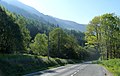
Deutsch: Loch Eck ist ein Süßwassersee in den schottischen Lowlands. Er liegt etwa 10 km nördlich von Dunoon in der Unitary Authority Argyll and Bute im Argyll Forest Park, welcher wiederum Bestandteil des Loch Lomond and the Trossachs National Park ist. Das Ostufer des Sees ist über die gut ausgebauten A815 leicht zu erreichen. Das Westufer wird hingegen nur von Waldwegen erschlossen.
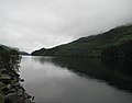
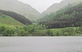
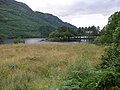
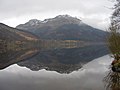
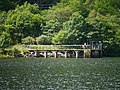
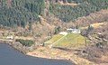
English: Loch Eck ( Gaelic: Loch Eich) is a loch located on the Cowal peninsula, north of Dunoon, Argyll and Bute, Scotland. It is seven miles long. Apart from Loch Lomond, it is the only naturally occurring habitat of the powan.
Français : Le loch Eck est un loch situé au nord de Dunoon, dans la région d'Argyll and Bute en Écosse. Il s'étend sur une longueur de 11 km de long. Mis à part le Loch Lomond, c'est le seul habitat naturel du Coregonus clupeoides.
Norsk nynorsk: Loch Eck er ein innsjø nord for Dunoon i Argyll and Bute i Skottland. Han er 11 km lang. Bortsett frå Loch Lomond er han det einaste naturlege habitatet for haustsik.
Süßwassersee in Schottland  | |||||
| Medium hochladen | |||||
| Ist ein(e) | |||||
|---|---|---|---|---|---|
| Liegt in Schutzgebiet | |||||
| Ort | Argyll and Bute, Schottland | ||||
| Breite |
| ||||
| Länge |
| ||||
| Zufluss |
| ||||
| Abfluss |
| ||||
 | |||||
Unterkategorien
Es werden 2 von insgesamt 2 Unterkategorien in dieser Kategorie angezeigt:
In Klammern die Anzahl der enthaltenen Kategorien (K), Seiten (S), Dateien (D)
C
- Coylet Inn (4 D)
W
- Whistlefield Inn (4 D)
Medien in der Kategorie „Loch Eck“
Folgende 89 Dateien sind in dieser Kategorie, von 89 insgesamt.
-
 2008-08 - Plum Island and Cowal Games 409.jpg 1.517 × 1.185; 337 KB
-
 Across Loch Eck to Bernice - geograph.org.uk - 2413366.jpg 640 × 409; 57 KB
-
 Across Loch Eck to Bernice - geograph.org.uk - 2967082.jpg 1.200 × 1.600; 413 KB
-
 Autumn Pine by Loch Eck (1142428466).jpg 1.535 × 959; 936 KB
-
 Beinn Bheag - geograph.org.uk - 1084121.jpg 640 × 480; 72 KB
-
 Beinn Bheag - geograph.org.uk - 1233944.jpg 640 × 359; 77 KB
-
 Bernice Glen - geograph.org.uk - 33609.jpg 640 × 480; 113 KB
-
 Boats at the side of Loch Eck - geograph.org.uk - 762732.jpg 640 × 480; 116 KB
-
 Burn flowing into Loch Eck - geograph.org.uk - 1028229.jpg 640 × 480; 183 KB
-
 Caravan Park from Creag Liath - geograph.org.uk - 1201970.jpg 640 × 480; 77 KB
-
 Caravan Park, Coylet - geograph.org.uk - 420003.jpg 640 × 490; 83 KB
-
 Crag on Beinn Bheag - geograph.org.uk - 1235329.jpg 640 × 359; 92 KB
-
 Daybreak on Loch Eck at the Coylet Inn - geograph.org.uk - 2847405.jpg 1.600 × 1.200; 454 KB
-
 Dornoch Bay Loch Eck - geograph.org.uk - 1412340.jpg 640 × 480; 87 KB
-
 East side of Beinn Bheag - geograph.org.uk - 1235313.jpg 640 × 480; 116 KB
-

-
 Flippin' Eck^ - geograph.org.uk - 3053416.jpg 3.448 × 4.592; 3,88 MB
-
 Forest track above Loch Eck - geograph.org.uk - 1885268.jpg 3.648 × 2.736; 2,32 MB
-
 Hillside below Tom Soilleir - geograph.org.uk - 1235295.jpg 451 × 640; 78 KB
-
 Idyllic beach on Loch Eck - geograph.org.uk - 2531925.jpg 900 × 1.200; 296 KB
-
 Island - geograph.org.uk - 1233963.jpg 640 × 390; 65 KB
-
 Loch Eck (1330520328).jpg 1.024 × 768; 504 KB
-
 Loch Eck (1330521286).jpg 1.024 × 768; 351 KB
-
 Loch Eck (1330522222).jpg 1.024 × 768; 370 KB
-
 Loch Eck - geograph.org.uk - 1040615.jpg 640 × 359; 99 KB
-
 Loch Eck - geograph.org.uk - 1040643.jpg 640 × 480; 89 KB
-
 Loch Eck - geograph.org.uk - 1168829.jpg 640 × 480; 46 KB
-
 Loch Eck - geograph.org.uk - 125316.jpg 640 × 480; 89 KB
-
 Loch Eck - geograph.org.uk - 1429052.jpg 640 × 428; 104 KB
-
 Loch Eck - geograph.org.uk - 85377.jpg 640 × 480; 89 KB
-
 Loch Eck - geograph.org.uk - 994390.jpg 640 × 480; 69 KB
-
 Loch Eck 1.jpg 750 × 465; 142 KB
-
 Loch eck bathymetry.png 1.920 × 905; 1,1 MB
-
 Loch Eck by the Coylet Hotel - geograph.org.uk - 4069499.jpg 640 × 480; 110 KB
-
 Loch Eck Caravan Site - geograph.org.uk - 2415431.jpg 640 × 480; 96 KB
-
 Loch Eck Caravan Site - geograph.org.uk - 4108799.jpg 640 × 481; 75 KB
-
 Loch Eck from A815 - geograph.org.uk - 2413344.jpg 640 × 468; 79 KB
-
 Loch Eck from Cambusdhu - geograph.org.uk - 1201961.jpg 640 × 480; 31 KB
-
 Loch Eck from Caravan site - geograph.org.uk - 2413154.jpg 640 × 458; 62 KB
-
 Loch Eck from Coylet Inn - geograph.org.uk - 2413145.jpg 640 × 443; 69 KB
-

-
 Loch Eck from south of Coylet inn - geograph.org.uk - 2413140.jpg 640 × 480; 58 KB
-
 Loch Eck from the A815 - geograph.org.uk - 2967089.jpg 1.600 × 1.110; 331 KB
-
 Loch Eck from the caravan park at Coylet Hotel - geograph.org.uk - 2160701.jpg 3.648 × 2.736; 2,34 MB
-

-
 Loch Eck Water Treatment Works Intake - geograph.org.uk - 3053325.jpg 4.592 × 3.448; 4 MB
-
 Loch Eck, Argyll ^ Bute - geograph.org.uk - 2032599.jpg 1.024 × 768; 251 KB
-

-

-

-

-

-

-
 Loch Eck, Bernice Farm - geograph.org.uk - 159895.jpg 640 × 480; 149 KB
-
 Loch Eck. water treatment plant - geograph.org.uk - 85376.jpg 640 × 480; 147 KB
-
 Loch Eckside Near The Coylet Inn - geograph.org.uk - 3053336.jpg 3.448 × 4.592; 3,92 MB
-
 LochEck, Island Farm - geograph.org.uk - 85382.jpg 640 × 480; 113 KB
-
 Lock Eck (1329630463).jpg 1.024 × 768; 500 KB
-
 Lock Eck (1330524546).jpg 1.024 × 768; 322 KB
-
 Lock Eck - geograph.org.uk - 1007930.jpg 640 × 423; 102 KB
-
 Lock Eck and woodland - geograph.org.uk - 1029447.jpg 400 × 566; 318 KB
-
 Looking across Loch Eck to Bernice - geograph.org.uk - 1200762.jpg 640 × 480; 72 KB
-

-
 Looking along Loch Eck - geograph.org.uk - 762730.jpg 640 × 480; 99 KB
-
 Looking ashore from Loch Eck - geograph.org.uk - 762735.jpg 640 × 480; 93 KB
-
 Looking up Loch Eck - geograph.org.uk - 2531918.jpg 1.500 × 1.075; 390 KB
-
 Moorland, looking North to Loch Eck - geograph.org.uk - 413655.jpg 640 × 480; 96 KB
-
 North Shore of Loch Eck - geograph.org.uk - 1343439.jpg 480 × 640; 115 KB
-
 Ordnance Survey One-Inch Sheet 65 Dunoon & Loch Fyne, Published 1927.jpg 12.153 × 9.383; 11,77 MB
-
 Paper caves - geograph.org.uk - 1195056.jpg 640 × 441; 82 KB
-
 Rubha Croise - geograph.org.uk - 1235270.jpg 640 × 388; 85 KB
-
 Slipway in to Loch Eck - geograph.org.uk - 762737.jpg 640 × 480; 90 KB
-
 Sparkling Loch Eck - geograph.org.uk - 994392.jpg 640 × 480; 69 KB
-
 Spring colour on the A815 by Loch Eck - geograph.org.uk - 2967091.jpg 1.600 × 1.011; 400 KB
-

-
 The peloton (203240711).jpg 1.024 × 768; 462 KB
-
 Top of Loch Eck - geograph.org.uk - 85384.jpg 640 × 480; 134 KB
-

-

-
 View from Coylet Inn Loch Eck Cowal - geograph.org.uk - 10148.jpg 427 × 640; 83 KB
-
 Whistlefield - geograph.org.uk - 1233955.jpg 640 × 386; 85 KB
-
 Whistlefields Inn, Loch Eck - geograph.org.uk - 29995.jpg 640 × 480; 96 KB
-
 Loch Eck - geograph.org.uk - 419943.jpg 640 × 480; 55 KB
-
 Loch Eck - geograph.org.uk - 624337.jpg 640 × 480; 59 KB
-
 Loch Eck - geograph.org.uk - 680152.jpg 640 × 480; 91 KB
-

-
 Loch Eck, Allt na Blathaich Houses - geograph.org.uk - 85379.jpg 640 × 480; 101 KB
-

-
 Loch Eck, Jubilee Point - geograph.org.uk - 85381.jpg 640 × 480; 96 KB


.jpg)


.jpg)
.jpg)
.jpg)


.jpg)
.jpg)


.jpg)


