Category:Loch Mhòr
Jump to navigation
Jump to search
reservoir in Highland, Scotland, UK  | |||||
| Upload media | |||||
| Instance of | |||||
|---|---|---|---|---|---|
| Location | Highland, Scottish Highlands, Scotland | ||||
| Inflows |
| ||||
| Outflows |
| ||||
| Dam |
| ||||
 | |||||
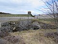
Loch Mhòr is a loch in the traditional county of Inverness-shire in the Scottish Highlands. It occupies much of the wide floor of Stratherrick which runs roughly parallel to Loch Ness around 3mi / 5km to its southeast. A generally shallow body of water, Loch Mhòr achieves a depth in excess of 20m towards its southern end. Loch Mhòr was originally two separate lochs, Loch Garth in the southwest and Loch Farraline in the northeast, but these were joined when the water level was raised, so it could be used as a reservoir for the hydro-electric scheme and aluminium smelter at Foyers.
Media in category "Loch Mhòr"
The following 31 files are in this category, out of 31 total.
-
 Closed for Maintenance - geograph.org.uk - 810100.jpg 640 × 480; 54 KB
-
 Corriegarth Estate boundary fence - geograph.org.uk - 809638.jpg 640 × 480; 90 KB
-
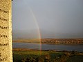
 Double Rainbow on Loch Mhor - geograph.org.uk - 1028199.jpg 640 × 480; 34 KB
-
-
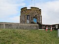
 Intake, Loch Mhor - geograph.org.uk - 621433.jpg 640 × 480; 80 KB
-
 Loch Farraline - Mhor across to farraline Estate - geograph.org.uk - 1745012.jpg 3,264 × 2,448; 3.47 MB
-
 Loch Garth - geograph.org.uk - 809616.jpg 640 × 480; 70 KB
-
 Loch Mhor - geograph.org.uk - 284725.jpg 640 × 480; 98 KB
-
 Loch Mhor 1213.jpg 4,608 × 3,456; 5.43 MB
-
 Loch Mhor 1215.jpg 4,608 × 3,456; 4.3 MB
-
 Loch Mhor 1218.jpg 4,608 × 3,456; 5.62 MB
-
 Loch Mhor 1219.jpg 4,608 × 3,456; 4.08 MB
-
 Loch Mhor 1220.jpg 4,608 × 3,456; 5.48 MB
-
 Loch Mhor 1221.jpg 4,608 × 3,456; 6.22 MB
-
 Loch Mhor 1223.jpg 4,608 × 3,456; 5.44 MB
-
 Loch Mhor 1228.jpg 4,608 × 3,456; 4.44 MB
-
 Loch Mhor 1229.jpg 4,608 × 3,456; 4.49 MB
-
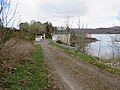
 Loch Mhor Dam - geograph.org.uk - 621432.jpg 640 × 480; 107 KB
-
 Loch Mhor Dam - geograph.org.uk - 817358.jpg 640 × 480; 66 KB
-
 Loch Mhor from Farraline - geograph.org.uk - 568818.jpg 640 × 480; 51 KB
-
 Loch Mhor Near Farraline - geograph.org.uk - 1009003.jpg 640 × 480; 68 KB
-
 Loch Mhor no more - geograph.org.uk - 193094.jpg 640 × 424; 57 KB
-
 Loch Mhòr.jpg 4,032 × 2,692; 2.52 MB
-

-

-
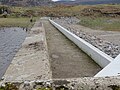
 Road to Aberchalder and channel - geograph.org.uk - 798967.jpg 640 × 480; 52 KB
-
 Shoreline of Loch Mhor - geograph.org.uk - 801306.jpg 480 × 640; 83 KB
-
 View of Farraline from Errogie - geograph.org.uk - 798892.jpg 640 × 480; 74 KB
-
 Loch Farraline - Mhor - geograph.org.uk - 192543.jpg 640 × 424; 71 KB
-
 Loch Garth - geograph.org.uk - 192284.jpg 640 × 424; 48 KB
-
 Loch Mor Stratherrick - geograph.org.uk - 370769.jpg 640 × 362; 90 KB


