Category:Maps of Haifa
Zur Navigation springen
Zur Suche springen
Wikimedia-Kategorie | |||||
| Medium hochladen | |||||
| Ist ein(e) | |||||
|---|---|---|---|---|---|
| Kategorie kombiniert die Themen | |||||
| Haifa | |||||
Großstadt in Israel     | |||||
| Ist ein(e) | |||||
| Ist Teil von | |||||
| Ort | Haifa Subdistrict, Bezirk Haifa, Israel | ||||
| Leiter der Regierung oder Verwaltung |
| ||||
| Datum der Gründung, Erstellung, Entstehung, Erbauung |
| ||||
| Schlüsselereignis |
| ||||
| Einwohnerzahl |
| ||||
| Fläche |
| ||||
| offizielle Website | |||||
 | |||||
Unterkategorien
Es werden 4 von insgesamt 4 Unterkategorien in dieser Kategorie angezeigt:
In Klammern die Anzahl der enthaltenen Kategorien (K), Seiten (S), Dateien (D)
P
Medien in der Kategorie „Maps of Haifa“
Folgende 51 Dateien sind in dieser Kategorie, von 51 insgesamt.
-
 1415-24-Haifa-1942.jpg 10.135 × 8.288; 13,32 MB
-
 HaifaAerodrome.jpg 791 × 1.174; 316 KB
-
 Mapka Centr Bahai.jpg 766 × 414; 79 KB
-
 Bat Galim 1932.jpg 2.961 × 3.136; 3,16 MB
-
 Carmel Map - December 5, 2010.png 1.565 × 2.228; 1,13 MB
-
 CarmelTunneksBig.png 2.984 × 955; 2,01 MB
-
 CBD.png 1.906 × 1.840; 653 KB
-
 Central Haifa.png 4.110 × 3.827; 2,67 MB
-
 German Colony.png 1.404 × 1.426; 591 KB
-
 Hadar HaCarmel Center map.svg 458 × 716; 491 KB
-
 Hadar HaCarmel map.svg 831 × 1.108; 1,2 MB
-
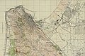 Haifa 1942.jpg 4.406 × 2.931; 5,59 MB
-
 Haifa after mapping party.png 739 × 734; 208 KB
-
 Haifa auditorium floor sketch-he.svg 830 × 440; 137 KB
-
 Haifa auditorium floor sketch.svg 830 × 440; 93 KB
-
 Haifa before mapping party.png 712 × 529; 192 KB
-
 Haifa city street map plan Israel Level 12 English.svg 820 × 812; 1,33 MB
-
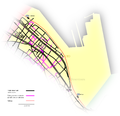
 Haifa districts map.jpg 874 × 657; 187 KB
-
 Haifa in 1922.svg 1.657 × 1.289; 143 KB
-
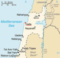 Haifa Israel Map.png 285 × 275; 15 KB
-
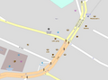
 Haifa Jerusalem st.svg 730 × 753; 749 KB
-
 Haifa location map.svg 483 × 394; 52 KB
-
 Haifa map.png 1.000 × 2.681; 33 KB
-
 Haifa metropolis.gif 2.048 × 2.649; 115 KB
-
 Haifa OSM.svg 604 × 493; 7,06 MB
-
 Haifa quarters map - Russian.svg 699 × 502; 324 KB
-
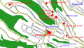
 Haifa-trail-map2.jpg 942 × 1.021; 358 KB
-
 HaifaCentrale EN.svg 1.160 × 651; 698 KB
-
 HaifaCentrale-HE.svg 1.160 × 651; 925 KB
-
 HaifaCentrale.svg 1.160 × 651; 884 KB
-
 Halisa.png 1.902 × 1.706; 844 KB
-
 Haïfa-Israël.jpg 320 × 595; 59 KB
-
 Historical map series for the area of Haifa (1870s).jpg 1.220 × 875; 366 KB
-
 Historical map series for the area of Haifa (1940s with modern overlay).jpg 1.220 × 875; 641 KB
-
 Historical map series for the area of Haifa (1940s).jpg 1.220 × 875; 530 KB
-
 Historical map series for the area of Haifa (modern).jpg 1.220 × 875; 332 KB
-
 Localització de Haifa.svg 300 × 200; 46 KB
-
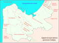
 Location haifa.png 750 × 970; 106 KB
-
 Map of haifa-cs.png 272 × 182; 63 KB
-
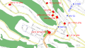
 Map-carmel.png 1.565 × 2.228; 987 KB
-
 Mosaic Sail Tower.jpg 1.024 × 769; 404 KB
-
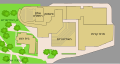
 MuzeonMapat Ezor.jpg 1.122 × 794; 82 KB
-
 Oily Beach.png 2.151 × 3.186; 937 KB
-
 OSM Carmelit.png 1.026 × 1.133; 1,32 MB
-
 Printable map haifa israel g view level 12 eng svg.svg 750 × 766; 1,34 MB
-
 Stela maris mapa.png 932 × 962; 170 KB
-
 Tell Abu Hawam 008.png 2.096 × 1.376; 728 KB
-
 Tell Abu Hawam 011.jpg 2.157 × 1.824; 1,28 MB
-
 Wadi Nisnas.png 897 × 864; 333 KB
-
 Wadi Salib.png 1.124 × 1.382; 512 KB
-
 רובעי רמזור חיפה.png 1.293 × 889; 780 KB


.jpg)
.jpg)
.jpg)
.jpg)


