Category:Maps of Pakistan
Hopp til navigering
Hopp til søk
Land i Asia: Afghanistan · Armenia‡ · Aserbajdsjan‡ · Bahrain · Bangladesh · Bhutan · Brunei Darussalam · Egypt‡ · Filippinene · De forente arabiske emirater · Georgia‡ · India · Indonesia‡ · Irak · Iran · Israel · Japan · Jemen · Jordan · Kambodsja · Kasakhstan‡ · Kina · Kirgisistan · Kuwait · Kypros‡ · Laos · Libanon · Malaysia · Maldivene · Mongolia · Myanmar · Nepal · Nord-Korea · Oman · Pakistan · Qatar · Russland‡ · Saudi-Arabia · Singapore · Sri Lanka · Syria · Sør-Korea · Tadsjikistan · Thailand · Turkmenistan · Tyrkia‡ · Usbekistan · Vietnam · Øst-Timor
Begrenset anerkjennelse: Abkhasia‡ · Nord-Kypros‡ · Palestina · Sør-Ossetia‡ · Taiwan – Andre territorier: Akrotiri og Dhekelia‡ · Det britiske territoriet i Indiahavet · Hongkong · Macao
‡: delvis i Asia
Begrenset anerkjennelse: Abkhasia‡ · Nord-Kypros‡ · Palestina · Sør-Ossetia‡ · Taiwan – Andre territorier: Akrotiri og Dhekelia‡ · Det britiske territoriet i Indiahavet · Hongkong · Macao
‡: delvis i Asia
Use the appropriate category for maps showing all or a large part of Pakistan. See subcategories for smaller areas:
| If the map shows | Category to use |
|---|---|
| Pakistan on a recently created map | Category:Maps of Pakistan or its subcategories |
| Pakistan on a map created more than 70 years ago | Category:Old maps of Pakistan or its subcategories |
| the history of Pakistan on a recently created map | Category:Maps of the history of Pakistan or its subcategories |
| the history of Pakistan on a map created more than 70 years ago | Category:Old maps of the history of Pakistan or its subcategories |
- See also maps needing categories in Category:Unidentified maps
English: Maps of Pakistan
اردو: پاکستان کے نقشے
Wikimedia-kategori | |||||
| Last opp mediefiler | |||||
| Forekomst av | |||||
|---|---|---|---|---|---|
| Kategorien kombinerer emnene | |||||
 | |||||

Underkategorier
Denne kategorien har følgende 42 underkategorier, av totalt 42.
*
- OpenStreetMap maps of Pakistan (26 filer)
A
B
C
- CIA World Factbook maps of Pakistan (19 filer)
D
E
- ECHO Daily Maps of Pakistan (29 filer)
- Maps of education in Pakistan (3 filer)
F
G
H
- Maps of the Hindu Kush (20 filer)
K
- Maps of the Karakoram Highway (6 filer)
- Khyber Pass maps (12 filer)
L
- Lulusar-Dudipatsar National Park map (1 fil)
M
- Maps of glaciers of Pakistan (3 filer)
- Maps of Pakistan on stamps (3 filer)
- Maps of the Indus River (Pakistan) (1 fil)
- Military maps of Pakistan (1 fil)
O
P
R
S
- Sports maps of Pakistan (1 fil)
T
U
- Pakistan maps by U.S. Army Map Service (77 filer)
W
Sider i kategorien «Maps of Pakistan»
Under vises 2 av totalt 2 sider som befinner seg i denne kategorien.
Filer i kategorien «Maps of Pakistan»
Følgende 200 filer er i denne kategorien, av totalt 214.
(forrige side) (neste side)-
 "FIGHTING CLANS" of the British Indian Empire, 1918 — North East.jpg 1 996 × 1 430; 767 KB
-
 "FIGHTING CLANS" of the British Indian Empire, 1918 — North West.jpg 2 012 × 1 372; 482 KB
-
 "FIGHTING CLANS" of the British Indian Empire, 1918 — South East.jpg 1 988 × 1 280; 423 KB
-
 "FIGHTING CLANS" of the British Indian Empire, 1918 — South West.jpg 2 008 × 1 296; 226 KB
-
 14 Ochomiles.png 4 480 × 2 472; 10,45 MB
-
 15th Spetsnaz Brigade strike into Pakistan during the Soviet war in Afghanistan.png 1 221 × 1 619; 2,38 MB
-
 20151012 ECHO AfPak Refugees v3.pdf 1 754 × 1 239; 698 KB
-
 20151026 Afghanistan Earthquake.jpg 1 040 × 720; 179 KB
-
 20151026 Afghanistan Earthquake.pdf 1 625 × 1 125; 1,12 MB
-
 20160902 Afghans from Pakistan v3.pdf 1 754 × 1 239; 3,72 MB
-
 20160902 Afghans from Pakistan v3.png 1 123 × 794; 1,13 MB
-
 Administration Divisional Map of West Pakistan Province.jpg 1 080 × 1 337; 687 KB
-
 Administrative Divisions of Azad Kashmir.jpg 825 × 1 102; 196 KB
-
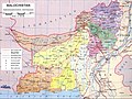 Administrative Divisions of Balochistan.jpg 1 100 × 825; 239 KB
-
 Administrative Divisions of Pakistan.jpg 1 064 × 792; 178 KB
-
 Afghanistan-Pakistan Border - DPLA - 9e39ecc11a1d6af934e4080d0957d7d6.jpg 2 536 × 3 266; 6,6 MB
-
 Alexander's Indian route.jpg 1 169 × 1 074; 168 KB
-
 Archaeological Sites Swat Valley.jpg 2 500 × 1 497; 638 KB
-
 Autonomous regions in the Middle East and Asia.jpg 720 × 694; 204 KB
-
 Bahawalpur map.jpg 603 × 478; 43 KB
-
 Bahawalpur Pakistan.jpg 722 × 600; 90 KB
-
 Bajisitan-bankuai-zh-tw.png 244 × 266; 16 KB
-
 Bajisitan-bankuai-zh.png 244 × 266; 15 KB
-
 Bajisitan-bianjie-zh.png 833 × 1 026; 103 KB
-
 Chitral Khyber PK.jpg 722 × 600; 90 KB
-
 Chitral state Pakistan.png 451 × 585; 23 KB
-
 Cholistan desert location.jpg 250 × 236; 13 KB
-
 Corridorcpec.jpg 820 × 768; 930 KB
-
 CPEC.png 1 780 × 1 122; 1,16 MB
-
 Cpec.png 659 × 620; 431 KB
-
 Current Pakistani Provincial Governments.png 3 488 × 2 456; 97 KB
-
 Dera Ismail Khan map.jpg 148 × 191; 5 KB
-
 DeraBugti.map.jpg 184 × 225; 11 KB
-
 Deserts of Pakistan.jpg 711 × 545; 63 KB
-
 Dhudikemap.gif 600 × 371; 31 KB
-
 DI Khan &Tank Language Map.png 1 265 × 1 056; 314 KB
-
 Dir Pakistan.jpg 722 × 600; 90 KB
-
 Disputataj landlimoj inter Barato, Ĉinio kaj Pakistano.png 924 × 669; 154 KB
-
 Durand Line Border Between Afghanistan And Pakistan.jpg 1 036 × 1 272; 257 KB
-
 ECDM 2013 06 18 India Pakistan Nepal SevereWeather.pdf 1 625 × 1 125; 840 KB
-
 ECDM 2013 09 26 World ECHOFlashEvents.pdf 1 625 × 1 125; 375 KB
-
 ECDM 20131024 World Events.pdf 1 625 × 1 125; 397 KB
-
 ECDM 20150227 World Events.pdf 1 625 × 1 125; 712 KB
-
 ECDM 20150303 IndiaPakAfghan SevereWeather.pdf 1 625 × 1 125; 397 KB
-
 ECDM 20150518 World Events.pdf 1 625 × 1 125; 460 KB
-
 ECDM 20150605 Worlds Events.pdf 1 625 × 1 125; 444 KB
-
 ECDM 20150608 Mexico ArabianSea TCs.jpg 1 040 × 720; 167 KB
-
 ECDM 20150624 World Events.pdf 1 625 × 1 125; 495 KB
-
 ECDM 20150721 Asia Events.pdf 1 625 × 1 125; 629 KB
-
 ECDM 20150728 ASIA Severe weather.pdf 1 625 × 1 125; 628 KB
-
 ECDM 20150729 Asia SevereWeather.pdf 1 625 × 1 125; 551 KB
-
 ECDM 20150811 ASIA Severe weather.pdf 1 625 × 1 125; 656 KB
-
 ECDM 20151027 Afghanistan Earthquake.pdf 1 625 × 1 125; 1,04 MB
-
 ECDM 20151029 Afghanistan Earthquake.pdf 1 625 × 1 125; 1,14 MB
-
 ECDM 20151116 AfPak Refugees.pdf 1 754 × 1 239; 749 KB
-
 ECDM 20160224 CountriesOfOrigin DailyMap.pdf 1 754 × 1 239; 910 KB
-
 ECDM 20160315 World SevereWeather.pdf 1 625 × 1 125; 532 KB
-
 ECDM 20160323 World SevereWeather.pdf 1 625 × 1 125; 612 KB
-
 ECDM 20160405 World SevereWeather.pdf 1 625 × 1 125; 620 KB
-
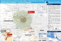 ECDM 20160411 Afghanistan Earthquake.pdf 1 625 × 1 125; 1,05 MB
-
 ECDM 20160701 World SevereWeather.pdf 1 625 × 1 125; 667 KB
-
 ECDM 20160704 Asia SevereWeather.pdf 1 625 × 1 125; 543 KB
-
 ECDM 20160711 Asia Severe Weather.pdf 1 625 × 1 125; 581 KB
-
 ECDM 20160719 Asia Severe Weather V1.pdf 1 625 × 1 125; 572 KB
-
 ECDM 20190304 Afghanistan-Pakistan Floods.pdf 1 625 × 1 125; 950 KB
-
 ECDM 20190306 Afghanistan-Pakistan-Iran Floods.pdf 1 625 × 1 125; 869 KB
-
 ECDM 20191015 Monsoon season.pdf 2 479 × 1 754; 1,57 MB
-
 ECDM 20200113 Iran-Afghanistan-Pakistan.pdf 1 625 × 1 125; 864 KB
-
 ECDM 20200710 South-Asia Monsoon.pdf 2 479 × 1 754; 1,33 MB
-
 ECDM 20200728 Asia Monsoon.pdf 2 479 × 1 754; 1,11 MB
-
 ECDM 20240416 Afghanistan Pakistan.pdf 2 479 × 1 754; 1,45 MB
-
 ECHO Caucasus Central Asia Editable A4 Landscape.pdf 1 754 × 1 239; 576 KB
-
 ECHO Caucasus Central Asia Editable A4 Landscape.png 1 123 × 794; 541 KB
-
 ECHO Pakistan Editable A4 Landscape.pdf 1 754 × 1 239; 401 KB
-
 ECHO Pakistan Editable A4 Landscape.png 1 123 × 794; 388 KB
-
 F09-06 1853 Geological Sketch Map of Salt Range.jpg 6 304 × 2 656; 7,14 MB
-
 FLII Pakistan.png 1 390 × 897; 311 KB
-
 Ggfg - Copy - Copy.png 525 × 593; 19 KB
-
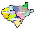
 Hub-District-Map-with-Tehsils-complete.jpg 700 × 658; 254 KB
-
 Hunza Valley Map.jpg 1 024 × 768; 222 KB
-
 India and Pakistan November 1971.png 1 270 × 1 108; 68 KB
-
 India, Pakistan and disputed Kashmir.jpg 5 442 × 4 021; 641 KB
-
 Indian Empire in 1912.jpg 1 850 × 1 416; 613 KB
-
 IranAndNeighbours.png 538 × 316; 11 KB
-
 Islamabad.png 2 365 × 1 890; 403 KB
-
 Jalalpur Irrigation Project.jpg 1 486 × 1 146; 287 KB
-
 Kakar Range.jpg 300 × 241; 11 KB
-
 Kalat Pakistan.jpg 722 × 600; 91 KB
-
 Kashkar region 2004.jpg 484 × 295; 51 KB
-
 Kashmir Borders Urdu.svg 2 200 × 1 777; 155 KB
-
 Khadir-and-bangar.jpg 400 × 400; 25 KB
-
 Khairpur Pakistan.jpg 722 × 600; 90 KB
-
 Khalistan2map.png 850 × 850; 192 KB
-
 Kharan Pakistan.jpg 722 × 600; 90 KB
-
 Khyber Pass1914.jpg 1 664 × 1 140; 678 KB
-
 Kouradia.gif 1 000 × 979; 265 KB
-
 Kwaja Khel settlement.jpg 791 × 1 024; 119 KB
-
 LA-14 Bagh-I (2021).png 1 636 × 1 720; 56 KB
-
 LA-20 Poonch & Sudhanoti-III (2021).png 1 636 × 1 720; 56 KB
-
 LA-22 Poonch & Sudhanoti-V (2021).png 1 636 × 1 720; 56 KB
-
 Lahore Subah.png 1 460 × 1 104; 2,63 MB
-
 Largest cities of Pakistan.png 3 840 × 2 160; 848 KB
-
 Las Bela Pakistan.jpg 722 × 600; 90 KB
-
 Major Powers and Central Asian Invasions, c. 250 BCE - 550 CE.jpg 1 016 × 1 380; 190 KB
-
 Makoran Sea Makran Sea map01.png 2 000 × 1 890; 756 KB
-
 Map Khetran.JPG 2 246 × 4 148; 541 KB
-
 Map new.png 647 × 460; 91 KB
-
 Map of Gandhara, Pakistan.jpg 1 485 × 870; 512 KB
-
 Map of Hattian Bala.png 1 380 × 2 120; 147 KB
-
 Map of Kasur District.png 552 × 452; 142 KB
-
 Map of Pakhali Sarkar along with Capital and Garrison Cities.png 800 × 804; 89 KB
-
 Map of Pakistan showing borders length.jpg 1 600 × 1 451; 276 KB
-
 Map of Peristan.jpg 547 × 547; 74 KB
-
 Map of Swat including Kwaja Khel settlement.jpg 813 × 1 027; 141 KB
-
 Map of the Northern territories of Pakistan.jpg 318 × 280; 14 KB
-

-
 Mapa Pákistánu.PNG 330 × 354; 47 KB
-
 Mintaka pass pakistan map (1990 version).jpg 351 × 377; 49 KB
-
 Nagar Pakistan.jpg 722 × 600; 90 KB
-
 Nagri Tutial Abbottabad.png 600 × 490; 15 KB
-
 Nara Tehsil Map.png 720 × 635; 144 KB
-
 Nartopa signpot.jpg 964 × 754; 178 KB
-
 Nawabshah.png 3 264 × 3 264; 829 KB
-
-
 Northern Pakistan 37.JPG 1 800 × 2 400; 4,42 MB
-
 NWFP 1947 Referendum result.png 989 × 1 341; 36 KB
-
 OG00007.jpg 1 688 × 2 200; 827 KB
-
 Orthographic projection centred over Gwadar, Pakistan.png 488 × 487; 23 KB
-
 Orthographic projection centred over Karachi, Pakistan.png 488 × 487; 23 KB
-
 Pakistan - Balochistan - Hub (2022).png 2 560 × 1 965; 529 KB
-
 Pakistan - Balochistan - Lasbela (2022).png 2 560 × 1 965; 530 KB
-
 Pakistan - DPLA - 3c1d1302c48a8d33180f5583b62dc8eb.jpg 2 556 × 3 272; 7,33 MB
-
 Pakistan - DPLA - 61932b74a341a9ea7a2d7a31850ac4cb.jpg 2 560 × 3 282; 6,72 MB
-
 Pakistan - DPLA - 752783d45b7d578be0ee5b39e7c25fef.jpg 2 556 × 3 276; 6,65 MB
-
 Pakistan - DPLA - acf44facadf1b529b26dcdf79ac37e96.jpg 2 556 × 3 274; 5,72 MB
-
 Pakistan - DPLA - bebe78f61e9012e184d88e5404800943.jpg 2 550 × 3 280; 6,07 MB
-
 Pakistan - DPLA - c7c0afee239d5d87b5065fd76ef8d62e.jpg 2 554 × 3 274; 6,39 MB
-
 Pakistan - DPLA - e64cb709a2dae8adf7216877909e9211.jpg 2 556 × 3 274; 5,54 MB
-
 Pakistan - Gujrat map.png 302 × 240; 34 KB
-
 Pakistan - Punjab - Chakwal (2022).png 1 969 × 2 048; 527 KB
-
 Pakistan - Punjab - Dera Ghazi Khan (2022).png 1 969 × 2 048; 530 KB
-
 Pakistan - Punjab - Gujranwala (2022).png 1 969 × 2 048; 529 KB
-
 Pakistan - Punjab - Gujranwala (division) (2022).png 1 969 × 2 048; 530 KB
-
 Pakistan - Punjab - Gujrat (division).png 1 969 × 2 048; 531 KB
-
 Pakistan - Punjab - Murree.png 1 969 × 2 048; 529 KB
-
 Pakistan - Punjab - Muzaffargarh (2022).png 1 969 × 2 048; 530 KB
-
 Pakistan - Punjab - Rawalpindi (2022).png 1 969 × 2 048; 529 KB
-
 Pakistan - Punjab - Talagang.png 1 969 × 2 048; 527 KB
-
 Pakistan - Punjab - Taunsa.png 1 969 × 2 048; 529 KB
-
 Pakistan - Punjab - Wazirabad.png 1 969 × 2 048; 529 KB
-
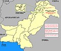
 Pakistan and Afghanistan Map.jpg 486 × 554; 114 KB
-
 Pakistan Base Map.png 1 104 × 698; 427 KB
-
 Pakistan boundaries.png 833 × 1 026; 26 KB
-
 Pakistan disputed w1 countrymap.svg 1 000 × 1 000; 37 KB
-
 Pakistan Div.png 926 × 774; 49 KB
-
 Pakistan Dives.png 400 × 334; 61 KB
-
 Pakistan GHI Solar-resource-map GlobalSolarAtlas World-Bank-Esmap-Solargis.png 1 842 × 2 046; 2,72 MB
-
 Pakistan image.jpg 517 × 425; 34 KB
-
 Pakistan Jul06.PNG 926 × 774; 43 KB
-
 Pakistan Khairabad digital elevation model by TanDEM-X (DLR).jpg 2 268 × 2 526; 2,28 MB
-
 Pakistan Map and Neighbors.jpg 712 × 600; 98 KB
-
 Pakistan map blank.png 2 015 × 1 504; 380 KB
-
 Pakistan Map explaining Kashmir.jpg 634 × 646; 106 KB
-
 Pakistan map outline.png 406 × 363; 3 KB
-
 Pakistan Map with Sea Ports.jpg 1 002 × 799; 247 KB
-
 Pakistan Map.jpg 709 × 600; 101 KB
-
 Pakistan Maps.svg 2 350 × 1 890; 409 KB
-
 Pakistan Provinces and Territories.svg 640 × 640; 57 KB
-
 Pakistan psl map cities 2022.png 3 596 × 2 448; 91 KB
-
 Pakistan psl map logos.png 406 × 363; 21 KB
-
 Pakistan Punjab relief map.svg 849 × 1 031; 1,68 MB
-
 Pakistan regional map.png 406 × 363; 4 KB
-
 Pakistan rivers and provinces.png 951 × 899; 112 KB
-

-
 Pakistan with claimed territories (orthographic projection).png 2 000 × 2 000; 713 KB
-
 Pakistan- Administrative Divisions - DPLA - cadc808b02bdaa4d3526ccf2e5b92012.jpg 2 554 × 3 268; 5,11 MB
-
 Pakistan-Cricket-Regions-Map.png 3 596 × 2 448; 96 KB
-
 PakistanPremierLeagueMap2004.png 409 × 353; 40 KB
-
 PalulaMap.png 645 × 980; 1,05 MB
-
 Parri Bangla.png 750 × 599; 98 KB
-
 PAT - Pakistan.gif 855 × 1 000; 334 KB
-
 Peshawar city map.jpg 1 609 × 1 219; 103 KB
-
 Phulra Pakistan.jpg 722 × 600; 100 KB
-
 Physical Map of Balochistan.jpg 1 103 × 827; 247 KB
-
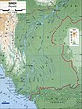
 Physical Map of NWFP.jpg 833 × 1 109; 245 KB
-
 Physical Map of Pakistan.jpg 1 103 × 812; 212 KB
-
 Physical Map of Punjab.jpg 826 × 1 085; 208 KB
-
 Physical Map of SIndh.jpg 829 × 1 106; 209 KB
-
 Plan map of Lahore Fort 1911.jpg 427 × 673; 145 KB
-
 PM visits by Imran Khan.png 4 500 × 2 234; 305 KB
-
 Pothohar map.jpg 958 × 656; 223 KB
-
 Ppl06-07.png 396 × 339; 34 KB
-
 PU GEOGRAPHER.jpg 4 320 × 3 600; 2,91 MB
-
 Rigvedic geography.jpg 756 × 539; 149 KB
-
 SAARC 1717549468.png 273 × 287; 8 KB
-
 Saraiki region of Sindh and Balochistan.jpg 752 × 960; 59 KB
-
 Saraikistan.JPG 532 × 455; 41 KB
-
 Siddiqui in Pakistan 2014.png 1 280 × 720; 56 KB
-
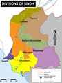 Sindh-Divisions-Map.png 1 400 × 1 864; 353 KB
-
 Sivallik Hills map.svg 3 099 × 2 868; 6,99 MB


.png)
.png)
.png)


.jpg)


.png)
.png)


.png)
.png)
.png)
_(2022).png)
.png)

.png)
.png)


.jpg)


.png)


