Category:Maps of submarine communication cables
Zur Navigation springen
Zur Suche springen
nonprofit dedicated to submarine cable protection | |||||
| Medium hochladen | |||||
| Ist ein(e) | |||||
|---|---|---|---|---|---|
| offizielle Website | |||||
| |||||
Unterkategorien
Es werden 2 von insgesamt 2 Unterkategorien in dieser Kategorie angezeigt:
In Klammern die Anzahl der enthaltenen Kategorien (K), Seiten (S), Dateien (D)
M
Medien in der Kategorie „Maps of submarine communication cables“
Folgende 97 Dateien sind in dieser Kategorie, von 97 insgesamt.
-
 2008 submarine cable disruption map.jpg 1.076 × 580; 237 KB
-
 AC-1-route.png 425 × 179; 12 KB
-
 AC-2-route.png 353 × 156; 7 KB
-
 African undersea cables v44.jpg 2.466 × 2.332; 2,78 MB
-
 African undersea cables v47-it.png 2.466 × 2.331; 1,28 MB
-
 AJC-Cable-route.png 276 × 414; 15 KB
-
 ALPAL-2-route.png 576 × 488; 44 KB
-
 AMERICAS-II-route.png 235 × 270; 13 KB
-
 Apollo-Cable-route.png 370 × 118; 9 KB
-
 ARCOS-1-route.png 1.126 × 874; 199 KB
-
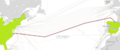
 Arctic Fibre.PNG 777 × 413; 154 KB
-
 Arimao communication between Cuba and Martinica.svg 1.000 × 500; 2,84 MB
-
 Asia-europe cable Route.png 1.540 × 484; 327 KB
-
 Atlantica-1-route.png 1.218 × 1.729; 295 KB
-
 Atlantis-II-map.png 466 × 488; 20 KB
-
 Bay of Bengal Gateway.png 2.999 × 2.249; 716 KB
-
 Bell telephone magazine (1922) (14569651087).jpg 2.180 × 1.198; 387 KB
-
 Bell telephone magazine (1922) (14753105761).jpg 2.074 × 996; 412 KB
-
 Brazil+US Terrestrial copy.jpg 3.840 × 2.160; 4,26 MB
-
 C-lion cable card.png 1.185 × 652; 822 KB
-
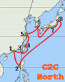 C2C-North-route.png 156 × 196; 37 KB
-
 C2C-Pacific-route.png 472 × 200; 48 KB
-
 C2C-route.png 192 × 251; 63 KB
-
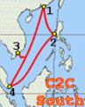 C2C-South-route.png 114 × 142; 24 KB
-
 Cable map of the world - btv1b53065000s.jpg 12.184 × 7.864; 9,96 MB
-
 Cable map of the world - Geographical Section General Staff - btv1b531582999.jpg 12.300 × 7.382; 8,09 MB
-
 Cable METISS.png 812 × 648; 47 KB
-
 Cable Route.png 1.056 × 684; 611 KB
-
 CANTAT-3-route.png 400 × 166; 12 KB
-
 China-US-CN-route.png 561 × 284; 96 KB
-
 Concerto-1-Map.png 434 × 428; 76 KB
-
 Câbles sous-marins en Afrique v45.png 2.630 × 2.487; 1,55 MB
-
 EAC-route.png 1.023 × 1.446; 307 KB
-
 ECFS-route.png 358 × 343; 34 KB
-
 ESnet Europe connection.png 944 × 720; 238 KB
-
 FARICE-1-map.png 529 × 402; 46 KB
-
 FLAG FEA map.svg 705 × 291; 166 KB
-
 Network Map.png 961 × 349; 316 KB
-
 Hibernia Atlantic-Map.png 2.016 × 1.131; 362 KB
-
 Insert picture oc.png 723 × 456; 176 KB
-
 Internet Tube.png 3.508 × 2.303; 553 KB
-
 ITUR-route.png 240 × 144; 25 KB
-
 Lebanon submarine telecommunications cables.png 1.244 × 912; 261 KB
-
 LEG 1 - Map.png 1.040 × 720; 245 KB
-
 LEV-route.png 888 × 570; 166 KB
-
 Main one phase 1.png 213 × 211; 36 KB
-
 Map of Cameroon-Brazil Cable System route.svg 1.321 × 977; 1,66 MB
-
 Map of Caucasus Cable System.svg 1.000 × 622; 4,61 MB
-
 Map of Ellalink submarine cable routes.jpg 800 × 736; 130 KB
-
 Map of Ellalink submarine cable.svg 1.119 × 1.029; 1,55 MB
-
 Map of South Atlantic Cable System route.svg 1.321 × 977; 1,67 MB
-
 Map of South Atlantic Express submarine cable route 2011.svg 1.321 × 977; 1,63 MB
-
 Map of South Atlantic Express submarine cable route 2012.svg 1.321 × 977; 1,63 MB
-
 Map of South Atlantic Express submarine cable route 2017.svg 1.321 × 1.282; 1,62 MB
-
 Map of South Atlantic Express submarine cable route.svg 1.321 × 977; 1,6 MB
-
 Map of subsea system Seabras-1 .jpg 2.560 × 2.560; 2,23 MB
-
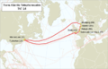 Map TAT-14.png 765 × 494; 244 KB
-
 MAREA Cable.png 984 × 413; 118 KB
-
 MAREA.png 332 × 201; 14 KB
-
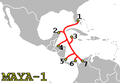 MAYA-1-route.png 223 × 155; 8 KB
-
 MedNautilus-route.png 910 × 562; 184 KB
-
 NPC-route.png 359 × 175; 34 KB
-
 PanAm.jpg 2.000 × 2.814; 610 KB
-
 PC-1-Cable-route.png 384 × 184; 31 KB
-
 PEC-cable-map.png 219 × 149; 7 KB
-
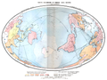 Planche 10 - Tarifs douaniers et cables sous-marins - Liv4-Ch09.png 4.072 × 3.064; 4,67 MB
-
 Polar Express route map 2021-04-22.png 1.452 × 820; 1,44 MB
-
 Proposed electricity route between Venezuela and Cuba.svg 1.000 × 500; 2,84 MB
-
 REMBRANDT-1-route.png 298 × 210; 27 KB
-
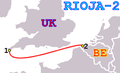 RIOJA-2-route.png 285 × 174; 10 KB
-
 Russian Optical Trans-Arctic Submarine Cable System.svg 475 × 283; 494 KB
-
 SAFE-route.png 418 × 238; 16 KB
-
 SAT-3--WASC-route.png 273 × 392; 21 KB
-
 SEA-ME-WE 5 Route Map.jpg 1.454 × 774; 127 KB
-
 SEA-ME-WE-2-Route.svg 994 × 681; 1,13 MB
-
 SEA-ME-WE-3-Route.png 712 × 458; 38 KB
-
 SEA-ME-WE-3-Route.svg 994 × 681; 1,14 MB
-
 SEA-ME-WE-4-Route.png 3.006 × 1.656; 773 KB
-
 SEA-ME-WE-4-Route.svg 994 × 681; 1,13 MB
-
 SEA-ME-WE-5-Route.svg 994 × 681; 1,13 MB
-
 Seaborn Network World Map.jpg 1.871 × 1.056; 449 KB
-
 Seacom africa map.png 691 × 659; 37 KB
-
 Setem 1967 Seacom.png 1.058 × 379; 786 KB
-
 Southern Cross Cable route.svg 630 × 597; 54 KB
-
 Submarine cable actual location.png 1.025 × 614; 17 KB
-
 Submarine cable map umap.png 1.040 × 541; 318 KB
-
 Submarine cables.png 1.021 × 955; 81 KB
-
 Taiwan Hengchun 2006 Seekabel.svg 700 × 844; 158 KB
-
 Tangerine-Map.png 237 × 241; 8 KB
-
 TIISCS-route.png 202 × 172; 16 KB
-
 Trans-Pacific-Express.jpg 550 × 185; 14 KB
-
 TWA-1-route.png 254 × 156; 19 KB
-
 UNISUR-route.png 205 × 280; 8 KB
-
 Unterseekabel Afrika-Mittelmeer-Orient.svg 1.520 × 1.480; 396 KB
-
 WASACE submarine cable route map.svg 1.624 × 1.088; 1,66 MB
-
 World map of submarine cables.png 1.601 × 1.025; 74 KB
-
 Стенд проекта "Полярный экспресс" на выставке "Россия в движении" ВДНХ.jpg 1.280 × 736; 295 KB


_(14569651087).jpg)
_(14753105761).jpg)


