Category:Monk's Gate
Jump to navigation
Jump to search

Main Wikipedia article: Monk's Gate.
village in the United Kingdom  | |||||
| Upload media | |||||
| Instance of | |||||
|---|---|---|---|---|---|
| Location | Nuthurst, Horsham, West Sussex, South East England, England | ||||
 | |||||
Monk's Gate is a hamlet in the civil parish of Nuthurst, and the Horsham District of West Sussex, England.
Mobile device view makes it difficult to view Monk's Gate's immediate and useful surrounding parish pictures. For this, click Nuthurst.
Desktop view links are at the bottom of the page.
Media in category "Monk's Gate"
The following 13 files are in this category, out of 13 total.
-
 Cows and calves - geograph.org.uk - 420949.jpg 640 × 428; 430 KB
-
 Footpath goes north to Nuthurst Road (geograph 5219401).jpg 800 × 600; 203 KB
-

-
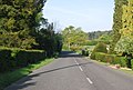
 Nuthurst Rd (geograph 4232084).jpg 640 × 430; 69 KB
-
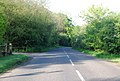
 Nuthurst Rd (geograph 4232085).jpg 640 × 430; 81 KB
-
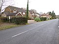
 Nuthurst Rd (geograph 4232086).jpg 640 × 430; 78 KB
-
-
 Nuthurst Road, Monks Gate, Sussex (geograph 1906119).jpg 3,872 × 2,592; 5.84 MB
-
 Pond by Nuthurst road - geograph.org.uk - 403880.jpg 640 × 480; 159 KB
-
 Saxtons Farm, Monks Gate, West Sussex - geograph.org.uk - 86107.jpg 640 × 607; 174 KB
-

-
 The end of Nuthurst Rd, Monks Gate (geograph 1863968).jpg 640 × 430; 148 KB
-
 Village Sign at Monk's Gate, Sussex - geograph.org.uk - 1906122.jpg 3,872 × 2,592; 3.59 MB

.jpg)

.jpg)
.jpg)
.jpg)
.jpg)
.jpg)


.jpg)
