Category:Muasdale
Zur Navigation springen
Zur Suche springen
village in Argyll and Bute, Scotland, UK  | |||||
| Medium hochladen | |||||
| Ist ein(e) | |||||
|---|---|---|---|---|---|
| Ort |
| ||||
 | |||||
English: Muasdale is a hamlet on the western coast of the Kintyre Peninsula of Scotland. The village is along West Loch Tarbert. As of the year 2000 Muasdale had a population of 300. By the year 1750 the Roy map showed a coastal track along the west coast of Kintyre, even though the population level of the entire southern peninsula was very low.
Medien in der Kategorie „Muasdale“
Folgende 21 Dateien sind in dieser Kategorie, von 21 insgesamt.
-
 A Chleit. - geograph.org.uk - 138835.jpg 640 × 480; 71 KB
-
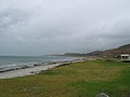
 Coastline at Muasdale - geograph.org.uk - 800302.jpg 640 × 416; 68 KB
-
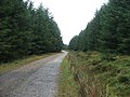
 Forestry Track on Braid Hill. - geograph.org.uk - 254977.jpg 636 × 477; 113 KB
-
 Forestry Track on Braid Hill. - geograph.org.uk - 254979.jpg 636 × 477; 118 KB
-

-

-

-
 Muasdale Burn - panoramio.jpg 3.264 × 4.928; 2,03 MB
-
 Ronachan House. - geograph.org.uk - 347268.jpg 640 × 480; 108 KB
-

-
 Allt a' Bhlair. - geograph.org.uk - 255107.jpg 640 × 480; 100 KB
-
 Allt a' Ghlaoidh. - geograph.org.uk - 257233.jpg 640 × 480; 82 KB
-
 Bellochantuy Bay Before the Storm. - geograph.org.uk - 255834.jpg 640 × 480; 60 KB
-

-
 Bellochantuy beach looking north. - geograph.org.uk - 367206.jpg 640 × 480; 47 KB
-
 Bellochantuy. - geograph.org.uk - 367208.jpg 640 × 480; 72 KB
-
 Fire Break on Braid Hill. - geograph.org.uk - 254980.jpg 636 × 477; 136 KB
-
 Outgoing Tide - geograph.org.uk - 274820.jpg 640 × 480; 54 KB
-
 Rain on Rocks. - geograph.org.uk - 255822.jpg 640 × 480; 128 KB
-
 Sea Shower. - geograph.org.uk - 255826.jpg 640 × 480; 89 KB
-
 Shoreline by Bellochantuy. - geograph.org.uk - 367209.jpg 640 × 480; 91 KB


_and_Manse,_North_Crubasdale_-_geograph.org.uk_-_128413.jpg)


