Category:Newport, Wales
Skočit na navigaci
Skočit na vyhledávání

Cymraeg: Casnewydd.
třetí největší město ve Walesu   | |||||
| Načíst soubor | |||||
| Instance (čeho) | |||||
|---|---|---|---|---|---|
| Část (čeho) |
| ||||
| Místo | Newport, Wales | ||||
| Na vodním toku či ploše nebo u ní | |||||
| Počet obyvatel |
| ||||
| Plošná výměra |
| ||||
| oficiální web | |||||
 | |||||
Podkategorie
Zobrazuje se 18 podkategorií z celkového počtu 18 podkategorií v této kategorii.
!
- Quality images of Newport (21 F)
A
C
E
G
- Gaer Tunnel (2 F)
H
I
N
- Newport Crown Court (1 F)
- Newport Women's History Mosaics (12 F)
P
S
T
V
- Views of Newport, Wales (13 F)
Stránky v kategorii „Newport, Wales“
V této kategorii je pouze následující stránka.
Soubory v kategorii „Newport, Wales“
Zobrazuje se 200 souborů z celkového počtu 241 souborů v této kategorii.
(předchozí stránka) (další stránka)-
 20190303 Newport Field.jpg 1 647 × 926; 130 KB
-
 20190303 Overlooking Newport from Field.jpg 1 647 × 926; 211 KB
-
 20190624 Newport bus stop platform pig 2.jpg 4 160 × 2 340; 2,93 MB
-
 20190624 Newport bus stop platform pig.jpg 4 160 × 2 340; 2,85 MB
-
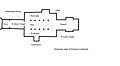 A Plan of Newport Cathedral.jpg 1 712 × 942; 81 KB
-
 A Secluded Corner.jpg 5 472 × 3 648; 6,46 MB
-
 Abandoned shopping trolley, Cat's Ash - geograph.org.uk - 1254184.jpg 426 × 640; 107 KB
-
 Allotment Gardens beside the M4 - geograph.org.uk - 348038.jpg 640 × 441; 114 KB
-
 Allotment notice - geograph.org.uk - 1441427.jpg 640 × 585; 120 KB
-
 Allotment path to Cae Perllan road - geograph.org.uk - 1441423.jpg 640 × 480; 116 KB
-
 Allt-yr-yn Lock Autumn.jpg 3 456 × 5 184; 7,15 MB
-
 Asda - clothes.jpg 3 434 × 2 289; 2,57 MB
-
 Asda - fish.jpg 3 434 × 1 481; 1,52 MB
-
 Autumn in Beechwood Park.jpg 5 472 × 3 648; 8,48 MB
-
 Bassaleg Comprehensive School - geograph.org.uk - 1121282.jpg 640 × 480; 157 KB
-
 Beeches by the lane - geograph.org.uk - 1041682.jpg 640 × 480; 113 KB
-
 Beechwood Park Autumn.jpg 5 472 × 3 648; 8,01 MB
-
 Beechwood Park Shadows.jpg 5 184 × 3 456; 9,08 MB
-
 Belle Vue Park Autumn.jpg 5 472 × 3 648; 8,53 MB
-
 Belle Vue Pavilion Sunrise.jpg 5 472 × 3 648; 6,45 MB
-
 Belle Vue Shadows.jpg 5 472 × 3 648; 8,6 MB
-
 Belle Vue Terrace in the Rain.jpg 5 184 × 3 456; 7,67 MB
-
 Best Kept Village sign, Bassaleg - geograph.org.uk - 1038054.jpg 640 × 478; 140 KB
-
 Bike in Usk mud - geograph.org.uk - 1561833.jpg 640 × 480; 119 KB
-
 Breakwater - geograph.org.uk - 440574.jpg 640 × 480; 111 KB
-
 Brewhouse Tea Room.jpg 5 184 × 3 456; 6,52 MB
-
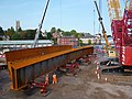 Bridge Street bridge reconstruction (9) (geograph 5123070).jpg 640 × 480; 156 KB
-
 Caer Perllan Road Allotments - geograph.org.uk - 745698.jpg 640 × 480; 170 KB
-
 Canal Bridge at Allt-yr-yn.jpg 5 184 × 3 456; 11,14 MB
-
 Canal overspill - geograph.org.uk - 884663.jpg 640 × 480; 136 KB
-
 Cedar Garden and its Boundary Wall.jpg 4 000 × 2 666; 9,24 MB
-
 Cedar Garden Old Walls.jpg 5 184 × 3 456; 11,95 MB
-
-
 Classics at a Festival.jpg 2 272 × 1 704; 2,72 MB
-
 Clogs Canton.jpg 3 648 × 5 472; 7,3 MB
-
 Contrails Over the Hill Fort.jpg 5 472 × 3 648; 5,88 MB
-
 Country Park Lodges.jpg 5 184 × 3 456; 12,42 MB
-
 Countryside near High Cross.jpg 5 472 × 3 648; 9,19 MB
-
 Curved Corner.jpg 5 472 × 3 648; 5,69 MB
-
 Disused quarry, Penhow - geograph.org.uk - 1725902.jpg 3 296 × 2 472; 1,87 MB
-
 Dock Lock Landscape.jpg 5 184 × 3 456; 9,78 MB
-
 Down the Terrace Steps.jpg 5 472 × 3 648; 8,86 MB
-
 Dr Edward Llewellyn Treharne.jpg 484 × 774; 439 KB
-
Drudwennod Gwarchodfa Natur Genedlaethol Gwlyptir Casnewydd.webm 1 min 39 s, 640 × 360; 8,53 MB
-
 Dutch Delight - geograph.org.uk - 1066527.jpg 640 × 480; 70 KB
-
 Ebbw River Rock Circle.jpg 5 472 × 3 648; 7,67 MB
-
 Ebbw River Rocks.jpg 5 472 × 3 648; 7,5 MB
-
 Edney Gates in Snow.jpg 3 648 × 5 472; 5,42 MB
-
 El Sieco's.jpg 2 283 × 3 104; 1,33 MB
-
 Entrance gate to Cae Perllan allotments - geograph.org.uk - 1441426.jpg 640 × 423; 106 KB
-
-
-
 Entrance to Woodland Park - geograph.org.uk - 1566439.jpg 640 × 480; 121 KB
-
 Estuary and Henllys.jpg 5 184 × 3 456; 6,1 MB
-
 Evening LIght on The Hill Fort.jpg 5 472 × 3 648; 7,89 MB
-
 Farmland and the Llanwern Steelworks - geograph.org.uk - 1260760.jpg 640 × 426; 81 KB
-
 Field next to Ty-ffynnon canal lock - geograph.org.uk - 1569862.jpg 640 × 480; 134 KB
-
 FLAG OF NEWPORT.jpg 360 × 216; 24 KB
-
 Flag of Newport.png 5 356 × 3 212; 85 KB
-

-
 Former entrance to Penhow Quarry - geograph.org.uk - 1725909.jpg 3 296 × 2 472; 1,84 MB
-
 Frozen Morgan's Pool - geograph.org.uk - 1731248.jpg 1 600 × 1 200; 506 KB
-
 Gaer Fort Lower Woodlands.jpg 4 032 × 3 024; 3,13 MB
-
 Gaer Hill Fort Snow.jpg 5 184 × 3 456; 6,19 MB
-
 Garden of Remembrance, Clarence Place, Newport (geograph 6318581).jpg 1 600 × 1 200; 377 KB
-
 Gates to Waterloo Road.jpg 5 184 × 3 456; 7,57 MB
-
 George Street Bridge and the City Footbridge.jpg 5 184 × 3 456; 5,4 MB
-
 Going through Plymouth - panoramio (1).jpg 3 648 × 2 736; 1,87 MB
-
 Going through Plymouth - panoramio.jpg 3 648 × 2 736; 2,09 MB
-
 Goldcliffe from Whitson - panoramio.jpg 600 × 450; 100 KB
-
 Golden Evening on Lodge Hill - geograph.org.uk - 1751907.jpg 1 024 × 768; 158 KB
-
 Great Barn Blue Sky.jpg 5 184 × 3 456; 7,3 MB
-
 GreatSpottedWoodpecker1.jpg 1 256 × 1 256; 579 KB
-
 Grey Heron beside Woodstock Pool - geograph.org.uk - 1723816.jpg 482 × 640; 168 KB
-
 Gwasted Bridge and Lock.jpg 5 184 × 3 456; 11,16 MB
-
 High Bank, Newport - geograph.org.uk - 1427905.jpg 640 × 318; 46 KB
-
 Hillfort Bluebells.jpg 5 472 × 3 648; 7,5 MB
-
 Hillfort trees.jpg 3 648 × 5 472; 7,45 MB
-
 Hogarth Close, Newport - geograph.org.uk - 1703776.jpg 640 × 480; 93 KB
-
 Housing at Bassaleg - geograph.org.uk - 1122468.jpg 640 × 480; 120 KB
-
-
 Inverness to Kyle RiscaCuckoo12050486 (16720798657).jpg 3 372 × 1 780; 4,49 MB
-
 Laundry and Dairy Close-Up.jpg 5 184 × 3 456; 7,13 MB
-
 Lodges in Spring.jpg 5 472 × 3 648; 8,71 MB
-
 Lonely Bench.jpg 5 472 × 3 648; 3,76 MB
-
 Market Arcade, Newport during renovation.jpg 3 024 × 4 032; 1,76 MB
-
 Mary Lowndes Album 0233 (25092974587).jpg 3 617 × 3 790; 770 KB
-
 Mary Lowndes Album 0236 (39253752774).jpg 3 381 × 5 455; 3,36 MB
-

-
 Monmouthshire and Brecon Canal - geograph.org.uk - 703819.jpg 640 × 480; 154 KB
-
 Monument and Cedar Garden.jpg 5 472 × 3 648; 6,96 MB
-
 Nash Marshland - panoramio.jpg 500 × 375; 96 KB
-
 Newport (17069123628).jpg 3 000 × 4 000; 2,77 MB
-
 Newport - Waste container.jpg 2 121 × 1 702; 1,38 MB
-
 Newport Bridge Sunset.jpg 5 184 × 3 456; 5,76 MB
-
 Newport Bus route 588 terminus - geograph.org.uk - 1646075.jpg 640 × 477; 64 KB
-
 Newport Cathedral - East End.jpg 1 512 × 2 016; 882 KB
-
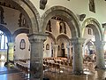 Newport Cathedral - Nave Arcade.jpg 2 016 × 1 512; 738 KB
-
 Newport Cathedral - Tower from the West.jpg 1 512 × 2 016; 1,38 MB
-

-
 Newport Docks taken from Hertfordshire Rail Tours The Valley Basher on 03 May 1980.jpg 3 120 × 4 788; 2,37 MB
-
 Newport from the train 02.JPG 4 272 × 2 848; 2,49 MB
-
 Newport Market.png 1 730 × 1 298; 3,71 MB
-
 Newport montage1.jpg 1 353 × 2 062; 982 KB
-
 Newport railway bridge.jpg 4 032 × 3 024; 2,3 MB
-
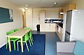 Newport Student Village kitchen.jpg 5 410 × 3 570; 3 MB
-
-
 Newport, cranes in silhouette - geograph.org.uk - 695980.jpg 640 × 480; 50 KB
-

-
 Newport, Monmouthshire (1132152).jpg 1 000 × 712; 156 KB
-
 Newport, Wales MG 0128 - panoramio.jpg 1 600 × 1 062; 744 KB
-
 Newport, Wales MG 0131 - panoramio.jpg 1 600 × 838; 550 KB
-
 NewportBuiltUpArea.png 1 050 × 850; 1,23 MB
-
 No climbing on Robbins Lane - geograph.org.uk - 1442968.jpg 596 × 640; 106 KB
-

-
 Northern edge of Pilton Vale - geograph.org.uk - 1497276.jpg 640 × 480; 102 KB
-
 Orangery Flowers.jpg 3 648 × 5 472; 6,96 MB
-
 Orangery Paths.jpg 5 184 × 3 456; 7,27 MB
-
 Ordnance Survey One-Inch Sheet 155 Bristol & Newport, Published 1946.jpg 10 929 × 12 822; 17,45 MB
-
 Ordnance Survey One-Inch Sheet 155 Bristol & Newport, Published 1953.jpg 8 282 × 9 952; 12,01 MB
-
 Ordnance Survey One-Inch Sheet 155 Bristol & Newport, Published 1972.jpg 11 058 × 13 150; 47,6 MB
-
 Outside the Friars.jpg 5 184 × 3 456; 6,14 MB
-
 P090414PS-0252 (16601903459).jpg 1 500 × 1 000; 363 KB
-
 Park in Clifton Road - geograph.org.uk - 718433.jpg 640 × 480; 142 KB
-
 Park Place, Newport, Monmouthshire.jpeg 700 × 446; 179 KB
-
 Path to the Lodges.jpg 5 472 × 3 648; 8,16 MB
-
 Patterns in mud.jpg 3 648 × 5 472; 8,04 MB
-
 Pavilion and a Puddle.jpg 3 648 × 5 472; 5,73 MB
-
 Pavilion in Autumn.jpg 3 648 × 5 472; 9,11 MB
-
 Pavilion in the Snow.jpg 5 472 × 3 648; 5,19 MB
-
 Pavilion Morning Light.jpg 5 184 × 3 456; 7,7 MB
-
 Pavilion on a Misty Morning.jpg 5 472 × 3 648; 5,19 MB
-
 Pavilion Spring.jpg 3 648 × 5 472; 6,49 MB
-
 Pen Y Lan Road towards Bassaleg - geograph.org.uk - 1122291.jpg 640 × 481; 149 KB
-
 Peonies 'Bowl of Beauty'.jpg 3 648 × 5 472; 4,38 MB
-
 Percoed Reen - geograph.org.uk - 1298794.jpg 640 × 480; 65 KB
-
 Pigeon on the Terrace Wall.jpg 5 472 × 3 648; 5,9 MB
-
 Pink Tinged Sunset.jpg 3 648 × 5 472; 5,34 MB
-
 Pollarded withy (willow) trees - geograph.org.uk - 750768.jpg 640 × 480; 190 KB
-
 Postbox, Lee Way, Newport - geograph.org.uk - 1571170.jpg 640 × 462; 96 KB
-
 Potential for Development^ - geograph.org.uk - 439550.jpg 640 × 480; 129 KB
-
 Pylon, Nash Road , Newport - geograph.org.uk - 1575722.jpg 480 × 640; 85 KB
-
 Rain on the Terracing.jpg 5 184 × 3 456; 3,67 MB
-
 Recreation area, Summerhill, Newport - geograph.org.uk - 1725491.jpg 640 × 480; 66 KB
-
 Red Wall and Blue Flowers.jpg 5 472 × 3 648; 9,4 MB
-
 Rice and vegetables 2.jpg 4 274 × 2 959; 2,82 MB
-
 River bank - geograph.org.uk - 752085.jpg 480 × 640; 104 KB
-
-
 River Usk - geograph.org.uk - 1439765.jpg 640 × 480; 64 KB
-
 River Usk - geograph.org.uk - 829058.jpg 640 × 481; 100 KB
-
 River Usk at Ultra Pontem - geograph.org.uk - 746095.jpg 640 × 480; 135 KB
-
-
 River Usk near Malpas.jpg 4 160 × 3 120; 4,81 MB
-
 Rock at Penhow Quarry - geograph.org.uk - 1725907.jpg 3 296 × 2 472; 1,86 MB
-
 Romanesque portal in Newport Cathedral.jpg 1 512 × 2 016; 770 KB
-
 Rounded Terrace Corner.jpg 5 472 × 3 648; 6,34 MB
-

-
 Ruperra Gates in Snow.jpg 5 472 × 3 648; 6,51 MB
-
 Rustic Mist.jpg 3 648 × 5 472; 5,21 MB
-
 Severn Estuary and Newport.jpg 5 184 × 3 456; 5,27 MB
-
 Severn Estuary from the Woodland.jpg 5 184 × 3 456; 7,58 MB
-
 Sheep at Hill Farm - geograph.org.uk - 750777.jpg 640 × 480; 134 KB
-
 Sirhowy Valley Walk (1) - geograph.org.uk - 1021272.jpg 640 × 476; 181 KB
-
 Sirhowy Valley Walk (2) - geograph.org.uk - 1021268.jpg 640 × 480; 166 KB
-
 Snow Covered Twm Barlwm.jpg 5 472 × 3 648; 7,51 MB
-
 Snowy Ebbw River.jpg 5 472 × 3 648; 5,17 MB
-
 Snowy sunset (8413900567).jpg 1 896 × 1 403; 839 KB
-
 Somerton Park, Newport - 2 - geograph-1225324.jpg 640 × 432; 59 KB
-
 Somerton Park, Newport - geograph-1225331.jpg 640 × 512; 102 KB
-
Spectacular Starlings at Newport Wetlands Nature Reserve, Cymru, Wales.webm 1 min 39 s, 640 × 360; 8,49 MB
-
 St Brides Brook, at Penhow - geograph.org.uk - 1725860.jpg 3 296 × 2 472; 1,92 MB
-
 St Gwynllyw - Stained glass window.jpg 800 × 800; 71 KB
-
 St Woolos Cathedral, Side View.jpg 5 472 × 3 648; 6,99 MB
-
 St Woolos Fountain Decorations.jpg 5 472 × 3 648; 5,05 MB
-
 St Woolos Fountain Inscription.jpg 5 472 × 3 648; 5,75 MB
-
 St Woolos Lych Gate Dedication.jpg 5 472 × 3 648; 7,24 MB
-
 Stable Block Spring.jpg 5 472 × 3 648; 8,11 MB
-
 Stairway to the Terrace.jpg 5 472 × 3 648; 7,03 MB
-
 Start of the 30 zone, Caerleon - geograph.org.uk - 5265172.jpg 800 × 646; 103 KB
-
 Steps to the Terrace.jpg 5 184 × 3 456; 8,52 MB
-
 Stile on Castleton Circular Walk - geograph.org.uk - 1480537.jpg 640 × 480; 221 KB
-
 Stream near Bassaleg School - geograph.org.uk - 1121292.jpg 640 × 480; 173 KB
-
 Summer on the Terrace.jpg 5 472 × 3 648; 7,15 MB
-
 Summer Terrace Shadows.jpg 5 184 × 3 456; 9,98 MB
-
 Teahouse and Forsythia.jpg 5 472 × 3 648; 6,89 MB
-
 Teahouse in Autumn.jpg 5 472 × 3 648; 10,66 MB
-
 Teahouse in Mist.jpg 5 472 × 3 648; 5,49 MB
-
 Teahouse Morning Sun.jpg 5 472 × 3 648; 4,91 MB
-
 Teahouse Through the Trees.jpg 3 648 × 5 472; 11,08 MB
-
 Telephone booth Newport.jpg 3 543 × 4 975; 2,97 MB
-
 Terrace Begonias.jpg 5 184 × 3 456; 5,86 MB
-
 Terrace Levels.jpg 5 472 × 3 648; 7,83 MB
-
 Terrace Walls and Shapes.jpg 5 472 × 3 648; 6,15 MB
-
 Terracing in the Rain.jpg 5 184 × 3 456; 10,87 MB
-

-
 The commanding position occupied by Penhow Castle - geograph.org.uk - 1725894.jpg 3 296 × 2 472; 1,88 MB
-
 The meandering River Usk - geograph.org.uk - 1280983.jpg 640 × 480; 144 KB
-
 The Usk Valley - geograph.org.uk - 1253876.jpg 640 × 426; 84 KB
-
 Tredegar House and Boathouse.jpg 5 472 × 3 648; 5,55 MB
-
 Tredegar House Autumn Reflection.jpg 5 184 × 3 456; 6,61 MB


_(geograph_5123070).jpg)


.jpg)


.jpg)


%27_(11238747193).jpg)
.jpg)


.jpg)
.jpg)
_-_geograph.org.uk_-_648005.jpg)


.jpg)


.jpg)


.jpg)


_trees_-_geograph.org.uk_-_750768.jpg)


_-_geograph.org.uk_-_1021272.jpg)
_-_geograph.org.uk_-_1021268.jpg)


.jpg)


