Category:Odense Kommune
Jump to navigation
Jump to search
municipality in Denmark  Odense rådhus Foto: Kåre Thor Olsen   | |||||
| Upload media | |||||
| Instance of | |||||
|---|---|---|---|---|---|
| Named after | |||||
| Location |
| ||||
| Street address |
| ||||
| Located on street |
| ||||
| Capital | |||||
| Head of government |
| ||||
| Inception |
| ||||
| Population |
| ||||
| Area |
| ||||
| Elevation above sea level |
| ||||
| Replaces |
| ||||
| Different from | |||||
| official website | |||||
 | |||||
Subcategories
This category has the following 26 subcategories, out of 26 total.
A
- Odense Kommune in art (16 F)
B
E
- Elmelund Skov (1 F)
F
- Fynsværket (5 F)
H
- Holmstrup (Fyn) (1 F)
L
O
P
- Parishes in Odense Kommune (33 F)
R
S
- Stige Ø (5 F)
T
- Tarup-Davinde Hundeskov (5 F)
Å
Media in category "Odense Kommune"
The following 10 files are in this category, out of 10 total.
-
 Anker Boye.jpg 2,404 × 2,056; 2.08 MB
-
 Bellingekort.jpg 850 × 638; 312 KB
-
 Bofællesskabet Æblegrenen set fra bagsiden.jpg 5,630 × 3,753; 3.67 MB
-
 Davindelinden.jpg 1,000 × 642; 393 KB
-
 Hole Kilde.jpg 2,560 × 1,920; 1.15 MB
-
 Lettebaek1.jpg 425 × 339; 160 KB
-
 Lettebaek2.jpg 850 × 638; 362 KB
-
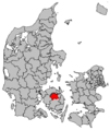 Map DK Odense.PNG 465 × 550; 19 KB
-
 Odense Municipality Parishes.png 533 × 449; 98 KB
-
 Odense-DK.png 1,023 × 967; 1.42 MB


