Category:Owyhee County, Idaho
Jump to navigation
Jump to search
Counties of Idaho: Ada · Adams · Bannock · Bear Lake · Benewah · Bingham · Blaine · Boise · Bonner · Bonneville · Boundary · Butte · Camas · Canyon · Caribou · Cassia · Clark · Clearwater · Custer · Elmore · Franklin · Fremont · Gem · Gooding · Idaho · Jefferson · Jerome · Kootenai · Latah · Lemhi · Lewis · Lincoln · Madison · Minidoka · Nez Perce · Oneida · Owyhee · Payette · Power · Shoshone · Teton · Twin Falls · Valley · Washington
county in Idaho, United States   | |||||
| Upload media | |||||
| Instance of | |||||
|---|---|---|---|---|---|
| Named after | |||||
| Location | Idaho, Estados Unidos | ||||
| Capital | |||||
| Inception |
| ||||
| Population |
| ||||
| Area |
| ||||
| official website | |||||
 | |||||
English: Media related to Owyhee County, Idaho, a county in southwestern Idaho, United States.
Mga ubos-nga-kaarangay
Ini nga kaarangay mayda han mga nasunod nga 13 nga mga ubos-nga-kaarangay, tikang hin 13 nga kabug-osan.
Media ha kaarangay nga "Owyhee County, Idaho"
An mga nasunod nga 42 ka mga fayl aada han hini nga kaarangay, tikang hin 42 nga kabug-osan.
-
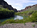 Battle Creek Idaho.jpg 265 × 204; 66 nga KB
-
 Wildhorsesowyhee.jpg 350 × 263; 19 nga KB
-

-
 2013-07-07 15 52 26 The Jarbidge Mountains in Nevada viewed from Three Creek Road in Idaho.jpg 1,074 × 336; 238 nga KB
-
 2013-08-15 07 31 05 View of the Jarbige Mountains from Three Creek Road in southern Idaho.jpg 3,264 × 2,448; 2.64 nga MB
-
 2013-08-15 07 31 17 View east along Three Creek Road towards the Jarbidge Mountains.jpg 3,264 × 2,448; 2.74 nga MB
-

-

-

-

-

-

-
 2014-10-04 17 54 16 View of Jarbidge Peak, Nevada from Three Creek Road in Owyhee County, Idaho.JPG 3,264 × 2,448; 3.98 nga MB
-
 Aloha - panoramio.jpg 4,010 × 2,869; 3.67 nga MB
-
-
 Bruneau Jarbidge River Wilderness (23929332655).jpg 2,520 × 2,938; 7.5 nga MB
-
 Day 3 Soda Fire Emergency Wild Horse Gather (20798337428).jpg 3,456 × 2,304; 3.74 nga MB
-

-
 Farming House HWY 78 Hammett Idaho - panoramio.jpg 2,304 × 1,728; 1.66 nga MB
-
 Hardtrigger Owyhee County (23661971256).jpg 3,024 × 800; 2.08 nga MB
-
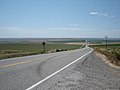
 Highway 51 Bruneau Idaho - panoramio - Chanilim714.jpg 2,304 × 1,728; 1.81 nga MB
-
 Highway 51 Bruneau Idaho - panoramio.jpg 2,304 × 1,728; 1.64 nga MB
-
 HWY 78 between Farming land Hammett Idaho - panoramio.jpg 2,304 × 1,728; 1.67 nga MB
-
 IDMap-doton-GrandView.PNG 197 × 300; 20 nga KB
-
 IDMap-doton-Homedale.PNG 197 × 300; 20 nga KB
-
 IDMap-doton-Marsing.PNG 197 × 300; 20 nga KB
-
 Jump Creek Falls 1.jpg 1,000 × 664; 506 nga KB
-
 Jump Creek Falls 2.jpg 664 × 1,000; 567 nga KB
-
-
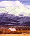 Owyhee Mountains.jpg 600 × 706; 94 nga KB
-
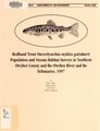
 Population structure of spotted frogs in the Owyhee Mountains (IA populationstruct00engl).pdf 629 × 827, 12 mga pakli; 706 nga KB
-
 Potato Farming Land Bruneau Idaho - panoramio.jpg 2,304 × 1,728; 1.63 nga MB
-
 Quartz mine and mill - famous de Lamar mine and mill LCCN2008676705.jpg 2,564 × 4,207; 3.14 nga MB
-
-
 Sheep Creek Idaho.jpg 153 × 204; 40 nga KB
-
 Soda Fire Emergency Wild Horse Gather (20747307058).jpg 5,472 × 2,909; 5.04 nga MB
-
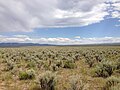
 South of Marsing sagebrush steppe (Somer Camp Road area) (9677455554).jpg 4,608 × 3,456; 4.6 nga MB
-
 South of Marsing sagebrush steppe (Somer Camp Road) (9674223427).jpg 4,608 × 3,456; 4.51 nga MB
-
 South of Marsing sagebrush steppe (Somer Camp Road) (9677454564).jpg 4,608 × 3,456; 4.62 nga MB
-
 U.S. 95 Between Jordan Valley, Oregon and Marsing, Idaho.jpg 4,000 × 1,687; 3.21 nga MB
-
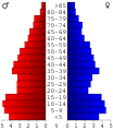 USA Owyhee County, Idaho age pyramid.svg 520 × 600; 8 nga KB
-
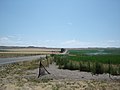
 이정표 near by Bruneau Dunes State Park ID - panoramio.jpg 2,304 × 1,728; 1.75 nga MB


_about_7.5_miles_north_of_Gold_Creek_Road_(Elko_County_Route_749)_and_Diamond_A_Road_(Elko_County_Route_751)_near_the_Nevada_and_Idaho_border.JPG)
_about_7.8_miles_north_of_Gold_Creek_Road_(Elko_County_Route_749)_and_Diamond_A_Road_(Elko_County_Route_751)_at_the_signed_Nevada_and_Idaho_border.JPG)
_about_7.8_miles_north_of_Gold_Creek_Road_(Elko_County_Route_749)_and_Diamond_A_Road_(Elko_County_Route_751)_at_the_signed_Nevada_and_Idaho_border.JPG)
_about_7.8_miles_north_of_Gold_Creek_Road_(Elko_County_Route_749)_and_Diamond_A_Road_(Elko_County_Route_751)_at_the_signed_Nevada_and_Idaho_border.JPG)
_about_7.8_miles_north_of_Gold_Creek_Road_(Elko_County_Route_749)_and_Diamond_A_Road_(Elko_County_Route_751)_at_the_signed_Nevada_and_Idaho_border.JPG)
_about_7.8_miles_north_of_Gold_Creek_Road_(Elko_County_Route_749)_and_Diamond_A_Road_(Elko_County_Route_751)_at_the_signed_Nevada_and_Idaho_border.JPG)


.jpg)
.jpg)


.jpg)
_(9677455554).jpg)
_(9674223427).jpg)
_(9677454564).jpg)


.jpg)