Category:Ozark Mountains
Zur Navigation springen
Zur Suche springen
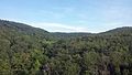
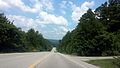
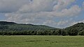
- The Ozark Mountains—Ozarks — mountain range and dissected plateau in Arkansas, Kansas, Missouri, and Oklahoma.
Gebirgszug  View of the Ozarks from the Buffalo National River, Newton County, Arkansas | |||||
| Medium hochladen | |||||
| Ist ein(e) | |||||
|---|---|---|---|---|---|
| Ist Teil von | |||||
| Material | |||||
| Ort | |||||
| Breite |
| ||||
| Länge |
| ||||
| Fläche |
| ||||
| Höhe über dem Meeresspiegel |
| ||||
 | |||||
Unterkategorien
Es werden 12 von insgesamt 12 Unterkategorien in dieser Kategorie angezeigt:
In Klammern die Anzahl der enthaltenen Kategorien (K), Seiten (S), Dateien (D)
Medien in der Kategorie „Ozark Mountains“
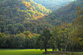
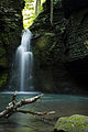
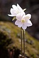
Folgende 107 Dateien sind in dieser Kategorie, von 107 insgesamt.
-
 A beautiful scene on Current River in the Ozarks (79270).jpg 3.303 × 2.100; 2,88 MB
-
 A destitute family, Ozark Mountains area, Arkansas, 8a16384.jpg 4.092 × 2.744; 3,84 MB
-
 A destitute family, Ozark Mountains area, Arkansas, 8a16384.tif 4.282 × 3.006; 24,57 MB
-
 A rural scene in the beautiful Ozarks (80267).jpg 3.264 × 2.080; 2,73 MB
-
 A typical float scene in the scenic Ozarks (78185).jpg 3.300 × 2.070; 2,89 MB
-
 Arkansas and Missouri Railroad 001.jpg 1.974 × 2.968; 2,52 MB
-
 Arkansas and Missouri Railroad 002.jpg 2.014 × 3.033; 2,83 MB
-
 Arkansas Nuclear One cooling tower.jpg 3.648 × 2.736; 5,57 MB
-
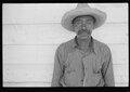
 Arkansas sharecropper, 8a16804a.jpg 4.147 × 2.767; 4,2 MB
-
 Arkansas sharecropper, 8a16804a.tif 4.336 × 3.055; 25,29 MB
-
 Artist's Point, AR.JPG 4.000 × 3.000; 5,07 MB
-
 Beech on the River (13170981894).jpg 2.400 × 1.600; 1,78 MB
-
 Big Sugar Creek.jpg 425 × 290; 47 KB
-
 Boston Mountains 001.jpg 4.128 × 2.322; 4,68 MB
-
 Boston Mountains 002.jpg 4.128 × 2.322; 4,16 MB
-
 Boston Mountains. Looking East on Gaither Mountain.jpg 10.304 × 4.010; 3,14 MB
-
 Boxley Valley 001.jpg 2.984 × 1.996; 2,22 MB
-
 Boxley Valley 002.jpg 2.611 × 3.911; 3,44 MB
-
 Boxley Valley 003.jpg 3.167 × 2.112; 1,82 MB
-
 Boxley Valley 004.jpg 3.000 × 2.004; 2,04 MB
-
 Buffalo River Outcrops (13170963854).jpg 2.400 × 1.600; 1,15 MB
-
 Buffalo River trail.jpg 2.160 × 2.880; 1,71 MB
-
 Buffalo River, AR (13170712135).jpg 2.400 × 1.600; 1,57 MB
-
 Bulletin - Biological Survey (1908) (19808465003).jpg 3.080 × 2.080; 2,76 MB
-
 Canebrake (13170822213).jpg 2.400 × 1.600; 1,65 MB
-
 Destitute tenant farmer's family, Ozark Mountains, Arkansas, 8a16361.jpg 4.104 × 2.726; 4,18 MB
-
 Destitute tenant farmer's family, Ozark Mountains, Arkansas, 8a16361.tif 4.288 × 3.030; 24,81 MB
-
 Entering Noel, Mo., the Price Drive of the Ozarks, U.S. Highway 71 (78308).jpg 3.306 × 2.064; 2,85 MB
-
 Fall in the Ozarks.jpg 5.202 × 3.463; 17,71 MB
-
 Fence Lizard (13170757493).jpg 1.926 × 1.285; 664 KB
-
 Fishing is always good in the Ozarks (80266).jpg 3.309 × 2.108; 3,17 MB
-
 Frog Pond (13170932084).jpg 2.400 × 1.600; 1,92 MB
-
 Fuzzybutt Falls.jpg 3.312 × 4.968; 9,95 MB
-
 Gfp-arkansas-mount-magazine-state-park-the-ozark-valley.jpg 3.253 × 2.194; 1,48 MB
-
 Gulf Coastal Plains and Ozarks LCC (14037139560).jpg 4.000 × 2.248; 2,11 MB
-
 Ha Ha Tonka Spring on Lake of the Ozarks.jpg 1.872 × 416; 1,05 MB
-
 Hepatica Bloom (13170939304).jpg 1.512 × 2.274; 551 KB
-
 Highway 5, 9 and 14 in Mountain View, AR 002.jpg 4.128 × 2.322; 2,79 MB
-
 Highway 5, 9 and 14 in Mountain View, AR 003.jpg 4.128 × 2.322; 2,8 MB
-
 Highway 66 overlook near Mountain View, AR.jpg 2.820 × 1.761; 703 KB
-
 Highway 66, between Waynesville and Rolla, Missouri in the beautiful Ozarks (79681).jpg 3.291 × 2.073; 2,9 MB
-
 Home in the Ozark Mountains, Colp Arkansas (7977385274).jpg 448 × 315; 59 KB
-
 I-540 and US 71 run in Fayetteville.jpg 3.413 × 2.174; 1,04 MB
-
 I-540 near Winslow, Arkansas.jpg 2.272 × 1.704; 912 KB
-
 John Vachon, Ozark children getting mail from RFD box, Missouri, 1940.jpg 3.598 × 2.524; 1,26 MB
-
 Lake Fort Smith 001.jpg 3.000 × 2.000; 7,48 MB
-
 Level IV ecoregions, Nebraska and Kansas.pdf 6.654 × 5.264; 3,36 MB
-
 Looking out into the Ozark forest from the Bluff Shelter.jpg 3.888 × 2.592; 4,45 MB
-
 Lower Boston Mountains near Marshall, AR.jpg 3.887 × 2.187; 789 KB
-
 Meadowcreek Sign.jpg 122 × 100; 4 KB
-
 Mina Sauk Falls.jpg 1.852 × 3.216; 3,14 MB
-
 Misty Bluff along the Buffalo River.jpg 3.072 × 2.304; 1,73 MB
-
 Misty mountains.JPG 2.048 × 1.536; 224 KB
-
 Mount Sequoyah and Fayetteville from University of Arkansas.jpg 4.000 × 3.000; 4,29 MB
-
 Native Dogwood in the beautiful Ozarks (80268).jpg 3.299 × 2.089; 2,9 MB
-
 Natural Dam, Arkansas 002.jpg 3.455 × 1.944; 908 KB
-
 Nuberscher Ozark Landscape 1920.jpg 400 × 308; 46 KB
-
 Nuderscher nocturn.jpg 844 × 840; 184 KB
-
 October Ozark Woodlands.jpg 1.600 × 1.200; 1,14 MB
-
 Ouachitas II (13157570275).jpg 1.724 × 1.600; 376 KB
-
 Ozark Bluffs (13170643145).jpg 1.600 × 2.374; 1,53 MB
-
 Ozark Cliffs (13170772513).jpg 2.400 × 1.600; 2,2 MB
-
 Ozark Folk Center.png 143 × 163; 41 KB
-
 Ozark Highlands ecoregion, Level III.png 244 × 185; 40 KB
-
 Ozark Highlands Scenic Byway 002.jpg 2.570 × 3.870; 3,21 MB
-
 Ozark Mountains farmer and family, Missouri, 8c17559.jpg 12.842 × 9.510; 43,8 MB
-
 Ozark Mountains farmer and family, Missouri, 8c17559.tif 13.917 × 10.767; 142,93 MB
-
 Ozark Mtn Stream (13170917124).jpg 2.400 × 1.600; 1,81 MB
-
 Ozark Pool (13170696425).jpg 3.089 × 1.600; 2,03 MB
-
 Ozark Seep (13170907034).jpg 2.400 × 1.600; 1,81 MB
-
 Ozark Stream (13170689525).jpg 2.400 × 1.600; 1,97 MB
-
 Ozark Trail completed sections w relief v3.jpg 1.214 × 924; 812 KB
-
 Ozark Trail Jan2009 relief map v3.jpg 2.217 × 1.529; 1,08 MB
-
 Ozark-Folk-Center2.jpg 200 × 110; 33 KB
-
 OzarkRelief.jpg 800 × 658; 167 KB
-
 Ozarks Highlands of Missouri.png 523 × 474; 186 KB
-
 Ozarks.jpg 2.560 × 1.920; 927 KB
-
 Scenic Lookout on White Rock Mountain.jpg 1.024 × 768; 487 KB
-
 Shelter on White Rock Mountain.jpg 3.072 × 2.304; 1,34 MB
-
 Snawfus Breathing.jpg 987 × 660; 691 KB
-
 Snawfus Leaping.jpg 720 × 1.080; 1,15 MB
-
 Snawfus.jpg 2.100 × 1.586; 833 KB
-
 South Fork river at Kia Kima Scout Reservation.jpg 4.032 × 3.024; 3,31 MB
-
 Spring Peeper at Rest (13170680995).jpg 2.400 × 1.600; 721 KB
-
 Spring Peeper Calling.jpg 2.252 × 1.501; 816 KB
-
 Sunset from Reed Mountain.jpg 2.544 × 1.676; 889 KB
-
 Theb1618 - Flickr - NOAA Photo Library.jpg 776 × 1.388; 327 KB
-
 U.S. Highway 71, the Prize Drive of the Ozarks, near Noel, Mo (78307).jpg 3.288 × 2.056; 3,09 MB
-
 U.S. Highway 71, the Prize Drive of the Ozarks, near Noel, Mo (78309).jpg 2.123 × 3.284; 3,17 MB
-
 University of Arkansas Campus 03.jpg 895 × 596; 121 KB
-
 University of Arkansas Campus 06.jpg 1.180 × 786; 155 KB
-
 US 62 and US 412 in Mountain Home.jpg 3.184 × 2.123; 1,65 MB
-
 View from Mount Magazine.JPG 3.648 × 2.736; 3,95 MB
-
 View from Taum Sauk Mountain Lookout Tower.JPG 3.648 × 2.736; 4,09 MB
-
 View from White Rock Mountain.jpg 4.277 × 2.835; 8,38 MB
-

-

-
 Walton College in the Ozark Mountains.jpg 5.248 × 2.952; 2,38 MB
-
 White River, famous for float trips, in the beautiful Ozarks (79277).jpg 3.301 × 2.053; 2,81 MB
-
 White Rock Mountain overlook 001.jpg 4.128 × 2.322; 2,26 MB
-
 White Rock Mountain overlook 002.jpg 4.128 × 2.322; 2,62 MB
-
 White Rock Mountain overlook 003.jpg 2.322 × 4.128; 2,43 MB
-
 White Rock Mountain overlook 004.jpg 4.128 × 2.322; 2,26 MB
-
 White Rock Mountain.jpg 4.264 × 2.824; 8,4 MB
-
 White Rock SM.jpg 800 × 533; 138 KB
-
 Wild Azaleas in beautiful Ozarks (79500).jpg 2.111 × 3.303; 3,05 MB
-
 Camassia scilloides Ozarks.jpg 1.328 × 2.000; 596 KB
.jpg)

.jpg)
.jpg)


.jpg)


.jpg)

.jpg)
_(19808465003).jpg)
.jpg)

.jpg)

.jpg)
.jpg)
.jpg)


.jpg)
.jpg)


.jpg)
.jpg)


.jpg)


.jpg)
.jpg)
.jpg)


.jpg)
.jpg)
.jpg)
.jpg)


.jpg)


.jpg)
.jpg)


.jpg)


.jpg)
