Category:Penzance
Zur Navigation springen
Zur Suche springen
Kleinstadt im Vereinigten Königreich  Панорама Пензанса со стороны гавани | |||||
| Medium hochladen | |||||
| Aussprache (Audiodatei) | |||||
|---|---|---|---|---|---|
| Ist ein(e) | |||||
| Ort | Cornwall, Südwestengland, England | ||||
| Einwohnerzahl |
| ||||
| Fläche |
| ||||
| Höhe über dem Meeresspiegel |
| ||||
| offizielle Website | |||||
 | |||||
Unterkategorien
Es werden 39 von insgesamt 39 Unterkategorien in dieser Kategorie angezeigt:
In Klammern die Anzahl der enthaltenen Kategorien (K), Seiten (S), Dateien (D)
- Boundary stones of Penzance (24 D)
1
- Penzance in the 1940s (1 D)
2
B
- Bash Street Theatre Company (28 D)
- Battle of Cornwall (1 D)
C
- Chyandour (29 D)
- COVID-19 pandemic in Penzance (42 D)
E
G
- Graffiti in Penzance (24 D)
H
J
- Jubilee Pool (69 D)
M
- Maps of Penzance (16 D)
N
P
- Penzance Promenade (81 D)
- Plaques in Penzance (14 D)
- Post boxes in Penzance (30 D)
R
- Regent Square, Penzance (6 D)
S
- Sheffield, Cornwall (16 D)
T
- Truro and Penwith College (13 D)
V
- Views of St Michael's Mount (271 D)
W
- Wherrytown (50 D)
~
Medien in der Kategorie „Penzance“
Folgende 200 Dateien sind in dieser Kategorie, von 627 insgesamt.
(vorherige Seite) (nächste Seite)-
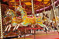
 'Galloping horses' carousel in Penzance - geograph.org.uk - 3021297.jpg 480 × 640; 112 KB
-
 'Pirate' ship in Penzance Harbour - geograph.org.uk - 5250061.jpg 480 × 640; 81 KB
-
 30 mile speed limit - geograph.org.uk - 5127159.jpg 470 × 640; 130 KB
-
 A car being hoisted aboard the Scillonian III at Penzance - geograph.org.uk - 5506576.jpg 3.864 × 5.152; 5,01 MB
-
 A country bus stop - geograph.org.uk - 6266469.jpg 1.024 × 768; 277 KB
-
 A lamppost to the skies (450561744).jpg 2.136 × 2.848; 876 KB
-

-
 Acrocercops brongniardella mine.jpg 2.050 × 2.733; 1,59 MB
-
 Alder tongue gall (Taphrina alni).jpg 3.024 × 4.032; 2,86 MB
-
 Alley off Bread St - geograph.org.uk - 5134305.jpg 640 × 426; 80 KB
-
 Alley off Bread St - geograph.org.uk - 5134309.jpg 640 × 426; 77 KB
-
 Alley off North Cliff - geograph.org.uk - 6181044.jpg 1.500 × 2.000; 3,02 MB
-
 Along the Shoreline - geograph.org.uk - 3392085.jpg 6.000 × 4.000; 7,78 MB
-
 Along the shoreline at Roskilly - geograph.org.uk - 4791114.jpg 1.142 × 857; 339 KB
-
 Amauromyza verbasci.jpg 1.951 × 2.015; 1,55 MB
-
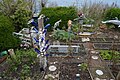 An interesting garden - geograph.org.uk - 5115800.jpg 640 × 426; 126 KB
-

-
 B3315 toward Treen - geograph.org.uk - 5463760.jpg 640 × 480; 54 KB
-
 B3315 towards Sheffield - geograph.org.uk - 5463755.jpg 640 × 480; 57 KB
-
 Back alley off St Mary's Street, Penzance, Cornwall - June 2022 (1).jpg 3.024 × 4.032; 3,17 MB
-
 Back alley off St Mary's Street, Penzance, Cornwall - June 2022 (2).jpg 3.630 × 2.778; 2,06 MB
-
 Battery Rocks - geograph.org.uk - 5085832.jpg 640 × 411; 64 KB
-
 Battery Rocks - geograph.org.uk - 5095133.jpg 640 × 426; 76 KB
-
 Battery Rocks - geograph.org.uk - 5095134.jpg 640 × 426; 46 KB
-
 Beach at Wherry Town - geograph.org.uk - 5103327.jpg 640 × 426; 88 KB
-
 Beach north of Newlyn - geograph.org.uk - 5103341.jpg 640 × 426; 91 KB
-
 Beach, Wherry Town - geograph.org.uk - 5095257.jpg 640 × 426; 76 KB
-

-
 Between Roskilly and Skilly - geograph.org.uk - 4791116.jpg 1.306 × 979; 414 KB
-
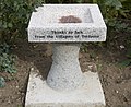 Birdbath at Tredavoe - geograph.org.uk - 3142941.jpg 640 × 522; 119 KB
-
 Bleu bridge - geograph.org.uk - 3394779.jpg 772 × 579; 416 KB
-
 Bluebell Dell above Newlyn - geograph.org.uk - 4448956.jpg 1.024 × 768; 435 KB
-
 Boat, Penzance Dock - geograph.org.uk - 5085805.jpg 640 × 426; 43 KB
-
 Boscathnoe Lane near Polteggan House - geograph.org.uk - 5384625.jpg 4.000 × 3.000; 4,06 MB
-
 Boscathnoe Reservoir - geograph.org.uk - 2972479.jpg 640 × 427; 86 KB
-
 Bowls Pavilion - geograph.org.uk - 5103331.jpg 640 × 426; 47 KB
-
 British Telecom property - geograph.org.uk - 3185185.jpg 640 × 427; 135 KB
-
 Building by Penzance Station - geograph.org.uk - 5132083.jpg 640 × 426; 47 KB
-
 Car Park North of Penzance Harbour - geograph.org.uk - 5462981.jpg 1.600 × 1.200; 718 KB
-
 Car park, Alverton Rd - geograph.org.uk - 5134138.jpg 640 × 426; 75 KB
-
 Carousel near Penzance harbour (7378).jpg 4.288 × 2.848; 6,17 MB
-
 Carousel near Penzance harbour (7379).jpg 4.288 × 2.848; 6,79 MB
-
 1 Carrick-98005 - Penzance from Newlyn - John Mulcaster Carrick.jpg 1.728 × 1.137; 504 KB
-
 Castle Horneck YHA Camping Lawn - geograph.org.uk - 4968204.jpg 4.608 × 3.456; 5,88 MB
-
 Cave Lane - geograph.org.uk - 6245137.jpg 4.032 × 3.024; 2,86 MB
-

-
 Chimney Rocks - geograph.org.uk - 5095137.jpg 640 × 369; 50 KB
-
 Chimney Rocks - geograph.org.uk - 5095189.jpg 640 × 426; 95 KB
-
 Chimney Rocks - geograph.org.uk - 5095209.jpg 640 × 426; 93 KB
-
 Church Archway ^ 2CV - geograph.org.uk - 5445119.jpg 2.194 × 3.290; 3,01 MB
-
 Clear water - geograph.org.uk - 2997014.jpg 600 × 800; 194 KB
-
 Cliff Rd - geograph.org.uk - 5115598.jpg 640 × 426; 65 KB
-
 Cliff Rd - geograph.org.uk - 5115599.jpg 640 × 426; 61 KB
-
 Cliff Rd - geograph.org.uk - 5115613.jpg 640 × 426; 86 KB
-
 Cliff Rd - geograph.org.uk - 5115617.jpg 640 × 426; 83 KB
-
 Cliff Rd - geograph.org.uk - 5115762.jpg 640 × 426; 61 KB
-
 Closed, New St - geograph.org.uk - 5140061.jpg 640 × 426; 73 KB
-
 Coach depot and supermarket - geograph.org.uk - 5885226.jpg 4.896 × 3.672; 6,67 MB
-
 Coast FM, Studio A.jpg 2.715 × 2.036; 484 KB
-
 Coastal defences near Penzance - geograph.org.uk - 5463705.jpg 640 × 480; 61 KB
-
 Coastal defences near Penzance - geograph.org.uk - 5463709.jpg 640 × 480; 77 KB
-
 Coastal Defences, Penzance - geograph.org.uk - 3392132.jpg 4.000 × 2.666; 6,73 MB
-
 Coastal path approaching Newlyn - geograph.org.uk - 6296341.jpg 1.024 × 779; 670 KB
-
 Coastal Path, Penzance - geograph.org.uk - 3392099.jpg 6.000 × 4.000; 6,61 MB
-
 Coastal Path, Penzance - geograph.org.uk - 3392146.jpg 6.000 × 4.000; 7,54 MB
-
 Coastline at Roskilly - geograph.org.uk - 6296339.jpg 1.024 × 776; 809 KB
-
 Communications trio on a Penzance corner - geograph.org.uk - 4991517.jpg 800 × 783; 191 KB
-
 Cornish flag sticker, Penzance.jpg 4.032 × 3.024; 1,95 MB
-
 Cottages above Cliff Road - geograph.org.uk - 4791128.jpg 1.306 × 979; 385 KB
-
 Country lane near Lesingey - geograph.org.uk - 6245046.jpg 4.032 × 3.024; 2,83 MB
-
 Creeping Lane at Tolcarne - geograph.org.uk - 5384741.jpg 4.000 × 3.000; 4,67 MB
-
 Crepes Suzettes - geograph.org.uk - 3035051.jpg 1.024 × 768; 166 KB
-
 Daft Dog scares his mum^ - geograph.org.uk - 4790965.jpg 1.469 × 1.102; 450 KB
-

-
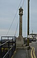
 Davey Monument - geograph.org.uk - 5140051.jpg 370 × 640; 58 KB
-
 Davey Monument - geograph.org.uk - 5140659.jpg 482 × 640; 75 KB
-
 Decorative flag pole base, St John's Hall, Penzance, Cornwall - June 2022 (1).jpg 1.294 × 3.576; 1,69 MB
-
 Decorative flag pole base, St John's Hall, Penzance, Cornwall - June 2022 (2).jpg 1.631 × 4.397; 1,73 MB
-

-
 Detail of the raised flowerbed - geograph.org.uk - 3142944.jpg 640 × 427; 142 KB
-
 Different modes of transport - geograph.org.uk - 5103336.jpg 640 × 426; 82 KB
-
 Directions sign in Penzance - geograph.org.uk - 4984670.jpg 800 × 642; 127 KB
-
 Disused quarry, Penlee Point - geograph.org.uk - 5115796.jpg 640 × 426; 76 KB
-
 Don't drop it - geograph.org.uk - 6174226.jpg 1.600 × 1.200; 546 KB
-
 Donnington Rd - geograph.org.uk - 5127153.jpg 640 × 426; 53 KB
-
 Doorway on Love Lane Bridleway - geograph.org.uk - 5001077.jpg 4.608 × 3.456; 6,51 MB
-
 Elizabeth II postbox outside Penzance Railway Station - geograph.org.uk - 5465332.jpg 2.848 × 2.136; 1,46 MB
-
 Entrance to farm at Raginnis - geograph.org.uk - 3447252.jpg 640 × 427; 85 KB
-
 Entrance to Penzance Harbour - geograph.org.uk - 5085784.jpg 640 × 426; 35 KB
-
 Environment Agency Bench Mark at Newlyn - geograph.org.uk - 5463299.jpg 1.600 × 1.202; 537 KB
-
 Environment Agency Benchmark - geograph.org.uk - 5463291.jpg 1.418 × 1.139; 710 KB
-
 Ernest Dade - A Penzance Boat Off To The Fishing Grounds.jpg 518 × 361; 63 KB
-
 Exposed rocks at the end of Eastern Green Beach - geograph.org.uk - 4238106.jpg 3.872 × 2.592; 4,12 MB
-
 Field near Tredavoe - geograph.org.uk - 5092215.jpg 2.592 × 1.944; 1,4 MB
-
 Field of daffodils - in December^ - geograph.org.uk - 3288252.jpg 1.024 × 768; 279 KB
-
 Fish Processing Unit - geograph.org.uk - 5103632.jpg 640 × 426; 66 KB
-
 Fitzroy Barometer - geograph.org.uk - 5118979.jpg 640 × 426; 93 KB
-
 Fitzroy Barometer, The Ship Inn - geograph.org.uk - 5118982.jpg 426 × 640; 93 KB
-
 Fitzroy Barometer, The Ship Inn - geograph.org.uk - 5118983.jpg 426 × 640; 107 KB
-
 Fitzroy Barometer, The Ship Inn - geograph.org.uk - 5121185.jpg 404 × 640; 85 KB
-
 Flat rocks - geograph.org.uk - 5107495.jpg 640 × 375; 79 KB
-
 Floral centre - geograph.org.uk - 3142940.jpg 640 × 482; 153 KB
-

-
 Footbridge - geograph.org.uk - 3142387.jpg 640 × 427; 142 KB
-
 Footbridge Across the Line - geograph.org.uk - 3392162.jpg 4.000 × 2.510; 5,86 MB
-
 Footbridge over the railway near Penzance - geograph.org.uk - 5323885.jpg 4.000 × 3.000; 3,2 MB
-
 Footpath to Paul - geograph.org.uk - 3197246.jpg 640 × 427; 102 KB
-
 Fore St - geograph.org.uk - 5107419.jpg 640 × 426; 80 KB
-
 Fore St - geograph.org.uk - 5118800.jpg 640 × 426; 68 KB
-
 Fore St, St Peter's Hill - geograph.org.uk - 5107331.jpg 640 × 426; 71 KB
-

-
 Further detail of the raised flowerbed - geograph.org.uk - 3142946.jpg 427 × 640; 147 KB
-
 Garden allotments along Cliff Road - geograph.org.uk - 4791113.jpg 1.068 × 801; 350 KB
-
 Gateway - geograph.org.uk - 3005332.jpg 800 × 600; 175 KB
-
 Ginko. (spring). PZ . - panoramio.jpg 3.000 × 4.000; 4,73 MB
-
 Ginko. (summer). PZ. - panoramio.jpg 3.000 × 4.000; 6,93 MB
-
 Girder across the stream - geograph.org.uk - 3142404.jpg 427 × 640; 135 KB
-
 Glider over penzance (6313).jpg 4.288 × 2.848; 2,62 MB
-
 Gravestones - geograph.org.uk - 5445120.jpg 2.441 × 3.661; 3,75 MB
-
 Grenfall St - geograph.org.uk - 5118810.jpg 640 × 426; 89 KB
-
 Grenfall St - geograph.org.uk - 5118814.jpg 640 × 426; 84 KB
-
 Gry Maritha off Mousehole (7317).jpg 4.288 × 2.848; 5,01 MB
-
 Gry Maritha off St Clement's Isle (7314).jpg 4.288 × 2.848; 6,17 MB
-
 Guide post to Penzance.jpg 3.024 × 4.032; 4,55 MB
-
 Gull on Chimney Rocks (6289).jpg 4.288 × 2.848; 5,92 MB
-
 Gulval Church - geograph.org.uk - 5024214.jpg 640 × 480; 133 KB
-
 Gurnick Street - geograph.org.uk - 6181062.jpg 1.500 × 2.000; 2,46 MB
-
 Gurnick Street - geograph.org.uk - 6181066.jpg 2.000 × 1.520; 2,46 MB
-
 Gurnick Street in Mousehole - geograph.org.uk - 4790285.jpg 1.142 × 857; 346 KB
-
 Gwavas Lake - geograph.org.uk - 5908250.jpg 1.024 × 768; 143 KB
-
 Harbour Court - geograph.org.uk - 4238016.jpg 3.872 × 2.592; 4,18 MB
-
 Harbourside building - geograph.org.uk - 5107399.jpg 640 × 426; 77 KB
-
 Harbourside Cafe - geograph.org.uk - 5085794.jpg 640 × 426; 56 KB
-
 Harbourside Houses - geograph.org.uk - 5118808.jpg 640 × 426; 59 KB
-
 Harbourside Houses - geograph.org.uk - 5118997.jpg 640 × 479; 76 KB
-
 Heading south east on the A30 - geograph.org.uk - 5464473.jpg 640 × 480; 79 KB
-
 Heavy seas at Penzance - geograph.org.uk - 5703678.jpg 5.202 × 3.465; 4,24 MB
-
 Hedge and ploughed field, from Lesingey Lane - geograph.org.uk - 4880525.jpg 1.600 × 1.200; 454 KB
-
 Hedgebanks along Lesingey Lane - geograph.org.uk - 4881047.jpg 1.600 × 1.200; 313 KB
-
 Helicopter on its way to the Scillies - geograph.org.uk - 449471.jpg 640 × 426; 59 KB
-
 Herb planter & fairy door, Causewayhead, Penzance, Cornwall - June 2022.jpg 3.576 × 2.520; 2,19 MB
-
 Here Comes the Beach^ - geograph.org.uk - 3391557.jpg 4.000 × 2.666; 5,84 MB
-
 High and dry - geograph.org.uk - 6170298.jpg 640 × 480; 65 KB
-
 High and dry, Penzance - geograph.org.uk - 462993.jpg 640 × 480; 57 KB
-
 HMS Penzance memorial, Penlee Gardens - geograph.org.uk - 4057094.jpg 3.275 × 2.713; 2,08 MB
-
 Hole Foods - geograph.org.uk - 5115917.jpg 640 × 426; 53 KB
-
 Home of Dolly Pentreath - geograph.org.uk - 4263578.jpg 900 × 600; 142 KB
-
 Horse chestnut trees along the A30 - geograph.org.uk - 2397823.jpg 640 × 427; 102 KB
-
 Houses at Raginnis - geograph.org.uk - 6245125.jpg 4.032 × 3.024; 2,44 MB
-
 Houses on Cliff Rd - geograph.org.uk - 5115588.jpg 640 × 422; 62 KB
-
 Houses on Polmeere Road - geograph.org.uk - 5464465.jpg 640 × 480; 86 KB
-
 In Penzance - geograph.org.uk - 4189049.jpg 4.000 × 2.664; 4,25 MB
-
 Indoor Cycle Fitness @ YMCA - geograph.org.uk - 5134129.jpg 640 × 426; 53 KB
-
 Inlet in Wave cut platform - geograph.org.uk - 5107509.jpg 640 × 426; 99 KB
-
 It's not Land's End - geograph.org.uk - 6245147.jpg 3.024 × 4.032; 1,6 MB
-
 Keeping the home fires burning - geograph.org.uk - 3423611.jpg 1.024 × 768; 199 KB
-
 Keigwen Place - geograph.org.uk - 6181053.jpg 1.729 × 2.000; 2,5 MB
-
 Keigwin - geograph.org.uk - 5118988.jpg 640 × 426; 88 KB
-
 Keigwin - geograph.org.uk - 5118989.jpg 426 × 640; 69 KB
-
 Lariggan River - Skunk Cabbage (01).jpg 3.024 × 4.032; 4,64 MB
-
 Lariggan Rocks - geograph.org.uk - 5095276.jpg 640 × 411; 71 KB
-
 Lariggan Rocks - geograph.org.uk - 5095285.jpg 640 × 426; 68 KB
-
 Larrigan Brook - geograph.org.uk - 2976368.jpg 778 × 584; 428 KB
-
 Larrigan Brook - geograph.org.uk - 2976395.jpg 778 × 584; 443 KB
-
 Last stand - geograph.org.uk - 3472418.jpg 1.024 × 755; 83 KB
-
 Le Tour du monde-11-p365.jpg 2.856 × 1.902; 2,42 MB
-
 Leaving Mousehole - geograph.org.uk - 4189044.jpg 3.424 × 2.436; 3,7 MB
-
 Lesingey Lane near the entrance to Lesingey - geograph.org.uk - 5384617.jpg 4.000 × 3.000; 3,84 MB
-
 Lesingey Lane, bridge over Larriggan River - geograph.org.uk - 4879812.jpg 1.600 × 1.200; 457 KB
-
 Light pink semi-cactus dahlia in Penzance - June 2019.jpg 4.608 × 3.456; 5,45 MB
-
 Lighthouse at end of South Pier - geograph.org.uk - 5445122.jpg 3.000 × 4.000; 2,59 MB
-
 Lighthouse at end of South Pier - geograph.org.uk - 5445124.jpg 4.000 × 3.000; 2,34 MB
-

-
 Lighthouse on South Pier - geograph.org.uk - 6140414.jpg 3.264 × 2.448; 2,12 MB
-
 Lodge ^ Thomas Penzance office - geograph.org.uk - 4982899.jpg 800 × 615; 124 KB
-
 Looking across to St Clement's Isle - geograph.org.uk - 6245135.jpg 4.032 × 3.024; 1,63 MB
-
 Looking across to St Clement's Isle - geograph.org.uk - 6245144.jpg 4.032 × 3.024; 1,96 MB
-
 Looking back to Penzance - geograph.org.uk - 5103541.jpg 640 × 426; 84 KB
-
 Looking towards Penzance at low tide - geograph.org.uk - 5885233.jpg 4.896 × 3.672; 6,69 MB
-
 Low tide rocks, looking across to St Clement's Isle - geograph.org.uk - 6245151.jpg 4.032 × 3.024; 2,22 MB
-
 Lower Trevaylor - geograph.org.uk - 3010523.jpg 800 × 571; 70 KB
-
 Medieval wayside cross, Paul (detail) - geograph.org.uk - 5145061.jpg 767 × 1.024; 408 KB
-
 Memorial Fountain beside railway station - geograph.org.uk - 1547300.jpg 491 × 640; 105 KB
-
 Memorial to Bill Harris - geograph.org.uk - 5107389.jpg 640 × 426; 54 KB
-
 Memorial ^ Battery Rocks, Penzance - geograph.org.uk - 3061300.jpg 640 × 356; 39 KB
-
 Memorials at Penlee Lifeboat Station (7323).jpg 4.288 × 2.848; 6,42 MB
-
-

-

-
 Mill Lane - geograph.org.uk - 6181050.jpg 2.000 × 1.500; 2,64 MB
-
 Minor road towards Mousehole - geograph.org.uk - 6296332.jpg 1.024 × 768; 818 KB
-
 Minor road towards Paul - geograph.org.uk - 5463757.jpg 640 × 480; 66 KB
-
 Monument to Louisa Mc Grigor - geograph.org.uk - 5107272.jpg 408 × 640; 42 KB
-
 Monument to Louisa Mc Grigor - geograph.org.uk - 5107280.jpg 426 × 640; 58 KB
-
 Mounts Bay Electrical shop, Penzance - geograph.org.uk - 4991621.jpg 800 × 762; 155 KB
-
 National Cycle Network Milepost - geograph.org.uk - 5107522.jpg 426 × 640; 102 KB
-
 National Cycle Network Milepost - geograph.org.uk - 5126975.jpg 640 × 426; 39 KB
-
 National Cycle Network route 3 at Skilly - geograph.org.uk - 4791125.jpg 1.306 × 979; 412 KB
-
 National Cycle Route 3 - geograph.org.uk - 5107488.jpg 640 × 426; 71 KB
-
 National Cycle Route 3 - geograph.org.uk - 5107499.jpg 640 × 426; 55 KB


.jpg)


.jpg)


.jpg)
.jpg)


.jpg)
.jpg)


._PZ_._-_panoramio.jpg)
._PZ._-_panoramio.jpg)

.jpg)


.jpg)
.jpg)

.jpg)


.jpg)


_-_geograph.org.uk_-_5145061.jpg)


.jpg)


.jpg)
.jpg)