Category:Plate tectonics
Skočit na navigaci
Skočit na vyhledávání
Italiano: Tettonica delle placche
· Magyar: Lemeztektonika
· Македонски: Тектоника на плочите
· 日本語: プレートテクトニクス
· věda zabývající se pohybem litosférických desek   | |||||
| Načíst soubor | |||||
| Instance (čeho) | |||||
|---|---|---|---|---|---|
| Nadtřída |
| ||||
| Část (čeho) | |||||
| Datum vydání |
| ||||
| |||||
Podkategorie
Zobrazuje se 32 podkategorií z celkového počtu 32 podkategorií v této kategorii.
+
- Diagrams of mid-ocean ridges (45 F)
A
- Accreted terrane (3 F)
C
- Continental breakup (2 F)
E
F
I
L
M
O
P
R
S
T
V
Soubory v kategorii „Plate tectonics“
Zobrazuje se 96 souborů z celkového počtu 96 souborů v této kategorii.
-

-
 2008 age of ocean plates.png 2 560 × 1 346; 6,13 MB
-
 2008 age of oceans plates.jpg 2 560 × 1 539; 2,94 MB
-
 Age of oceanic lithosphere.png 2 000 × 1 432; 2,52 MB
-
 Age-ocean-floor.jpg 750 × 350; 252 KB
-
 Antarctica Oceanic-Crust.jpg 600 × 600; 314 KB
-
 Antonio Snider-Pellegrini Opening of the Atlantic.jpg 1 834 × 1 079; 1,15 MB
-
 At Catavento, São Paulo 2019 143.jpg 5 184 × 3 456; 17,98 MB
-
 At Catavento, São Paulo 2019 144.jpg 3 456 × 5 184; 18,22 MB
-
 At San Francisco 2015 032.jpg 5 184 × 3 456; 2,79 MB
-
 At San Francisco 2015 033.jpg 5 184 × 3 456; 4,82 MB
-
 Atlantic Oceanic-Crust.jpg 600 × 600; 301 KB
-
 BAB of the World -Converted-.jpg 2 279 × 1 395; 462 KB
-
 Bac-arc-basin hg.png 1 625 × 1 155; 926 KB
-
 Carnegie Ridge.png 1 276 × 739; 933 KB
-
 Coiba & Malpelo Plates and major seismic faults of Colombia.jpg 768 × 759; 476 KB
-
 CourtHotspots.png 682 × 398; 60 KB
-
 Earth seafloor crust age 1996 - 2.png 1 624 × 1 020; 1,2 MB
-
 Earth seafloor crust age 1996.png 1 624 × 1 020; 958 KB
-
 Earth seafloor crust age poster.png 1 728 × 2 232; 2,13 MB
-
 Earth's global heat flow map.png 5 240 × 2 930; 1,6 MB
-
 Earth's seafloor age.png 5 585 × 2 742; 3,63 MB
-
 East Pacific Rise Oceanic-Crust.jpg 600 × 600; 320 KB
-
 Gpsavrasya.png 646 × 453; 219 KB
-
 Great Rift Valley map-gl.svg 1 403 × 1 808; 1,05 MB
-
 Grouse Creek block location1.jpg 1 131 × 1 206; 565 KB
-
 HotspotHighway.jpg 2 159 × 1 535; 1,67 MB
-
 Iberian Tectonic EN.svg 382 × 485; 695 KB
-
 India-Oceanic-Crustal-Map-with legend.jpg 450 × 450; 186 KB
-
 Ja-Platetechsimple.png 2 000 × 2 000; 67 KB
-
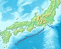
 Japan separation.png 1 500 × 1 056; 3,32 MB
-
 JPVD-NGTM2023-Comp2.jpg 15 007 × 6 858; 10,58 MB
-
 JPVD-NGTM2023-Terranes.jpg 6 000 × 2 747; 2,06 MB
-
 Legend-for-Oceanic-Crustal-Map.jpg 448 × 93; 56 KB
-
 Lwandle plate.svg 537 × 746; 281 KB
-
 Magnetic anomalies off west coast of North America.gif 435 × 664; 69 KB
-
 Magnetic anomalies off west coast of North America.png 435 × 664; 131 KB
-
 Map of tectonics in Asia.jpg 2 671 × 3 372; 1,54 MB
-
 Map of the Sumatra Trench.jpg 946 × 549; 638 KB
-
 Mape seyisses.jpg 350 × 219; 23 KB
-
 Mount Meager tectonics.png 470 × 575; 362 KB
-
 NASA fiordland 2009 earthquake.png 720 × 480; 363 KB
-
 NewEngland Seamount Chain.jpg 1 291 × 889; 194 KB
-
 North America and Europe Oceanic-Crust.jpg 600 × 600; 264 KB
-
 North Atlantic crust age 1996.gif 607 × 520; 174 KB
-
 Northeastern Philippine Sea Plate.jpg 748 × 600; 136 KB
-
 Northern end of the Philippine Sea Plate.jpg 813 × 601; 171 KB
-
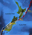 NZ faults.png 963 × 1 034; 765 KB
-
 Ocean Spreading Sediments.svg 512 × 251; 7 KB
-
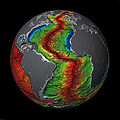 Oceanic Crust Sphere Map1.jpg 6 100 × 6 090; 7,79 MB
-
 OceanSpreadingMagnetism-N.svg 512 × 251; 18 KB
-
 Pacific seafloor crust age 2.gif 883 × 908; 439 KB
-
 Paleomagnetismoa.jpg 1 280 × 687; 75 KB
-
 Panoramica Plegamiento de Campodola.jpg 5 200 × 1 328; 3,82 MB
-
 Plate.png 855 × 601; 264 KB
-
 RISE project region.svg 916 × 793; 3,94 MB
-
 SDFE GNSS reference station Esbjerg, 2020-09-12.jpg 2 268 × 4 032; 1,49 MB
-
 Seafloor Spreading Sediments Animation.gif 571 × 280; 39 KB
-
 SeafloorSpreadingMagAnimation.gif 1 920 × 942; 317 KB
-
 Sezione vulcanologica del museo eoliano 07.jpg 4 272 × 2 848; 3,21 MB
-
 Sfbay srt 1906108.jpg 540 × 458; 105 KB
-
 Southwest Indian Ridge Oceanic-Crust.jpg 600 × 600; 306 KB
-
 Stamps2008animated.svg 340 × 604; 89 KB
-
 Subduction of the Pacific Plate beneath the North American Plate.jpg 850 × 723; 191 KB
-
 Tectonic plates boundary types & movement.png 2 806 × 2 162; 355 KB
-
 Tectonic plates rotation IT.png 1 280 × 720; 117 KB
-
 Tectonic plates rotation passive margins IT.png 1 280 × 720; 107 KB
-
 Tektonik Kurve von Isparta.jpg 1 193 × 1 282; 487 KB
-
 The New Glocal Tectonic Map - Hemisphere Projections.jpg 1 753 × 919; 531 KB
-
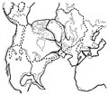
 The origin of continents and oceans - Wegener (1924) - figure 01.jpg 1 351 × 2 081; 809 KB
-
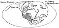
 The origin of continents and oceans - Wegener (1924) - figure 02.jpg 1 355 × 2 127; 836 KB
-
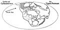
 The origin of continents and oceans - Wegener (1924) - figure 08.jpg 2 392 × 1 635; 1,12 MB
-
 The origin of continents and oceans - Wegener (1924) - figure 09.jpg 1 285 × 1 854; 901 KB
-
 The origin of continents and oceans - Wegener (1924) - figure 10.jpg 1 291 × 1 433; 515 KB
-
 The origin of continents and oceans - Wegener (1924) - figure 11.jpg 1 076 × 1 066; 651 KB
-
 The origin of continents and oceans - Wegener (1924) - figure 12.jpg 612 × 229; 77 KB
-
 The origin of continents and oceans - Wegener (1924) - figure 13.jpg 1 250 × 722; 429 KB
-
 The origin of continents and oceans - Wegener (1924) - figure 14.jpg 2 555 × 2 017; 913 KB
-
 The origin of continents and oceans - Wegener (1924) - figure 16.jpg 2 532 × 857; 635 KB
-
 The origin of continents and oceans - Wegener (1924) - figure 17.jpg 1 252 × 639; 113 KB
-
 The origin of continents and oceans - Wegener (1924) - figure 18.jpg 1 942 × 1 025; 1,03 MB
-
 The origin of continents and oceans - Wegener (1924) - figure 20.jpg 1 280 × 1 120; 467 KB
-
 The origin of continents and oceans - Wegener (1924) - figure 22.jpg 1 152 × 559; 96 KB
-
 The origin of continents and oceans - Wegener (1924) - figure 23.jpg 1 144 × 573; 87 KB
-
 The origin of continents and oceans - Wegener (1924) - figure 24.jpg 1 263 × 658; 451 KB
-
 The origin of continents and oceans - Wegener (1924) - figure 25.jpg 1 230 × 2 427; 518 KB
-
 The origin of continents and oceans - Wegener (1924) - figure 27.jpg 3 136 × 2 229; 1,3 MB
-
 The origin of continents and oceans - Wegener (1924) - figure 30.jpg 1 232 × 455; 350 KB
-
 The origin of continents and oceans - Wegener (1924) - figure 31.jpg 1 197 × 1 914; 682 KB
-
 The origin of continents and oceans - Wegener (1924) - figure 34.jpg 1 026 × 2 859; 1,05 MB
-
 The origin of continents and oceans - Wegener (1924) - figure 39.jpg 620 × 1 411; 325 KB
-
 The origin of continents and oceans - Wegener (1924) - figure 41.jpg 1 368 × 2 129; 495 KB
-
 The origin of continents and oceans - Wegener (1924) - figure 43.jpg 630 × 736; 138 KB
-
 Vematransform.svg 1 020 × 609; 393 KB
-
 WestcoastSeaplates.svg 878 × 666; 106 KB
-
 WorldCrustalAge - Hawaii hotspot.png 1 364 × 900; 584 KB


_-_figure_01.jpg)
_-_figure_02.jpg)
_-_figure_08.jpg)
_-_figure_09.jpg)
_-_figure_10.jpg)
_-_figure_11.jpg)
_-_figure_13.jpg)
_-_figure_14.jpg)
_-_figure_17.jpg)
_-_figure_18.jpg)
_-_figure_20.jpg)
_-_figure_22.jpg)
_-_figure_23.jpg)
_-_figure_24.jpg)
_-_figure_25.jpg)
_-_figure_27.jpg)
_-_figure_31.jpg)
_-_figure_39.jpg)
_-_figure_41.jpg)
_-_figure_43.jpg)


_-_figure_12.jpg)
_-_figure_16.jpg)
_-_figure_30.jpg)
_-_figure_34.jpg)