Category:Puerto Rico Highway 53
Jump to navigation
Jump to search
 | number: | (fifty-three) |
|---|---|---|
| Highways in Puerto Rico: | 33 · 34 · 35 · 36 · 37 · 38 · 39 · 40 · 41 · 42 · 47 · 52 · 53 · 54 · 60 · 63 · 64 · 65 · 66 |
highway in Puerto Rico   | |||||
| Upload media | |||||
| Instance of | |||||
|---|---|---|---|---|---|
| Location | Puerto Rico, Caribbean | ||||
| Transport network | |||||
| Owned by |
| ||||
| Maintained by |
| ||||
| Length |
| ||||
 | |||||
English: Media related to Puerto Rico Highway 53 (PR-53), a 94.0-kilometer (58.4-mile) primary highway in Puerto Rico.
Subcategories
This category has the following 3 subcategories, out of 3 total.
Media in category "Puerto Rico Highway 53"
The following 6 files are in this category, out of 6 total.
-
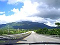 Highway from Naguabo to Ceiba, Puerto Rico.jpg 600 × 450; 61 KB
-
 PR old toll road 53.svg 600 × 600; 30 KB
-
 PR primary 53.svg 601 × 601; 5 KB
-
 PR secondary 53.svg 600 × 600; 3 KB
-
 PR urban primary 53.svg 601 × 601; 5 KB
-
 PR-53 Terminus.jpg 2,592 × 1,944; 998 KB


