Category:Ramsden, Oxfordshire
Jump to navigation
Jump to search
village and civil parish in West Oxfordshire, Oxfordshire, England  | |||||
| Upload media | |||||
| Instance of | |||||
|---|---|---|---|---|---|
| Location | West Oxfordshire, Oxfordshire, South East England, England | ||||
| official website | |||||
 | |||||
Subcategories
This category has the following 3 subcategories, out of 3 total.
Media in category "Ramsden, Oxfordshire"
The following 41 files are in this category, out of 41 total.
-
 Footpath to Ramsden - geograph.org.uk - 2777561.jpg 640 × 480; 68 KB
-
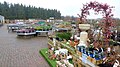
 Hilltop garden Centre, 1 - geograph.org.uk - 4399853.jpg 800 × 450; 204 KB
-
 Hilltop garden Centre, 2 - geograph.org.uk - 4399854.jpg 800 × 450; 199 KB
-
 Hilltop garden Centre, 3 - geograph.org.uk - 4399857.jpg 800 × 450; 224 KB
-
 Hilltop garden Centre, 4 - geograph.org.uk - 4399861.jpg 800 × 450; 222 KB
-
 Hilltop Garden Store, Witney Road, Ramsden, Oxon - geograph.org.uk - 4974796.jpg 1,024 × 658; 136 KB
-
 Leafield Road - geograph.org.uk - 6393213.jpg 800 × 450; 102 KB
-
 Leafield Road - geograph.org.uk - 6393218.jpg 800 × 450; 100 KB
-
 Leafield Road near Finstock - geograph.org.uk - 6286090.jpg 1,892 × 1,236; 1.83 MB
-
 Leafield Road to Finstock - geograph.org.uk - 6248377.jpg 2,700 × 2,025; 474 KB
-
 Leafield Road to Finstock - geograph.org.uk - 6248378.jpg 2,700 × 2,025; 589 KB
-
 Leafield Road, looking west - geograph.org.uk - 4400577.jpg 800 × 450; 187 KB
-

-
 Mount Skippet, Finstock - geograph.org.uk - 2734404.jpg 640 × 480; 58 KB
-

-
 Ramsden Memorial and Church - geograph.org.uk - 6496.jpg 475 × 600; 107 KB
-
 Ramsden AkemanCottage RoyalOak.JPG 3,000 × 1,800; 698 KB
-
 Ramsden Chapel & MemorialHall.JPG 3,000 × 1,800; 2.37 MB
-
 Ramsden memorial hall - geograph.org.uk - 1843044.jpg 640 × 480; 67 KB
-
 Ramsden Telephone Exchange, Oxon - geograph.org.uk - 5167008.jpg 2,592 × 1,944; 1.44 MB
-
 Road Junction near Ramsden - geograph.org.uk - 1040128.jpg 640 × 480; 51 KB
-
 Road through Ramsden - geograph.org.uk - 1843047.jpg 640 × 480; 68 KB
-
 Road to Ramsden - geograph.org.uk - 2777551.jpg 640 × 480; 61 KB
-
 The road from Finstock to Leafield - geograph.org.uk - 791095.jpg 640 × 427; 107 KB
-

-
 Wilcote Lane - geograph.org.uk - 2777569.jpg 640 × 480; 92 KB
-
 Woods by Leafield Road - geograph.org.uk - 6286089.jpg 1,878 × 1,214; 1.88 MB
-
 Woods by Leafield Road - geograph.org.uk - 6286091.jpg 1,872 × 1,204; 1.23 MB
-
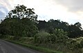
 Edge of Wychwood - geograph.org.uk - 53264.jpg 640 × 427; 96 KB
-
 Footpath to Finstock - geograph.org.uk - 6512.jpg 640 × 460; 108 KB
-
 Lower Farm, Ramsden - geograph.org.uk - 6516.jpg 640 × 480; 105 KB
-
 New Found Out Farm - geograph.org.uk - 319376.jpg 640 × 480; 77 KB
-
 New sign for the Bird In Hand - geograph.org.uk - 319366.jpg 640 × 480; 68 KB
-
 North Leigh Lane - geograph.org.uk - 319381.jpg 640 × 480; 92 KB
-
 Post and lines in cut cornfield - geograph.org.uk - 43777.jpg 640 × 427; 67 KB
-
 Six-way junction - geograph.org.uk - 319371.jpg 640 × 480; 70 KB
-
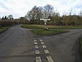
 SP3614 road junction - geograph.org.uk - 6510.jpg 640 × 480; 104 KB
-
 The edge of Wychwood Forest - geograph.org.uk - 406474.jpg 640 × 480; 95 KB
-
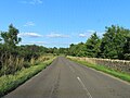
 The road to Witney - geograph.org.uk - 190479.jpg 640 × 427; 92 KB
-
 Towards Dogslade Bottom - geograph.org.uk - 395492.jpg 640 × 480; 108 KB
-
 Transmitter near Wychwood Forest - geograph.org.uk - 201328.jpg 427 × 640; 106 KB


