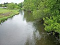
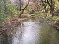
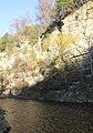
Category:Rivers of Minnesota
Saltar para a navegação
Saltar para a pesquisa
Estados dos Estados Unidos: Alabama · Alaska · Arizona · Arkansas · California · Colorado · Connecticut · Delaware · Florida · Georgia (U.S. state) · Hawaii · Idaho · Illinois · Indiana · Iowa · Kansas · Kentucky · Louisiana · Maine · Maryland · Massachusetts · Michigan · Minnesota · Mississippi (state) · Missouri · Montana · Nebraska · Nevada · New Hampshire · New Jersey · New Mexico · New York (state) · North Carolina · North Dakota · Ohio · Oklahoma · Oregon · Pennsylvania · Rhode Island · South Carolina · South Dakota · Tennessee · Texas · Utah · Vermont · Virginia · Washington (state) · West Virginia · Wisconsin · Wyoming – Washington
Guam · Puerto Rico
Guam · Puerto Rico
categoria de um projeto da Wikimedia | |||||
| Cargar fexeiro | |||||
| Instância de | |||||
|---|---|---|---|---|---|
| Tópicos combinados na categoria | |||||
| Categoria contém | |||||
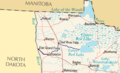
| Minnesota | |||||
estado dos Estados Unidos .jpg)     | |||||
| Áudio da pronúncia | |||||
| Instância de | |||||
| Parte de |
| ||||
| Nomeado em referência a | |||||
| Localização | Stados Ounidos de la América | ||||
| Banhado por | |||||
| Capital | |||||
| Órgão legislativo | |||||
| Órgão executivo | |||||
| Suprema autoridade judiciária |
| ||||
| Hino |
| ||||
| Chefe de governo |
| ||||
| Data de criação ou fundação |
| ||||
| Ponto mais elevado | |||||
| População |
| ||||
| Área |
| ||||
| Altitude |
| ||||
| Substituiu | |||||
| Temperatura máxima registada |
| ||||
| Temperatura mínima registada |
| ||||
| sítio web oficial | |||||
 | |||||
Subcatadories
Esta catadorie cuntén las seguintes 50 subcatadories (dun total de 50).
*
- River banks in Minnesota (5 F)
- River beaches in Minnesota (3 F)
+
- Maps of rivers in Minnesota (44 F)
.
B
- Blue Earth River (7 F)
C
- Caribou Falls State Wayside (3 F)
- Chippewa River (Minnesota) (2 F)
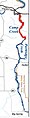
- Cross River (Minnesota) (3 F)
E
- Elk River (Minnesota) (4 F)
- Embarrass River (Minnesota) (2 F)
G
K
- Kawishiwi River (8 F)
L
M
N
- Nemadji River (5 F)
O
P
R
- Root River (Minnesota) (8 F)
S
- Sand River, Minnesota (1 F)
T
V
W
- Wapsipinicon River (6 F)
- Whetstone River (2 F)
Z
Multimédia na catadorie "Rivers of Minnesota"
Esta catadorie cuntén ls seguintes 129 fexeiros (dun total de 129).
-
 "Yellow Medicine River, Taken June 25, 1905".jpg 3 700 × 2 734; 8,01 MB
-
 Damaged dam, with water flowing through it. Mound Lake, Minnesota. - NARA - 285937.jpg 3 000 × 1 936; 1,28 MB
-
 Bank Pan - panoramio.jpg 9 716 × 1 452; 4,94 MB
-
 BanksPlumCreek.jpg 5 184 × 3 456; 11,88 MB
-
 BigRockPlumCreek.jpg 4 139 × 3 232; 3,07 MB
-
 Blueberry River Minnesota.jpg 2 856 × 2 142; 2,57 MB
-
 Boardwalk Bridge Over Sauk River - Saint Cloud, Minnesota (23900705240).jpg 5 713 × 3 809; 18,21 MB
-
 Bois de Sioux 2.jpg 669 × 450; 381 KB
-
 Bois de Sioux.jpg 671 × 465; 445 KB
-
 Boundary Waters Korb River.JPG 2 816 × 2 112; 1,83 MB
-
 Boy River - Minnesota.jpg 1 061 × 708; 69 KB
-
 Branches over rapids, Isabella River 744.jpg 2 124 × 1 220; 811 KB
-
-
 Browns Valley flood 07.jpg 2 400 × 1 800; 609 KB
-
 Buffalo River MN.jpg 671 × 426; 337 KB
-
 Buffalo River MN2.jpg 669 × 425; 114 KB
-
 Buffalo River State Park MN.jpg 1 024 × 768; 230 KB
-
 Camp Creek.jpg 102 × 400; 18 KB
-

-
 Cedar River.jpg 1 532 × 1 024; 358 KB
-
 Clearwater River MN.jpg 2 515 × 1 754; 4,38 MB
-
 Cloquet riparian forest clipped.jpg 1 800 × 240; 97 KB
-
 Cloquet Riparian Forest.jpg 2 272 × 1 704; 1,94 MB
-
 Cobb River.jpg 503 × 318; 245 KB
-
 Coon Creek trail - panoramio.jpg 4 176 × 960; 4,86 MB
-
 Cottonwood River Flandrau.jpg 2 856 × 2 142; 4,31 MB
-
 Credit River Savage.jpg 2 676 × 2 142; 2,63 MB
-
 Crooked Creek.jpg 666 × 339; 46 KB
-
 Crow Wing River - Oylen, Minnesota (42635061375).jpg 7 613 × 4 945; 30,17 MB
-
 Crow Wing River.JPG 2 376 × 1 626; 815 KB
-
 Crowcreek-vert.jpg 1 200 × 1 800; 818 KB
-
 Edge of the Wilderness - The River Near Bigfork - NARA - 7718191.jpeg 2 592 × 1 944; 964 KB
-
 First Bridge over the Mississippi River.jpg 4 032 × 3 024; 12,94 MB
-
 Fish Hook River.jpg 2 856 × 2 142; 2,49 MB
-
-
 Flowing River Superior Hiking Trail Minnesota (16564339906).jpg 3 888 × 2 592; 5,75 MB
-
 Gfp-minnesota-superior-nationa-forest-baptism-river-flow.jpg 2 500 × 1 542; 1,41 MB
-
 Gfp-minnesota-superior-national-forest-stony-river.jpg 2 500 × 1 667; 1,47 MB
-
 Grand Rounds Scenic Byway - Wading in the Minnehaha River - NARA - 7718715.jpg 3 008 × 2 000; 3,13 MB
-
 Gunflint Trail Scenic Byway - North Brule River - NARA - 7719058.jpg 2 048 × 1 536; 689 KB
-

-
-
 Gunflint Trail, Timber Creek (15622657977).jpg 3 339 × 2 110; 6,27 MB
-
 Hay Creek.jpg 517 × 534; 47 KB
-
 InterstateStateParkMN arf3.JPG 1 023 × 768; 430 KB
-
 Isabella River shore showing burnt trees and regrowth from the Pagami Creek Fire 762.jpg 6 000 × 4 000; 7,75 MB
-
 Kettle River St. Croix low.jpg 2 112 × 2 816; 2,76 MB
-
 Lac qui Parle Riv.jpg 2 856 × 2 142; 1,93 MB
-
 Lac qui Parle River.jpg 2 856 × 2 142; 2,1 MB
-
 Late fall colors along the Platte River at Crane Meadows National Wildlife Refuge.jpg 6 016 × 4 016; 20,28 MB
-
 Le Seurre River in January.jpg 2 448 × 3 264; 3,27 MB
-
 Le Sueur River Red Jacket.jpg 2 856 × 2 101; 1,99 MB
-
 Le Sueur River.jpg 503 × 318; 242 KB
-
 Leaf River MN.jpg 432 × 286; 81 KB
-
 Little Cannon River at Sogn.jpg 4 288 × 2 848; 6,32 MB
-
 Little Cannon River Bridge.jpg 1 600 × 776; 265 KB
-
 Little Cottonwood River.jpg 2 856 × 2 142; 2,59 MB
-
 Little Indian Sioux River, Minnesota (37435908872).jpg 6 016 × 4 016; 20,22 MB
-
 Little Sioux River.jpg 621 × 405; 27 KB
-
 Long Prairie Riv.jpg 2 856 × 2 142; 1,99 MB
-
 Long Prairie River.jpg 2 856 × 2 142; 2,03 MB
-
 Manitou River Cascades Waterfall, Minnesota (43999268670).jpg 7 535 × 5 014; 34,28 MB
-
 Map of watersheds and basins in Minnesota-no names.svg 567 × 670; 5,07 MB
-
 Map of watersheds and basins in Minnesota-with county outlines.svg 567 × 670; 5,34 MB
-
 Map of watersheds and basins in Minnesota.svg 582 × 705; 5,28 MB
-
 Maple River MN.jpg 503 × 318; 237 KB
-
 Marsh River near Shelly, Minnesota.jpeg 3 000 × 4 000; 5,87 MB
-
 Milaca-Rum River 2.jpg 800 × 600; 156 KB
-
 Minnesota - Namakan River through Nett Lake - NARA - 23941617.jpg 4 385 × 3 382; 2,45 MB
-
 Minnesota Lakes and Rivers.jpg 1 808 × 2 000; 376 KB
-
 MN St Louis County 190720094985pelican river.jpg 2 592 × 1 774; 1,09 MB
-
 Murphy'sLanding.JPG 1 311 × 759; 237 KB
-
 Mustinka River.jpg 670 × 455; 331 KB
-
 N-Fork-Whitewater-River-Minnesota.jpg 575 × 387; 64 KB
-
 Nina Moose River, 1965 (5187452293).jpg 2 752 × 2 030; 3,6 MB
-
 North Shore Scenic Drive - French River - NARA - 7720696.jpg 2 395 × 3 586; 6,09 MB
-
 Poplar River Falls (NYPL NYPG90-F415-G90F415 017F).tiff 3 072 × 1 751; 15,39 MB
-
 Partridge River.jpg 459 × 313; 83 KB
-
 Photograph of Upper Poplar River Falls - NARA - 2127665.jpg 580 × 1 025; 441 KB
-
 Pike River.jpg 3 067 × 2 301; 4,26 MB
-
 Pine Creek.jpg 640 × 480; 78 KB
-
 PlumCreekMinnesota.jpg 426 × 507; 51 KB
-
 Rapids, Isabella River 760.jpg 6 000 × 4 000; 10,66 MB
-
 Crookston Minnesota aerial view.jpg 1 500 × 1 053; 820 KB
-
 Redeye River.jpg 2 856 × 2 142; 2,07 MB
-
 Redlakeriver-map.png 281 × 171; 15 KB
-
 Revetment Rivers 04.jpg 233 × 350; 15 KB
-
 Rice Creek Fridley.jpg 2 856 × 2 142; 2,73 MB
-
 Rice Creek.jpg 2 142 × 2 856; 2,44 MB
-
 Riley Creek, Minnesota.jpg 4 000 × 3 000; 5,09 MB
-
 Rochesterflood.jpg 1 024 × 768; 773 KB
-
 Root River and major tributaries.jpg 1 004 × 511; 63 KB
-
 RootRiver.jpg 3 393 × 4 834; 4,42 MB
-
 RootRiverMN2006-05-27.JPG 2 560 × 1 920; 838 KB
-
 Roy Berglund State Wayside.JPG 1 024 × 768; 254 KB
-
 Rum River in Princeton, Minnesota (29572111696).jpg 5 651 × 3 767; 21,25 MB
-
 Saint Francis River Minnesota.jpg 2 856 × 2 142; 2,23 MB
-
 Sand Hill River Climax Minnesota.jpg 1 024 × 768; 238 KB
-
 Sand Hill River Drop Structure.jpg 250 × 194; 19 KB
-
 Sauk river minnesota.jpg 800 × 533; 197 KB
-
 Shell River Minnesota.jpg 2 856 × 2 142; 1,71 MB
-
 Snake River - Mora Minnesota.jpg 1 900 × 1 900; 628 KB
-
 Steamboat River MN.jpg 2 560 × 1 645; 3,58 MB
-
 StLouisRiver JayCooke.JPG 2 592 × 1 944; 2,86 MB
-
 Stlouisrivermap.jpg 590 × 670; 227 KB
-
 Straight River Hubbard County.jpg 2 856 × 2 142; 2,55 MB
-
 Straight River Owatonna.jpg 2 856 × 2 142; 2,59 MB
-
 Sturgeon River of St Louis County MN.JPG 1 280 × 896; 204 KB
-
 Sunrise River.jpg 800 × 600; 203 KB
-
 Temperance River State Park SHT Bridge.jpg 600 × 800; 187 KB
-
 TemperanceRiverStatePark.jpg 1 200 × 1 600; 401 KB
-
 TemperanceRiverStateParkUpstream02.jpg 1 600 × 1 200; 852 KB
-
 The End Of The River.jpg 3 264 × 2 448; 2,79 MB
-
 Trout Brook in Miesville Ravine.jpg 4 032 × 3 024; 8,26 MB
-
 Vermilion River, Minnesota (37476509161).jpg 5 973 × 3 987; 22,21 MB
-
 Watabcreeksartell.jpg 1 500 × 1 125; 792 KB
-
 Watersheds of Minnesota.GIF 550 × 550; 23 KB
-
 West Savanna River, Minnesota (35191120635).jpg 5 760 × 3 840; 25,85 MB
-
 West Split Rock River.jpg 3 264 × 2 448; 3,88 MB
-
 Whitewater State Park.jpg 1 024 × 768; 244 KB
-
 Wild Rice River (Minnesota).jpg 4 608 × 3 072; 3,47 MB
-
 Wing River.jpg 432 × 308; 80 KB
-
 Winona Trout Streams.jpg 905 × 499; 77 KB
-
 Yellow Bank Riv.jpg 2 856 × 2 142; 2,43 MB
-
 Yellow Bank River.jpg 2 856 × 2 142; 2,57 MB
-
 Yellow Medicine Riv.jpg 2 856 × 2 142; 1,77 MB
-
 Yellow Medicine River.jpg 2 856 × 2 142; 1,78 MB
-
 Yellow Trees at Whitewater State Park, Minnesota (36454583733).jpg 6 016 × 4 016; 24,46 MB
-
 •DSCF1341-Devils Track River (34644696270).jpg 4 608 × 3 456; 13,9 MB


.jpg)


.jpg)


_-_NARA_-_551537.jpg)
.jpg)


.jpg)


.jpg)


.jpg)


.jpg)


.jpg)


.jpg)


.jpg)


.jpg)


.jpg)
.jpg)