Category:Roads in Benin
Naar navigatie springen
Naar zoeken springen
Landen in Afrika: Algerije · Angola · Benin · Botswana · Burkina Faso · Burundi · Centraal-Afrikaanse Republiek · Congo-Brazzaville · Congo-Kinshasa · Djibouti · Egypte‡ · Equatoriaal-Guinea · Eritrea · Ethiopië · Gabon · Gambia · Ghana · Guinee · Guinee-Bissau · Ivoorkust · Kaapverdië · Kameroen · Kenia · Lesotho · Liberia · Libië · Madagaskar · Malawi · Mali · Marokko · Mauritanië · Mauritius · Mozambique · Namibië · Niger · Nigeria · Oeganda · Rwanda · Sao Tomé en Principe · Senegal · Seychellen · Sierra Leone · Soedan · Somalië · Swaziland · Tanzania · Togo · Tsjaad · Tunesië · Zambia · Zimbabwe · Zuid-Afrika · Zuid-Soedan
Andere gebieden: Canarische Eilanden · Madeira · Mayotte · Réunion · Westelijke Sahara
‡: deels gelegen in Afrika
Andere gebieden: Canarische Eilanden · Madeira · Mayotte · Réunion · Westelijke Sahara
‡: deels gelegen in Afrika
Wikimedia-categorie | |||||
| Media uploaden | |||||
| Is een | |||||
|---|---|---|---|---|---|
| Onderwerpen van categorie | |||||
 | |||||
Ondercategorieën
Deze categorie bevat de volgende 7 subcategorieën, van de 7 in totaal.
Media in categorie "Roads in Benin"
Deze categorie bevat de volgende 200 bestanden, van in totaal 254.
(vorige pagina) (volgende pagina)-
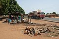
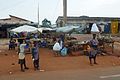
 Abords du marché central de Tanguieta.jpg 5.472 × 3.648; 4,54 MB
-
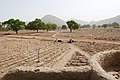
 Agriculture dans l'Atacora (1).jpg 5.472 × 3.648; 6,03 MB
-
 Agriculture dans l'Atacora (2).jpg 5.472 × 2.015; 3,14 MB
-
 Aller de cocotier.jpg 6.000 × 4.000; 2,74 MB
-

-
 Allées au jardin botanique de l'UAC.jpg 5.472 × 3.648; 9,53 MB
-
 Aoro (Bénin) (3).jpg 5.472 × 3.648; 6,16 MB
-
 Aoro (Bénin) (4).jpg 5.472 × 3.648; 4,1 MB
-
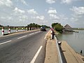 Aperçu sur le passage du pont sur le lac Ahémé en 2018.jpg 1.000 × 750; 58 kB
-
 Aspect du transport sur la voie Inter-état Cotonou Allada au Bénin 01.jpg 6.000 × 4.000; 5,83 MB
-
 Aspect du transport sur la voie Inter-état Cotonou Allada au Bénin 02.jpg 6.000 × 4.000; 5,21 MB
-
 Aspect du transport sur la voie Inter-état Cotonou Allada au Bénin 03.jpg 6.000 × 4.000; 5,7 MB
-
 Aspect du transport sur la voie Inter-état Cotonou Allada au Bénin 04.jpg 6.000 × 4.000; 5,67 MB
-
 Aspect du transport sur la voie Inter-état Cotonou Allada au Bénin 05.jpg 6.000 × 4.000; 5,35 MB
-
 Aspect du transport sur la voie Inter-état Cotonou Allada au Bénin 06.jpg 6.000 × 4.000; 5,31 MB
-
 Atacora-Vente de charbon de bois (1).jpg 5.472 × 3.648; 5,77 MB
-
 Atacora-Vente de charbon de bois (2).jpg 5.472 × 3.648; 6,45 MB
-
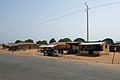
 Atacora.jpg 960 × 720; 145 kB
-
 Autoroute menant à Tanguiéta.jpg 4.128 × 3.096; 7,75 MB
-
 Autoroute sous la passerelle du marché dantokpa à Cotonou Bénin.jpg 5.472 × 3.648; 3,24 MB
-
 Azovè-Maisons non conformes en cours de destruction (1).jpg 5.472 × 3.648; 4,76 MB
-
 Azovè-Maisons non conformes en cours de destruction (2).jpg 5.472 × 3.648; 3,69 MB
-
 Azovè-Maisons non conformes en cours de destruction (3).jpg 5.472 × 3.648; 3,8 MB
-
 Azovè-Maisons non conformes en cours de destruction (4).jpg 5.472 × 3.648; 3,88 MB
-
 Azovè-Maisons non conformes en cours de destruction (5).jpg 5.472 × 3.648; 3,91 MB
-
 Azovè-Maisons non conformes en cours de destruction (7).jpg 5.472 × 3.648; 3,62 MB
-
 Azovè-Maisons non conformes en cours de destruction (8).jpg 5.472 × 3.648; 4,53 MB
-
 Azovè-Maisons non conformes en cours de destruction (9).jpg 5.472 × 3.648; 4,85 MB
-
 Azovè-Rond-point.jpg 5.472 × 3.648; 3,75 MB
-
 Bembèrèkè from highway.jpg 1.560 × 1.170; 86 kB
-
 Benin Atakora dirt road.JPG 3.872 × 2.592; 2,41 MB
-
 Benin Atakora.JPG 3.872 × 2.592; 2,32 MB
-
 Bohicon voie inter-État Bénin-Niger Bénin 01.jpg 6.000 × 4.000; 5,62 MB
-
 Bohicon voie inter-État Bénin-Niger Bénin 02.jpg 4.478 × 2.724; 2,15 MB
-
 Bohicon voie inter-État Bénin-Niger Bénin 03.jpg 6.000 × 4.000; 6,52 MB
-
 Bohicon voie inter-État Bénin-Niger Bénin 04.jpg 6.000 × 4.000; 6,38 MB
-
 Bohicon voie inter-État Bénin-Niger Bénin 05.jpg 6.000 × 4.000; 6,16 MB
-
 Bohicon voie inter-État Bénin-Niger Bénin 06.jpg 6.000 × 4.000; 5,44 MB
-
 Bohicon voie inter-État Bénin-Niger Bénin 07.jpg 6.000 × 4.000; 5,45 MB
-
 Bohicon voie inter-État Bénin-Niger Bénin 08.jpg 6.000 × 4.000; 5,71 MB
-
 Bohiconroad.jpg 2.112 × 2.816; 2,17 MB
-
 Borne routière Angaradébou Malanville 08.jpg 2.560 × 1.920; 1,13 MB
-
 Boukoumbé-Rue (1).jpg 5.472 × 3.648; 5,49 MB
-
 Boukoumbé-Rue (2).jpg 5.472 × 3.648; 4,88 MB
-
 Boukoumbé-Rue (3).jpg 5.472 × 3.648; 7,32 MB
-
 Boukoumbé-Rue (4).jpg 5.472 × 3.648; 5,43 MB
-
 Boukoumbé-Rue (5).jpg 5.472 × 3.648; 3,4 MB
-
 Boulevard Edouard ADJANOHOUN.jpg 4.032 × 3.024; 4,36 MB
-
 Bœufs traversant la voie à Sakété 01.jpg 3.456 × 4.608; 7,61 MB
-
 Bœufs traversant la voie à Sakété 03.jpg 3.456 × 4.608; 6,11 MB
-
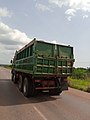
 Camion de ciment circulant la nuit.jpg 3.456 × 4.608; 4,24 MB
-
 Camion en mouvement.jpg 3.456 × 4.608; 4,61 MB
-
 Carrefour SOBEBRA.jpg 4.000 × 2.248; 4,3 MB
-
 Carrying the humanity.jpg 3.801 × 3.264; 5,67 MB
-
 Children playing football at the crossroad Aïdjèdo Cotonot-Benin.jpg 5.472 × 3.648; 9,61 MB
-
 CIRCULATION A DOUBLE SENS.jpg 4.160 × 2.080; 2,58 MB
-
 Circulation routière.jpg 2.560 × 1.920; 1,19 MB
-
 Circulation à Akpakpa.jpg 3.456 × 4.608; 4,51 MB
-
Circulation à Porto-Novo.webm 22 s, 608 × 1.080; 14,09 MB
-
 Citerne Transportant du Caburant.jpg 5.184 × 3.888; 7 MB
-
 Cloture de l'aéroport international de Cotonou.jpg 4.000 × 2.672; 3,22 MB
-
 Comè-Scène de rue (1).jpg 5.472 × 3.648; 3,67 MB
-
 Comè-Scène de rue (2).jpg 5.472 × 3.648; 3,42 MB
-
 Comè-Scène de rue (3).jpg 5.472 × 3.648; 3,46 MB
-
 Comè-Scène de rue (4).jpg 5.472 × 3.648; 3,71 MB
-
 Comè-Scène de rue (5).jpg 5.472 × 3.648; 3,59 MB
-
 Comè-Scène de rue (6).jpg 5.331 × 2.643; 2,79 MB
-
 Comè-Voiture accidentée.jpg 5.472 × 3.648; 4,95 MB
-
 DEGAN Gabin ( at the entrance of the city of TCHAOROU).jpg 7.000 × 4.667; 2,95 MB
-
 DEGAN Gabin ( Diho weighing station).jpg 7.000 × 4.411; 2,73 MB
-
 DEGAN Gabin ( haie à l'entrée de TCHAOROU ).jpg 7.000 × 4.667; 3,09 MB
-
 DEGAN Gabin ( home of the three hills of the city of Savè).jpg 7.000 × 4.667; 3,68 MB
-
 DEGAN Gabin ( the Calavi Allada section ).jpg 7.000 × 4.906; 3,18 MB
-
 DEGAN Gabin ( the haunted place of road accidents).jpg 7.000 × 4.649; 3,02 MB
-
 DEGAN Gabin (a new construction).jpg 7.000 × 4.667; 2,27 MB
-
 DEGAN Gabin (CANA, place of remembrance).jpg 7.000 × 4.667; 3,17 MB
-
 DEGAN Gabin (Work on the port road axis is progressing considerably m).jpg 8.000 × 5.313; 2,41 MB
-
 DEGAN Gabin 1 -(haie à l'entrée de TCHAOROU).jpg 7.000 × 4.667; 3,1 MB
-
 DEGAN Gabin 2 (haie à l'entrée de TCHAOROU).jpg 7.000 × 4.667; 2,55 MB
-
 Deplacement des bois dans le vehicule.jpg 3.840 × 2.160; 3,31 MB
-
 Deux individus poussent un mimi-bus en panne sur le tronçon Abomey-Calavi -Cotonou.jpg 3.968 × 2.240; 1,87 MB
-
 Dédoublement de camions.jpg 3.456 × 4.608; 4,22 MB
-
 Dépression Allada voie inter-État Bénin-Niger au Bénin 02.jpg 6.000 × 4.000; 3,84 MB
-
 Dépression Allada voie inter-État Bénin-Niger au Bénin 03.jpg 6.000 × 4.000; 5,29 MB
-
 Dépression Allada voie inter-État Bénin-Niger au Bénin 04.jpg 6.000 × 4.000; 5,75 MB
-
 Dépression Allada voie inter-État Bénin-Niger au Bénin 05.jpg 6.000 × 4.000; 5,9 MB
-
 Dépression Allada voie inter-État Bénin-Niger au Bénin 06.jpg 6.000 × 4.000; 5,43 MB
-
 Dépression Allada voie inter-État Bénin-Niger au Bénin 07.jpg 6.000 × 4.000; 5,88 MB
-
 Dépression Allada voie inter-État Bénin-Niger au Bénin 08.jpg 6.000 × 4.000; 5,74 MB
-
 Dépression Allada voie inter-État Bénin-Niger au Bénin 09.jpg 6.000 × 4.000; 5,78 MB
-
 Dépression Allada voie inter-État Bénin-Niger au Bénin 10.jpg 6.000 × 4.000; 4,4 MB
-
 Dépression Allada voie inter-État Bénin-Niger au Bénin 11.jpg 6.000 × 4.000; 5,24 MB
-
 Dépression Allada voie inter-État Bénin-Niger au Bénin 12.jpg 6.000 × 4.000; 5,65 MB
-
 Dépression Allada voie inter-État Bénin-Niger au Bénin 13.jpg 6.000 × 4.000; 5,45 MB
-
 Dépression Allada voie inter-État Bénin-Niger au Bénin 14.jpg 6.000 × 4.000; 5,73 MB
-
 Dépression Allada voie inter-État Bénin-Niger au Bénin 15.jpg 6.000 × 4.000; 5,43 MB
-
 Eglise Notre Dame des Apôtres Cotonou.JPG 3.264 × 1.836; 849 kB
-
 Empierrement d'une route (Dahomey).jpg 1.645 × 1.052; 532 kB
-
 Enfants vont à l'école par pirogue.jpg 5.184 × 3.888; 6,59 MB
-
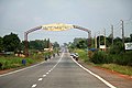
 Entrée de la ville de Tanguiéta.jpg 5.184 × 3.888; 12,87 MB
-
 Entrée de la ville de Tanguiété dans le département de l'Atacora au Nord du Bénin.jpg 3.096 × 4.128; 7,6 MB
-
 Gare routière de kpota.jpg 4.608 × 3.456; 6,24 MB
-
 Going to Abomey.jpg 4.192 × 2.358; 1,96 MB
-
 Goudron de Porto-Novo.jpg 3.456 × 4.608; 4,95 MB
-
 Grand camion.jpg 3.456 × 4.608; 4,49 MB
-
 Grand-Popo-Route en bord de mer.jpg 5.472 × 1.932; 2,74 MB
-
 Grumes de teck dans la forêt de la Lama au Bénin.jpg 6.000 × 4.000; 4 MB
-
 HOMME SUR vélo.jpg 2.448 × 3.264; 2,37 MB
-
 I'taa carrefour.jpg 2.560 × 1.920; 2,31 MB
-
 Image des zémes.jpg 2.448 × 3.264; 2,14 MB
-
 Immeuble en construction a cotonou Bénin non fini.jpg 2.107 × 2.809; 2,07 MB
-
 Infrastructures routières aménagées.jpg 4.160 × 2.080; 2,62 MB
-
 La circulation le I'taa carrefour.jpg 2.560 × 1.920; 2,14 MB
-
La circulation à Porto-Novo.webm 16 s, 608 × 1.080; 9,28 MB
-
 La route de Guezin au Bénin.jpg 5.184 × 3.888; 5,27 MB
-
 La voie Pobé Onigbolo.jpg 3.456 × 4.608; 4,98 MB
-
 La voie Porto-Novo vers Takon.jpg 3.456 × 4.608; 4,2 MB
-
 La voie à Pobé.jpg 3.456 × 4.608; 4,49 MB
-
 La voie à Porto-Novo.jpg 3.456 × 4.608; 4,68 MB
-
 Le passage supérieur en partant Cadjèhoun.jpg 2.560 × 1.920; 1,81 MB
-
 Le paysage de Cotonou vue de l'échangeur.jpg 2.560 × 1.920; 1,65 MB
-
 Le retour de la fête à Pobé.jpg 3.456 × 4.608; 4,87 MB
-
 Le transport au Bénin la nuit.jpg 3.456 × 4.608; 3,83 MB
-
 Le transport au Bénin.jpg 3.120 × 3.044; 1,4 MB
-
 Le transport de la volaille au Bénin.jpg 3.456 × 4.608; 4,69 MB
-
 Le transport de la volaille en voiture.jpg 3.456 × 4.608; 4,12 MB
-
 Le transport de marchandises à moto.jpg 3.456 × 4.608; 4,49 MB
-
 Le transport du charbon à pobé au Bénin.jpg 3.456 × 4.608; 4,39 MB
-
 Le transport du charbon à pobé.jpg 3.456 × 4.608; 4,9 MB
-
 Le transport à Abomey-Calavi 03.jpg 3.456 × 4.608; 4,64 MB
-
 Le transport à Abomey-Calavi 04.jpg 3.456 × 4.608; 5,06 MB
-
 Le transport à Abomey-Calavi 05.jpg 3.456 × 4.608; 4,79 MB
-
 Les enfants vont à l'école par pirogue.jpg 5.184 × 3.888; 6,25 MB
-
 Les garde-corps sr l'échangeur et une vue sur le paysage de la ville de Cotonou.jpg 2.560 × 1.920; 1,94 MB
-
 Les Trois mamelles de Save.jpg 1.960 × 4.032; 2,43 MB
-
 Les voies bitumées au Bénin.jpg 3.120 × 4.160; 3,91 MB
-
 Les élèves dans Pirogue à Guezin.jpg 5.184 × 3.888; 4,74 MB
-
 Old trusty.jpg 4.192 × 2.358; 2,27 MB
-
 On reste a trois sur une moto.jpg 3.456 × 4.608; 5,32 MB
-
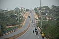
 Parakouroad.jpg 2.816 × 2.112; 2,27 MB
-
 Parc national de la Pendjari-Route (2).jpg 5.472 × 3.648; 5,19 MB
-
 Parc national de la Pendjari-Route.jpg 5.472 × 3.648; 6,16 MB
-
 Passage supérieur de Ouidah au Bénin.jpg 3.230 × 2.423; 1,65 MB
-
 Passerelle à Cadjehoun 01.jpg 4.608 × 3.456; 5,53 MB
-
 Pavé Houéyiho.jpg 4.000 × 2.672; 2,93 MB
-
 Petit commerce de quartier à Zoca, Abomey-calavi.jpg 9.216 × 6.912; 18,08 MB
-
 Peugeot Car Laden with Firewood - Abomey - Benin.jpg 3.456 × 2.304; 3,02 MB
-
 Plaque d'indication de Guezin au Bénin.jpg 5.184 × 3.888; 5,84 MB
-
 Plaque d'indication de l'arrondissement d'Akodéha.jpg 4.608 × 3.456; 6,55 MB
-
 Plaque de la Rue Delcasse à Porto-Novo au Bénin.jpg 9.216 × 6.912; 14,13 MB
-
 Plaque indiquant la début de délimitation de la localité de possotomè au Bénin.jpg 4.160 × 3.120; 5,5 MB
-
 Plaque indiquant la fin de délimitation de la localité de possotomè au Bénin.jpg 4.160 × 3.120; 6,3 MB
-
 Pont du quartier Womey 3.jpg 9.216 × 6.912; 13,71 MB
-
 Pont à Guezin.jpg 5.184 × 3.888; 4,38 MB
-
 Porto-Novo-Une rue (Dahomey).jpg 1.642 × 1.055; 765 kB
-
 Porto-Novo-Une rue un jour de marché (Dahomey).jpg 1.636 × 1.062; 618 kB
-
 Porto-Novo-Une rue.jpg 1.628 × 1.058; 629 kB
-
 Route au CRA PP Pobé.jpg 2.448 × 3.264; 4,52 MB
-
 Route CRA PP Pobé.jpg 2.448 × 3.264; 4,03 MB
-
 Route dans la chaine de l'atacora à Tanguiéta.jpg 6.000 × 4.000; 5,63 MB
-
 Route de Guezin au Bénin.jpg 5.184 × 3.888; 5,08 MB
-
 Route de la Côte (entre Togo et Bénin).jpg 1.122 × 749; 217 kB
-
 Route de Zè.jpg 3.024 × 3.780; 2,37 MB
-
 Route en construction à Adjarra, au Bénin.jpg 6.912 × 6.912; 10,24 MB
-
 Route en pays otammari (1).jpg 5.472 × 3.648; 5,74 MB
-
 Route en pays otammari (2).jpg 5.472 × 3.648; 6,87 MB
-
 Route en terre battue, cocotier, plage et océan Atlantique.jpg 6.000 × 4.000; 2,48 MB
-
 Route principale au CRA PP Pobé.jpg 2.448 × 3.264; 4,41 MB
-
 Rue d'Abomey (1).jpg 5.472 × 3.648; 9,71 MB
-
 Rue d'Abomey (2).jpg 5.472 × 3.648; 3,9 MB
-
 Rue de cotonou 3.JPG 3.264 × 1.836; 718 kB
-
 Rue de Hévé (Grand-Popo).jpg 5.472 × 3.648; 5,69 MB
-
 Rue de Ouidah.jpg 4.928 × 3.264; 1,58 MB
-
 Rue de Tanguieta (1).jpg 5.472 × 3.648; 5,38 MB
-
 Rue de Tanguieta (2).jpg 3.648 × 5.472; 7,29 MB
-
 Rue de Tanguieta (3).jpg 5.472 × 3.648; 9,83 MB
-
 Rue de Tanguieta (4).jpg 5.472 × 3.648; 4,28 MB
-
 Rue de Tanguieta (5).jpg 5.472 × 3.648; 5,39 MB
-
 Rue de Tanguieta (6).jpg 3.648 × 5.472; 5,23 MB
-
 Rue de village dans l'Atacora.jpg 3.648 × 5.472; 6,77 MB
-
 Rue principale de Ganhi-Cotonou.JPG 3.264 × 1.836; 821 kB
-
 Rue à Grand-Popo.jpg 5.472 × 3.648; 4,99 MB
-
 Rue à l'intérieur du campus d'Abomey-Calavi UAC.jpg 3.456 × 4.608; 6,58 MB
-
 Rue à l'intérieur du campus d'Abomey-Calavi.jpg 3.456 × 4.608; 7,77 MB
-
 Ruel à pobé.jpg 2.448 × 3.264; 3,06 MB
-
 Ruelle Benin.jpg 2.268 × 4.032; 2,76 MB
-
 Ruelle centrale du centre de recherche agricole plantes pérennes Pobé CRA-PP Pobé.jpg 2.448 × 3.264; 3,56 MB
-
 Ruelle centre de recherche agricole plantes pérennes Pobé CRA-PP Pobé.jpg 2.448 × 3.264; 3,59 MB
-
 Savè 01.jpg 6.016 × 4.000; 3,08 MB
-
 Sentier dans la savane.jpg 5.604 × 3.736; 5,01 MB
-
 Slave route Ouidah Benin.jpg 4.928 × 3.264; 1,89 MB
-
 Straßenbild djougou.JPG 2.816 × 2.112; 2,09 MB
-
 Street at dusk in Ouidah Benin Jan 2018.jpg 5.472 × 3.072; 5,85 MB
-
 Sur la voie inter-État Bénin-Niger au Bénin 01.jpg 4.861 × 3.931; 1,87 MB
-
 Sur la voie inter-État Bénin-Niger au Bénin 03.jpg 4.788 × 3.815; 1,34 MB
-
 Sur la voie inter-État Bénin-Niger au Bénin 04.jpg 5.086 × 4.000; 1,94 MB
-
 Sur le tronçon Cotonou houidah.jpg 2.080 × 4.160; 1,29 MB
-
 Tanguieta-Rond-point.jpg 5.472 × 3.648; 4,13 MB
-
 Tanougou-Signalétique (1).jpg 5.472 × 3.648; 5,63 MB
-
 Tanougou-Signalétique (4).jpg 5.472 × 3.648; 6,31 MB

.jpg)


_(3).jpg)
_(4).jpg)

.jpg)
.jpg)


.jpg)
.jpg)
.jpg)
.jpg)
.jpg)
.jpg)
.jpg)
.jpg)


.jpg)
.jpg)
.jpg)
.jpg)
.jpg)


.jpg)
.jpg)
.jpg)
.jpg)
.jpg)
.jpg)

.jpg)
.jpg)
.jpg)
.jpg)
.jpg)
.jpg)
.jpg)
.jpg)
.jpg)
.jpg)
.jpg)


.jpg)


.jpg)


.jpg)
.jpg)


.jpg)


.jpg)
.jpg)


.jpg)
.jpg)

.jpg)

.jpg)
.jpg)
.jpg)
.jpg)
.jpg)
.jpg)


.jpg)
.jpg)
.jpg)