Category:Rotherham
Zur Navigation springen
Zur Suche springen

Stadt in South Yorkshire, England  | |||||
| Medium hochladen | |||||
| Ist ein(e) | |||||
|---|---|---|---|---|---|
| Ort | Metropolitan Borough of Rotherham, South Yorkshire, Yorkshire and the Humber, England | ||||
| Einwohnerzahl |
| ||||
| Verschieden von | |||||
| offizielle Website | |||||
 | |||||
NB Many of the images in this category have been mis-categorised and should be in subcategories of Category:Metropolitan Borough of Rotherham
Unterkategorien
Es werden 13 von insgesamt 13 Unterkategorien in dieser Kategorie angezeigt:
In Klammern die Anzahl der enthaltenen Kategorien (K), Seiten (S), Dateien (D)
Medien in der Kategorie „Rotherham“
Folgende 200 Dateien sind in dieser Kategorie, von 500 insgesamt.
(vorherige Seite) (nächste Seite)-
 4 lanes junction - geograph.org.uk - 550504.jpg 640 × 512; 88 KB
-
 A Fieldfare feeding on apple - geograph.org.uk - 1154444.jpg 640 × 452; 50 KB
-
 Abbey Lane junction with A634 - geograph.org.uk - 822889.jpg 640 × 461; 63 KB
-
 Aldwarke Lock from the modern bridge - geograph.org.uk - 635151.jpg 456 × 640; 71 KB
-
 Aldwarke Lock on the River Don - geograph.org.uk - 635142.jpg 640 × 441; 66 KB
-
 Another view of the Stone Wall Stone - geograph.org.uk - 822891.jpg 640 × 513; 104 KB
-

-
 Aston Hall hotel exit - geograph.org.uk - 605508.jpg 640 × 480; 168 KB
-
 Barbers Avenue, Parkgate, Rotherham - geograph.org.uk - 1215545.jpg 640 × 480; 53 KB
-
 Barnsley (8479354370).jpg 2.541 × 1.906; 606 KB
-
 Beatson Clark glass factory - geograph.org.uk - 799135.jpg 640 × 426; 77 KB
-
 Blackburn Meadows at the golden hour.jpg 710 × 947; 302 KB
-
 Blackburn Meadows Nature Reserve - geograph.org.uk - 945514.jpg 640 × 480; 84 KB
-
 Blue Footbridge, Manvers Way - geograph.org.uk - 56424.jpg 640 × 480; 129 KB
-

-
 Bollards in Market Street (geograph 5965690).jpg 640 × 480; 66 KB
-
 Bronagh flooding.jpg 2.048 × 1.365; 231 KB
-
 Cable stayed bridge mast - geograph.org.uk - 683413.jpg 482 × 640; 61 KB
-
 Caesar's Camp or Castle Holmes - geograph.org.uk - 1749232.jpg 2.560 × 1.920; 1,98 MB
-
 Canal Footbridge, Parkgate, Rotherham - geograph.org.uk - 1567084.jpg 640 × 480; 118 KB
-
 Catcliffe Flash 2007-09-18.jpg 800 × 534; 114 KB
-

-
 Clifton Park, Rotherham.jpg 792 × 1.188; 1,05 MB
-

-

-
 Corrugated fence in Rotherham, South Yorkshire.jpg 544 × 640; 144 KB
-
 Courtyard gates Wentworth Woodhouse - geograph.org.uk - 669785.jpg 640 × 480; 82 KB
-
 D & S Clarke.jpeg 3.648 × 2.056; 2,99 MB
-
 Dale Road.jpg 2.592 × 1.936; 1,08 MB
-
 Dalton - Dalton Parva.jpg 640 × 427; 83 KB
-
 Detail of Aston Hall hotel gates - geograph.org.uk - 605512.jpg 447 × 640; 118 KB
-
 Doncaster gate hosp jw.jpg 1.133 × 706; 298 KB
-
 Drummond Street railway bridge - geograph.org.uk - 799140.jpg 640 × 426; 82 KB
-
 East Pennines Assembly Hall - panoramio.jpg 648 × 486; 84 KB
-
 Entrance to Thundercliffe Grange - geograph.org.uk - 1045657.jpg 640 × 480; 125 KB
-
 Farmer John's Road Sign - geograph.org.uk - 521291.jpg 640 × 480; 80 KB
-
 Fernleigh Drive - geograph.org.uk - 799099.jpg 640 × 426; 114 KB
-
 Flotsam and jetsam on the River Don - geograph.org.uk - 684114.jpg 640 × 480; 162 KB
-
 Former student accommodation - geograph.org.uk - 669774.jpg 640 × 480; 73 KB
-
 Gated entrance to Grange Moor Quarry - geograph.org.uk - 1724970.jpg 640 × 480; 149 KB
-

-
 Gates opening - geograph.org.uk - 1570518.jpg 640 × 480; 56 KB
-
 Gates to water pumping station - geograph.org.uk - 587620.jpg 640 × 339; 83 KB
-
 Gildingwells.jpg 640 × 480; 82 KB
-
 Grafton Old Bridge - geograph.org.uk - 1220944.jpg 640 × 480; 69 KB
-
 Hollings Lane Dalton, Rotherham - geograph.org.uk - 1268025.jpg 640 × 480; 88 KB
-
 Holmes Engine Works Rotherham.png 502 × 706; 74 KB
-
 Impathible - geograph.org.uk - 799510.jpg 640 × 480; 289 KB
-

-

-
 Inverness to Kyle Boothsscrap50sMar93 (16305582293).jpg 3.015 × 1.990; 3,77 MB
-
 Is there a BandQ in Rotherham^ - geograph.org.uk - 1564094.jpg 640 × 480; 52 KB
-
 J E James cycles - geograph.org.uk - 1215541.jpg 347 × 640; 46 KB
-

-
 Keppel's column from Scholes Lane - geograph.org.uk - 744616.jpg 640 × 449; 58 KB
-
 Kiveton Park - geograph.org.uk - 2540.jpg 640 × 480; 57 KB
-
 Kiveton Waters Fishery - geograph.org.uk - 575816.jpg 640 × 480; 123 KB
-
 Landscape at Barbot Hall - geograph.org.uk - 799495.jpg 640 × 480; 152 KB
-

-
 Lock on the Don - geograph.org.uk - 1428206.jpg 640 × 480; 71 KB
-
 Long Shadows - geograph.org.uk - 240871.jpg 640 × 480; 78 KB
-
 Looking Towards Greasborough Dams - geograph.org.uk - 1040995.jpg 640 × 480; 115 KB
-
 Looking up Jubilee Street - geograph.org.uk - 799478.jpg 480 × 640; 159 KB
-
 M18 motorway bridge over M1 - geograph.org.uk - 605628.jpg 640 × 342; 40 KB
-
 Mangham House Farm - geograph.org.uk - 799519.jpg 640 × 480; 207 KB
-
 Mangham Road - geograph.org.uk - 799518.jpg 640 × 480; 112 KB
-
 May in May - geograph.org.uk - 799116.jpg 640 × 426; 190 KB
-
 Metallurgical plant - geograph.org.uk - 799182.jpg 480 × 640; 101 KB
-
 Metallurgical plant - geograph.org.uk - 799184.jpg 640 × 480; 137 KB
-
 Milepost, Broom Road, Rotherham.jpg 1.200 × 1.600; 431 KB
-
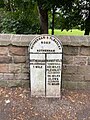 Milepost, Moorgate Road, Rotherham.jpg 720 × 960; 369 KB
-
 Milepost, Moorgate Road.jpg 496 × 684; 55 KB
-
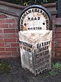
 Milepost, West Bawtry Road, Rotherham.jpg 1.200 × 1.600; 463 KB
-
 Milepost, Wickersley Road.jpg 1.200 × 1.600; 475 KB
-
 Milestone, Doncaster Road, Rotherham.jpg 480 × 640; 374 KB
-
 Mill Street - geograph.org.uk - 799465.jpg 480 × 640; 127 KB
-
 Multicoloured Silos - geograph.org.uk - 1212537.jpg 640 × 480; 142 KB
-
 Munsbrough Juniors F.C. - geograph.org.uk - 799508.jpg 640 × 437; 142 KB
-
 New Housing Canklow - geograph.org.uk - 811002.jpg 640 × 480; 47 KB
-
 Newburgh Precision Limited.tif 1.596 × 888; 2,96 MB
-
 Next stop Meadowhall - geograph.org.uk - 684203.jpg 640 × 480; 91 KB
-
 North and South Anston - The Green, North Anston.jpg 640 × 480; 102 KB
-
 Parkgate Steelworks 1786348 130ee4bd.jpg 640 × 393; 158 KB
-
 Part of the Roman ridge at rawmarsh, Rotherham south Yorkshire.jpg 5.312 × 2.988; 4,75 MB
-
 Pathfinder Tours, The York, Moors And Scarborough Explorer 05.jpg 4.000 × 3.000; 3,33 MB
-
 Phoenix Golf Course - geograph.org.uk - 799200.jpg 640 × 480; 145 KB
-
 Phoenix Golf Course - geograph.org.uk - 799203.jpg 640 × 480; 114 KB
-
 Phoenix Golf Course - geograph.org.uk - 799451.jpg 640 × 480; 128 KB
-
 Phoenix Golf Course - geograph.org.uk - 799453.jpg 640 × 480; 164 KB
-
 Phoenix golf course in February snow - geograph.org.uk - 1771365.jpg 4.351 × 2.370; 7,53 MB
-
 Pillars of steel - geograph.org.uk - 684216.jpg 640 × 512; 96 KB
-
 Postbox and tanks - geograph.org.uk - 605487.jpg 640 × 564; 74 KB
-
 Public bridleway near Grange Farm - geograph.org.uk - 1045661.jpg 640 × 389; 65 KB
-

-

-

-
 Rape crops from Scrooby Lane - geograph.org.uk - 799504.jpg 640 × 480; 112 KB
-
 Rape crops from Scrooby Lane - geograph.org.uk - 799505.jpg 640 × 480; 194 KB
-
 Ravenfield - Ravenfield Lane.jpg 640 × 480; 61 KB
-

-
 River Don - geograph.org.uk - 1138760.jpg 640 × 426; 52 KB
-
 River Rother and flour mills - geograph.org.uk - 799469.jpg 640 × 480; 150 KB
-
 Road bend Linthwaite Lane to Elsecar - geograph.org.uk - 587631.jpg 640 × 480; 137 KB
-
 Rolling Mill - geograph.org.uk - 799555.jpg 640 × 480; 172 KB
-
 Roman remains, Clifton Park, Rotherham.jpg 1.989 × 1.479; 924 KB
-
 Rossington Colliery - geograph.org.uk - 958503.jpg 640 × 421; 43 KB
-
 Rother Valley - geograph.org.uk - 799187.jpg 480 × 640; 174 KB
-
 Rother Valley footpath - geograph.org.uk - 799186.jpg 640 × 480; 193 KB
-
 Rother Valley footpath - geograph.org.uk - 799189.jpg 640 × 480; 160 KB
-
 Rother Valley from above Brinsworth - geograph.org.uk - 799197.jpg 640 × 480; 166 KB
-
 Rother Valley from above Brinsworth - geograph.org.uk - 799198.jpg 640 × 480; 141 KB
-
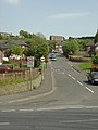
 Rother View Road - geograph.org.uk - 799460.jpg 640 × 473; 167 KB
-
 Rotherham - Booth's Scrapyard - geograph.org.uk - 1069671.jpg 640 × 480; 61 KB
-
 Rotherham - Clifton Park Memorial Garden - geograph.org.uk - 957521.jpg 640 × 480; 121 KB
-

-

-
 Rotherham - Eastwood Footbridge.JPG 2.272 × 1.704; 872 KB
-

-

-
 Rotherham - Leaving Clifton Park - geograph.org.uk - 957522.jpg 640 × 480; 72 KB
-
 Rotherham - Middle Lane - geograph.org.uk - 956887.jpg 640 × 480; 77 KB
-

-

-

-
 Rotherham - railway bridges over Navigation.jpg 2.272 × 1.704; 1,11 MB
-
 Rotherham - TPT walkway under Centenary Way.jpg 2.272 × 1.704; 905 KB
-
 Rotherham Grammar School - geograph.org.uk - 1002444.jpg 640 × 477; 71 KB
-
 Rotherham Interchange - geograph.org.uk - 1219143.jpg 640 × 480; 183 KB
-
 Rotherham Masboro Signalbox.jpg 689 × 577; 214 KB
-
 Rotherham Round Walk - geograph.org.uk - 799584.jpg 640 × 480; 168 KB
-
 Rotherham Round Walk near Wentworth Park - geograph.org.uk - 1746472.jpg 2.560 × 1.920; 1,25 MB
-
 Rotherham Roundwalk towards Fenton Road (geograph 4197963).jpg 1.600 × 1.064; 1,01 MB
-
 Rotherham Skyline from Coronation Bridge.jpg 2.016 × 908; 99 KB
-
 Rotherham Suburb - geograph.org.uk - 111212.jpg 640 × 479; 138 KB
-

-
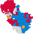
 Rotherham wards 2016.svg 1.220 × 1.306; 504 KB
-
 Rotherham wards 2021.svg 669 × 694; 342 KB
-
 Rotherham wards 2024.svg 669 × 694; 342 KB
-
 Rotherham's new leisure complex - geograph.org.uk - 1215529.jpg 640 × 480; 57 KB
-
 Rotherham, England, 2 May 2010 (1).jpg 4.288 × 2.848; 4,13 MB
-
 Rotherham, England, 2 May 2010 (10).jpg 4.288 × 2.848; 6,18 MB
-
 Rotherham, England, 2 May 2010 (12).jpg 4.288 × 2.848; 6,87 MB
-
 Rotherham, England, 2 May 2010 (13).jpg 4.288 × 2.848; 6,17 MB
-
 Rotherham, England, 2 May 2010 (14).jpg 4.288 × 2.848; 6,33 MB
-
 Rotherham, England, 2 May 2010 (15).jpg 4.288 × 2.848; 5,84 MB
-
 Rotherham, England, 2 May 2010 (17), the New County pub and Rotherham town centre.jpg 4.288 × 2.848; 5,32 MB
-
 Rotherham, England, 2 May 2010 (18).jpg 2.848 × 4.288; 5,76 MB
-
 Rotherham, England, 2 May 2010 (2).jpg 4.288 × 2.848; 5 MB
-
 Rotherham, England, 2 May 2010 (20), Rotherham fountain.jpg 4.288 × 2.848; 6,01 MB
-
 Rotherham, England, 2 May 2010 (3).jpg 4.288 × 2.848; 5,51 MB
-
 Rotherham, England, 2 May 2010 (30).jpg 2.848 × 4.288; 6,58 MB
-
 Rotherham, England, 2 May 2010 (33).jpg 4.288 × 2.848; 6,1 MB
-
 Rotherham, England, 2 May 2010 (34).jpg 4.288 × 2.848; 5,39 MB
-
 Rotherham, England, 2 May 2010 (35).jpg 4.288 × 2.848; 6,29 MB
-
 Rotherham, England, 2 May 2010 (36).jpg 2.848 × 4.288; 5,68 MB
-
 Rotherham, England, 2 May 2010 (37).jpg 4.288 × 2.848; 5,65 MB
-
 Rotherham, England, 2 May 2010 (40).jpg 2.848 × 4.288; 5,91 MB
-
 Rotherham, England, 2 May 2010 (41).jpg 4.288 × 2.848; 4,52 MB
-
 Rotherham, England, 2 May 2010 (42).jpg 4.288 × 2.848; 4,32 MB
-
 Rotherham, England, 2 May 2010 (7).jpg 4.288 × 2.848; 6,08 MB
-
 Rotherham, Herringthorpe area. - geograph.org.uk - 113141.jpg 640 × 479; 90 KB
-
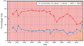
 RotherhamGraph.svg 512 × 282; 42 KB
-
 RotherValleyCollege.jpg 250 × 129; 15 KB
-
 RotherValleyGraph.svg 512 × 282; 33 KB
-
 Roundabout on Centenary Way - geograph.org.uk - 1420570.jpg 640 × 480; 88 KB
-
 Scholes Coppice - geograph.org.uk - 139027.jpg 640 × 480; 196 KB
-
 Scholes Lane near Rotherham - geograph.org.uk - 1215512.jpg 640 × 480; 115 KB
-
 School field in winter - geograph.org.uk - 986689.jpg 640 × 415; 86 KB
-
 Scrap Yard at Millmoor - geograph.org.uk - 1229493.jpg 640 × 457; 53 KB
-
 Scrooby Lane, Greasbrough - geograph.org.uk - 799501.jpg 640 × 480; 146 KB
-
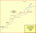 Sheff&roth1839.png 1.019 × 956; 42 KB
-
 Sheff&roth1840.png 1.019 × 956; 48 KB
-
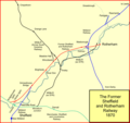 Sheff&roth1870.png 1.019 × 956; 80 KB
-

-
 Sheffield Road - geograph.org.uk - 799468.jpg 640 × 480; 138 KB
-
 Skippy - geograph.org.uk - 684466.jpg 640 × 430; 98 KB
-
 Staircase detail - geograph.org.uk - 799141.jpg 426 × 640; 118 KB
-
 Steel Bridge - geograph.org.uk - 206167.jpg 640 × 480; 93 KB
-
 Steps leading to All Saints Church - geograph.org.uk - 464193.jpg 480 × 640; 88 KB
-
 Stone stile - geograph.org.uk - 631422.jpg 640 × 427; 93 KB
-
 Sundial, Clifton House, Rotherham.jpg 1.536 × 2.048; 1,36 MB
-
 Sunset Stallions (217322067).jpeg 2.048 × 1.371; 978 KB
-

-
 The bottom of Scrooby Lane - geograph.org.uk - 799515.jpg 640 × 480; 116 KB
-
 The lonely post box. - geograph.org.uk - 550518.jpg 640 × 480; 161 KB
-
 The pound - geograph.org.uk - 705007.jpg 640 × 347; 39 KB
-
 The Royal Oak, Ulley - geograph.org.uk - 540901.jpg 640 × 428; 129 KB
-
 This was the Scout hut - geograph.org.uk - 590804.jpg 640 × 375; 77 KB
-
 Todwick - Pocket Handkerchief Lane.jpg 640 × 480; 67 KB
-
 Tower crane reflections - geograph.org.uk - 684121.jpg 480 × 640; 73 KB
-
 Towpath Cyclist, Parkgate, Rotherham - geograph.org.uk - 1567116.jpg 640 × 480; 92 KB
-
 Train crossing - geograph.org.uk - 1570493.jpg 640 × 480; 53 KB
-
 Tulley's Marine, Northfield Lane - geograph.org.uk - 799484.jpg 640 × 480; 122 KB
-
 Tulley's Marine, Northfield Lane - geograph.org.uk - 799487.jpg 640 × 480; 121 KB
-
 Turnpike marker - geograph.org.uk - 799194.jpg 640 × 480; 231 KB
-

-
 Ulleyres.jpg 640 × 480; 31 KB
-
 Unusual combination - geograph.org.uk - 605493.jpg 640 × 378; 89 KB
-
 Vehicle tracks in snow - geograph.org.uk - 1771410.jpg 3.000 × 2.250; 6,31 MB
-
 Victorian House, Mountenoy Road - geograph.org.uk - 986717.jpg 640 × 553; 96 KB


.jpg)


.jpg)


_At_Rotherham_Town_Hall_(RLH-800x600).jpg)


_Born_in_Rotherham_and_educated_at_Rotherham_Grammar_School._Inventor_of_the_Bailey_Bridge_which_was_so_vital_to_the_success_of_the_Allied_Forces_in_World_War_II.jpg)

.jpg)


_-_geograph.org.uk_-_956921.jpg)


.jpg)


.jpg)
.jpg)
.jpg)
.jpg)
.jpg)
.jpg)
,_the_New_County_pub_and_Rotherham_town_centre.jpg)
.jpg)
.jpg)
,_Rotherham_fountain.jpg)
.jpg)
.jpg)
.jpg)
.jpg)
.jpg)
.jpg)
.jpg)
.jpg)
.jpg)
.jpg)
.jpg)


.jpeg)


