Category:Ryton-on-Dunsmore
Zur Navigation springen
Zur Suche springen
Ort bei Rugby in Warwickshire  | |||||
| Medium hochladen | |||||
| Ist ein(e) | |||||
|---|---|---|---|---|---|
| Ort | Ryton-on-Dunsmore, Borough of Rugby, Warwickshire, West Midlands, England | ||||
 | |||||

English: Ryton-on-Dunsmore is a village and civil parish in the Rugby district of Warwickshire, and is south-east of Coventry, England. The 2001 census recorded a population of 1,672 in the parish. The A45 dual carriageway passes through the village.
Norsk bokmål: Ryton-on-Dunsmore (i dagligtale bare Ryton) er en landsby og et verdslig sogn i Warwickshire, England. Den ligger sørøst for Coventry, og regnes ofte som en av byens forsteder.
Unterkategorien
Es werden 2 von insgesamt 2 Unterkategorien in dieser Kategorie angezeigt:
In Klammern die Anzahl der enthaltenen Kategorien (K), Seiten (S), Dateien (D)
R
Medien in der Kategorie „Ryton-on-Dunsmore“
Folgende 124 Dateien sind in dieser Kategorie, von 124 insgesamt.
-
 A423 flyover, A45-A423 junction - geograph.org.uk - 2901412.jpg 640 × 480; 59 KB
-
 A423 Oxford Road - geograph.org.uk - 2948353.jpg 2.000 × 1.466; 386 KB
-
 A423 Oxford Road - geograph.org.uk - 3363501.jpg 640 × 427; 41 KB
-
 A423 Oxford Road at Ryton - geograph.org.uk - 5900525.jpg 640 × 480; 85 KB
-
 A423 Oxford Road, Ryton-on-Dunsmore - geograph.org.uk - 1891708.jpg 2.000 × 1.494; 170 KB
-
 A445 near Ryton - geograph.org.uk - 2834365.jpg 640 × 480; 91 KB
-

-

-
 A45 approaching Ryton roundabout - geograph.org.uk - 2901376.jpg 640 × 480; 58 KB
-
 A45 approaching Ryton-on-Dunsmore - geograph.org.uk - 2901386.jpg 640 × 480; 61 KB
-
 A45 at Grange Farm - geograph.org.uk - 2901374.jpg 640 × 480; 60 KB
-
 A45 at Ryton on Dunsmore - geograph.org.uk - 1202094.jpg 640 × 428; 107 KB
-
 A45 London Road, Ryton-on-Dunsmore - geograph.org.uk - 1893376.jpg 2.000 × 1.493; 216 KB
-
 A45-A423 junction, Ryton - geograph.org.uk - 2901408.jpg 640 × 480; 52 KB
-
 Bagshaw Close by London Road, Ryton - geograph.org.uk - 6145572.jpg 1.920 × 1.280; 1,39 MB
-
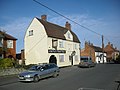
 Blacksmiths Arms, Ryton on Dunsmore - geograph.org.uk - 1202108.jpg 640 × 427; 80 KB
-

-
 Centenary Way footpath to Ryton-on-Dunsmore - geograph.org.uk - 1891637.jpg 2.000 × 1.502; 219 KB
-
 Children's Adventure Playground - geograph.org.uk - 2478722.jpg 3.648 × 2.048; 3,65 MB
-
 Church Road, Ryton - geograph.org.uk - 6141916.jpg 1.920 × 1.280; 1,41 MB
-
 Coventry City FC training ground, Ryton - geograph.org.uk - 3380524.jpg 640 × 625; 110 KB
-

-
 Defunct car plant - keep out - geograph.org.uk - 416922.jpg 640 × 480; 96 KB
-
 Entrance to Oak Tree Farm - geograph.org.uk - 2948338.jpg 2.000 × 1.333; 307 KB
-

-
 Footpath at Ryton - geograph.org.uk - 416946.jpg 640 × 480; 96 KB
-
 Footpath to Grange Farm^ - geograph.org.uk - 2948294.jpg 2.000 × 1.333; 393 KB
-
 Footpath to Ryton-on-Dunsmore - geograph.org.uk - 1893406.jpg 2.000 × 1.506; 230 KB
-
 Freeboard Lane - geograph.org.uk - 2948317.jpg 2.000 × 1.502; 420 KB
-
 Grassland at Ryton - geograph.org.uk - 5900527.jpg 640 × 480; 64 KB
-
 High Street, Ryton - geograph.org.uk - 6141392.jpg 1.856 × 1.178; 1,18 MB
-
 High Street, Ryton - geograph.org.uk - 6141395.jpg 1.920 × 1.280; 1,29 MB
-
 Holiday Inn, Ryton Bridge - geograph.org.uk - 2901443.jpg 640 × 480; 50 KB
-
 Houses by the A45, Ryton-on-Dunsmore - geograph.org.uk - 2901389.jpg 640 × 480; 47 KB
-
 Inside the Ryton Subway - geograph.org.uk - 6141912.jpg 1.882 × 1.220; 1,1 MB
-
 Knightlow Cross - geograph.org.uk - 4273776.jpg 2.448 × 1.624; 1,6 MB
-
 Knightlow Cross - geograph.org.uk - 4273781.jpg 2.448 × 1.624; 2,09 MB
-
 Knightlow Cross and mound.jpg 2.736 × 3.648; 6,02 MB
-
 Knightlow Hill - so near and yet so far^ - geograph.org.uk - 38084.jpg 640 × 480; 109 KB
-
 Layby on London Road, Stretton-on-Dunsmore - geograph.org.uk - 6145580.jpg 1.920 × 1.280; 1,1 MB
-
 Leamington Road, Ryton - geograph.org.uk - 6141388.jpg 1.920 × 1.280; 1,09 MB
-
 LG warehouse in Prologis Park Ryton - geograph.org.uk - 6141008.jpg 1.850 × 1.164; 1,26 MB
-
 London Road, Ryton-on-Dunsmore - geograph.org.uk - 6141096.jpg 1.920 × 1.280; 1.014 KB
-
 London Road, Stretton-on-Dunsmore - geograph.org.uk - 6145581.jpg 1.882 × 1.220; 1,79 MB
-
 Lots of space available - geograph.org.uk - 2901402.jpg 640 × 480; 63 KB
-
 Malt Shovel, Ryton on Dunsmore - geograph.org.uk - 1202118.jpg 640 × 428; 81 KB
-
 Marshalling yard, RPMR - geograph.org.uk - 2478809.jpg 3.648 × 2.736; 4,65 MB
-
 Maypole dancers on Ryton subway - geograph.org.uk - 6141002.jpg 1.920 × 1.280; 1,03 MB
-
 New House at Ryton Pool - geograph.org.uk - 3515127.jpg 640 × 480; 105 KB
-

-
 Oxford Road roundabout - geograph.org.uk - 2838108.jpg 640 × 481; 53 KB
-
 Oxford Road, Ryton - geograph.org.uk - 6141408.jpg 1.888 × 1.232; 1,2 MB
-
 Oxford Road, Ryton - geograph.org.uk - 6141922.jpg 1.787 × 1.190; 1,22 MB
-
 Path at Ryton Pools Country Park - geograph.org.uk - 1204904.jpg 640 × 429; 91 KB
-
 Path at Ryton Pools Country Park - geograph.org.uk - 1204946.jpg 640 × 429; 143 KB
-
 Pathway in Ryton Wood - geograph.org.uk - 1204920.jpg 429 × 640; 187 KB
-
 Peugeot Ryton Assembly Plants - geograph.org.uk - 3088665.jpg 640 × 480; 66 KB
-
 Potato Field - geograph.org.uk - 3084154.jpg 640 × 480; 72 KB
-
 Potato Field near Ryton on Dunsmore - geograph.org.uk - 3088254.jpg 640 × 480; 88 KB
-

-
 Prologis Park, Ryton - geograph.org.uk - 6141006.jpg 1.920 × 1.280; 1,07 MB
-
 Prologis Park, Ryton - geograph.org.uk - 6141924.jpg 1.920 × 1.280; 1 MB
-
 Pulling in to Ryton - geograph.org.uk - 2478852.jpg 2.736 × 3.648; 3,45 MB
-
 Returning to Ryton - geograph.org.uk - 2478847.jpg 3.648 × 2.736; 2,76 MB
-
 Ryton Bridge on the A45 - geograph.org.uk - 1206447.jpg 640 × 480; 51 KB
-
 Ryton Fishing Lakes - geograph.org.uk - 2000737.jpg 640 × 480; 72 KB
-
 Ryton gardens, 1994 - geograph.org.uk - 2838008.jpg 640 × 475; 99 KB
-
 Ryton Halt - geograph.org.uk - 4135755.jpg 1.024 × 683; 235 KB
-

-
 Ryton Halt, RPMR - geograph.org.uk - 2478876.jpg 3.648 × 2.736; 3,86 MB
-
 Ryton On Dunsmore - geograph.org.uk - 717710.jpg 640 × 480; 71 KB
-
 Ryton On Dunsmore Allotments - geograph.org.uk - 3284357.jpg 640 × 480; 62 KB
-
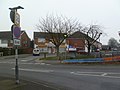
 Ryton On Dunsmore High Street - geograph.org.uk - 2000841.jpg 640 × 480; 82 KB
-
 Ryton On Dunsmore-Church Road - geograph.org.uk - 714578.jpg 640 × 480; 63 KB
-
 Ryton On Dunsmore-River Avon - geograph.org.uk - 714573.jpg 640 × 480; 92 KB
-
 Ryton Organic Gardens - geograph.org.uk - 735375.jpg 640 × 447; 117 KB
-
 Ryton Pool - feeding time - geograph.org.uk - 2478736.jpg 2.736 × 3.648; 4,26 MB
-
 Ryton Pools Country Park - geograph.org.uk - 4135762.jpg 1.024 × 683; 154 KB
-
-

-
 Ryton Subway - geograph.org.uk - 3284456.jpg 640 × 480; 68 KB
-
 Ryton Subway - geograph.org.uk - 6141098.jpg 1.870 × 1.202; 1,54 MB
-
 Ryton Subway - geograph.org.uk - 6141913.jpg 1.920 × 1.280; 1,34 MB
-
 Ryton Subway - geograph.org.uk - 6141915.jpg 1.920 × 1.280; 1.022 KB
-
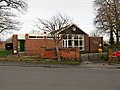 Ryton Village Hall - geograph.org.uk - 3284443.jpg 640 × 480; 92 KB
-
 Ryton-Church Road - geograph.org.uk - 717713.jpg 640 × 480; 67 KB
-
 Ryton-Fishing Pools - geograph.org.uk - 2001099.jpg 640 × 480; 103 KB
-
 Ryton-on-Dunsmore village hall - geograph.org.uk - 27521.jpg 640 × 480; 148 KB
-
 Ryton-on-Dunsmore, shops - geograph.org.uk - 2793414.jpg 1.024 × 768; 154 KB
-
 Ryton-on-Dunsmore, The Blacksmith's Arms - geograph.org.uk - 2793418.jpg 1.024 × 768; 116 KB
-
 Second Hand Car Sales and Waterbeds - geograph.org.uk - 2834103.jpg 640 × 480; 65 KB
-
 Shops on Bagshaw Close, Ryton - geograph.org.uk - 6141907.jpg 1.856 × 1.174; 1,38 MB
-
 Site of old Peugeot works, Ryton-on-Dunsmore - geograph.org.uk - 1891620.jpg 2.000 × 1.505; 220 KB
-
 Sports Connexion, Ryton - geograph.org.uk - 3380537.jpg 640 × 480; 56 KB
-
 Stonemarket, Ryton - geograph.org.uk - 6141398.jpg 1.882 × 1.220; 1,34 MB
-
 Subway at Ryton on Dunsmore - geograph.org.uk - 1202066.jpg 640 × 428; 94 KB
-
 Subway at Ryton on Dunsmore - geograph.org.uk - 1202070.jpg 640 × 428; 54 KB
-
 Subway at Ryton on Dunsmore - geograph.org.uk - 1202083.jpg 430 × 640; 58 KB
-
 The 13-58 from Ryton - geograph.org.uk - 2478840.jpg 3.648 × 2.736; 4,47 MB
-
 The back end of Ryton car plant - geograph.org.uk - 416933.jpg 640 × 480; 96 KB
-
 The Bridge, RPMR - geograph.org.uk - 2478860.jpg 2.807 × 2.070; 2,43 MB
-
 The Cook's Garden, Ryton Organic - geograph.org.uk - 1748577.jpg 640 × 413; 290 KB
-

-
 The Old Bull and Butcher - geograph.org.uk - 3088619.jpg 640 × 480; 68 KB
-
 The Old Bull and Butcher - geograph.org.uk - 3088626.jpg 640 × 480; 64 KB
-
 The Old Bull and Butcher - geograph.org.uk - 3363494.jpg 640 × 427; 52 KB
-
 The old Peugeot works site at Ryton-on-Dunsmore - geograph.org.uk - 1901628.jpg 2.000 × 1.502; 205 KB
-
 The path to Ryton Wood - geograph.org.uk - 1204940.jpg 640 × 429; 148 KB
-
 The River Avon - geograph.org.uk - 4744553.jpg 640 × 480; 49 KB
-
 The sign of The Old Bull ^ Butcher - geograph.org.uk - 3363498.jpg 640 × 640; 70 KB
-

-
 View from Knightlow Hill - geograph.org.uk - 38081.jpg 640 × 480; 86 KB
-
 View over Ryton Pool - geograph.org.uk - 1204900.jpg 640 × 429; 146 KB
-
 View over Ryton Pools Country Park - geograph.org.uk - 1204907.jpg 640 × 429; 161 KB
-
 View west down Wolston Lane towards A45 - geograph.org.uk - 2156871.jpg 2.000 × 1.500; 193 KB
-
 Visitor Centre, Ryton Pools - geograph.org.uk - 2478571.jpg 3.648 × 2.048; 3,15 MB
-
 Wolston Lane - geograph.org.uk - 5576727.jpg 1.600 × 900; 425 KB
-
 Wolston Sewage Works - geograph.org.uk - 820321.jpg 640 × 480; 73 KB
-
 Fishing Lakes - Ryton-on-Dunsmore - geograph.org.uk - 34748.jpg 640 × 480; 113 KB
-
 Ryton sports centre - geograph.org.uk - 27524.jpg 640 × 480; 91 KB
-
 Ryton Wood - geograph.org.uk - 172162.jpg 640 × 431; 186 KB
-
 Ryton-on-Dunsmore - geograph.org.uk - 27515.jpg 640 × 480; 79 KB
-
 Ryton-on-Dunsmore main street - geograph.org.uk - 27514.jpg 640 × 480; 89 KB
-


