Category:Sacramento River
Naar navigatie springen
Naar zoeken springen
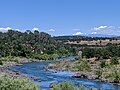
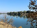
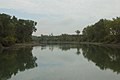
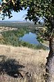
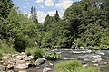
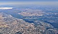
English: The Sacramento River — flowing through the Sacramento Valley to the San Francisco Bay.
- Rising in the Klamath Mountains, the river flows south for 445 miles (716 km) in the northern Central Valley of California, before reaching its Sacramento–San Joaquin River Delta mouth.
rivier  V deltě řeky  | |||||
| Media uploaden | |||||
| Is een | |||||
|---|---|---|---|---|---|
| Locatie | Californië, Pacific States Region | ||||
| Lengte |
| ||||
| Mondt uit in | |||||
| Stroomgebied |
| ||||
| Stroomgebiedsland | |||||
| Zijrivier |
| ||||
 | |||||
Ondercategorieën
Deze categorie bevat de volgende 22 subcategorieën, van de 22 in totaal.
- Maps of the Sacramento River (16 B)
B
- Butte Basin (2 B)
C
- Castle Lake (California) (15 B)
D
- Discovery Park (Sacramento) (5 B)
M
- Mount Shasta Big Springs (4 B)
N
P
S
- Sutter Bypass (1 B)
W
Y
Pagina’s in categorie "Sacramento River"
Deze categorie bevat de volgende 2 pagina’s, van de 2 in totaal.
Media in categorie "Sacramento River"
Deze categorie bevat de volgende 166 bestanden, van in totaal 166.
-
-
 -CALIFORNIA-L-0028- Sherman Island Flood (50006741643).jpg 2.956 × 1.590; 2,08 MB
-
 100-Year old Water Induction Pump (29603660606).jpg 6.000 × 3.761; 4,78 MB
-
 20150415-NRCS-LSC-0178 (17116621659).jpg 4.721 × 5.406; 20,34 MB
-
 A SP freight in the Sacramento River Canyon (29892768073).jpg 2.000 × 1.360; 4,65 MB
-
 A SP freight in the Sacramento River Canyon (30438333891).jpg 2.000 × 1.339; 4,28 MB
-
 Aerial view of Tehama, California, September 2022.JPG 5.184 × 3.888; 15,93 MB
-
 Albert Bierstadt A View From Sacramento.jpg 800 × 583; 115 kB
-
 American River-sacramento.jpg 1.600 × 1.200; 400 kB
-
 Andrus Island (California) Highlighted.png 817 × 818; 1,06 MB
-

-

-

-
 Archaeological investigations at a Sacramento River mining camp (CA-SHA-1450), Shasta County, California (IA archaeologicalin00vaug).pdf 1.189 × 1.620, 104 pagina's; 4,73 MB
-
 CAM Taber, Sacramento in October 1848.jpg 1.475 × 904; 676 kB
-
 At the Confluence (26590728182).jpg 3.910 × 2.103; 1,59 MB
-
 Autumn scene near Sacramento River (23994348947).jpg 4.032 × 3.024; 4,85 MB
-
 Bacon Island (California).png 606 × 813; 805 kB
-
 Beautiful Fall Tree (38859013761).jpg 3.024 × 4.032; 4,93 MB
-
 Bouldin Island (California).png 1.046 × 786; 1,26 MB
-
 CalfDawnBreachWindsurfers.jpg 1.601 × 1.070; 200 kB
-
 California - Angle Island through Arrowhead Lake - NARA - 23934067.jpg 5.356 × 4.183; 5,04 MB
-
 California - Sacramento River and orchards - NARA - 23934795.jpg 4.438 × 3.382; 3,54 MB
-

-
 California fish and game (19889982984).jpg 2.465 × 1.849; 879 kB
-
 California fish and game (20325201508).jpg 1.746 × 2.072; 1,62 MB
-
 California Gold Diggers 1.jpg 1.536 × 1.236; 344 kB
-
 California Gold Diggers.jpg 1.318 × 907; 239 kB
-
 Cantara Loop 1.jpg 3.072 × 2.304; 2,79 MB
-
 Cantara Loop 2.jpg 3.072 × 2.304; 2,84 MB
-
 Castle Crags-California (3654956205).jpg 2.368 × 1.940; 487 kB
-
 The rivers and floods of the Sacramento and San Joaquin watersheds (IA CAT31391090).pdf 802 × 1.250, 102 pagina's; 8,5 MB
-
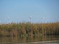 Collinsville on the Sacramento river with wind farm in background.jpg 2.048 × 1.536; 152 kB
-
 Concrete Pier Shasta and Eastern Railway.jpg 1.348 × 1.864; 859 kB
-
 Courtland view from across the Sacramento River.jpg 4.652 × 1.483; 3,63 MB
-
 Delta Cross-Channel Facility.jpg 3.264 × 1.840; 2,12 MB
-
 Delta Smelt (32294193740).jpg 4.288 × 2.848; 3,18 MB
-
 Fall Color along the River (27082941629).jpg 3.024 × 4.032; 4,51 MB
-
 Fall Colors (37972331065).jpg 4.032 × 3.024; 3,25 MB
-
 Fall colors near the river (23994350927).jpg 4.032 × 3.024; 3,91 MB
-
 Fall on the Sacramento River (38828597762).jpg 3.024 × 4.032; 4,17 MB
-
 FEMA - 1322 - Photograph by Dave Gatley taken on 02-26-1998 in California.jpg 3.113 × 1.958; 3,89 MB
-
 FEMA - 1323 - Photograph by Dave Gatley taken on 02-26-1998 in California.jpg 2.995 × 1.903; 4,73 MB
-

-

-

-
 Fish stories alleged and experienced (Plate 15) (7644339236).jpg 1.189 × 1.830; 500 kB
-
 Floating Robots in the Sacramento River Delta.jpg 2.500 × 1.651; 4,37 MB
-
 FMIB 33527 Terrapin Net.1.jpeg 740 × 475; 141 kB
-
 FMIB 33527 Terrapin Net.jpeg 798 × 523; 155 kB
-
 FMIB 40918 Sacramento River at Dunsmuir.jpeg 597 × 902; 163 kB
-
 FMIB 40920 Sacramento River near Sims, 'Pool B'.jpeg 1.120 × 763; 319 kB
-
 FMIB 40921 Sacramento River in the Vicinity of Princeton.jpeg 1.173 × 702; 247 kB
-
 FMIB 41213 Playing a Dolly Varden Trout Upper Sacramento River, California.jpeg 615 × 1.090; 208 kB
-
 FMIB 51130 Orthodon Chub.jpeg 1.955 × 964; 439 kB
-
-
-

-
 Fredrick Miller Regional Park, Sacramento River (25721928220).jpg 5.760 × 3.840; 25,44 MB
-
 Freeport Bridge from Freeport.jpg 4.080 × 2.239; 2,26 MB
-
 Freeport Intake Facility 2017-02-15 (32751721394).jpg 5.760 × 3.840; 6,8 MB
-

-
 Grand Island (California).png 683 × 760; 928 kB
-
 Habitat for Fish in the Sacramento River (9027317679).jpg 5.184 × 3.456; 7,2 MB
-
 Headwaters of the Sacramento River-750px.JPG 750 × 554; 114 kB
-
 Headwaters of the Sacramento River-spring-750px.JPG 750 × 555; 92 kB
-
 High capacity lines exting the intake facility (29603717746).jpg 6.000 × 3.624; 4,37 MB
-
 Humpback Whale Monument Rio Vista California - panoramio.jpg 2.592 × 1.936; 1,94 MB
-
 King Island (California).png 624 × 624; 521 kB
-
 Kings Island and others (California).png 1.092 × 806; 1,21 MB
-
 Lambert Road Pear Orchards - panoramio.jpg 2.592 × 1.936; 2,5 MB
-
 Lambert Road ^ Highway 160 - panoramio.jpg 2.592 × 1.936; 2,01 MB
-
 Little Mandeville Island (California).png 998 × 748; 1,24 MB
-
 Livingston Stone National Fish Hatchery (36443765216).jpg 5.760 × 3.840; 9,51 MB
-
 Mandeville Island (California).png 606 × 813; 921 kB
-

-
 Marina View Drive, Sacramento (28101213482).jpg 2.560 × 1.707; 4,47 MB
-
 McDonald Island (California).png 856 × 854; 1,1 MB
-
 Monitoring station at knights landing in the Sacramento river.jpg 2.048 × 1.536; 253 kB
-
 Montezuma hills along the Sacramento river.jpg 2.048 × 1.536; 93 kB
-
 Morrow Island (California).png 571 × 861; 860 kB
-

-
 Mt. Lassen and the Sacramento River.jpg 4.032 × 3.024; 2,74 MB
-
 New Sacramento River Water Intake Facility (29638689105).jpg 6.000 × 2.962; 3,73 MB
-
 Old Courthouse In Courtland California - panoramio (1).jpg 2.592 × 1.936; 1,86 MB
-
 Old Town Sacramento - Sacramento, California (8777136329).jpg 3.072 × 2.304; 673 kB
-
 Prospect Island (California).png 430 × 853; 574 kB
-
 Red Bluff Diversion Dam (32388283926).jpg 5.760 × 3.840; 7,04 MB
-
 Redding, California 6959156824 o.jpg 3.000 × 2.000; 5,62 MB
-
 Releasing steelhead (35697085102).jpg 5.760 × 3.840; 6,74 MB
-
 Rindge Tract (California).png 1.109 × 837; 1,38 MB
-
 Rio Vista Bridge Over Sacramento River - panoramio.jpg 2.592 × 1.936; 1,85 MB
-
 RioVistaBridge.jpg 4.272 × 2.848; 8,69 MB
-
 Roberts Island (California).png 657 × 826; 827 kB
-
 Ryer Island (California).png 445 × 890; 603 kB
-
 S. Sac. River Road 3372 - panoramio (1).jpg 950 × 713; 347 kB
-
 S. Sac. River Road 3372 - panoramio.jpg 950 × 713; 273 kB
-
 S. Sac. River Road 3373 - panoramio.jpg 950 × 713; 402 kB
-
 S. Sac. River Road 3378 - panoramio.jpg 950 × 713; 293 kB
-
 S. Sac. River Road 3379 - panoramio.jpg 950 × 713; 341 kB
-
 S. Sac. River Road 3380 - panoramio.jpg 950 × 713; 286 kB
-
 S. Sac. River Road 3381 - panoramio.jpg 950 × 713; 405 kB
-
 S. Sac. River Road 3383 - panoramio.jpg 950 × 713; 255 kB
-
 S. Sac. River Road 3384 - panoramio.jpg 950 × 713; 254 kB
-
 S. Sac. River Road 3385 - panoramio.jpg 950 × 713; 288 kB
-
 S. Sac. River Road 3389 - panoramio.jpg 950 × 713; 364 kB
-
 SacDelta1.jpg 651 × 199; 59 kB
-
 Sacramento River (5204362431).jpg 3.648 × 2.736; 1,89 MB
-
 Sacramento River (5393706178).jpg 1.504 × 1.000; 323 kB
-
 Sacramento River (8758968509).jpg 5.616 × 3.744; 1,43 MB
-
 Sacramento River (9027319215).jpg 4.608 × 3.456; 3,72 MB
-
 Sacramento River at Shasta Dam.JPG 4.608 × 3.072; 1,79 MB
-
-
 Sacramento River Bend BLM.jpg 960 × 640; 84 kB
-
 Sacramento river castle crags state park.jpg 5.184 × 3.456; 8,41 MB
-
 Sacramento river delta p1080765.jpg 2.560 × 1.920; 2,35 MB
-
 Sacramento River from the bridge at Sacramento City LCCN2002721072.jpg 1.536 × 1.421; 272 kB
-
 Sacramento River from the bridge at Sacramento City LCCN2002721072.tif 1.536 × 1.421; 2,08 MB
-
 Sacramento River Front.jpg 2.080 × 1.368; 587 kB
-
 Sacramento River in Bend, California.jpg 4.032 × 3.024; 5,9 MB
-
 Sacramento River In Redding California - panoramio.jpg 2.592 × 1.936; 1,58 MB
-
 Sacramento River in Rio Vista, California.jpg 3.264 × 2.448; 2,2 MB
-
 Sacramento River in the Autumn (38828599432).jpg 4.032 × 3.024; 5,18 MB
-
 Sacramento River in the Fall (38143495304).jpg 4.032 × 3.024; 4,32 MB
-
 Sacramento River Juvenile Anadromous Fish Monitoring Project at Red Bluff (22554363638).jpg 5.472 × 3.648; 2,74 MB
-
 Sacramento River Levee.jpg 1.944 × 1.296; 922 kB
-
 Sacramento River Red Bluff.jpg 2.560 × 1.440; 1,16 MB
-

-
 Sacramento River view, Bidwell-Sacramento River State Park.jpg 6.720 × 3.780; 18,73 MB
-
 Sacramento River wing dam marked by buoy (5998793439).jpg 2.816 × 1.872; 1,88 MB
-
 Sacramento River.JPG 3.264 × 2.448; 7,42 MB
-
 Sacramento Riverfront.jpg 1.000 × 600; 604 kB
-
 Sacramento Skyline (cropped).jpg 4.030 × 1.127; 1,3 MB
-
 Sacramento skyline from the river (cropped).jpg 2.456 × 1.125; 918 kB
-
 Sacramento skyline from the river.jpg 3.702 × 1.127; 1,2 MB
-
 Sacramento Skyline.jpg 6.014 × 1.460; 2,02 MB
-
 San Joaquin Sacramento confluence at Antioch CA.jpg 2.310 × 1.385; 964 kB
-

-
-
 Sims Bridge (23994352527).jpg 4.032 × 3.024; 4,52 MB
-
 Sims Bridge in the Fall (38828591012).jpg 4.032 × 3.024; 5,35 MB
-
 Squaw Hill Bridge near Corning c1890.jpg 1.999 × 1.409; 510 kB
-
 Staten Island (California).png 594 × 864; 763 kB
-
 Steelhead release (35866238045).jpg 5.760 × 3.840; 6,44 MB
-
 Sun Dial Bride Redding CA.jpg 3.264 × 1.836; 1,74 MB
-
-

-

-
 The Disney Daylight (30227313960).jpg 2.000 × 1.332; 3,94 MB
-
 The Sacramento River in Rio Vista, California.jpg 3.264 × 2.448; 1,93 MB
-
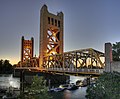 Tower Bridge Sacramento.jpg 2.500 × 2.064; 798 kB
-

-
 United States Exploring Expedition BHL32614032.jpg 3.088 × 2.159; 874 kB
-
 Upper Sacramento River near Red Bluff (31584875694).jpg 5.760 × 3.840; 6,54 MB
-
 US-CA-Sacramento-SacramentoRiver-WaterTreatmentInlet-2012-04-18T13-45-37.jpg 4.290 × 2.856; 2,57 MB
-
 US-CA-Sacramento-SacramentoRiver-WaterTreatmentInlet-2012-04-18T13-45-53.jpg 2.856 × 4.290; 2,41 MB
-
 View across the Sacramento River, Bidwell-Sacramento River State Park.jpg 6.720 × 4.480; 17,12 MB
-
 View from Sims Bridge (38828593932).jpg 4.032 × 3.024; 5,4 MB
-
 View of the Sacramento River (9029547800).jpg 4.608 × 3.456; 4,39 MB
-
 View of the Sacramento river above knights landing.jpg 2.048 × 1.536; 296 kB
-
 View of the Sacramento river.jpg 2.048 × 1.362; 96 kB
-
 Walnut Grove Bridge over Sacramento River open for sailboat (2006).jpg 3.504 × 2.336; 5,77 MB
-
 West Sacramento, CA, Riverbank Stabilization, 2006 - panoramio (1).jpg 1.504 × 1.000; 1,2 MB
-
 West Sacramento, CA, Riverbank Stabilization, 2006 - panoramio.jpg 1.504 × 1.000; 1,41 MB
-
 Woodward Island (California).png 1.102 × 827; 1,31 MB
-

.jpg)
.jpg)
.jpg)
.jpg)
.jpg)


_Highlighted.png)
_(14591632397).jpg)
_(14797981923).jpg)
_(14780497232).jpg)

.jpg)
.jpg)
.png)
.jpg)
.png)


.jpg)
.jpg)


.jpg)


.jpg)
.jpg)
.jpg)
.jpg)
.jpg)


_(7644339236).jpg)


,_Hysterocarpus_traski_Gibbons_Battle_Creek,_Sacramento_River.jpeg)
.jpg)

.jpg)
.jpg)
.png)
.jpg)


.jpg)

.png)
.png)


.png)
.jpg)
.png)
.jpg)
.png)


.png)


.jpg)
.jpg)
.jpg)
.png)
.jpg)

.jpg)
.png)


.png)
.png)
.jpg)


.jpg)
.jpg)
.jpg)
.jpg)

.jpg)


.jpg)
.jpg)
.jpg)


.jpg)


.jpg)

.jpg)
.jpg)

.png)
.jpg)

.jpg)


.jpg)


.jpg)
.jpg)


.jpg)
.jpg)

.png)

.jpg)
Categorieën:
- Rivers of Contra Costa County, California
- Sacramento Valley (California)
- Sacramento–San Joaquin River Delta
- Tributaries of San Pablo Bay
- Nature of the Central Valley of California
- Geography of the San Francisco Bay Area
- Geography of Sacramento County, California
- Geography of Solano County, California
- Geography of Siskiyou County, California
- Geography of Shasta County, California
- Geography of Tehama County, California
- Geography of Butte County, California
- Geography of Glenn County, California
- Geography of Colusa County, California
- Geography of Sutter County, California
- Geography of Yolo County, California
- Rivers of the United States by name