Category:Sancreed
Zur Navigation springen
Zur Suche springen
village in Cornwall, England, UK  | |||||
| Medium hochladen | |||||
| Ist ein(e) | |||||
|---|---|---|---|---|---|
| Ort | Cornwall, Südwestengland, England | ||||
 | |||||
Unterkategorien
Es werden 11 von insgesamt 11 Unterkategorien in dieser Kategorie angezeigt:
In Klammern die Anzahl der enthaltenen Kategorien (K), Seiten (S), Dateien (D)
C
- Caer Bran hill fort (2 D)
D
G
- Goldherring (7 D)
N
- Newbridge, Cornwall (9 D)
S
- Sancreed Beacon (7 D)
- Sancreed War Memorial (2 D)
T
- The Blind Fiddler (8 D)
- Trerice, Sancreed (1 D)
W
Medien in der Kategorie „Sancreed“
Folgende 200 Dateien sind in dieser Kategorie, von 232 insgesamt.
(vorherige Seite) (nächste Seite)-

-

-
 A Useful Warning - geograph.org.uk - 926129.jpg 640 × 427; 135 KB
-
 A30 heading north east through woodland - geograph.org.uk - 5464327.jpg 640 × 480; 133 KB
-
 A30 towards Penzance - geograph.org.uk - 5464262.jpg 640 × 480; 129 KB
-
 A30, Catchall - geograph.org.uk - 5465344.jpg 2.848 × 2.136; 1,19 MB
-
 A3071 east of Jericho Farm - geograph.org.uk - 3199187.jpg 3.648 × 2.048; 1.004 KB
-
 Access Road to Boslow Farmhouse - geograph.org.uk - 5030643.jpg 4.608 × 3.456; 6,26 MB
-
 After the potato harvest - geograph.org.uk - 4742138.jpg 4.896 × 3.672; 6,86 MB
-
 Almost everything you need at a crossroads - geograph.org.uk - 3827729.jpg 1.536 × 1.024; 937 KB
-
 Alongside the B3283 - geograph.org.uk - 748291.jpg 640 × 480; 81 KB
-
 Approaching sancreed well cornwall.jpg 2.112 × 2.816; 1,26 MB
-
 Approaching Trevorian - geograph.org.uk - 3153328.jpg 640 × 427; 85 KB
-

-
 B3283 near Hendra - geograph.org.uk - 5464294.jpg 640 × 480; 67 KB
-
 B3283 towards St Buryan - geograph.org.uk - 5464290.jpg 640 × 480; 74 KB
-
 Baptistry chapel near Sancreed - geograph.org.uk - 3197336.jpg 2.000 × 1.500; 1,26 MB
-
 Barn at Brane End - geograph.org.uk - 3138201.jpg 640 × 427; 84 KB
-
 Bejowans Vean - geograph.org.uk - 3153347.jpg 640 × 427; 70 KB
-
 Blind Fiddler - geograph.org.uk - 130857.jpg 640 × 480; 143 KB
-
 Boathouse and fishing ticket office, Drift Reservoir - geograph.org.uk - 3827713.jpg 1.536 × 1.152; 906 KB
-
 Bojuthnoe Farm - geograph.org.uk - 1932052.jpg 640 × 480; 72 KB
-
 Boslow Farm - geograph.org.uk - 5596091.jpg 1.024 × 683; 248 KB
-
 Boswarthen from the field gate - geograph.org.uk - 3138117.jpg 640 × 427; 115 KB
-
 Boswens Common - geograph.org.uk - 4488967.jpg 2.560 × 1.651; 2,28 MB
-
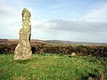 Boswens Menhir - geograph.org.uk - 75084.jpg 640 × 480; 137 KB
-
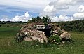 Brane burial chamber - geograph.org.uk - 1040 (cropped).jpg 450 × 287; 74 KB
-
 Brane burial chamber - geograph.org.uk - 1040.jpg 640 × 480; 136 KB
-
 Brane Burial Chamber - geograph.org.uk - 4413927.jpg 1.679 × 1.120; 443 KB
-
 Brane Cross - geograph.org.uk - 505324.jpg 640 × 467; 121 KB
-
 Brane End Farm - geograph.org.uk - 3138186.jpg 640 × 427; 88 KB
-
 Brane Farm - geograph.org.uk - 3138175.jpg 640 × 427; 82 KB
-
 Bridlepath skirts woodland - geograph.org.uk - 3153336.jpg 640 × 427; 141 KB
-
 Bridlepath to Bosvenning - geograph.org.uk - 1888058.jpg 427 × 640; 110 KB
-
 Buildings at Botrea - geograph.org.uk - 4742130.jpg 1.600 × 1.200; 494 KB
-
 Buildings at Brane Farm - geograph.org.uk - 3138139.jpg 640 × 401; 80 KB
-
 Buildings at Sellan - geograph.org.uk - 2993864.jpg 2.592 × 1.944; 1,79 MB
-
 Buildings at Tregonebris - geograph.org.uk - 1379353.jpg 640 × 427; 93 KB
-
 Bullocks below Caer Bran - geograph.org.uk - 40928.jpg 640 × 480; 154 KB
-
 Caer Brân hillfort - geograph.org.uk - 5156912.jpg 1.024 × 768; 247 KB
-
 Car park and picnic area, Drift Reservoir - geograph.org.uk - 3827720.jpg 1.536 × 1.152; 1,03 MB
-
 Carn Euny - geograph.org.uk - 2999179.jpg 800 × 600; 287 KB
-
 Carn Euny - geograph.org.uk - 2999196.jpg 800 × 600; 249 KB
-
 Carn Euny - geograph.org.uk - 2999206.jpg 800 × 600; 277 KB
-
 Carn Euny - geograph.org.uk - 2999212.jpg 800 × 600; 238 KB
-
 Carn Euny - geograph.org.uk - 2999343.jpg 800 × 600; 216 KB
-
 Carn Euny - geograph.org.uk - 2999353.jpg 800 × 600; 307 KB
-
 Carn Euny - geograph.org.uk - 2999359.jpg 800 × 600; 219 KB
-
 Carn Euny - geograph.org.uk - 2999366.jpg 800 × 600; 244 KB
-
 Carn Euny - geograph.org.uk - 2999372.jpg 800 × 600; 206 KB
-
 Carn Euny - geograph.org.uk - 2999382.jpg 800 × 600; 253 KB
-
 Carn Euny - geograph.org.uk - 2999387.jpg 800 × 600; 211 KB
-
 Carn Euny - geograph.org.uk - 2999392.jpg 800 × 600; 269 KB
-
 Carn Euny - geograph.org.uk - 2999405.jpg 800 × 600; 256 KB
-
 Carn Euny - geograph.org.uk - 3001188.jpg 800 × 600; 226 KB
-
 Carn Euny, information sign - geograph.org.uk - 2629155.jpg 428 × 640; 86 KB
-

-

-
 Cereal crop and woodland - geograph.org.uk - 5464256.jpg 640 × 480; 60 KB
-
 Cock's Roost Farm - geograph.org.uk - 925892.jpg 640 × 427; 74 KB
-
 Comms towers on the hill - geograph.org.uk - 912183.jpg 640 × 480; 226 KB
-
 Cornish Cross, Sancreed - geograph.org.uk - 5120423.jpg 1.200 × 1.600; 760 KB
-
 Cottage at Tregonebris Farm - geograph.org.uk - 4742073.jpg 4.896 × 3.672; 6,73 MB
-

-
 Detached House in Sancreed - geograph.org.uk - 5030759.jpg 4.608 × 3.456; 6,77 MB
-
 Deveral Common - geograph.org.uk - 4488950.jpg 2.560 × 1.920; 2,43 MB
-

-

-

-
 Donkeys at Newham Farm - geograph.org.uk - 5156810.jpg 1.024 × 769; 271 KB
-
 Drift Reservoir - geograph.org.uk - 1989960.jpg 640 × 426; 67 KB
-
 Drift Reservoir - geograph.org.uk - 2806506.jpg 640 × 445; 84 KB
-
 Drift Reservoir - geograph.org.uk - 4561605.jpg 2.560 × 1.920; 1,95 MB
-
 Drift Reservoir - geograph.org.uk - 5927107.jpg 4.000 × 3.000; 4,58 MB
-
 Drift Reservoir - geograph.org.uk - 5927113.jpg 4.000 × 3.000; 6,49 MB
-
 Drift Reservoir - geograph.org.uk - 5927119.jpg 4.000 × 3.000; 4,73 MB
-
 Drift Reservoir - geograph.org.uk - 5927121.jpg 4.000 × 3.000; 3,77 MB
-
 Drift Reservoir near Sancreed - geograph.org.uk - 4970113.jpg 3.264 × 1.840; 3,59 MB
-
 Drift Reservoir near Sancreed - geograph.org.uk - 5030888.jpg 4.608 × 3.456; 6,89 MB
-
 Drift village - geograph.org.uk - 2993892.jpg 2.592 × 1.944; 1,56 MB
-
 Drystone Wall near Bodinnar Farm - geograph.org.uk - 5030737.jpg 4.608 × 3.456; 6,12 MB
-
 Elizabeth II postbox on the A30, Catchall - geograph.org.uk - 5465342.jpg 1.109 × 1.763; 535 KB
-
 Entering Drift - geograph.org.uk - 5464307.jpg 640 × 480; 55 KB
-
 Entrance to the fogou, Carn Euny - geograph.org.uk - 3197300.jpg 2.000 × 1.500; 968 KB
-
 Farm access track on Hewes Common - geograph.org.uk - 1932042.jpg 640 × 480; 91 KB
-
 Farm buildings at Caer Bran Farm - geograph.org.uk - 2993794.jpg 2.592 × 1.944; 1,81 MB
-
 Farm buildings at Great Bosullow - geograph.org.uk - 1932058.jpg 640 × 480; 88 KB
-
 Farm entrances - geograph.org.uk - 912399.jpg 640 × 480; 192 KB
-
 Farm Track to Boswen Common - geograph.org.uk - 5030708.jpg 4.608 × 3.456; 6,21 MB
-
 Farmland towards Great Bosullow - geograph.org.uk - 4970139.jpg 4.608 × 3.456; 6,48 MB
-
 Field and solar panels at Bosvenning - geograph.org.uk - 2993870.jpg 2.592 × 1.944; 1,14 MB
-
 Field entrance near Hendra - geograph.org.uk - 5464299.jpg 640 × 480; 71 KB
-
 Field near Bodinnar Farm - geograph.org.uk - 5030732.jpg 4.608 × 3.456; 5,92 MB
-
 Fields near Catchall - geograph.org.uk - 4742019.jpg 1.600 × 1.200; 569 KB
-
 Fields near Catchall - geograph.org.uk - 4742021.jpg 4.896 × 3.672; 6,6 MB
-
 Fluorescent green alga, Carn Euny fogou - geograph.org.uk - 5199040.jpg 1.024 × 768; 296 KB
-

-
 Fogou, Carn Euny - geograph.org.uk - 5120417.jpg 1.600 × 1.200; 407 KB
-
 Footpath near Bojuthnoe Farm - geograph.org.uk - 5030723.jpg 4.608 × 3.456; 6,88 MB
-
 Footpath to Caer Bran - geograph.org.uk - 3138082.jpg 640 × 427; 142 KB
-
 Footpath to Trenuggo - geograph.org.uk - 780415.jpg 489 × 640; 217 KB
-
 Garage at Newbridge - geograph.org.uk - 1933308.jpg 640 × 480; 66 KB
-
 Gate and Parked Car near Roceven - geograph.org.uk - 5012510.jpg 4.608 × 3.456; 6,63 MB
-
 Gateway for animals to Grumbla Common - geograph.org.uk - 3827693.jpg 1.536 × 1.152; 990 KB
-
 Grassland and woodland near Drift - geograph.org.uk - 5464310.jpg 640 × 480; 93 KB
-
 Grazing and hedgerow off the A30 - geograph.org.uk - 5464266.jpg 640 × 480; 57 KB
-

-
 Grumbla Common - geograph.org.uk - 3827690.jpg 1.536 × 768; 673 KB
-
 Guide Post - St Just or Pendeen - geograph.org.uk - 4450715.jpg 480 × 640; 112 KB
-
 Have you seen this owl^ - geograph.org.uk - 2629186.jpg 640 × 428; 77 KB
-
 Hedgerow near Trannack Farm - geograph.org.uk - 1932038.jpg 640 × 480; 110 KB
-
 Higher Botrea farm - geograph.org.uk - 4742139.jpg 4.896 × 3.672; 6,96 MB
-
 Horse field by the A30 - geograph.org.uk - 4742032.jpg 4.896 × 3.672; 6,6 MB
-
 Horses near the A3071 - geograph.org.uk - 4742141.jpg 4.896 × 3.672; 6,52 MB
-
 House at Grumbla - geograph.org.uk - 3138102.jpg 640 × 427; 108 KB
-
 Houses near Trannack Mill - geograph.org.uk - 2993831.jpg 2.592 × 1.944; 1,04 MB
-
 Housing at Newbridge - geograph.org.uk - 1933314.jpg 640 × 480; 69 KB
-
 Internal chamber of fogou, Carn Euny - geograph.org.uk - 5157051.jpg 1.024 × 768; 305 KB
-
 Lane at Trelanergh - geograph.org.uk - 5156827.jpg 1.024 × 768; 267 KB
-
 Lane through Bosvenning - geograph.org.uk - 1888078.jpg 640 × 427; 113 KB
-
 Lawn Near Bodinnar - geograph.org.uk - 5030753.jpg 4.608 × 3.456; 6,17 MB
-
 Little Receven - Converted Farmhouse - geograph.org.uk - 4970137.jpg 4.608 × 3.456; 6,37 MB
-
 Little Sellan - geograph.org.uk - 1386387.jpg 640 × 427; 94 KB
-

-

-
 Maintenance work at Carn Euny - geograph.org.uk - 3197279.jpg 2.000 × 1.500; 1.009 KB
-
 Memorial cross and baptistry chapel, Sancreed – - geograph.org.uk - 3197359.jpg 3.018 × 2.232; 1,81 MB
-
 Milestone - Penzance 5 - geograph.org.uk - 4450729.jpg 480 × 640; 95 KB
-
 Milestone on the B3318 - geograph.org.uk - 5596094.jpg 683 × 1.024; 359 KB
-
 Minor road near Newbridge - geograph.org.uk - 1888031.jpg 640 × 427; 86 KB
-
 Minor road near Treganhoe Farm - geograph.org.uk - 5093241.jpg 2.592 × 1.944; 1,4 MB
-
 Modern Cairn On Tumulus On Deveral Common - geograph.org.uk - 4488960.jpg 2.560 × 1.920; 2,09 MB
-
-
 Moor Magy farm - geograph.org.uk - 2991286.jpg 2.592 × 1.944; 1,97 MB
-
 Mud and rushes at the west end of Drift Reservoir - geograph.org.uk - 5093263.jpg 2.592 × 1.944; 1,6 MB
-
 Old building near Tregonebris Farm - geograph.org.uk - 5986239.jpg 3.874 × 2.790; 6,18 MB
-

-
 Old Milestone by the A30, Catchall - geograph.org.uk - 5623387.jpg 600 × 800; 204 KB
-

-
 Old Wayside Cross (geograph 6496226).jpg 960 × 720; 235 KB
-

-
 Ordnance Survey 1GL Bolt - geograph.org.uk - 5293916.jpg 640 × 344; 87 KB
-
 Ordnance Survey Flush Bracket 1567 - geograph.org.uk - 5431040.jpg 3.888 × 2.915; 3,05 MB
-
 Ordnance Survey Flush Bracket 1569 - geograph.org.uk - 5431016.jpg 4.000 × 3.000; 4,41 MB
-
 Ordnance Survey Fundamental Bench Mark - Sancreed - geograph.org.uk - 5431027.jpg 4.000 × 3.000; 4,51 MB
-
 Out of milk - geograph.org.uk - 2166598.jpg 629 × 549; 285 KB
-
 Path to Carn Euny - geograph.org.uk - 2999171.jpg 800 × 600; 276 KB
-
 Path to St Euny's Well - geograph.org.uk - 3197247.jpg 2.000 × 1.500; 1,25 MB
-
 Penwith , The A30 - geograph.org.uk - 2499623.jpg 4.274 × 2.826; 5,49 MB
-
 Penwith , The A30 - geograph.org.uk - 2499624.jpg 4.288 × 2.848; 6,07 MB
-
 Penwith sancreed.png 217 × 208; 31 KB
-
 Potato Field - geograph.org.uk - 4488965.jpg 2.560 × 1.920; 2,44 MB
-
 Remains of Iron Age house, Carn Euny - geograph.org.uk - 3197262.jpg 2.000 × 1.500; 865 KB
-
 Remains of Iron-Age house, Carn Euny - geograph.org.uk - 3197287.jpg 2.000 × 1.500; 1,17 MB
-
 Road entering Sancreed - geograph.org.uk - 5384730.jpg 4.000 × 3.000; 3,16 MB
-
 Road from Drift to Chyenhal - geograph.org.uk - 5384733.jpg 4.000 × 3.000; 3,87 MB
-
 Road to Sancreed - geograph.org.uk - 2999143.jpg 800 × 600; 136 KB
-
 Road to the east of Bosvenning and Roskennals Common - geograph.org.uk - 5384709.jpg 4.000 × 3.000; 3,54 MB
-
 Road to the east of Trannack Farm - geograph.org.uk - 5384720.jpg 4.000 × 3.000; 2,86 MB
-
 Road to Trerice - geograph.org.uk - 1364148.jpg 640 × 427; 122 KB
-
 Roceven Farmyard - geograph.org.uk - 5030748.jpg 4.608 × 3.456; 6,38 MB
-
 Romano-British Settlement at Carn Euny - geograph.org.uk - 5157039.jpg 1.024 × 768; 333 KB
-
 Rosemergy cottage - geograph.org.uk - 4742037.jpg 1.600 × 1.200; 524 KB
-
 Sancreed - Fundamental Benchmark.jpg 1.273 × 1.697; 1,01 MB
-
 Sancreed - Penwith Gate 01.jpg 3.024 × 4.032; 3,96 MB
-
 Sancreed - Penwith Gate 02.jpg 3.024 × 4.032; 4,9 MB
-
 Sancreed - Penwith Gate 03.jpg 3.456 × 4.608; 5,57 MB
-
 Sancreed - Penwith Gate 04.jpg 3.024 × 4.032; 4,46 MB
-
 Sancreed - Penwith Gate 05.jpg 3.456 × 4.608; 6,68 MB
-
 Sancreed Beacon - geograph.org.uk - 4561209.jpg 2.560 × 1.920; 2,09 MB
-
 Sancreed Beacon - geograph.org.uk - 4591222.jpg 1.182 × 1.654; 497 KB
-
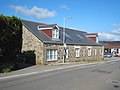
 Sancreed Church - geograph.org.uk - 4561598.jpg 2.560 × 1.920; 2,15 MB
-
 Sancreed Church and Crosses - geograph.org.uk - 4413948.jpg 1.062 × 1.770; 635 KB
-
 Sancreed Finger Post 01.jpg 2.442 × 2.845; 2,61 MB
-
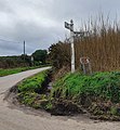 Sancreed Finger Post 02.jpg 2.303 × 2.497; 1,66 MB
-
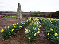
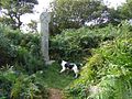
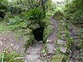
 Sancreed Holy Well - geograph.org.uk - 937683.jpg 483 × 640; 135 KB
-
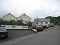
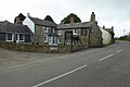
 Sancreed Village Hall - geograph.org.uk - 926146.jpg 640 × 427; 136 KB
-
 Sancreed war memorial and gateway to the churchyard - geograph.org.uk - 3827698.jpg 1.195 × 1.536; 1,44 MB
-
 Scrub on the edge of Hewes Common - geograph.org.uk - 1932046.jpg 640 × 480; 96 KB
-
 Sellan Veor Farm - geograph.org.uk - 5093275.jpg 2.592 × 1.944; 1,69 MB
-
 Skimmel Bridge - geograph.org.uk - 1373756.jpg 640 × 427; 114 KB
-
 Skimmel Bridge - geograph.org.uk - 77777.jpg 640 × 480; 184 KB
-
 Spring hedgerow at Lower Grumbla - geograph.org.uk - 1297125.jpg 640 × 427; 119 KB
-
 St Credan’s Well, Sancreed - geograph.org.uk - 3197367.jpg 1.500 × 2.000; 1,05 MB
-
 St Credan’s Well, Sancreed - geograph.org.uk - 5156717.jpg 768 × 1.024; 331 KB
-
 Stepping Stones over Stream near Sellan - geograph.org.uk - 5031157.jpg 4.608 × 3.456; 6,72 MB
-

-
 Stream crosses bridlepath - geograph.org.uk - 3153332.jpg 427 × 640; 135 KB
-
 Tangle Wood (may contain nuts) - geograph.org.uk - 2993849.jpg 2.592 × 1.944; 2,61 MB
-
 The A30 near The Blind Fiddler - geograph.org.uk - 4742033.jpg 4.896 × 3.672; 7,14 MB
-
 The A3071 - geograph.org.uk - 4742143.jpg 1.600 × 1.200; 401 KB
-
 The B3318 approaching a junction with the A3071 - geograph.org.uk - 5596075.jpg 1.024 × 768; 223 KB
-
 The Blind Fiddler 1935 - geograph.org.uk - 1899449.jpg 620 × 797; 124 KB
-
 The cottage - geograph.org.uk - 3138155.jpg 640 × 427; 72 KB
-
 The dam of Drift Reservoir - geograph.org.uk - 3827701.jpg 1.536 × 1.152; 895 KB
-
 The Fountain, Newbridge - geograph.org.uk - 5595293.jpg 1.024 × 683; 170 KB
-
 The holy well of St Euny - geograph.org.uk - 5986220.jpg 4.000 × 3.000; 4,93 MB
-
 The junction of the A30 and the B3283 - geograph.org.uk - 4742024.jpg 4.896 × 3.672; 6,6 MB
-
 The lane at Trannack Farm - geograph.org.uk - 2993839.jpg 2.592 × 1.944; 1,78 MB
-
 The lane to Little Sellan Farm - geograph.org.uk - 5093280.jpg 2.592 × 1.944; 1,66 MB
.jpg)
.jpg)


.jpg)


_-_geograph.org.uk_-_2629168.jpg)


.jpg)
.jpg)


_-_geograph.org.uk_-_2993849.jpg)


