Category:Savièse
Zur Navigation springen
Zur Suche springen
Gemeinde im Kanton Wallis in der Schweiz    | |||||
| Medium hochladen | |||||
| Ist ein(e) | |||||
|---|---|---|---|---|---|
| Ort | Bezirk Sitten, Kanton Wallis, Schweiz | ||||
| Amtssprache | |||||
| Einwohnerzahl |
| ||||
| Fläche |
| ||||
| Höhe über dem Meeresspiegel |
| ||||
| offizielle Website | |||||
 | |||||
Unterkategorien
Es werden 13 von insgesamt 13 Unterkategorien in dieser Kategorie angezeigt:
In Klammern die Anzahl der enthaltenen Kategorien (K), Seiten (S), Dateien (D)
B
- Bisse de Savièse (34 D)
C
D
E
- École de Savièse (2 D)
F
- Flags of Savièse (6 D)
G
- Glacier de Tsanfleuron (1 S, 33 D)
H
- Historical images of Savièse (12 D)
- Hôtel du Col du Sanetsch (3 D)
L
Q
S
- Schluchhorn (20 D)
W
- Wildhorn (51 D)
Medien in der Kategorie „Savièse“
Folgende 43 Dateien sind in dieser Kategorie, von 43 insgesamt.
-
 Bisse Pont suspendu 140 m Savièse - SkyPromenade.com - panoramio.jpg 2.048 × 1.536; 1,53 MB
-
 Chalet de la Lé's around - panoramio.jpg 1.536 × 2.048; 726 KB
-
 CHE Savièse Flag.svg 589 × 585; 53 KB
-
 Château de la Soie - fortification (1).jpg 6.240 × 4.160; 14,76 MB
-
 Col des Audanne's area sight toward "Glacier des Diableret" on fall - panoramio.jpg 2.592 × 1.944; 2,27 MB
-
 Col des Audanne's area sight toward "Gältehore" on fall - panoramio.jpg 2.592 × 1.944; 2,13 MB
-
 Col des Audanne's sight toward "Lac des Audannes" on fall - panoramio.jpg 2.592 × 1.944; 2,31 MB
-
 Commune de Savièse.jpg 2.048 × 1.073; 260 KB
-
 En aval de Savièse vers l'Ouest en automne Valais-Suisse.JPG 2.556 × 1.604; 1,81 MB
-
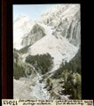
 ETH-BIB-Abfang von Nettage zum Bisse de Savièse-Tunnel (7)-Dia 247-13010.tif 3.114 × 3.414; 30,57 MB
-
 ETH-BIB-Bisse de Savièse, neue Chapelle Sainte Thérèse Mayens de la Lour-Dia 247-12880.tif 3.612 × 2.814; 29,21 MB
-
 ETH-BIB-Chandolin sur Savièse du Village-Dia 247-13002.tif 3.144 × 3.426; 30,94 MB
-
 ETH-BIB-Chapelle St. Marguerite am alten Bisse du Savièse ab Chandolin-Dia 247-12875.tif 2.970 × 3.426; 29,27 MB
-
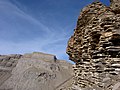
 ETH-BIB-Fels-Ecke am alten Bisse de Savièse (auswärts)-Dia 247-13014.tif 3.120 × 3.420; 30,64 MB
-
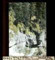
 ETH-BIB-Morge-Schlucht, Savièse-Dia 247-00619.tif 3.525 × 2.803; 9,53 MB
-
 ETH-BIB-Moränen-Talfüllung (Lugeon) unter Bisses de Savièse, Morge-Dia 247-13039.tif 3.085 × 3.407; 30,21 MB
-
 ETH-BIB-Pont Neuf am Sanetschweg-Dia 247-13005.tif 2.976 × 3.414; 29,2 MB
-
 ETH-BIB-Schuttkegel am Six Neire, Nettage aufwärts-Dia 247-13013.tif 3.006 × 3.414; 29,51 MB
-
 ETH-BIB-Tour St. Martin-Dia 247-00615.tif 3.573 × 2.740; 9,42 MB
-
 Glacier du Tsanfleron's sight toward "Weisshorn" - panoramio.jpg 4.000 × 3.000; 4,95 MB
-
 Grand gouille's area on fall - panoramio.jpg 1.944 × 2.592; 1,75 MB
-
 Grand gouille's sight toward "Mont Pucel" on fall - panoramio.jpg 2.592 × 1.944; 2,08 MB
-
 Karte Gemeinde Savièse 2007.png 1.476 × 1.398; 415 KB
-
 Karte Gemeinde Savièse.png 944 × 887; 133 KB
-
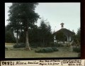
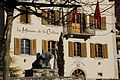 Maison de la Culture à Savièse en Valais Suisse.jpg 1.936 × 1.296; 1,23 MB
-
 Maison villageoise Ormône Savièse.jpg 1.919 × 1.276; 228 KB
-
 Mont pucel's area on fall - panoramio.jpg 2.592 × 1.944; 2,3 MB
-
 Oldenhorn's sight toward "Furggenspitz" - panoramio.jpg 4.000 × 3.000; 4,86 MB
-
 Prabé - panoramio.jpg 4.000 × 3.000; 4,77 MB
-
 Prabé's hut - panoramio.jpg 4.000 × 3.000; 4,41 MB
-
 Sanetsch pass area's sight toward "Sanetschhorn" - panoramio.jpg 4.000 × 3.000; 4,77 MB
-
 Sanetschhorn's sight to "la Dent Blanche" - panoramio.jpg 1.536 × 2.048; 723 KB
-
 CHE Savièse COA.svg 500 × 600; 8 KB
-
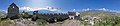
 Savièse - 2022.jpg 20.140 × 7.954; 60,22 MB
-
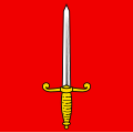
 Savièse-coat of arms.svg 603 × 763; 25 KB
-
 Savièse. Veduta di un ponte di pietra.jpg 3.000 × 2.042; 501 KB
-
 Savièse.jpg 5.183 × 2.312; 3,37 MB
-
 Sion depuis Nax - 2022.jpg 15.708 × 9.266; 100,33 MB
-
 Tourbillon Castle panorama.jpg 7.614 × 1.648; 4,56 MB
-
 View from the Oldensattel (30784065608).jpg 5.184 × 3.456; 6,58 MB
-
 View from the Oldensattel (42844351710).jpg 5.184 × 3.456; 6,53 MB
-
 Wildhorn and Pra Roua.jpg 4.951 × 3.301; 3,61 MB
-
 Wine and Snow.jpg 4.000 × 3.000; 10,12 MB


.jpg)


.jpg)
.jpg)

