Category:Silkstone
Naar navigatie springen
Naar zoeken springen
English: Silkstone is a village and civil parish in the Metropolitan Borough of Barnsley in South Yorkshire, England. It is situated in the foothills of the Pennines, between the towns of Barnsley and Penistone, and includes the village of Silkstone Common. At the 2001 census it had a population of 2,954.
Nederlands: Silkstone is een dorp (village) en civil parish in het bestuurlijke gebied Barnsley, in het Engelse graafschap South Yorkshire. De civil parish telt
South Yorkshire  | |||||
| Media uploaden | |||||
| Is een | |||||
|---|---|---|---|---|---|
| Locatie | Silkstone, Barnsley, Zuid-Yorkshire, Yorkshire and the Humber, Engeland | ||||
| officiële website | |||||
 | |||||
Ondercategorieën
Deze categorie bevat de volgende 3 subcategorieën, van de 3 in totaal.
S
- All Saints, Silkstone (8 B)
- Silkstone glassworks (4 B)
Media in categorie "Silkstone"
Deze categorie bevat de volgende 200 bestanden, van in totaal 261.
(vorige pagina) (volgende pagina)-
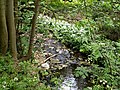 A lane side beck. - geograph.org.uk - 427838.jpg 640 × 480; 151 kB
-
 A spoil heap on Silkstone Wagon Way - geograph.org.uk - 600788.jpg 640 × 480; 131 kB
-
 A628 about to enter Noblethorpe - geograph.org.uk - 3428047.jpg 640 × 428; 70 kB
-
 A628 nears High Street junction - geograph.org.uk - 3036981.jpg 640 × 479; 67 kB
-
 A628, Barnsley Road - geograph.org.uk - 3430986.jpg 640 × 430; 59 kB
-
 All Saints Church at Silksworth - geograph.org.uk - 3776032.jpg 4.000 × 3.000; 5,12 MB
-
 All Saints Church, Silkstone - geograph.org.uk - 4192303.jpg 640 × 480; 61 kB
-
 All Saints' Church, Silkstone. Spring 2011 - geograph.org.uk - 2378155.jpg 2.272 × 1.704; 2,29 MB
-
 Bank House Farm (House) - geograph.org.uk - 520206.jpg 640 × 480; 119 kB
-
 Bank House Farm Silkstone - geograph.org.uk - 520204.jpg 640 × 480; 103 kB
-
 Banks Bottom dike - geograph.org.uk - 2052359.jpg 640 × 480; 114 kB
-
 Barnsley Road - geograph.org.uk - 4192644.jpg 640 × 480; 88 kB
-
 Barnsley Road - geograph.org.uk - 4192645.jpg 640 × 480; 86 kB
-
 Barnsley Road near Silkstone Fall - geograph.org.uk - 3036926.jpg 640 × 480; 89 kB
-

-
 Ben Bank Road, Silkstone Common - geograph.org.uk - 5090327.jpg 1.600 × 1.065; 583 kB
-
 Ben Bank Road, Silkstone Common - geograph.org.uk - 5090375.jpg 1.600 × 1.065; 493 kB
-
 Ben Bank Road, Silkstone Common - geograph.org.uk - 5090614.jpg 1.600 × 1.065; 568 kB
-
 Ben Bank Road, Silkstone Common - geograph.org.uk - 858250.jpg 640 × 480; 80 kB
-
 Bench on Hall Royd Lane - geograph.org.uk - 5090156.jpg 1.600 × 1.065; 751 kB
-

-
 Black Horse Drive at Silkstone Common - geograph.org.uk - 2003421.jpg 2.848 × 2.144; 1,52 MB
-
 Blacker Dam - geograph.org.uk - 2003444.jpg 2.848 × 2.144; 1,53 MB
-
 Blacker Dam near Silkstone - geograph.org.uk - 938940.jpg 640 × 480; 105 kB
-
 Blacker Dam, Silkstone Common - geograph.org.uk - 2800995.jpg 4.320 × 3.240; 3,05 MB
-
 Blackergreen Lane between the A628 and Blacker Dam - geograph.org.uk - 5836405.jpg 4.000 × 3.000; 4,12 MB
-
 Blackergreen Lane near Lower Coates - geograph.org.uk - 2322184.jpg 3.296 × 2.472; 1,1 MB
-
 Building at Lees Hall Farm - geograph.org.uk - 4037410.jpg 1.600 × 1.200; 633 kB
-
 Bull Haw Hall Farm - geograph.org.uk - 422194.jpg 640 × 480; 66 kB
-
 Bungalow on Hall Royd Lane - geograph.org.uk - 5090197.jpg 1.600 × 1.065; 557 kB
-
 Burning household refuse near Blacker Dam - geograph.org.uk - 938934.jpg 640 × 480; 149 kB
-
 Church of All Saints from Silkstone Lane - geograph.org.uk - 2572905.jpg 1.776 × 2.368; 1,41 MB
-
 Coates Lane (B6449) - geograph.org.uk - 4192724.jpg 640 × 480; 83 kB
-
 Comma butterfly on thistle - geograph.org.uk - 1411235.jpg 640 × 478; 93 kB
-
 Cone Lane, Silkstone Common - geograph.org.uk - 4192714.jpg 640 × 480; 91 kB
-
 Copses on Whin Moor - geograph.org.uk - 113422.jpg 640 × 426; 130 kB
-
 Cottage Bakery Shop, Silkstone Common - geograph.org.uk - 5090329.jpg 1.600 × 1.065; 562 kB
-
 Cottage on Hall Royd Lane - geograph.org.uk - 5090142.jpg 1.600 × 1.065; 716 kB
-
 Cottages at Moor End - geograph.org.uk - 3767092.jpg 4.460 × 3.568; 4,14 MB
-

-
 Derelict building off Kine Moor Lane - geograph.org.uk - 938985.jpg 640 × 480; 53 kB
-
 Derelict cottage in the wood - geograph.org.uk - 938961.jpg 640 × 480; 149 kB
-
 Derelict farm building on Kine Moor Lane - geograph.org.uk - 2161671.jpg 2.608 × 1.952; 1,44 MB
-
 Dodworth next stop - geograph.org.uk - 520196.jpg 640 × 480; 108 kB
-
 Dove Valley Trail marker - geograph.org.uk - 4981195.jpg 1.024 × 786; 357 kB
-
 Driveway to Pye Flatts - geograph.org.uk - 2161614.jpg 2.608 × 1.952; 1,86 MB
-
 Eatery at Silkstone - geograph.org.uk - 4384355.jpg 3.451 × 2.663; 1,76 MB
-
 End of the public road Blacker Green Lane - geograph.org.uk - 3056370.jpg 1.024 × 672; 237 kB
-
 Entering Silkstone - geograph.org.uk - 1115455.jpg 480 × 640; 56 kB
-
 Entering Silkstone Common - geograph.org.uk - 4192710.jpg 640 × 480; 84 kB
-
 Farm at Lower Coates - geograph.org.uk - 3649570.jpg 768 × 1.024; 262 kB
-
 Female Broad Bodied Chaser - geograph.org.uk - 3727641.jpg 2.359 × 2.979; 2,35 MB
-
 Field-edge footpath, Whin Moor - geograph.org.uk - 2572777.jpg 4.320 × 3.240; 3 MB
-
 Fields Farm and Pylons - geograph.org.uk - 402550.jpg 640 × 480; 105 kB
-
 Finger post in Silkstone Wood - geograph.org.uk - 5090138.jpg 1.600 × 1.065; 914 kB
-
 Fly Agaric (Amanita muscaria) - geograph.org.uk - 1622351.jpg 640 × 480; 114 kB
-
 Footbridge in Banks Wood plantation - geograph.org.uk - 2161589.jpg 2.353 × 1.760; 1,91 MB
-
 Footbridge over Silkstone Beck - geograph.org.uk - 2003453.jpg 2.848 × 2.144; 1,53 MB
-
 Footbridge over stream - geograph.org.uk - 4295966.jpg 1.024 × 768; 354 kB
-
 Footpath between fence and wall to Silkstone Common - geograph.org.uk - 5836393.jpg 4.000 × 3.000; 4,12 MB
-
 Footpath Crossroads near High Field Plantation - geograph.org.uk - 2322188.jpg 3.296 × 2.472; 1,12 MB
-
 Footpath from Fall Head towards Pot House Bridge - geograph.org.uk - 4037418.jpg 1.600 × 1.200; 1,07 MB
-
 Footpath Junction in Woodland near Silkstone - geograph.org.uk - 4384335.jpg 4.000 × 3.000; 2,52 MB
-
 Footpath near Silkstone - geograph.org.uk - 2572756.jpg 3.240 × 4.320; 2,89 MB
-
 Footpath off Hall Royd Lane - geograph.org.uk - 5090160.jpg 1.600 × 1.065; 924 kB
-
 Footpath off Hall Royd Lane - geograph.org.uk - 5090194.jpg 1.600 × 1.065; 682 kB
-
 Footpath towards Bull Haw Lane - geograph.org.uk - 4037634.jpg 1.600 × 1.200; 929 kB
-
 Former Railway Bridge at Moor End - geograph.org.uk - 4607823.jpg 4.000 × 3.000; 3,3 MB
-
 Gallops and fences - geograph.org.uk - 938949.jpg 640 × 480; 96 kB
-
 Georgian Postbox on Ben Bank Road - geograph.org.uk - 5090381.jpg 1.065 × 1.600; 479 kB
-
 Grazing, Hall Royd - geograph.org.uk - 4192707.jpg 640 × 480; 68 kB
-
 Green lane, Silkstone - geograph.org.uk - 4192299.jpg 640 × 480; 138 kB
-
 Hall Royd Lane, Silkstone Common - geograph.org.uk - 5090200.jpg 1.600 × 1.065; 707 kB
-
 Hay Wire at Bull Haw Hall Farm - geograph.org.uk - 422210.jpg 640 × 480; 63 kB
-
 House Carr Lane near Silkstone Common - geograph.org.uk - 4610768.jpg 4.000 × 3.000; 2,35 MB
-
 House on Fall Head Lane - geograph.org.uk - 5294913.jpg 1.200 × 799; 429 kB
-
 Houses on Moorend Lane, Silkstone Common - geograph.org.uk - 5090514.jpg 1.600 × 1.065; 539 kB
-
 Huskar Monument Detail - geograph.org.uk - 3767106.jpg 5.184 × 3.888; 6,11 MB
-
 Huskar Pit disaster monument - geograph.org.uk - 2375119.jpg 1.024 × 747; 313 kB
-
 Knabbs Lane (B6449) - geograph.org.uk - 4192718.jpg 640 × 480; 71 kB
-
 Knabbs Lane, Silkstone Common - geograph.org.uk - 5090663.jpg 1.600 × 1.065; 562 kB
-
 Knots - geograph.org.uk - 762901.jpg 640 × 481; 142 kB
-
 Leaving Silkstone - geograph.org.uk - 1115457.jpg 640 × 480; 114 kB
-
 Lees Hall Farm - geograph.org.uk - 4037411.jpg 1.600 × 1.200; 917 kB
-
 Lonesome tree on Whin Moor - geograph.org.uk - 2167681.jpg 2.317 × 1.735; 1,16 MB
-
 Looking down to the tunnel mouth - geograph.org.uk - 5557546.jpg 1.024 × 768; 208 kB
-
 Looking to Dodworth - geograph.org.uk - 519188.jpg 640 × 480; 120 kB
-
 Looking to Silkstone Common - geograph.org.uk - 519185.jpg 640 × 480; 115 kB
-
 Looking towards Silkstone Common - geograph.org.uk - 938956.jpg 640 × 480; 75 kB
-
 Low Mill - geograph.org.uk - 422502.jpg 640 × 480; 81 kB
-
 Meadow and Path Near Low Mill - geograph.org.uk - 5277494.jpg 4.608 × 3.456; 4,52 MB
-
 Methodist Church, Silkstone Common - geograph.org.uk - 5090377.jpg 1.600 × 1.065; 600 kB
-
 Monument near Horse Carr bridge - geograph.org.uk - 2375131.jpg 1.024 × 768; 251 kB
-
 Moor End Cottages - geograph.org.uk - 3236432.jpg 2.048 × 1.536; 726 kB
-
 Nabs Wood - geograph.org.uk - 380984.jpg 640 × 480; 63 kB
-
 Nether Royd View - geograph.org.uk - 2003477.jpg 2.848 × 2.144; 1,49 MB
-

-

-
 Old outbuilding at Knabbs Hall Farm - geograph.org.uk - 3767117.jpg 5.182 × 3.702; 5,97 MB
-
 Open air chapel at Silverwood Scout Campsite - geograph.org.uk - 3649579.jpg 1.024 × 768; 255 kB
-
 Open air chapel at Silverwood Scout Campsite - geograph.org.uk - 3649583.jpg 768 × 1.024; 307 kB
-
 Open gate - geograph.org.uk - 5557057.jpg 1.024 × 768; 360 kB
-
 Ordnance Survey Cut Mark - geograph.org.uk - 3062932.jpg 3.264 × 2.448; 2,59 MB
-
 Ordnance Survey Flush Bracket S9252 - geograph.org.uk - 3278245.jpg 1.944 × 2.592; 1,23 MB
-
 Ornamental gate beside footpath to Whin Moor - geograph.org.uk - 6113116.jpg 1.024 × 768; 318 kB
-
 Pack Horse Green, Silkstone - geograph.org.uk - 4192301.jpg 640 × 480; 82 kB
-
 Pasture near Cone Lane - geograph.org.uk - 2003466.jpg 2.848 × 2.144; 1,49 MB
-
 Patch of woodland, Whin Moor - geograph.org.uk - 2572772.jpg 3.240 × 4.320; 3,47 MB
-
 Path from Whin Moor towards Silkstone - geograph.org.uk - 2161605.jpg 2.608 × 1.952; 1,79 MB
-
 Path in Nabs Wood - geograph.org.uk - 5553902.jpg 1.024 × 768; 351 kB
-
 Path into Jays Wood - geograph.org.uk - 5090199.jpg 1.600 × 1.065; 725 kB
-
 Path leading to Beacon Hill, Silkstone Common - geograph.org.uk - 5090315.jpg 1.600 × 1.065; 567 kB
-
 Penistone Rail Trail in Silkstone Common - geograph.org.uk - 5090287.jpg 1.600 × 1.065; 859 kB
-
 Penistone Rail Trail on Hall Royd Lane - geograph.org.uk - 5090192.jpg 1.600 × 1.065; 528 kB
-
 Penistone Rail Trail towards Ben Bank Road - geograph.org.uk - 5090321.jpg 1.600 × 1.065; 793 kB
-
 Penistone Rail Trail towards Hall Royd Lane - geograph.org.uk - 5090153.jpg 1.600 × 1.065; 878 kB
-
 Penistone Rail Trail towards Oxspring Lane - geograph.org.uk - 5090880.jpg 1.600 × 1.065; 987 kB
-
 Penistone Rail Trail towards Silkstone Common - geograph.org.uk - 5090285.jpg 1.600 × 1.065; 761 kB
-
 Pile Driving Wooden Fence Posts - geograph.org.uk - 422226.jpg 640 × 480; 141 kB
-
 Play area off Martin Croft, Silkstone - geograph.org.uk - 5553921.jpg 1.024 × 768; 157 kB
-
 Pot House Hamlet - geograph.org.uk - 2052343.jpg 640 × 480; 54 kB
-
 Premises of Tom Horsfield, Rosegrower and Nurseryman - geograph.org.uk - 4037629.jpg 1.600 × 1.200; 741 kB
-
 Pylons near Silkstone - geograph.org.uk - 2052354.jpg 1.200 × 1.600; 254 kB
-
 Pyracantha hedge - geograph.org.uk - 5557044.jpg 1.024 × 768; 231 kB
-
 Rail bridge west of the Trans Pennine Trail - geograph.org.uk - 5090884.jpg 1.600 × 1.065; 711 kB
-
 Railway bridge southeast of Silkstone Common - geograph.org.uk - 3236416.jpg 2.048 × 1.536; 508 kB
-
 Rainbow at Silkstone.JPG 3.648 × 2.736; 3,79 MB
-
 Roger Royd - geograph.org.uk - 4037772.jpg 1.600 × 1.200; 471 kB
-
 Roger Royd on Whin Moor - geograph.org.uk - 2161595.jpg 2.405 × 1.799; 1 MB
-

-
 Silkstone Beck - geograph.org.uk - 762829.jpg 480 × 640; 131 kB
-
 Silkstone Church - geograph.org.uk - 6361680.jpg 1.024 × 544; 180 kB
-
 Silkstone churchyard - geograph.org.uk - 5557614.jpg 1.024 × 768; 198 kB
-
 Silkstone Common Railway Station - geograph.org.uk - 4192716.jpg 640 × 480; 84 kB
-
 Silkstone Common railway station, Yorkshire - geograph.org.uk - 3487543.jpg 1.024 × 768; 283 kB
-
 Silkstone Common School - geograph.org.uk - 2003474.jpg 2.848 × 2.144; 1,51 MB
-
 Silkstone Common Train Station - geograph.org.uk - 5090617.jpg 1.600 × 1.065; 713 kB
-
 Silkstone Common Train Station - geograph.org.uk - 5090623.jpg 1.600 × 1.065; 696 kB
-
 Silkstone tunnel portal - geograph.org.uk - 4981199.jpg 768 × 1.024; 243 kB
-
 Silkstone Tunnels closed - geograph.org.uk - 5557533.jpg 1.024 × 768; 267 kB
-
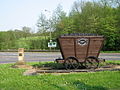
 Silkstone Waggonway - geograph.org.uk - 1301712.jpg 640 × 480; 87 kB
-
 Silkstone Waggonway Trail.jpg 2.592 × 1.944; 2,17 MB
-
 Silkstone Wagonway 1809 - geograph.org.uk - 570865.jpg 640 × 480; 119 kB
-
 Silverwood Scout Campsite - geograph.org.uk - 3649576.jpg 630 × 1.024; 191 kB
-
 South Yorkshire Buildings, Silkstone Common - geograph.org.uk - 5553896.jpg 1.024 × 768; 258 kB
-

-
 Steps down from the station - geograph.org.uk - 5557556.jpg 1.024 × 768; 200 kB
-
 Steps down to the Huskar pit disaster monument - geograph.org.uk - 2375121.jpg 768 × 1.024; 318 kB
-

-
 Stile near Knabbe's Hall Farm - geograph.org.uk - 3767122.jpg 3.702 × 5.182; 5,49 MB
-
 Stone bench on TPT near Silkstone Common - geograph.org.uk - 4017903.jpg 768 × 1.024; 300 kB
-
 Stonecroft Court off Knabbs Lane, Silkstone Common - geograph.org.uk - 5090873.jpg 1.600 × 1.065; 476 kB
-
 Stonecroft Court, Silkstone Common - geograph.org.uk - 3767111.jpg 5.182 × 3.702; 3,66 MB
-
 Stream swollen by melt water near Silkstone - geograph.org.uk - 4295956.jpg 1.024 × 768; 349 kB
-
 The bridge over Silkstone Beck - geograph.org.uk - 762839.jpg 480 × 640; 154 kB
-
 The Dove Valley Trail at Knabbs Lane - geograph.org.uk - 3237087.jpg 2.048 × 1.536; 663 kB
-
 The emergency run off lane on the A628 - geograph.org.uk - 2531010.jpg 800 × 600; 213 kB
-
 The Huskar Memorial (1988) - geograph.org.uk - 4192212.jpg 1.024 × 568; 250 kB
-
 The Huskar Monument - detail 1 - geograph.org.uk - 2003508.jpg 2.848 × 2.144; 1,53 MB
-
 The Huskar Monument - detail 2 - geograph.org.uk - 2003516.jpg 2.848 × 2.144; 1,5 MB
-
 The Huskar Monument in Nabs Wood - geograph.org.uk - 2003493.jpg 2.848 × 2.144; 1,51 MB
-
 The Huskar Pit Disaster - geograph.org.uk - 388869.jpg 640 × 475; 90 kB
-
 The last bus stop in Silkstone - geograph.org.uk - 1103898.jpg 640 × 480; 88 kB
-

-
 The Old Mill, pot house hamlet, silkstone.JPG 448 × 336; 61 kB
-
 The Potting Shed Resturant cafe, pot house hamlet.JPG 448 × 297; 35 kB
-
 The Red Lion on Silkstone Lane - geograph.org.uk - 388868.jpg 640 × 475; 71 kB
-
 The Station Hotel, Silkstone Common - geograph.org.uk - 3521388.jpg 1.024 × 768; 253 kB
-
 The Station Hotel, Silkstone Common - geograph.org.uk - 5090606.jpg 1.600 × 1.065; 601 kB
-
 The Station Inn, Silkstone Common - geograph.org.uk - 3521389.jpg 768 × 1.024; 263 kB
-
 The Station Inn, Silkstone Common - geograph.org.uk - 4192712.jpg 640 × 469; 57 kB
-
 The Station Inn, Silkstone Common - geograph.org.uk - 5090611.jpg 1.395 × 1.600; 646 kB
-
 The Station Inn, Silkstone Common - geograph.org.uk - 5557560.jpg 1.024 × 768; 135 kB
-
 The Trans Pennine Trail - geograph.org.uk - 4192721.jpg 640 × 480; 111 kB
-
 The Trans Pennine Trail at Silkstone Common - geograph.org.uk - 4610755.jpg 4.000 × 3.000; 3,19 MB
-
 The Trans Pennine Trail at Silkstone Common - geograph.org.uk - 4610761.jpg 4.000 × 3.000; 2,69 MB
-
 The Transpennine Trail east of Silkstone Common - geograph.org.uk - 3767075.jpg 5.184 × 3.888; 6,63 MB
-
 Track to Fall Head Farm - geograph.org.uk - 2846249.jpg 1.024 × 768; 234 kB
-
 Trans Pennine Trail (TPT) near Silkstone Common - geograph.org.uk - 4017884.jpg 768 × 1.024; 293 kB
-
 Trans Pennine Trail near Silkstone Common - geograph.org.uk - 4017879.jpg 1.024 × 768; 265 kB
-
 Trans Pennine Trail near Silkstone Common - geograph.org.uk - 5553893.jpg 1.024 × 768; 299 kB
-
 Trans Pennine Trail on Knabbs Lane - geograph.org.uk - 5090876.jpg 1.600 × 1.065; 886 kB
-
 Trans Pennine Trail to Oxspring - geograph.org.uk - 2003426.jpg 2.848 × 2.144; 1,55 MB
-
 Trees on Silkstone Lane - geograph.org.uk - 762813.jpg 640 × 480; 84 kB
-
 Tunnel is closed up and over now^ - geograph.org.uk - 4017899.jpg 1.024 × 768; 333 kB
-
 Two Black Fives at Silkstone Common - geograph.org.uk - 3379070.jpg 1.024 × 736; 187 kB
-
 View from the churchyard, Silkstone - geograph.org.uk - 5553906.jpg 1.024 × 768; 166 kB
-
 View from the derelict barn on Kine Moor Lane - geograph.org.uk - 2161669.jpg 2.361 × 1.762; 1,14 MB
-
 View Towards Champany Hill - geograph.org.uk - 4357778.jpg 2.560 × 1.920; 2,98 MB
-
 Wagonway silkstone.jpg 640 × 480; 121 kB
-
 Wall Pepper (Sedum acre) - geograph.org.uk - 858263.jpg 640 × 480; 126 kB
-
 Warning Sign - geograph.org.uk - 3315162.jpg 768 × 1.024; 361 kB
-
 Welcome to Silkstone Common - geograph.org.uk - 1089088.jpg 640 × 480; 73 kB
-
 Welcome To Silverwood Scout Camp - geograph.org.uk - 519181.jpg 640 × 480; 103 kB
-
 Who needs a bridge^ - geograph.org.uk - 766568.jpg 640 × 480; 133 kB
-
 Wooded Knoll near Pye Flatts - geograph.org.uk - 2322191.jpg 3.296 × 2.472; 1,07 MB
-
 Woodland at Hollow spring. - geograph.org.uk - 4036511.jpg 640 × 494; 122 kB
-
 Woodland footpath near Silkstone - geograph.org.uk - 2572761.jpg 3.240 × 4.320; 3,46 MB
-
 Woodland footpath steps - geograph.org.uk - 4295960.jpg 1.920 × 2.560; 950 kB
-


_-_geograph.org.uk_-_520206.jpg)


,_Silkstone_Common_-_geograph.org.uk_-_4192711.jpg)


_-_geograph.org.uk_-_4192724.jpg)


_-_geograph.org.uk_-_1622351.jpg)


_-_geograph.org.uk_-_4192718.jpg)


_-_geograph.org.uk_-_4192212.jpg)


_-_geograph.org.uk_-_858263.jpg)


_near_Silkstone_Common_-_geograph.org.uk_-_4017884.jpg)