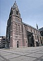
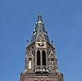
Category:Sint Petruskerk (Eindhoven)
Jump to navigation
Jump to search
| Object location | | View all coordinates using: OpenStreetMap |
|---|
church building in Eindhoven, Netherlands  | |||||
| Upload media | |||||
| Instance of | |||||
|---|---|---|---|---|---|
| Location | Eindhoven, North Brabant, Netherlands | ||||
| Street address |
| ||||
| Located on street |
| ||||
| Architect | |||||
| Heritage designation |
| ||||
| Inception |
| ||||
| Religion or worldview | |||||
 | |||||
Nederlands: Petruskerk - anno 1876
|
This is a category about rijksmonument number 14653
|
| Address |
|
Media in category "Sint Petruskerk (Eindhoven)"
The following 19 files are in this category, out of 19 total.
-
 Eindhoven, de Sint Petruskerk RM14653 IMG 8652 2019-01-20 12.54.jpg 2,550 × 3,645; 7.02 MB
-
 EntreeStPetrusKerk Rijksmonument14653.JPG 3,776 × 2,520; 4.49 MB
-
 Exterieur - Woensel - 20215823 - RCE.jpg 960 × 1,200; 153 KB
-
 Exterieur - Woensel - 20215824 - RCE.jpg 960 × 1,200; 199 KB
-
 Exterieur - Woensel - 20215825 - RCE.jpg 1,200 × 960; 443 KB
-
 Hemelrijken08.jpg 453 × 726; 101 KB
-
 Interieur - Woensel - 20215826 - RCE.jpg 960 × 1,200; 223 KB
-
 Interieur vanaf het altaar - Woensel - 20215827 - RCE.jpg 960 × 1,200; 205 KB
-
 Interieur, aanzicht orgel, orgelnummer 1805 - Eindhoven - 20417329 - RCE.jpg 767 × 1,200; 155 KB
-
 Koor petruskerk.jpg 1,200 × 801; 1.1 MB
-
 Kronehoef09.jpg 234 × 576; 32 KB
-
 Orgel petruskerk.jpg 1,200 × 801; 1.01 MB
-
 RM14653 Sint Petruskerk Eindhoven beelden aan de noordzijde van de ingang.jpg 4,000 × 6,000; 5.82 MB
-
 RM14653 Sint Petruskerk Eindhoven beelden aan de zuidzijde van de ingang.jpg 4,000 × 6,000; 5.77 MB
-
 RM14653 Sint Petruskerk Eindhoven voorzijde.jpg 6,000 × 4,000; 6.45 MB
-
 RM14653 Sint Petruskerk Eindhoven wimberg.jpg 6,000 × 4,000; 5.49 MB
-
 SintPetruskerk01.jpg 408 × 576; 66 KB
-
 SintPetruskerk02.jpg 241 × 577; 38 KB
-
 SintPetruskerk03.jpg 578 × 568; 51 KB


