<nowiki>Speichersdorf; Speichersdorf; Speichersdorf; Speichersdorf; Speichersdorf; Speichersdorf; Speichersdorf; 施派歇爾斯多爾夫; Speichersdorf; Speichersdorf; Speichersdorf; 施派歇爾斯多爾夫; Speichersdorf; Speichersdorf; Speichersdorf; Шпайхерсдорф; Speichersdorf; Speichersdorf; Speichersdorf; Speichersdorf; Speichersdorf; Speichersdorf; Speichersdorf; شپايحەرسدورف; Şpaýxersdorf; Speichersdorf; Шпајхерсдорф; Speichersdorf; Speichersdorf; Speichersdorf; Шпайхерсдорф; Speichersdorf; Speichersdorf; Speichersdorf; Speichersdorf; شبايشرسدورف; Speichersdorf; Speichersdorf; 施派歇尔斯多尔夫; Шпайхерсдорф; Speichersdorf; Speichersdorf; Speichersdorf; شپایشرسدورف; Speichersdorf; Шпайхерсдорф; Speichersdorf; Speichersdorf; Speichersdorf; Speichersdorf; Շպայհերսդորֆ; 施派歇尔斯多尔夫; Speichersdorf; Speichersdorf; シュパイヒャースドルフ; Speichersdorf; Speichersdorf; Speichersdorf; Speichersdorf; Speichersdorf; Шпайхерсдорф; Speichersdorf; Speichersdorf; Speichersdorf; Speichersdorf; Speichersdorf; Speichersdorf; Speichersdorf; Špajhersdorf; Speichersdorf; Speichersdorf; Speichersdorf; Шпајхерсдорф; Speichersdorf; Speichersdorf; Speichersdorf; Speichersdorf; Speichersdorf; Speichersdorf; Speichersdorf; Speichersdorf; Speichersdorf; Speichersdorf; Speichersdorf; Speichersdorf; Speichersdorf; Speichersdorf; Speichersdorf; Speichersdorf; Speichersdorf (munisipyo); Speichersdorf; Speichersdorf; Speichersdorf; Шпайхерсдорф; Speichersdorf; Speichersdorf; Шпайхерсдорф; Speichersdorf; Speichersdorf; Speichersdorf; Speichersdorf; chemun de la Germania; település Németországban; Gemeinde im Landkreis Bayreuth in Bayern; komunë në Gjermani; Şaredariyeke Almanyayê; kumun alaman; kommune i Bayern i Tyskland; municipio de Alemania; громада в Німеччині, федеральна земля Баварія; gemeente in Beieren; بلدية ألمانية في ولاية بافاريا; commune allemande; comune tedesco; municipality in Landkreis Bayreuth in Germany; municipality in Landkreis Bayreuth in Germany; komunumo en Bavario, Germanio; obec v zemském okresu Bayreuth v Německu; gmejna w Bayerskej; Спеичерсдорф; Shpayxersdorf; Шпайхерсдорф; Speichersdorf</nowiki>


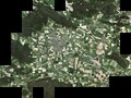 Digitales Orthofoto von Speichersdorf (Bayerische Vermessungsverwaltung).tif 30 000 × 22 500; 1,45 GB
 Marter bei Beerhof - panoramio.jpg 1 538 × 2 048; 1 MB
 Rastplatz bei Speichersdorf - panoramio.jpg 4 236 × 3 180; 2,02 MB
 Steinkreuzhütte.jpg 2 894 × 2 412; 1,26 MB
 Wegkreuz am Waldesrand - panoramio.jpg 2 048 × 1 536; 960 KB
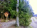 Wegkreuz bei Beerhof - panoramio.jpg 2 048 × 1 536; 858 KB
 Wegkreuz bei Kirchenlaibach - panoramio.jpg 2 048 × 1 536; 757 KB


