Category:Spokane County, Washington
Zur Navigation springen
Zur Suche springen
Counties of Washington (state): Adams · Asotin · Benton · Chelan · Clallam · Clark · Columbia · Cowlitz · Douglas · Ferry · Franklin · Garfield · Grant · Grays Harbor · Island · Jefferson · King · Kitsap · Kittitas · Klickitat · Lewis · Lincoln · Mason · Okanogan · Pacific · Pend Oreille · Pierce · San Juan · Skagit · Skamania · Snohomish · Spokane · Stevens · Thurston · Wahkiakum · Walla Walla · Whatcom · Whitman · Yakima
County im US-Bundesstaat Washington   | |||||
| Medium hochladen | |||||
| Ist ein(e) | |||||
|---|---|---|---|---|---|
| Benannt nach | |||||
| Ort | Washington, Pazifischer Nordwesten, Washington, Pacific States Region | ||||
| Hauptstadt | |||||
| Datum der Gründung, Erstellung, Entstehung, Erbauung |
| ||||
| Einwohnerzahl |
| ||||
| Fläche |
| ||||
| offizielle Website | |||||
 | |||||
Unterkategorien
Es werden 40 von insgesamt 40 Unterkategorien in dieser Kategorie angezeigt:
In Klammern die Anzahl der enthaltenen Kategorien (K), Seiten (S), Dateien (D)
B
C
D
- Daybreak Mine (19 D)
- Denison, Washington (1 D)
F
- Felts Field (10 D)
- Freeman, Washington (4 D)
G
- Glenrose, Washington (3 D)
L
- Liberty Lake, Washington (2 D)
M
- Marshall, Washington (3 D)
- Mica, Washington (3 D)
- Millwood, Washington (10 D)
N
P
R
- Rock Lake (Washington) (3 D)
S
- Spangle, Washington (1 D)
- Spokane County Jail (2 D)
- Spokane County Jane Doe (3 D)
T
V
- Valleyford, Washington (4 D)
W
- Waverly, Washington (2 D)
Medien in der Kategorie „Spokane County, Washington“
Folgende 190 Dateien sind in dieser Kategorie, von 190 insgesamt.
-
 02-06-00, bird - panoramio.jpg 2.064 × 1.400; 2,26 MB
-
 248xRP - Flickr - drewj1946.jpg 1.006 × 649; 258 KB
-
 262xRP - Flickr - drewj1946.jpg 1.006 × 668; 372 KB
-
 7 Indians hanged in September, 1858.jpg 3.024 × 4.032; 11,35 MB
-
 Abandoned McKinley School Spokane.png 3.768 × 2.583; 10,51 MB
-
 Airway Heights Municipal Building.png 4.032 × 3.024; 14,4 MB
-
 Airway Heights Welcome Tight.png 4.032 × 3.024; 19,56 MB
-
 Barker Road Bridge.png 4.032 × 3.024; 16,59 MB
-
 Birchwood farm pics 033.jpg 3.264 × 2.254; 1,09 MB
-
 Black Lunch Table Editathon at Terrain Gallery 02.jpg 3.150 × 2.446; 1,32 MB
-
 Black Lunch Table Editathon at Terrain Gallery.jpg 3.264 × 2.448; 1,1 MB
-
 BNSF Bridge Spokane.png 4.032 × 3.024; 16,73 MB
-
 Buckeye Estates.png 4.032 × 3.024; 22,86 MB
-
 Buckeye Little Spokane.png 4.032 × 3.024; 24,03 MB
-
 Cannon Hill Pond.png 4.032 × 1.825; 12,77 MB
-
 Carlson Hill.png 757 × 234; 330 KB
-
 Chattaroy Post Office.png 4.032 × 2.335; 9,21 MB
-
 Chattaroy View.png 4.032 × 1.946; 6,73 MB
-
 Cliff Park Stairs.png 3.024 × 4.032; 22,62 MB
-
 CliffCannon Cliff Pano.png 9.683 × 2.388; 49,47 MB
-
 Cmglee Spokane Valley night aerial original.jpg 3.264 × 4.928; 4,52 MB
-
 CommelliniEstateNorthFace.jpg 4.592 × 3.056; 7,41 MB
-
 CommelliniEstateSouthFace.jpg 4.592 × 3.056; 6,91 MB
-
 Comstock Park Pool.png 4.032 × 3.024; 21,5 MB
-
 ComstockEntrance.png 4.032 × 3.024; 15,58 MB
-

-

-

-
 Deep Creek Canyon.tif 4.516 × 5.683; 73,44 MB
-
 Dishman Hills.jpg 648 × 486; 129 KB
-
 Dwight Merkel Sports Complex.png 4.032 × 3.024; 17,3 MB
-
 Elk Post Office.png 4.032 × 3.024; 14,25 MB
-
 Elk Welcome.png 4.032 × 3.024; 13,47 MB
-
 Esh report 1887.jpg 524 × 800; 121 KB
-
 Espanola Building.png 4.032 × 3.024; 13,54 MB
-
 Espanola Rail.png 3.931 × 3.024; 11,03 MB
-
 Flag of Spokane County, Washington.svg 1.612 × 904; 16 KB
-

-

-
 Four Lakes Monument.png 3.024 × 4.032; 15,29 MB
-
 Four Lakes PO.png 4.032 × 3.024; 16,23 MB
-
 Franklin Elementary Spokane.png 4.032 × 3.024; 21,72 MB
-
 Geiger Heights Homes.png 4.032 × 3.024; 18,93 MB
-
 Geiger Heights MS.png 4.032 × 3.024; 13,51 MB
-
 Geiger Heights View.png 4.032 × 3.024; 15,82 MB
-
 Grandview Thorpe Road.png 4.032 × 3.024; 17,39 MB
-

-
 Greene Street Bridge.png 4.032 × 3.024; 19,27 MB
-

-
 Harvesting wheat, Spokane County, Washington, nd (WASTATE 292).jpeg 768 × 468; 71 KB
-
 Hays Park.png 4.032 × 3.024; 30,12 MB
-
 High Bridge Spokane.png 4.032 × 3.024; 14,38 MB
-
 Hitch a free ride 110328-F-XR500-021.jpg 2.100 × 1.500; 1,81 MB
-
 Holiday Hills.png 2.913 × 225; 1,2 MB
-

-
 Hub Cap Corner, Dishman, Washington LCCN2017707571.tif 5.256 × 3.590; 108,01 MB
-
 Indian Trail Park Spokane.png 4.032 × 3.024; 21,5 MB
-
 Jack and Dan's Close.png 4.032 × 3.024; 14,5 MB
-
 Jack and Dan's Wide.png 4.032 × 2.069; 9,99 MB
-
 Jesse B Dawg Washington.jpg 4.928 × 3.264; 9,02 MB
-
 Jesse B Dawg Washington.pdf 3.079 × 2.039; 22,63 MB
-
 KalispelGolf&CountryClub.jpg 4.592 × 3.056; 7,69 MB
-
 Kendall Yards and old West Central.png 4.031 × 1.866; 9 MB
-
 Kendall Yards Homes.png 4.032 × 3.024; 19,08 MB
-
 Knapweed Ranch - panoramio.jpg 2.048 × 1.536; 819 KB
-
 Krell Hill.jpg 3.264 × 2.448; 1,6 MB
-
 Lake Saltese.jpg 3.263 × 1.537; 813 KB
-
 Latah Valley Eagle Ridge.png 4.030 × 1.869; 10,22 MB
-
 Late-Night Banking (291249528).jpg 800 × 631; 233 KB
-
 Liberty Lake (Washington; 2022-2023 Winter).jpg 8.064 × 6.048; 46,09 MB
-
 Liberty Lake Welcome Sign.png 4.032 × 1.743; 7,37 MB
-
 LibertyLakefromLibertyLakeLoop.jpg 4.592 × 3.056; 6,78 MB
-
 Lincoln Heights Retirement Community.png 4.032 × 2.439; 11,85 MB
-
 LittleSpokaneRiver&DartfordDrive.jpg 4.592 × 3.056; 6,75 MB
-
 Looking SW From Krell Hill, September 2012.jpg 960 × 720; 164 KB
-
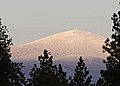
 Looking toward Mt. Spokane.jpg 3.810 × 2.286; 1,66 MB
-
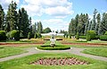
 Manito, Spokane, WA, USA - panoramio (10).jpg 4.922 × 3.254; 5,47 MB
-
 Manito, Spokane, WA, USA - panoramio (11).jpg 4.824 × 3.098; 6,79 MB
-
 Manito, Spokane, WA, USA - panoramio (12).jpg 4.926 × 3.262; 6,03 MB
-
 Manito, Spokane, WA, USA - panoramio (13).jpg 4.926 × 3.260; 4,9 MB
-
 Manito, Spokane, WA, USA - panoramio (14).jpg 4.814 × 3.084; 7,61 MB
-
 Manito, Spokane, WA, USA - panoramio (16).jpg 4.928 × 3.264; 5,86 MB
-
 Manito, Spokane, WA, USA - panoramio (17).jpg 4.926 × 3.262; 5,32 MB
-
 Manito, Spokane, WA, USA - panoramio (18).jpg 4.920 × 3.252; 7,63 MB
-
 Manito, Spokane, WA, USA - panoramio (19).jpg 4.840 × 3.126; 4,87 MB
-
 Manito, Spokane, WA, USA - panoramio (20).jpg 4.928 × 3.264; 5,58 MB
-
 Manito, Spokane, WA, USA - panoramio (21).jpg 4.894 × 3.214; 6,31 MB
-
 Manito, Spokane, WA, USA - panoramio (22).jpg 4.816 × 3.086; 5,17 MB
-
 Manito, Spokane, WA, USA - panoramio (23).jpg 4.760 × 2.988; 5,68 MB
-
 Manito, Spokane, WA, USA - panoramio (24).jpg 4.920 × 3.250; 6,42 MB
-
 Manito, Spokane, WA, USA - panoramio (25).jpg 4.928 × 3.264; 6,06 MB
-
 Manito, Spokane, WA, USA - panoramio (26).jpg 4.890 × 3.204; 7,92 MB
-
 Manito, Spokane, WA, USA - panoramio (27).jpg 4.878 × 3.186; 6,32 MB
-
 Manito, Spokane, WA, USA - panoramio (28).jpg 4.778 × 3.022; 5,28 MB
-
 Manito, Spokane, WA, USA - panoramio (29).jpg 4.820 × 3.094; 6,39 MB
-
 Manito, Spokane, WA, USA - panoramio (30).jpg 4.862 × 3.160; 4,64 MB
-
 Manito, Spokane, WA, USA - panoramio (31).jpg 3.264 × 4.928; 4,17 MB
-
 Manito, Spokane, WA, USA - panoramio (32).jpg 4.862 × 3.162; 4,47 MB
-
 Manito, Spokane, WA, USA - panoramio (33).jpg 3.264 × 4.928; 4,87 MB
-
 Manito, Spokane, WA, USA - panoramio (34).jpg 4.928 × 3.264; 5,51 MB
-
 Manito, Spokane, WA, USA - panoramio (35).jpg 4.920 × 3.252; 6,14 MB
-
 Manito, Spokane, WA, USA - panoramio (36).jpg 4.836 × 3.118; 7,47 MB
-
 Manito, Spokane, WA, USA - panoramio (37).jpg 4.836 × 3.120; 5,21 MB
-
 Manito, Spokane, WA, USA - panoramio (38).jpg 4.922 × 3.256; 8,44 MB
-
 Manito, Spokane, WA, USA - panoramio (39).jpg 4.796 × 3.052; 6,79 MB
-
 Manito, Spokane, WA, USA - panoramio (6).jpg 3.264 × 4.928; 4 MB
-
 Manito, Spokane, WA, USA - panoramio (9).jpg 4.928 × 3.264; 6,34 MB
-
 MasonicTempleDedication.PNG 234 × 156; 74 KB
-
 MeadHighSchoolSpokane.jpg 4.592 × 3.056; 4,31 MB
-

-
 Mica Peaks from Eagle Peak.jpg 4.342 × 1.526; 2,17 MB
-
 MidwayElementaryColbert.jpg 4.592 × 3.056; 4,13 MB
-
 Millwood Commercial.jpg 4.032 × 3.024; 7,85 MB
-
 Millwood Homes & Mill.jpg 4.032 × 2.428; 12,39 MB
-
 Mt Spokane antennas 20060528.jpg 1.855 × 1.122; 416 KB
-
 Mt Spokane chairlift 20060528.jpg 2.058 × 1.028; 372 KB
-
 Mt Spokane peak 20070106.jpg 1.564 × 930; 255 KB
-
 Mt Spokane peak closeup 20070106.jpg 785 × 561; 127 KB
-
 Mt Spokane ridgeline 20070106.jpg 3.008 × 427; 199 KB
-
 Mullan Military Road Monument Spokane WA 20230921.jpg 2.407 × 3.486; 3,25 MB
-
 NE Newman Lake Drive.jpg 4.032 × 3.024; 4,98 MB
-
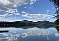 Newman Lake, WA.jpg 3.659 × 2.526; 1,72 MB
-
 North Indian Trail New Homes.png 4.032 × 2.074; 10,54 MB
-
 North Spokane Corridor at Wandermere.jpg 8.064 × 6.048; 10,27 MB
-
 Northwest Mountains Mount Spokane Summer No. 5.tif 5.766 × 4.616; 76,16 MB
-
 Outdoor fish hatchery near Spokane, Washington, 1925 (COBB 361).jpeg 382 × 512; 57 KB
-
 Packsaddle Mountain from Mount Spokane.jpg 3.264 × 2.448; 1,21 MB
-
 Palouse barn and stubble fields.jpg 1.024 × 768; 768 KB
-
 Plante's Ferry Footbridge.png 4.032 × 3.024; 16,08 MB
-
 Public Lands near Spokane, Washington (14000369108).jpg 3.264 × 2.448; 2,85 MB
-
 Public Lands near Spokane, Washington (14183725191).jpg 2.592 × 4.608; 2,66 MB
-
 Public Lands near Spokane, Washington (14207153283).jpg 4.608 × 3.456; 3,35 MB
-
 RidgelineHighSchoolLibertyLake.jpg 4.592 × 3.056; 5,13 MB
-
 Rockwood in Spring.png 4.032 × 3.024; 24,86 MB
-
 Saltese Flats (Facing South; 2023-02-11).jpg 8.064 × 6.048; 42,31 MB
-
 South Indian Trail Homes.png 4.032 × 3.024; 18,43 MB
-
 Southeast Sports Complex Spokane.png 4.032 × 2.435; 12,36 MB
-
 Spo Co Courthouse 1.png 3.024 × 4.032; 19,64 MB
-
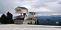
 Spokane Valley City Hall.jpg 3.262 × 1.705; 2,54 MB
-
 Spokane West Central 1900.tif 2.732 × 2.156; 5,63 MB
-
 Spokane, WA, USA - panoramio (1).jpg 1.200 × 1.600; 565 KB
-
 Spokane, WA, USA - panoramio (10).jpg 1.200 × 1.600; 665 KB
-
 Spokane, WA, USA - panoramio (11).jpg 1.200 × 1.600; 683 KB
-
 Spokane, WA, USA - panoramio (12).jpg 1.200 × 1.600; 611 KB
-
 Spokane, WA, USA - panoramio (13).jpg 1.200 × 1.600; 746 KB
-
 Spokane, WA, USA - panoramio (14).jpg 1.200 × 1.600; 647 KB
-
 Spokane, WA, USA - panoramio (15).jpg 1.200 × 1.600; 607 KB
-
 Spokane, WA, USA - panoramio (16).jpg 1.200 × 1.600; 722 KB
-
 Spokane, WA, USA - panoramio (17).jpg 1.200 × 1.600; 726 KB
-
 Spokane, WA, USA - panoramio (18).jpg 1.200 × 1.600; 553 KB
-
 Spokane, WA, USA - panoramio (19).jpg 1.200 × 1.600; 842 KB
-
 Spokane, WA, USA - panoramio (2).jpg 1.200 × 1.600; 511 KB
-
 Spokane, WA, USA - panoramio (20).jpg 1.200 × 1.600; 637 KB
-
 Spokane, WA, USA - panoramio (21).jpg 1.200 × 1.600; 674 KB
-
 Spokane, WA, USA - panoramio (22).jpg 1.200 × 1.600; 753 KB
-
 Spokane, WA, USA - panoramio (23).jpg 1.200 × 1.600; 623 KB
-
 Spokane, WA, USA - panoramio (24).jpg 1.200 × 1.600; 668 KB
-
 Spokane, WA, USA - panoramio (25).jpg 1.200 × 1.600; 674 KB
-
 Spokane, WA, USA - panoramio (26).jpg 1.200 × 1.600; 708 KB
-
 Spokane, WA, USA - panoramio (27).jpg 1.200 × 1.600; 671 KB
-
 Spokane, WA, USA - panoramio (28).jpg 1.200 × 1.600; 716 KB
-
 Spokane, WA, USA - panoramio (29).jpg 1.200 × 1.600; 529 KB
-
 Spokane, WA, USA - panoramio (3).jpg 1.200 × 1.600; 674 KB
-
 Spokane, WA, USA - panoramio (30).jpg 1.200 × 1.600; 799 KB
-
 Spokane, WA, USA - panoramio (31).jpg 1.200 × 1.600; 751 KB
-
 Spokane, WA, USA - panoramio (32).jpg 1.200 × 1.600; 616 KB
-
 Spokane, WA, USA - panoramio (33).jpg 1.200 × 1.600; 529 KB
-
 Spokane, WA, USA - panoramio (34).jpg 1.200 × 1.600; 580 KB
-
 Spokane, WA, USA - panoramio (4).jpg 1.200 × 1.600; 626 KB
-
 Spokane, WA, USA - panoramio (5).jpg 1.200 × 1.600; 658 KB
-
 Spokane, WA, USA - panoramio (6).jpg 1.200 × 1.600; 852 KB
-
 Spokane, WA, USA - panoramio (7).jpg 1.200 × 1.600; 744 KB
-
 Spokane, WA, USA - panoramio (8).jpg 1.200 × 1.600; 784 KB
-
 Spokane, WA, USA - panoramio (9).jpg 1.200 × 1.600; 583 KB
-
 Spokane, WA, USA - panoramio.jpg 1.200 × 1.600; 547 KB
-
 Sprague Ave International District E-bound.png 4.032 × 3.024; 14,18 MB
-
 Sprague Ave International District W-Bound.png 4.032 × 3.024; 13,12 MB
-

-

-
 Starr Road heading toward Newman Lake.jpg 2.278 × 1.486; 981 KB
-
 Sullivan Road Bridge.png 4.032 × 3.024; 19,51 MB
-
 The Gathering Place Monument.png 4.032 × 3.024; 25,5 MB
-
 Trent Avenue Bridge.png 4.032 × 3.024; 18,3 MB
-
 Tyler Store.jpg 3.264 × 2.448; 1,65 MB
-
 USA Spokane County, Washington age pyramid.svg 520 × 600; 8 KB
-
 USFWS Thank You to Our Cooperators (16788770694).jpg 3.264 × 1.836; 1,92 MB
-
 VCSpanthers sm.jpg 175 × 144; 42 KB
-
 WaikikiFarmManagersHouse.jpg 4.592 × 3.056; 6,76 MB
-
 Whitworth Entrance.png 4.032 × 3.024; 23,96 MB
-
 Woodridge Elementary Spokane.png 4.032 × 2.393; 15,38 MB


.jpeg)
.jpeg)
.jpeg)


.jpeg)
.jpeg)


.jpeg)

.jpeg)
.jpeg)


.jpeg)


.jpg)
.jpg)


.jpg)
.jpg)
.jpg)
.jpg)
.jpg)
.jpg)
.jpg)
.jpg)
.jpg)
.jpg)
.jpg)
.jpg)
.jpg)
.jpg)
.jpg)
.jpg)
.jpg)
.jpg)
.jpg)
.jpg)
.jpg)
.jpg)
.jpg)
.jpg)
.jpg)
.jpg)
.jpg)
.jpg)
.jpg)
.jpg)
.jpg)


.jpeg)


.jpeg)


.jpg)
.jpg)
.jpg)


.jpg)


.jpg)
.jpg)
.jpg)
.jpg)
.jpg)
.jpg)
.jpg)
.jpg)
.jpg)
.jpg)
.jpg)
.jpg)
.jpg)
.jpg)
.jpg)
.jpg)
.jpg)
.jpg)
.jpg)
.jpg)
.jpg)
.jpg)
.jpg)
.jpg)
.jpg)
.jpg)
.jpg)
.jpg)
.jpg)
.jpg)
.jpg)
.jpg)
.jpg)
.jpg)


.jpg)


