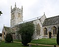
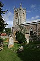
Category:St John the Baptist's church, Bere Regis
Jump to navigation
Jump to search
| Object location | | View all coordinates using: OpenStreetMap |
|---|
church in Bere Regis, Dorset, England, UK  | |||||
| Upload media | |||||
| Instance of | |||||
|---|---|---|---|---|---|
| Dedicated to | |||||
| Location | Bere Regis, Dorset, South West England, England | ||||
| Diocese | |||||
| Heritage designation |
| ||||
| Inception |
| ||||
| Religion or worldview | |||||
 | |||||
Subcategories
This category has the following 3 subcategories, out of 3 total.
Media in category "St John the Baptist's church, Bere Regis"
The following 18 files are in this category, out of 18 total.
-
 Bere Regis - geograph.org.uk - 1595339.jpg 640 × 480; 78 KB
-

-
 Bere Regis, St John The Baptist - geograph.org.uk - 224175.jpg 431 × 285; 37 KB
-

-
 Bere Regis, The Church of St. John the Baptist - geograph.org.uk - 4921049.jpg 3,678 × 2,456; 4.55 MB
-
 Bere Regis-02-St Johannes der Taeufer-2004-gje.jpg 2,400 × 1,924; 1.18 MB
-
 Bere Regis-04-St Johannes der Taeufer-2004-gje.jpg 2,048 × 3,072; 1.57 MB
-
 Bere Regis-06-St Johannes der Taeufer-2004-gje.jpg 2,656 × 1,984; 1.28 MB
-
 BereRegis12.JPG 450 × 338; 44 KB
-
 BereRegis15.jpg 422 × 301; 25 KB
-
 BereRegis17.JPG 540 × 389; 60 KB
-

-

-

-
 St.John the Baptist, Bere Regis - geograph.org.uk - 5044332.jpg 3,264 × 2,448; 3.61 MB
-
 The church of St John the Baptist at Bere Regis - geograph.org.uk - 3919003.jpg 4,000 × 3,000; 2.96 MB
-
 The church of St. John the Baptist, Bere Regis - geograph.org.uk - 4176705.jpg 1,024 × 768; 161 KB
-


_-_geograph.org.uk_-_3153478.jpg)
_-_geograph.org.uk_-_3153484.jpg)


