Category:Staffordshire
Naar navigatie springen
Naar zoeken springen

ceremonial county in England     | |||||
| Media uploaden | |||||
| Is een | |||||
|---|---|---|---|---|---|
| Onderdeel van | |||||
| Locatie |
| ||||
| Hoofdplaats | |||||
| Inwonertal |
| ||||
| Oppervlakte |
| ||||
| Niet gelijk aan | |||||
| Naar verluidt hetzelfde als | Staffordshire (traditioneel graafschap van Engeland, ceremoniële graafschappen van Engeland, 1844) | ||||
| officiële website | |||||
 | |||||


Ondercategorieën
Deze categorie bevat de volgende 60 subcategorieën, van de 60 in totaal.
!
*
A
B
C
- Campsites in Staffordshire (2 B)
D
E
F
G
- Graffiti in Staffordshire (2 B)
H
I
J
L
M
N
P
- Alice Hobbins Porter (2 B)
Q
- Quality images of Staffordshire (102 B)
S
- Gilbert Sheldon (5 B)
- Stableford, Staffordshire (9 B)
T
V
Media in categorie "Staffordshire"
Deze categorie bevat de volgende 200 bestanden, van in totaal 693.
(vorige pagina) (volgende pagina)-
 10 Millennium Planet Walk sculptures in the castle grounds Tamworth by Walenty Pytel.jpg 1.621 × 1.151; 251 kB
-
 11 peak district Edgetop and Dove Valley (1468577960).jpg 3.008 × 1.497; 3,4 MB
-
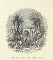 Roscoe L&BR(1839) p192 - Viaduct over the River Sow.jpg 891 × 1.002; 290 kB
-
 20210324 Gun hill in Staffordshire.jpg 1.301 × 867; 283 kB
-
 20210324 Gun hill summit.jpg 1.210 × 681; 342 kB
-
 A field full of Potatoes - geograph.org.uk - 385717.jpg 281 × 640; 61 kB
-

-
 A path leading to Leyland Road - geograph.org.uk - 1929818.jpg 2.048 × 3.072; 3,34 MB
-
 A path located along Marlborough Way (1) - geograph.org.uk - 1930125.jpg 3.072 × 2.048; 2,75 MB
-
 A Path located along Pennine Way (1) - geograph.org.uk - 1957440.jpg 3.072 × 2.048; 3,31 MB
-
 A Path located along the Marlborough Way (3) - geograph.org.uk - 2022562.jpg 3.072 × 2.048; 3,47 MB
-
 A Pathway located along the B5000 - geograph.org.uk - 2019227.jpg 3.072 × 2.048; 2,36 MB
-
 A View from Pennine Way (2) - geograph.org.uk - 1957422.jpg 3.072 × 2.048; 2,36 MB
-
 A view of the B5000 (22) - geograph.org.uk - 1986017.jpg 3.072 × 2.048; 3,39 MB
-
 A view of the B5000 (23) - geograph.org.uk - 1986031.jpg 3.072 × 2.048; 2,8 MB
-
 A View of the B5000 (24) - geograph.org.uk - 2003797.jpg 3.072 × 2.048; 2,44 MB
-
 A view of the B5000 (25) - geograph.org.uk - 2019396.jpg 3.072 × 2.048; 2,2 MB
-
 Abandoned farm building - geograph.org.uk - 1631184.jpg 480 × 640; 115 kB
-
 About to turn right at Gailey Island - geograph.org.uk - 857169.jpg 640 × 480; 60 kB
-
 Advertising (498413111).jpg 640 × 480; 95 kB
-
 AEthelred penny fragment.jpg 816 × 656; 103 kB
-
 Alvecote Meadows - geograph.org.uk - 3851257.jpg 640 × 430; 41 kB
-
 Amington, Bridge No 63 - geograph.org.uk - 5001111.jpg 1.024 × 768; 193 kB
-
 Amington, Bridge No 64 - geograph.org.uk - 5001131.jpg 1.024 × 768; 205 kB
-
 April snow in Bunkers Hill Wood - geograph.org.uk - 1628023.jpg 640 × 427; 130 kB
-
 Arable farmland, east of Amington Hall - geograph.org.uk - 5324379.jpg 1.024 × 768; 155 kB
-

-
 Ashby Road (B5493) - geograph.org.uk - 4489089.jpg 640 × 480; 39 kB
-
 Ashlands Farm - geograph.org.uk - 5324637.jpg 1.024 × 768; 238 kB
-
 Ashwood Marina looking north - geograph.org.uk - 1672288.jpg 800 × 592; 141 kB
-
 B5016 Near Yoxall - geograph.org.uk - 969681.jpg 640 × 480; 109 kB
-
 B5440 Junction overbridges - geograph.org.uk - 3855494.jpg 4.122 × 2.354; 3,83 MB
-
 B5493 near Statfold Barn Farm - geograph.org.uk - 1770025.jpg 640 × 480; 90 kB
-
 Bagot Street - Abbots Bromley (geograph 4030307).jpg 4.608 × 2.636; 5,49 MB
-
 Barn at Oakley Farm - geograph.org.uk - 1626391.jpg 640 × 430; 248 kB
-
 Barn, Ashlands Farm - geograph.org.uk - 4489022.jpg 640 × 460; 76 kB
-
 Beech Trees - geograph.org.uk - 456293.jpg 640 × 480; 171 kB
-

-

-
 Boat weighing dock - geograph.org.uk - 1583065.jpg 415 × 640; 85 kB
-
 Boats going nowhere - geograph.org.uk - 1672308.jpg 800 × 600; 115 kB
-
 Bobbington Church Path - geograph.org.uk - 1021741.jpg 640 × 480; 99 kB
-
 Boggy pool - geograph.org.uk - 1614063.jpg 640 × 360; 111 kB
-
 Bosley Cloud facing Staffordshire.jpg 1.024 × 771; 362 kB
-
 Bourne Brook At Hints - geograph.org.uk - 981946.jpg 640 × 480; 127 kB
-
 Bowl and saucer (AM 1952.95.2-1).jpg 1.589 × 2.404; 2 MB
-
 Bridgnorth Road - geograph.org.uk - 1245744.jpg 480 × 640; 77 kB
-
 Bridgnorth Road Sign - geograph.org.uk - 1245745.jpg 640 × 480; 77 kB
-
 Broomhall Lodge - geograph.org.uk - 787403.jpg 640 × 480; 221 kB
-
 Byway to the east of Perton - geograph.org.uk - 1759319.jpg 640 × 480; 180 kB
-

-
 Cafe India - geograph.org.uk - 359154.jpg 640 × 480; 91 kB
-
 Canal users' water point - geograph.org.uk - 1635041.jpg 460 × 640; 122 kB
-
 Cannock Chase Sherbrook Valley (37096640) (cropped).jpg 1.346 × 585; 419 kB
-
 Capped mineshaft - geograph.org.uk - 799717.jpg 640 × 480; 119 kB
-
 Car park, Two Gates - geograph.org.uk - 3407402.jpg 640 × 535; 87 kB
-

-
 Cattle grid and footpath gate, at Ling Cottage - geograph.org.uk - 5324606.jpg 1.024 × 768; 134 kB
-
-
 Chasewater February 2012.jpg 4.846 × 2.733; 3,5 MB
-
 Chemical works - geograph.org.uk - 793396.jpg 640 × 480; 74 kB
-
 Chewing the cud - geograph.org.uk - 943625.jpg 640 × 480; 111 kB
-
 Christmas trees for sale at Oakley Farm - geograph.org.uk - 1626399.jpg 640 × 480; 305 kB
-
 Church Avenue - geograph.org.uk - 1147401.jpg 640 × 405; 94 kB
-
 Church Avenue - geograph.org.uk - 1147421.jpg 640 × 395; 73 kB
-
 Church Lane junction on the A51 - geograph.org.uk - 1441738.jpg 640 × 426; 300 kB
-
 Clanway Sports Stadium (long gone) - geograph.org.uk - 196163.jpg 640 × 480; 31 kB
-
 Coal Brook downstream of Peatswood Lodge - geograph.org.uk - 787393.jpg 640 × 480; 382 kB
-
 Coal Brook upstream of Peatswood Lodge - geograph.org.uk - 787387.jpg 640 × 480; 303 kB
-
 Cockle Lucas Johnson.jpg 1.403 × 2.000; 1,37 MB
-
 Comberford Road, Tamworth (A513) - geograph.org.uk - 5335601.jpg 640 × 431; 95 kB
-
 Commerce Works, Commerce Street - geograph.org.uk - 1455709.jpg 640 × 427; 67 kB
-

-
 Copper Beech - geograph.org.uk - 1378509.jpg 640 × 480; 105 kB
-

-
 Coton Lane - geograph.org.uk - 3197949.jpg 640 × 480; 55 kB
-
 County boundary - geograph.org.uk - 810777.jpg 640 × 480; 93 kB
-
 Coventry Canal bridge No 63 - geograph.org.uk - 5049262.jpg 640 × 427; 96 kB
-
 Coventry Canal, Bridge Number 63 - geograph.org.uk - 3141243.jpg 640 × 480; 83 kB
-
 Cow Lane - geograph.org.uk - 1044166.jpg 640 × 480; 109 kB
-
 Cowley Hill Farm from Cowley Hill - geograph.org.uk - 1157817.jpg 640 × 480; 294 kB
-
 CPE Pressure - geograph.org.uk - 4756897.jpg 640 × 426; 44 kB
-
 CPE Pressure Vessels Ltd - geograph.org.uk - 5704331.jpg 640 × 426; 36 kB
-
 Cranmoor lodge - geograph.org.uk - 1618644.jpg 640 × 480; 75 kB
-
 Croft Farm, Croft Lane, Gailey - geograph.org.uk - 884719.jpg 640 × 480; 98 kB
-
 Crossing over the A5 - geograph.org.uk - 6206062.jpg 2.000 × 1.330; 1,22 MB
-
 Crossing Sneyd's Brook - geograph.org.uk - 1510145.jpg 480 × 640; 96 kB
-
 Croxall Lakes 03.JPG 3.648 × 2.736; 678 kB
-
 Cutting on the West Coast Main Line - geograph.org.uk - 3657864.jpg 640 × 430; 66 kB
-

-
 DarwinToBoulton.jpg 500 × 349; 26 kB
-
 Dead-end lane off the A51 - geograph.org.uk - 1441735.jpg 640 × 426; 354 kB
-
 Dimmingsdale Pumping Station - geograph.org.uk - 1061852.jpg 640 × 418; 72 kB
-
 Discarded Sandal by Roadside.jpg 3.648 × 2.736; 1,92 MB
-
 Diverted footpath, east of Amington Hall Farm - geograph.org.uk - 5324544.jpg 1.024 × 768; 241 kB
-
-
 Domesday Book Staffordshire.djvu 3.328 × 4.491, 10 pagina's; 1,32 MB
-
-
 Drayton Manor.jpg 8.779 × 5.094; 10,9 MB
-

-
 Dumolo's Lane (1) - geograph.org.uk - 1931454.jpg 3.072 × 2.048; 3,42 MB
-
 Dumolo's Lane (2) - geograph.org.uk - 1931470.jpg 3.072 × 2.048; 3,72 MB
-
 Dunstall Farm along Dunstall Lane - geograph.org.uk - 4697313.jpg 800 × 552; 117 kB
-
 East Cannock Road - geograph.org.uk - 799006.jpg 640 × 480; 63 kB
-
 Elderwell.jpg 3.484 × 2.356; 6,47 MB
-
 Electricity Sub-station - geograph.org.uk - 1527063.jpg 640 × 427; 73 kB
-
 Elizabeth II postbox on Comberford Road, Tamworth - geograph.org.uk - 5334723.jpg 2.136 × 2.848; 1,3 MB
-
 Elmore Park - Rugeley (34409487542).jpg 4.608 × 3.456; 6,35 MB
-
 Elmore Park - Rugeley (34571298575).jpg 4.608 × 3.456; 6,2 MB
-
 Elmore Park - Rugeley - Hall Pool and bluebells (34441001031).jpg 4.608 × 3.456; 5,81 MB
-
 Empty car park, off the A38 - geograph.org.uk - 1601856.jpg 640 × 480; 46 kB
-
En-rocester.ogg 2,0 s; 24 kB
-
 Entering Tamworth - geograph.org.uk - 5335600.jpg 640 × 480; 63 kB
-
 Entering Warwickshire - geograph.org.uk - 3850173.jpg 640 × 480; 90 kB
-
 Entrance gates to Windmill Farm - geograph.org.uk - 3197945.jpg 640 × 410; 57 kB
-
 Entrance to Hopwas Hays wood - geograph.org.uk - 834320.jpg 640 × 480; 156 kB
-
 Entrance to Lud's Church - geograph.org.uk - 1072776.jpg 480 × 640; 135 kB
-
 Entrance to Riftswood pub from Comberford Road - geograph.org.uk - 6535906.jpg 1.024 × 683; 217 kB
-
 Entrance to Trubshaw's Tunnel - geograph.org.uk - 416088.jpg 640 × 480; 136 kB
-
 Enville Road - geograph.org.uk - 882442.jpg 640 × 480; 72 kB
-
 Erie steam excavator at Statfold Barn - geograph.org.uk - 5837979.jpg 1.280 × 853; 337 kB
-
 Ex Reef. (25363913063).jpg 6.032 × 3.964; 23,9 MB
-
 Exit from Greenway Bank - geograph.org.uk - 1722241.jpg 2.048 × 1.536; 855 kB
-
 Factory off Sandy Way - geograph.org.uk - 3850166.jpg 640 × 480; 74 kB
-
 Farm track - geograph.org.uk - 803592.jpg 640 × 480; 115 kB
-
 Farmland - geograph.org.uk - 793435.jpg 640 × 480; 116 kB
-
 Farmland drained by the River Anker - geograph.org.uk - 5324618.jpg 1.024 × 768; 330 kB
-
 Farmland near Ashley - geograph.org.uk - 1209712.jpg 640 × 457; 132 kB
-
 Farmland on the banks of the River Anker - geograph.org.uk - 5324583.jpg 1.024 × 768; 154 kB
-
 Farmland, Whateley - geograph.org.uk - 3168657.jpg 640 × 480; 37 kB
-
 Fauld Hall From Stonepit Hills - geograph.org.uk - 1613970.jpg 640 × 480; 67 kB
-
 Fence and trees - geograph.org.uk - 1631178.jpg 640 × 480; 114 kB
-
 Fence around young tree - geograph.org.uk - 881549.jpg 640 × 480; 140 kB
-
 Field barn near Overdale - geograph.org.uk - 881558.jpg 640 × 480; 102 kB
-
 Fields near Compton, Staffordshire - geograph.org.uk - 398795.jpg 640 × 426; 136 kB
-
 Fish farm - geograph.org.uk - 788691.jpg 640 × 480; 351 kB
-
 Fishing pond reflections 1 - geograph.org.uk - 1024455.jpg 640 × 378; 60 kB
-
 Fishing pond reflections 2 - geograph.org.uk - 1024461.jpg 640 × 421; 58 kB
-

-
 Flood defences- upstream side - geograph.org.uk - 1632745.jpg 640 × 480; 132 kB
-

-
 Football pitches, edge of Tamworth - geograph.org.uk - 3657659.jpg 640 × 273; 31 kB
-
 Footbridge across the A5189, Stapenhill (geograph 4543583).jpg 1.024 × 747; 201 kB
-
 Footpath junction, north bank of the River Anker - geograph.org.uk - 5324550.jpg 1.024 × 768; 156 kB
-

-
 Footpath to Almington - geograph.org.uk - 788698.jpg 640 × 480; 239 kB
-

-
 Former Railway, Stafford - geograph.org.uk - 897617.jpg 640 × 457; 154 kB
-
 Freehold Wood - geograph.org.uk - 1610064.jpg 640 × 480; 96 kB
-
 From darkness into light - geograph.org.uk - 1378523.jpg 640 × 480; 108 kB
-
 From the Nursery Lane bridge - geograph.org.uk - 1373410.jpg 640 × 425; 206 kB
-
 From the rock outcrop, Mow Cop - geograph.org.uk - 847745.jpg 640 × 427; 96 kB
-
 Frozen water - geograph.org.uk - 1631156.jpg 480 × 640; 83 kB
-
 Gate on footpath to Cowley Hill - geograph.org.uk - 1157811.jpg 640 × 480; 350 kB
-
 Gladstone Pottery Museum - geograph.org.uk - 1458705.jpg 640 × 421; 57 kB
-
 Glascote Road (B5000) - geograph.org.uk - 3850160.jpg 640 × 480; 87 kB
-
 Glascote Road (B5000) - geograph.org.uk - 3850170.jpg 640 × 480; 74 kB
-
 Golf Bridge - geograph.org.uk - 1610097.jpg 640 × 480; 89 kB
-
 Gone Fishing - geograph.org.uk - 1338837.jpg 640 × 490; 154 kB
-

-
 Gothersley Lane Foal - geograph.org.uk - 421900.jpg 640 × 480; 164 kB
-
 Grapevines - geograph.org.uk - 265555.jpg 640 × 480; 145 kB
-

-
 Great Moor Stile - geograph.org.uk - 1610045.jpg 640 × 480; 116 kB
-
 Greensforge Mill and Smestow Brook - geograph.org.uk - 1672399.jpg 800 × 607; 213 kB
-
 Greenway Wood - geograph.org.uk - 879846.jpg 427 × 640; 143 kB
-
 Grotto Floor - geograph.org.uk - 1261845.jpg 640 × 480; 129 kB
-
 Growing area - geograph.org.uk - 795322.jpg 640 × 480; 117 kB
-
 Gun Dog Training - geograph.org.uk - 1610031.jpg 640 × 480; 96 kB
-
 Gypsy Cob stallion (6868661565).jpg 3.872 × 2.592; 6,23 MB
-
 Hazelhurst aqueduct - geograph.org.uk - 415987.jpg 479 × 640; 108 kB
-
 Hedged lane in autumn (Unsplash).jpg 5.469 × 3.646; 16,3 MB
-
 Hidden Footbridge - geograph.org.uk - 1510050.jpg 480 × 640; 112 kB
-
 Histons Hill railway bridge. - geograph.org.uk - 901275.jpg 640 × 480; 92 kB
-
-
 Hodge Lane footbridge - geograph.org.uk - 5182188.jpg 5.184 × 3.052; 7,36 MB
-
 Hopwas Hays Wood - geograph.org.uk - 834322.jpg 640 × 480; 135 kB
-
 Horse riders - geograph.org.uk - 800037.jpg 640 × 480; 117 kB
-
 House on the edge of Branston Water Park - geograph.org.uk - 1559208.jpg 640 × 480; 170 kB
-
 Houses on Comberford Road, Tamworth - geograph.org.uk - 5335603.jpg 640 × 480; 77 kB
-

-
 Houses on Tamar Road - geograph.org.uk - 3168672.jpg 640 × 380; 59 kB
-
 How are the mighty fallen ^ - geograph.org.uk - 1073649.jpg 480 × 640; 176 kB
-
 Ice crystals on a windowpane (Unsplash).jpg 4.288 × 2.848; 4,14 MB
-
 Industrial Estate, Tamworth - geograph.org.uk - 4335252.jpg 640 × 430; 42 kB
-
 Industrial Estate, The Leys - geograph.org.uk - 4369640.jpg 640 × 430; 40 kB
-
 Industrial Estate, The Leys - geograph.org.uk - 4369641.jpg 640 × 430; 37 kB
-
 Industrial Unit, The Leys - geograph.org.uk - 4756893.jpg 640 × 426; 41 kB
-
 Industrial Unit, The Leys - geograph.org.uk - 4756895.jpg 640 × 426; 43 kB
-
 Industry by the WCML - geograph.org.uk - 4369642.jpg 640 × 430; 36 kB
-
 Iron Tors - Ram Pump House - geograph.org.uk - 881567.jpg 640 × 480; 143 kB
-
 Jesse Shirley, past and present - geograph.org.uk - 1583080.jpg 640 × 427; 84 kB
-
 Jewsons, Builder Merchants (1) - geograph.org.uk - 1526948.jpg 640 × 427; 52 kB
-
 Jewsons, Builders Merchant (2) - geograph.org.uk - 1526959.jpg 640 × 427; 92 kB
-
 John Snape Lichfield Plan.jpg 2.866 × 2.087; 1,72 MB
-

-
-
 Junction of Whateley and Rushy Lanes - geograph.org.uk - 1074849.jpg 640 × 480; 164 kB
-
 Keelewardmap.gif 212 × 283; 3 kB
-
 Lake near Amington Hall Farm - geograph.org.uk - 1568522.jpg 640 × 480; 102 kB

.jpg)
_p192_-_Viaduct_over_the_River_Sow.jpg)


_-_geograph.org.uk_-_1930125.jpg)
_-_geograph.org.uk_-_1957440.jpg)
_-_geograph.org.uk_-_2022562.jpg)

_-_geograph.org.uk_-_1957422.jpg)
_-_geograph.org.uk_-_1986017.jpg)
_-_geograph.org.uk_-_1986031.jpg)
_-_geograph.org.uk_-_2003797.jpg)
_-_geograph.org.uk_-_2019396.jpg)


.jpg)


_-_geograph.org.uk_-_4489089.jpg)


.jpg)


.jpg)


_(cropped).jpg)


_-_geograph.org.uk_-_196163.jpg)


_-_geograph.org.uk_-_5335601.jpg)


_-_geograph.org.uk_-_3168688.jpg)


_-_geograph.org.uk_-_1931454.jpg)
_-_geograph.org.uk_-_1931470.jpg)


.jpg)
.jpg)
.jpg)


.jpg)


.jpg)


_-_geograph.org.uk_-_3850160.jpg)
_-_geograph.org.uk_-_3850170.jpg)


.jpg)

.jpg)


.jpg)


_-_geograph.org.uk_-_1526948.jpg)
_-_geograph.org.uk_-_1526959.jpg)

_and_Barracks_Lane_-_geograph.org.uk_-_1220263.jpg)


