Category:State Highway 8 (New Zealand)
Zur Navigation springen
Zur Suche springen
Deutsch: Der State Highway 8 (SH 8) ist ein neuseeländischer und Central Otago. Anfang und Ende des Highways bilden Anschlussstellen am State Highway 1. Die Kilometrierung verläuft von Nord nach Süd. (→New Zealand State Highway 8)
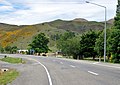
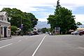
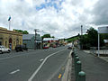
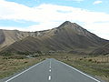
English: State Highway 8 is one of New Zealand's eight national highways. It forms an anticlockwise loop through the southern scenic regions of the Mackenzie Basin and Central Otago, starting and terminating in junctions with State Highway 1. Distances are measured from north to south. (→State Highway 8 (New Zealand))
Neuseeländische Fernstraße von nationalem Rang auf der Südinsel    | |||||
| Medium hochladen | |||||
| Ist ein(e) | |||||
|---|---|---|---|---|---|
| Ort |
| ||||
| Transportnetz |
| ||||
| Betreut durch | |||||
| Länge |
| ||||
| |||||
Unterkategorien
Es werden 6 von insgesamt 6 Unterkategorien in dieser Kategorie angezeigt:
In Klammern die Anzahl der enthaltenen Kategorien (K), Seiten (S), Dateien (D)
A
G
- Gladstone Grand Hotel (7 D)
L
M
- Mt Cook Line Building (6 D)
R
- Raes Junction (3 D)
S
- St Patrick's Union Church (9 D)
Medien in der Kategorie „State Highway 8 (New Zealand)“
Folgende 32 Dateien sind in dieser Kategorie, von 32 insgesamt.
-
 Autumn road. (20179246059).jpg 2.400 × 936; 2,87 MB
-
 Autumn road. - Flickr - Bernard Spragg.jpg 2.274 × 936; 2,81 MB
-
 Beaumont, New Zealand aerial photo 2006.jpg 1.327 × 932; 529 KB
-
 Beaumont, New Zealand bridge over the Clutha River.jpg 2.048 × 1.536; 2,71 MB
-
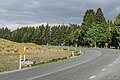
 Burkes Pass State Highway 8 001.JPG 3.520 × 2.492; 3,72 MB
-
 Burkes Pass State Highway 8 002.JPG 3.536 × 2.476; 3,69 MB
-
 Craigellachie, South Island, NZ.jpg 3.024 × 2.629; 2,32 MB
-
 Deadmans Point Bridge Lake Dunstan Cromwell.jpg 2.592 × 1.944; 2,91 MB
-
 Driving North From QTown Through Pass.jpg 1.600 × 1.200; 401 KB
-
 Ettrick, Otago, New Zealand.jpg 1.796 × 1.169; 1,42 MB
-
 Fairlie Main Street 002.JPG 3.872 × 2.592; 3,93 MB
-
 Foothills And Fields Of Southern Alps III.jpg 1.200 × 1.600; 234 KB
-
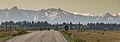
 Heading N on Hwy 8 toward Twizel (5796044220).jpg 2.121 × 1.414; 3,21 MB
-
 Heading N on Hwy 8 toward Twizel (5796044596).jpg 2.121 × 1.414; 2,76 MB
-
 Junction to Millers Flat.jpg 3.072 × 1.536; 1,8 MB
-
 Lawrence Ross Place 001.JPG 3.872 × 2.592; 3,84 MB
-
 Lawrence Ross Place 002.JPG 3.872 × 2.592; 3,87 MB
-
 Lawrence Ross Place 003.JPG 3.672 × 2.444; 3,6 MB
-
 Lawrence Ross Place 004.JPG 3.676 × 2.456; 3,42 MB
-
 Lawrence Ross Place 005.JPG 3.872 × 2.592; 3,62 MB
-
 LawrenceNZ.jpg 709 × 531; 124 KB
-
 Lindis pass.JPG 2.560 × 1.920; 890 KB
-
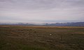
 Mackenzie Country Typical Colour.jpg 1.600 × 1.200; 367 KB
-
 NZSH8Alex.jpg 617 × 709; 215 KB
-
 Pukaki 7999, New Zealand - panoramio.jpg 1.600 × 960; 452 KB
-
 Roxburgh, New Zealand.jpg 2.048 × 1.536; 2,14 MB
-
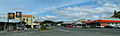
 Roxburgh-main-street-1.jpg 2.497 × 1.038; 1,33 MB
-
 Roxburgh-main-street-2.jpg 2.902 × 880; 1,14 MB
-
 State Highway 8 (1).jpg 3.411 × 1.205; 3,02 MB
-
 State Highway 8 (2).jpg 4.756 × 3.171; 12,13 MB
-
 Waitahuna Ryans Hill Culvert.JPG 3.616 × 2.520; 3,86 MB
-
 Похоже та сторона гор переполнилась облаками - panoramio.jpg 1.600 × 960; 476 KB


.jpg)
.jpg)


.jpg)


.jpg)
.jpg)