Category:Steentjeskerk (Eindhoven)
Jump to navigation
Jump to search
| Object location | | View all coordinates using: OpenStreetMap |
|---|
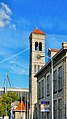
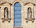
church building in Eindhoven, Netherlands  | |||||
| Upload media | |||||
| Instance of | |||||
|---|---|---|---|---|---|
| Part of | |||||
| Location | Eindhoven, North Brabant, Netherlands | ||||
| Street address |
| ||||
| Located on street | |||||
| Architect | |||||
| Occupant |
| ||||
| Heritage designation |
| ||||
 | |||||
|
This is a category about rijksmonument number 518710
|
| Address |
|
Media in category "Steentjeskerk (Eindhoven)"
The following 19 files are in this category, out of 19 total.
-
 1509 Eindhoven - Philipsdorp 22.jpg 5,472 × 3,648; 1.61 MB
-
 518710 Sint Antoniuskerk (Steentjeskerk).jpg 4,382 × 5,144; 14.4 MB
-
 7, westgevel en pastorie - Strijp - 20206648 - RCE.jpg 1,200 × 788; 208 KB
-
 7, zuidgevel - Strijp - 20206647 - RCE.jpg 1,200 × 788; 213 KB
-
 Eindhoven - Philipsdorp 3.jpg 3,464 × 6,143; 1.64 MB
-
 Eindhoven - Philipsdorp.jpg 3,048 × 3,048; 863 KB
-
 Sint-Petrus en abt Wilhelmus - Jan Custers - Steentjeskerk - Eindhoven.jpg 4,740 × 3,663; 4.73 MB
-
 Some Church Complex.jpg 3,746 × 2,488; 1.09 MB
-
 Steentjeskerk Eindhoven- Philipsdorp 1509-15.jpg 3,648 × 5,472; 1.91 MB
-
 Steentjeskerk Eindhoven- Philipsdorp 1509-16.jpg 4,579 × 3,519; 1.96 MB
-
 Steentjeskerk Eindhoven- Philipsdorp 1509-17.jpg 5,472 × 2,485; 1.55 MB
-
 Steentjeskerk Eindhoven- Philipsdorp 1509-214.jpg 3,514 × 5,273; 1.7 MB
-
 Steentjeskerk Eindhoven.jpg 1,712 × 2,282; 2.8 MB
-
 Steentjeskerk Pano 1509- P1.jpg 12,492 × 6,133; 6.89 MB
-
 Steentjeskerk Pano 1509-P2.jpg 8,092 × 3,911; 2.77 MB
-
 Steentjeskerk Pano 1509-P3.jpg 2,889 × 5,510; 1.53 MB
-
 Weerspiegeling Steentjeskerk Eindhoven- Philipsdorp 1509-14.jpg 3,871 × 3,387; 1.38 MB
-
 Weerspiegeling Steentjeskerk Eindhoven- Philipsdorp 1509-18.jpg 5,411 × 2,545; 1.48 MB
-
 Weerspiegeling Steentjeskerk Eindhoven- Philipsdorp 1509-19.jpg 3,495 × 3,495; 1.26 MB

.jpg)


