Category:Stockport
Zur Navigation springen
Zur Suche springen
englische Stadt im Großraum von Manchester   | |||||
| Medium hochladen | |||||
| Ist ein(e) | |||||
|---|---|---|---|---|---|
| Ort | Metropolitan Borough of Stockport, Greater Manchester, North West England, England | ||||
| Höhe über dem Meeresspiegel |
| ||||
| Verschieden von | |||||
| offizielle Website | |||||
 | |||||
Unterkategorien
Es werden 17 von insgesamt 17 Unterkategorien in dieser Kategorie angezeigt:
In Klammern die Anzahl der enthaltenen Kategorien (K), Seiten (S), Dateien (D)
B
- Battersby Hats (8 D)
M
O
- Offerton Park (8 D)
P
- Postcards of Stockport (3 D)
R
- River Mersey at Stockport (82 D)
S
- Stockport Harriers (1 D)
- Stockport Heritage Magazine (1 D)
T
V
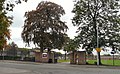
- Vernon Park, Stockport (79 D)
W
Medien in der Kategorie „Stockport“
Folgende 192 Dateien sind in dieser Kategorie, von 192 insgesamt.
-
De-Stockport.ogg 1,8 s; 17 KB
-
 2010 Christmas Tree - geograph.org.uk - 2188702.jpg 640 × 480; 122 KB
-
 6 Miles to Manchester (geograph 5679879).jpg 1.280 × 1.707; 2,19 MB
-
 A meeting of rivers and footpaths - geograph.org.uk - 4617710.jpg 1.000 × 750; 512 KB
-
 A psychic supper that needs advertising^ - geograph.org.uk - 3610690.jpg 640 × 640; 410 KB
-
 Act of Subgenius.jpg 3.072 × 2.304; 2,16 MB
-
 After Heaven ^ Hell the vision of a new Masterplan - geograph.org.uk - 4702197.jpg 3.000 × 2.250; 3,28 MB
-
 After the end of Heaven and Hell - geograph.org.uk - 3076784.jpg 640 × 408; 161 KB
-
 Albion Flour Mills - geograph.org.uk - 2996924.jpg 3.439 × 2.354; 2,5 MB
-
 At Bus Stop GG - geograph.org.uk - 1971760.jpg 640 × 382; 101 KB
-
 Behind the roadworks - geograph.org.uk - 5901043.jpg 1.280 × 810; 940 KB
-
 Bin in Stockport - geograph.org.uk - 2619504.jpg 2.676 × 3.162; 4,66 MB
-
 Biobank Stockport 1 Oct 2022.jpg 2.903 × 1.873; 738 KB
-
 Boat loading mechanism (geograph 6883311).jpg 1.024 × 768; 365 KB
-
 Bridgefield Street - geograph.org.uk - 2756997.jpg 640 × 480; 121 KB
-
 Buck ^ Dog detail - geograph.org.uk - 2739915.jpg 1.701 × 1.720; 945 KB
-
 Carrs, Stockport 6583.JPG 3.173 × 2.379; 1,13 MB
-
 Castle Yard - geograph.org.uk - 2055915.jpg 640 × 524; 152 KB
-
 Castle Yard - geograph.org.uk - 3294727.jpg 640 × 512; 152 KB
-
 Castle Yard Public Art - geograph.org.uk - 3294983.jpg 640 × 480; 169 KB
-
 Church Steps - geograph.org.uk - 5637361.jpg 1.280 × 960; 1,25 MB
-
 CIMG0222 (5876415887).jpg 4.000 × 3.000; 2,81 MB
-
 Clearing in Middle Wood, Middlewood, Cheshire.jpg 6.639 × 1.959; 3,15 MB
-
 Coming out of Stockport - geograph.org.uk - 1971810.jpg 640 × 491; 113 KB
-
 Cuzzons from Bridgehall - panoramio.jpg 3.072 × 2.304; 1,83 MB
-
 Cycling by the pyramid - geograph.org.uk - 2350521.jpg 640 × 480; 246 KB
-

-
 Daw Bank - geograph.org.uk - 3065930.jpg 640 × 480; 174 KB
-
 Daw Bank Daffodils - geograph.org.uk - 1778854.jpg 640 × 480; 210 KB
-
 Debenhams, Stockport - geograph.org.uk - 3308433.jpg 640 × 430; 58 KB
-
 Dodge Hill - geograph.org.uk - 2360981.jpg 640 × 469; 208 KB
-
 Dodge Hill - geograph.org.uk - 2361068.jpg 640 × 480; 206 KB
-
 Double Postbox SK1 385 ^ 386 - geograph.org.uk - 4158091.jpg 1.000 × 787; 594 KB
-
 CH Douglas Signature.svg 156 × 53; 6 KB
-
En-uk-Stockport.ogg 0,7 s; 8 KB
-
 Enterprise Mural - geograph.org.uk - 3654542.jpg 1.000 × 1.551; 671 KB
-

-

-
 Field Hospital Squadron - geograph.org.uk - 3065597.jpg 640 × 861; 186 KB
-
 Flight BA1396 from LHR to MAN, 15 May 2017 10.jpg 4.032 × 3.024; 6,14 MB
-
 Flight BA1396 from LHR to MAN, 15 May 2017 11.jpg 4.032 × 3.024; 6,31 MB
-
 Footbridge over St Mary's Way - geograph.org.uk - 1974980.jpg 800 × 600; 71 KB
-
 Footpath junction on Fred Perry Way - geograph.org.uk - 5024011.jpg 1.000 × 890; 614 KB
-
 Footpath off Station Road - geograph.org.uk - 3031698.jpg 640 × 480; 236 KB
-
 Footpath on to Reservoir Road - geograph.org.uk - 1290747.jpg 480 × 640; 103 KB
-
 Footpath to High Bankside - geograph.org.uk - 4309580.jpg 1.000 × 739; 684 KB
-
 Four Corinthian capitals - geograph.org.uk - 5802794.jpg 1.280 × 1.494; 1,6 MB
-
 Four Corinthian capitals - geograph.org.uk - 5802796.jpg 1.280 × 1.373; 1,34 MB
-
 Franked Mail Only - geograph.org.uk - 4158103.jpg 1.000 × 1.407; 994 KB
-
 Fred Perry Way - geograph.org.uk - 5027732.jpg 1.000 × 750; 944 KB
-
 Fred Perry Way sign.jpg 3.072 × 2.304; 1,25 MB
-
 From St Petersgate Bridge - geograph.org.uk - 2685470.jpg 640 × 522; 155 KB
-
 Geologyofglossop.svg 321 × 167; 137 KB
-
 George's Road - geograph.org.uk - 1955897.jpg 640 × 449; 147 KB
-
 George's Road Columns - geograph.org.uk - 2350566.jpg 640 × 853; 250 KB
-
 Grade II Listed phone boxes - geograph.org.uk - 3941136.jpg 1.000 × 786; 290 KB
-

-
 Grand Central - geograph.org.uk - 2484050.jpg 640 × 424; 147 KB
-
 Greenhalgh Terrace - geograph.org.uk - 2360977.jpg 640 × 540; 206 KB
-
 Gym window display - geograph.org.uk - 4455018.jpg 1.000 × 757; 583 KB
-
 Helen Clapcott - Roundabout.jpg 1.024 × 715; 156 KB
-
 Helen Clapcott - The Playground.jpg 1.024 × 833; 141 KB
-
 High Bank Side - geograph.org.uk - 2740199.jpg 640 × 480; 186 KB
-
 High Bank Side Retaining Wall - geograph.org.uk - 4309572.jpg 1.000 × 750; 834 KB
-
 High Bank Steps - geograph.org.uk - 3504783.jpg 640 × 516; 190 KB
-
 Hopes Carr - geograph.org.uk - 3637890.jpg 640 × 480; 182 KB
-
 Hopes Carr - geograph.org.uk - 5050470.jpg 1.000 × 750; 638 KB
-
 Hopes Carr from Orchard Street - geograph.org.uk - 3656839.jpg 1.000 × 750; 275 KB
-
 Inside Stockport Dungeon - geograph.org.uk - 4419103.jpg 1.000 × 750; 612 KB
-
 Inside Stockport Dungeon - geograph.org.uk - 4419105.jpg 1.000 × 750; 670 KB
-
 Inside Stockport Dungeon - geograph.org.uk - 6249039.jpg 1.280 × 1.707; 1,47 MB
-
 Inside the Court Leet - geograph.org.uk - 6249131.jpg 1.280 × 1.280; 1,2 MB
-
 Keep It Clean In Stockport - geograph.org.uk - 3769068.jpg 1.000 × 685; 324 KB
-
 King Street West Bridge - geograph.org.uk - 2588900.jpg 640 × 522; 144 KB
-
 Knightsbridge Car Park - geograph.org.uk - 2358831.jpg 640 × 371; 134 KB
-
 Knightsbridge View - geograph.org.uk - 2884827.jpg 640 × 519; 248 KB
-
 Lancashire Hill Underpass - geograph.org.uk - 1269328.jpg 640 × 480; 150 KB
-

-
 Leyland Street - geograph.org.uk - 1830941.jpg 640 × 447; 108 KB
-
 Looking down on Westgate - geograph.org.uk - 2161710.jpg 640 × 474; 117 KB
-
 Looking toward the light - geograph.org.uk - 5767678.jpg 1.280 × 960; 877 KB
-
 Lower Carr from Hopes Carr - geograph.org.uk - 4634940.jpg 1.000 × 750; 718 KB
-
 Mealhouse Brow - geograph.org.uk - 2055861.jpg 640 × 437; 130 KB
-
 Memorial planter, Lancashire Hill, Stockport (1).JPG 4.320 × 3.240; 5,51 MB
-
 Memorial planter, Lancashire Hill, Stockport (2).JPG 4.320 × 3.240; 4,81 MB
-
 Miggs ray.jpg 320 × 320; 53 KB
-
 Millgate from St Mary's - geograph.org.uk - 4634398.jpg 1.000 × 750; 733 KB
-
 Millgate Steps - geograph.org.uk - 2743332.jpg 640 × 468; 188 KB
-
 Morning Orders in 8 hours Promptly Executed - geograph.org.uk - 2484118.jpg 1.500 × 1.175; 852 KB
-
 Mortar Platoon - geograph.org.uk - 3065585.jpg 640 × 545; 148 KB
-
 Mottram Fold - geograph.org.uk - 3637868.jpg 640 × 502; 180 KB
-
 Mural by Middle Hillgate, Stockport - geograph.org.uk - 3097378.jpg 640 × 480; 392 KB
-
 NCN Millennium Milepost MP923 Stockport.jpeg 768 × 1.024; 287 KB
-
 NCN Millennium Milepost MP924 Stockport.jpeg 972 × 2.018; 1,54 MB
-
 Needham Stockport Drain Cover.jpg 5.152 × 3.864; 12,42 MB
-
 New bridge across the Mersey - geograph.org.uk - 5991585.jpg 1.280 × 1.715; 1,29 MB
-
 No Street Drinking - geograph.org.uk - 4054593.jpg 1.000 × 964; 237 KB
-
 Not a toilet - geograph.org.uk - 4307406.jpg 1.000 × 838; 1,09 MB
-
 Old Milepost by the former A6, south east of Hazel Grove (geograph 5622681).jpg 1.093 × 1.682; 253 KB
-
 Old Rum bottles, 2014.jpg 1.923 × 2.048; 748 KB
-
 Old Town Fringe Festival - geograph.org.uk - 4634298.jpg 2.848 × 2.589; 4,77 MB
-
 On Dodge Hill - geograph.org.uk - 2360992.jpg 640 × 480; 239 KB
-
 On the right track^ - geograph.org.uk - 1289087.jpg 640 × 480; 65 KB
-
 Passage off Rostron Brow - geograph.org.uk - 4630641.jpg 768 × 1.024; 201 KB
-
 Passage to Rostron Brow - geograph.org.uk - 4634413.jpg 1.000 × 1.000; 837 KB
-

-
 Planter in Stockport town centre (1).JPG 3.240 × 4.320; 3,71 MB
-
 Planter in Stockport town centre (2).JPG 4.320 × 3.240; 3,51 MB
-
 Postboxes on Exchange Street - geograph.org.uk - 4250919.jpg 1.000 × 848; 709 KB
-
 Pure-radio-logo.gif 140 × 140; 15 KB
-
 Qatar Airways flying in - geograph.org.uk - 6088150.jpg 1.280 × 900; 775 KB
-
 Railway Viaduct and Hat Museum - geograph.org.uk - 1974524.jpg 800 × 600; 288 KB
-
 Remembrances painted over - geograph.org.uk - 5727126.jpg 1.280 × 916; 898 KB
-
 Resin-bound gravel paving, Hopes Carr - geograph.org.uk - 3610677.jpg 496 × 640; 487 KB
-
 River Goyt - geograph.org.uk - 465345.jpg 640 × 480; 116 KB
-
 River Goyt - geograph.org.uk - 465348.jpg 640 × 480; 157 KB
-
 River Goyt from Portwood bridge - geograph.org.uk - 2884909.jpg 640 × 480; 212 KB
-
 River Goyt, Stockport - geograph.org.uk - 7729.jpg 640 × 480; 185 KB
-
 Riverside footpath - geograph.org.uk - 3567703.jpg 640 × 480; 207 KB
-
 Roadworks at Knightsbridge - geograph.org.uk - 5947630.jpg 1.280 × 1.079; 1,23 MB
-
 Rooftops of Stockport - geograph.org.uk - 3936100.jpg 1.000 × 741; 266 KB
-
 Rooftops of Stockport - geograph.org.uk - 4817556.jpg 1.000 × 1.000; 680 KB
-
 Sandlebridge Schools.jpg 396 × 251; 54 KB
-
 Self Storage - geograph.org.uk - 4383421.jpg 640 × 430; 48 KB
-
 Sex shop demolished - geograph.org.uk - 4629477.jpg 1.000 × 743; 571 KB
-
 Shadows down High Bank - geograph.org.uk - 4560646.jpg 1.000 × 1.333; 1,08 MB
-
 Shield Street - geograph.org.uk - 3065923.jpg 640 × 480; 184 KB
-
 Shield Street Footpath - geograph.org.uk - 1073467.jpg 640 × 611; 148 KB
-
 Site of Heaven and Hell - geograph.org.uk - 4624497.jpg 1.000 × 721; 580 KB
-
 Site of Stockport Grammar School 1832-1915 - geograph.org.uk - 3065367.jpg 1.000 × 1.129; 539 KB
-
 Site of the Warren Almshouses - geograph.org.uk - 3429954.jpg 640 × 480; 151 KB
-
 Site on Hempshaw Lane cleared - geograph.org.uk - 3333707.jpg 4.000 × 3.000; 4,54 MB
-
 Sitting area - geograph.org.uk - 3610547.jpg 640 × 480; 349 KB
-

-
 Steps to New Bridge Lane - geograph.org.uk - 3567677.jpg 640 × 480; 242 KB
-
 Steps to riverside footpath - geograph.org.uk - 3567674.jpg 640 × 480; 238 KB
-
 Steps to Stockport Station - geograph.org.uk - 1778843.jpg 640 × 583; 148 KB
-
 Steps to the Underbanks - geograph.org.uk - 2740193.jpg 640 × 480; 157 KB
-

-
 Stockport - geograph.org.uk - 3110263.jpg 2.566 × 1.237; 170 KB
-
 Stockport - geograph.org.uk - 5075410.jpg 5.184 × 3.153; 1,61 MB
-
 Stockport Adswood Sidings geograph-2806307-by-Ben-Brooksbank.jpg 2.394 × 1.382; 1,09 MB
-
 Stockport banner Town Hall.jpg 4.320 × 617; 947 KB
-
 Stockport c.1890.jpg 657 × 413; 93 KB
-
 Stockport College Logo.png 400 × 400; 68 KB
-
 Stockport Cricket Club - geograph.org.uk - 534771.jpg 640 × 231; 37 KB
-
-
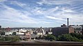
 Stockport from the air - geograph.org.uk - 4029400.jpg 640 × 480; 212 KB
-
 Stockport from the air - geograph.org.uk - 5951080.jpg 1.024 × 768; 368 KB
-
 Stockport from the air - geograph.org.uk - 5951084.jpg 1.024 × 768; 373 KB
-
 Stockport from the railway viaduct - geograph.org.uk - 3572807.jpg 1.024 × 981; 162 KB
-
 Stockport from the train - geograph.org.uk - 2545404.jpg 3.872 × 2.592; 2,48 MB
-
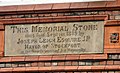 Stockport Lads Club Memorial Stone - geograph.org.uk - 1418913.jpg 640 × 391; 109 KB
-
 Stockport Memorial 2014-05-27 15-47.jpg 2.048 × 1.152; 667 KB
-
 Stockport residential street - geograph.org.uk - 1280341.jpg 640 × 480; 77 KB
-
 Stockport School (geograph 2609839).jpg 640 × 396; 167 KB
-
 Stockport Skyline.jpg 487 × 650; 51 KB
-
 Stockport Street Name Signs - geograph.org.uk - 1405455.jpg 640 × 436; 147 KB
-
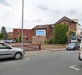
 Stockport town centre - geograph.org.uk - 1240869.jpg 640 × 480; 183 KB
-
 Stockport UK ward map 2022.svg 1.336 × 1.305; 395 KB
-
 Stockport UK ward map 2023.svg 644 × 541; 330 KB
-
 Stockport, August 1960 - geograph.org.uk - 1202487.jpg 600 × 403; 46 KB
-
 Stockport, from Stockport Viaduct - geograph.org.uk - 3126894.jpg 4.000 × 2.248; 3,35 MB
-
 Stockport, Kingston Mill 3475.JPG 3.488 × 2.616; 2,18 MB
-

-
 Stockport, United Kingdom (Unsplash).jpg 5.974 × 3.988; 6,15 MB
-

-
 Teen Shelter in Stockport.JPG 480 × 640; 150 KB
-
 Terraced housing in Stockport - geograph.org.uk - 1280339.jpg 640 × 480; 84 KB
-
 The Banner of the Industrial Revolution - geograph.org.uk - 3294734.jpg 640 × 502; 184 KB
-
 The bottom of Bridge Street - geograph.org.uk - 4630813.jpg 1.000 × 750; 633 KB
-
 The bottom of Pickfords Brow - geograph.org.uk - 6011536.jpg 1.280 × 960; 1,19 MB
-
 The end of Heaven ^ Hell - geograph.org.uk - 2949627.jpg 640 × 480; 161 KB
-
 The Goyt's Last Bend - geograph.org.uk - 2258617.jpg 640 × 566; 172 KB
-
 The old Astor Steps - geograph.org.uk - 3934237.jpg 1.000 × 809; 333 KB
-
 The site of the Tiviot - geograph.org.uk - 4630734.jpg 1.000 × 919; 638 KB
-
 The Warrens Alms Houses - geograph.org.uk - 2743357.jpg 1.500 × 1.125; 542 KB
-
 Tin Brook - Stockport.jpg 594 × 444; 296 KB
-
 Townscape, Stockport - geograph.org.uk - 2204332.jpg 640 × 337; 87 KB
-
 Trapped footpath signpost - geograph.org.uk - 5403345.jpg 1.024 × 1.529; 1,03 MB
-
 View across Stockport - geograph.org.uk - 4832476.jpg 3.504 × 2.150; 2,53 MB
-
 View from bottom of Dodge Hill - geograph.org.uk - 2954862.jpg 640 × 480; 174 KB
-
 View from halfway up Mersey Steps - geograph.org.uk - 5989255.jpg 1.280 × 996; 917 KB
-
 View from Stopford House (1) - geograph.org.uk - 1974501.jpg 1.365 × 1.024; 356 KB
-
 View from Stopford House (2) - geograph.org.uk - 1974515.jpg 800 × 600; 145 KB
-
 View of Stockport - geograph.org.uk - 3826897.jpg 640 × 430; 57 KB
-
 View over Stockport - geograph.org.uk - 3196000.jpg 640 × 573; 208 KB
-
 View over Stockport - geograph.org.uk - 3196010.jpg 640 × 521; 199 KB
-
 Warning sign - geograph.org.uk - 2459679.jpg 640 × 529; 201 KB
-
 Waste ground off Howard Street - geograph.org.uk - 4616123.jpg 1.000 × 750; 729 KB
-
 Watering trough, Hyde Bank (geograph 6883104).jpg 1.024 × 768; 437 KB
-
 Fred Perry Way - geograph.org.uk - 277883.jpg 640 × 480; 145 KB

.jpg)


.jpg)


.jpg)


.JPG)
.JPG)


.jpg)


.JPG)
.JPG)


.jpg)


.jpg)


_-_geograph.org.uk_-_1974501.jpg)
_-_geograph.org.uk_-_1974515.jpg)


.jpg)
