Category:Suriname
Gaan na navigasie
Gaan na soektog
Lande van Suid-Amerika: Argentinië · Bolivië · Brasilië · Chili · Colombia · Ecuador · Guyana · Paraguay · Peru · Suriname · Trinidad en Tobago‡ · Uruguay · Venezuela
Ander gebiede: Aruba · Bonaire · Curaçao · Falkland-eilande · Frans-Guyana · Suid-Georgië en die Suidelike Sandwicheilande
‡: deels geleë in Suid-Amerika
Ander gebiede: Aruba · Bonaire · Curaçao · Falkland-eilande · Frans-Guyana · Suid-Georgië en die Suidelike Sandwicheilande
‡: deels geleë in Suid-Amerika

| Category Suriname on sister projects: | |||||||||
|---|---|---|---|---|---|---|---|---|---|
Wikinews |
Commons
|
Wikivoyage | |||||||
country in South America   | |||||
| Laai media op | |||||
| Pronunciation audio | |||||
|---|---|---|---|---|---|
| Is 'n |
| ||||
| Onderdeel van | |||||
| Kultuur | |||||
| Ligging |
| ||||
| Hoofstad | |||||
| Regeringsvorm |
| ||||
| Wetgewende gesag | |||||
| Amptelike taal | |||||
| Volkslied | |||||
| Geldeenheid |
| ||||
| Staatshoof |
| ||||
| Datum van stigting of ontstaan |
| ||||
| Belangrike gebeurtenis |
| ||||
| Hoogste punt |
| ||||
| Bevolking |
| ||||
| Oppervlakte |
| ||||
| Vervang |
| ||||
| Topvlakdomein | |||||
| Nie dieselfde as | |||||
| amptelike webwerf | |||||
 | |||||
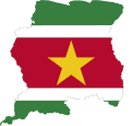
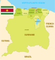
English: Suriname is a country in South America.
Nederlands: Suriname is een land in het noorden van Zuid-Amerika.

Subkategorieë
Hierdie kategorie bevat die volgende 16 subkategorië, uit 'n totaal van 16.
Media in kategorie "Suriname"
Die volgende 56 lêers is in hierdie kategorie, uit 'n totaal van 56.
-
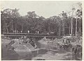 Aanleg van de Lawaspoorweg over de Witti Watra in Suriname, NG-2009-45-30.jpg 4 974 × 3 656; 2,27 MG
-
 Aldea Kawemhakan.png 487 × 346; 277 KG
-
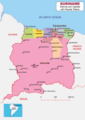
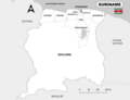 Alle districten van Suriname.png 7 920 × 6 120; 931 KG
-
 Apetina Foto.png 487 × 347; 398 KG
-
 Bakhuisspoorlijn.png 1 600 × 1 100; 338 KG
-
 Drie membraciden uit Suriname (IA biostor-13296).pdf 785 × 1 347, 5 bladsye; 1,36 MG
-
 Block 52 Offshore Map Suriname (Oil and Gas).png 8 420 × 5 950; 1,22 MG
-
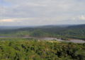
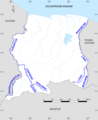 Border Rivers of Suriname.png 3 507 × 4 299; 704 KG
-
 Bruynzeelwoning Suriname.jpg 1 600 × 1 200; 329 KG
-
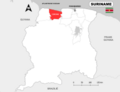
 District Brokopondo - Suriname - Location Map.png 7 920 × 6 120; 904 KG
-
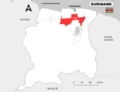
 District Commewijne - Suriname - Location Map.png 7 920 × 6 120; 892 KG
-
 District Coronie - Suriname - Location Map.png 7 920 × 6 120; 891 KG
-
 District Marowijne - Suriname - Location Map.png 7 920 × 6 120; 894 KG
-
 District Nickerie - Suriname- Location Map.png 7 920 × 6 120; 891 KG
-
 District Para - Suriname - Location Map.png 7 920 × 6 120; 894 KG
-
 District Saramacca - Suriname - Location Map.png 7 920 × 6 120; 893 KG
-
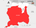 District Sipaliwini - Suriname - Location Map.png 7 920 × 6 120; 897 KG
-
 District Wanica - Suriname - Location Map.png 7 920 × 6 120; 889 KG
-
 Emission spéciale Rédemptoristes au Suriname.jpg 2 945 × 1 552; 1,37 MG
-
 Exterieur van gebouw De Doelen in Amsterdam door Surinaamse drugsverslaafden gekraakt.jpg 3 694 × 2 442; 1,06 MG
-
 Flag Map of Suriname.svg 827 × 791; 44 KG
-
 Fort Zeelandia Side view.jpg 1 280 × 1 280; 307 KG
-
 Grondwet van Suriname (1992).pdf 1 239 × 1 754, 45 bladsye; 232 KG
-
 Guyana Map with Disputed Areas (Esequiba and Tigri).png 3 507 × 2 480; 534 KG
-
 Joop Vernooij.jpg 465 × 620; 85 KG
-
 Kaart van Suriname met betwiste Gebieden.png 5 802 × 5 950; 858 KG
-
 Map of Suriname showing Districts and the capital cities.svg 1 448 × 1 572; 330 KG
-
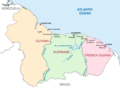 Map of Suriname, Guyana and French Guiana.png 2 381 × 1 829; 301 KG
-
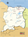
 Map of Suriname.png 8 415 × 5 950; 1,44 MG
-
 Map of Tigri Area Suriname.png 2 523 × 1 785; 3,35 MG
-
 Map Suriname with border rivers (Dutch).png 5 960 × 5 563; 1,18 MG
-
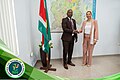 Minister Natural Resources Suriname - UNDP Meeting.jpg 2 048 × 1 365; 596 KG
-
 Ministerie NH Suriname - Kaart van Suriname 01.jpg 1 965 × 1 389; 695 KG
-
 Ministerie NH Suriname - Kaart van Suriname 05.jpg 787 × 592; 88 KG
-
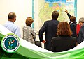
 Ministerie NH Suriname - Kaart van Suriname Presentatie 1.jpg 2 048 × 1 365; 1,05 MG
-
 Ministerie NH Suriname - Kaart van Suriname Presentatie.jpg 2 048 × 1 365; 602 KG
-
 Ministerie NH Suriname - Presentatie met kaart van Suriname.jpg 2 048 × 1 365; 492 KG
-
 Proposed Corantijn River Bridge Suriname-Guyana.png 4 210 × 2 975; 462 KG
-
 R. Dobru, strijdliederen uit Suriname (LP).jpg 2 984 × 3 061; 1,57 MG
-
 Seasons in Suriname original.png 7 834 × 6 343; 1,06 MG
-
 Staatsblad van Suriname 1975, No 3.pdf 1 754 × 1 239, 2 bladsye; 93 KG
-
 Stadsdistrict Paramaribo - Suriname - Location Map.png 7 920 × 6 120; 884 KG
-
 Suriname districts and capitals map.png 5 950 × 8 420; 1,38 MG
-
 Suriname Encyclopedia Map - Places.png 6 563 × 5 950; 2,09 MG
-
 Suriname Encyclopedia Map Physical Features.png 6 563 × 5 950; 2,57 MG
-
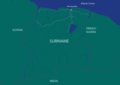
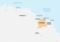 Suriname Location Map South America.png 8 420 × 5 950; 1,02 MG
-
 Suriname Location South America.png 7 920 × 6 120; 1,22 MG
-
 Suriname Locator Map Neutral.svg 842 × 595; 420 KG
-
 Suriname Map Green.png 8 420 × 5 950; 393 KG
-
 Suriname Map.png 5 950 × 7 588; 2,15 MG
-
 Suriname Offshore blocks 2022-2023.png 4 210 × 2 975; 476 KG
-
 Suriname Political Map Corrected.png 6 120 × 7 920; 2,25 MG
-
 The Reciprocal Enforcement of Foreign Judgments (Suriname) Order 1981 (UKSI 1981-735 qp).pdf 1 239 × 1 754, 6 bladsye; 1,18 MG
-
 The Reciprocal Enforcement of Foreign Judgments (Suriname) Order 1981 (UKSI 1981-735).pdf 1 239 × 1 752, 6 bladsye; 168 KG
-
 Waterwoods Cyanide site Brokopondo Suriname.png 3 507 × 2 480; 752 KG
-
 Wetboek van strafrecht Suriname.pdf 1 239 × 1 754, 117 bladsye; 704 KG


.png)


.png)


.png)


.jpg)


