Category:Tak Province
Zur Navigation springen
Zur Suche springen

English: Tak is, according to the 4 region system, a province of Northern Thailand. Following the 6 region system system, which is used by the scientific community and also here in Wikimedia, it is a province of Western Thailand.
ไทย: จังหวัดตาก เป็นจังหวัดในภาคเหนือตอนล่างของประเทศไทย
Provinz in Nordthailand    | |||||
| Medium hochladen | |||||
| Ist ein(e) | |||||
|---|---|---|---|---|---|
| Ort | Thailand | ||||
| Hauptstadt | |||||
| Einwohnerzahl |
| ||||
| Fläche |
| ||||
| offizielle Website | |||||
 | |||||
Unterkategorien
Es werden 11 von insgesamt 11 Unterkategorien in dieser Kategorie angezeigt:
In Klammern die Anzahl der enthaltenen Kategorien (K), Seiten (S), Dateien (D)
Medien in der Kategorie „Tak Province“
Folgende 44 Dateien sind in dieser Kategorie, von 44 insgesamt.
-
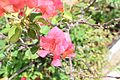 Bouganvillea glabra in Tak 1.JPG 6.000 × 4.000; 6,45 MB
-
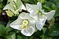 Bouganvillea glabra in Tak.JPG 6.000 × 4.000; 12,41 MB
-
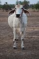 Brahman Thai cow.jpg 4.000 × 6.000; 6,37 MB
-
 Bug on mango tree.JPG 4.000 × 6.000; 6,32 MB
-
 Catharanthus roseus - periwikle - in Thailand.jpg 6.000 × 4.000; 14,67 MB
-
 Circular tree formation Taksin Maharat Park.JPG 6.000 × 4.000; 5,99 MB
-
 Koompassioxylon TAK1.jpg 3.088 × 2.056; 4,58 MB
-
 Low Jackfruit.jpg 640 × 480; 137 KB
-
 Mae Sot District, Thailand (Unsplash XL7eUN6KDTU).jpg 3.500 × 2.333; 9,14 MB
-
 Mae Sot District, Thailand (Unsplash).jpg 5.472 × 3.648; 11,11 MB
-
 Ping River in Tak 1.JPG 6.000 × 4.000; 5,32 MB
-
 Ping River in Tak 2.JPG 6.000 × 4.000; 6,98 MB
-
 Ping River in Tak 3.JPG 6.000 × 4.000; 7,08 MB
-
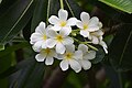
 Plumeria in Thailand 1.JPG 6.000 × 4.000; 5,5 MB
-
 Plumeria in Thailand 2.JPG 6.000 × 4.000; 5,09 MB
-
 Saraca thaipingensis.JPG 3.072 × 2.304; 1,73 MB
-
 Seal Tak.png 500 × 500; 99 KB
-
 Ta Ko Bi Cave.jpg 1.600 × 1.200; 521 KB
-
 Tak Province (10.3897-zookeys.775.26893) Figure 5.jpg 1.512 × 1.008; 2,44 MB
-
 Tak province Burmese mountains.jpg 1.600 × 1.200; 1,55 MB
-

-
 Thai general election, 2007 in Ban Mae Klong Noi School (Tak Province) 01.jpg 2.048 × 1.536; 625 KB
-
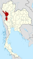 Thailand Tak locator map.svg 1.052 × 1.849; 1,21 MB
-
 ThaiTakProvince1.jpg 2.615 × 1.171; 504 KB
-
 ThaiTakProvince2.jpg 2.804 × 1.907; 1,95 MB
-
 ThaiTakProvince3.jpg 2.930 × 1.941; 2,23 MB
-
 ThaiTakProvince4.jpg 2.818 × 1.719; 827 KB
-
 ThaiTakProvince5.jpg 2.572 × 1.840; 1,18 MB
-
 Umphang Highway.jpg 1.200 × 900; 469 KB
-

-
 West Indian Jasmine - Thailand.JPG 6.000 × 4.000; 6,37 MB
-
 Women's only parking in Thailand.JPG 4.000 × 6.000; 6,89 MB
-
 Young mango fruits in Tak Province.JPG 6.000 × 4.000; 6,14 MB
-
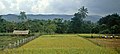
 จังหวัดตาก MUANG TAK - panoramio.jpg 3.072 × 2.304; 1,14 MB
-
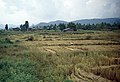
 อำเภอเมืองตาก จังหวัดตาก MUANG TAK - panoramio.jpg 3.072 × 2.304; 1,12 MB
-
 อุทยานแห่งชาติ แม่วงก์ - panoramio (1).jpg 2.048 × 1.536; 599 KB
-
 อุทยานแห่งชาติ แม่วงก์ - panoramio (2).jpg 2.048 × 1.536; 787 KB
-
 อุทยานแห่งชาติ แม่วงก์ - panoramio (3).jpg 2.048 × 1.536; 902 KB
-
 อุทยานแห่งชาติ แม่วงก์ - panoramio (4).jpg 1.536 × 2.048; 807 KB
-
 อุทยานแห่งชาติ แม่วงก์ - panoramio (5).jpg 1.536 × 2.048; 943 KB
-
 อุทยานแห่งชาติ แม่วงก์ - panoramio (6).jpg 1.536 × 2.048; 840 KB
-
 อุทยานแห่งชาติ แม่วงก์ - panoramio (7).jpg 1.536 × 2.048; 939 KB
-
 อุทยานแห่งชาติ แม่วงก์ - panoramio (9).jpg 1.536 × 2.048; 791 KB
-
 อุทยานแห่งชาติ แม่วงก์ - panoramio.jpg 2.048 × 1.536; 1,11 MB


.jpg)
.jpg)


_Figure_5.jpg)

.jpg)
_01.jpg)


_to_start_construction_of_a_new_recreation_center.jpg)


.jpg)
.jpg)
.jpg)
.jpg)
.jpg)
.jpg)
.jpg)
.jpg)
