Category:Tegg's Nose Country Park
Jump to navigation
Jump to search
country park and hill in Cheshire East, UK  | |||||
| Upload media | |||||
| Instance of | |||||
|---|---|---|---|---|---|
| Location |
| ||||
| Mountain range | |||||
| Elevation above sea level |
| ||||
 | |||||
Media in category "Tegg's Nose Country Park"
The following 50 files are in this category, out of 50 total.
-
 A bench with a view - geograph.org.uk - 2401791.jpg 640 × 480; 110 KB
-

-
 Atop the steep edge of Tegg's Nose - geograph.org.uk - 2706847.jpg 1,704 × 2,272; 609 KB
-
 Cattle grazing in field below Hardings - geograph.org.uk - 2155200.jpg 1,024 × 768; 202 KB
-
 Clarke Lane & Bottoms Reservoir, Langley - geograph.org.uk - 5219333.jpg 5,184 × 2,920; 5.65 MB
-
 Climbing face at Tegg's Nose Quarry - geograph.org.uk - 2325982.jpg 1,880 × 1,475; 625 KB
-
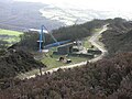
 Derrick crane - geograph.org.uk - 2325937.jpg 1,913 × 1,435; 645 KB
-
 Farmland near Ridgegate Reservoir - geograph.org.uk - 2559477.jpg 3,648 × 2,736; 4.7 MB
-
 Former quarry, Tegg's Nose - geograph.org.uk - 3296231.jpg 613 × 425; 29 KB
-
 From Tegg's Nose looking towards Ridgegate Resr-Macc Forest - panoramio.jpg 1,000 × 667; 132 KB
-
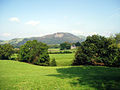
 Grazing land and Teggs Nose - geograph.org.uk - 2401777.jpg 640 × 480; 109 KB
-
 Looking along the boom - geograph.org.uk - 2325948.jpg 1,463 × 1,949; 435 KB
-

-
 Looking over to the climbing area - geograph.org.uk - 2325992.jpg 1,833 × 1,469; 492 KB
-
 Overgrown spoil heap on Teggs Nose - geograph.org.uk - 3530904.jpg 1,600 × 1,200; 496 KB
-
 Path on the side of Tegg's Nose - geograph.org.uk - 3703811.jpg 3,872 × 2,592; 5.14 MB
-
 Path up Tegg's Nose - geograph.org.uk - 3703793.jpg 3,872 × 2,592; 5.41 MB
-
 Quarry Face - Tegg's Nose - geograph.org.uk - 4846132.jpg 1,350 × 900; 134 KB
-

-
 Rock Crusher, Tegg's Nose Quarry.jpg 3,888 × 2,592; 4.98 MB
-
 Stream in Tegg's Nose Country Park - geograph.org.uk - 1900776.jpg 640 × 426; 134 KB
-
 Sutton - Tegg's Nose.jpg 640 × 480; 95 KB
-
 Swing saw - geograph.org.uk - 2325885.jpg 1,853 × 1,427; 464 KB
-
 Swing Saw, Tegg's Nose Quarry.jpg 3,888 × 2,592; 3.82 MB
-
 Tegg's Nose - geograph.org.uk - 1900808.jpg 640 × 426; 61 KB
-
 Tegg's Nose - geograph.org.uk - 4538017.jpg 3,648 × 2,736; 5.09 MB
-
 Tegg's Nose Country Park - geograph.org.uk - 5840303.jpg 683 × 1,024; 195 KB
-
 Tegg's Nose from Ridgegate Reservoir - geograph.org.uk - 5758010.jpg 1,280 × 960; 310 KB
-
 Tegg's Nose Rocks - geograph.org.uk - 5786381.jpg 3,365 × 2,479; 4.78 MB
-
 Tegg's Nose sunset - geograph.org.uk - 2706865.jpg 2,272 × 1,704; 654 KB
-
 Tegg's Nose Trail - geograph.org.uk - 2840053.jpg 5,184 × 3,456; 6.01 MB
-
 Tegg's Nose Trail stepping stones and ford - geograph.org.uk - 2838745.jpg 5,184 × 3,456; 6.8 MB
-
 Tegg's Nose viewing table - geograph.org.uk - 2706833.jpg 1,704 × 2,272; 671 KB
-
 Tegg's Nose viewpoint - geograph.org.uk - 258313.jpg 640 × 379; 103 KB
-
 Tegg's Nose viewpoint - geograph.org.uk - 5786372.jpg 3,564 × 2,486; 4.84 MB
-
 Tegg's Nose Visitor Centre - geograph.org.uk - 258311.jpg 523 × 640; 190 KB
-
 Teggs Nose - geograph.org.uk - 4986687.jpg 3,648 × 2,736; 5.09 MB
-
 Teggs Nose from Nessit Hill - geograph.org.uk - 4762656.jpg 1,200 × 900; 203 KB
-
 Teggs Nose quarry.jpg 640 × 480; 100 KB
-
 Teggs Nose Trail marker.jpg 185 × 183; 50 KB
-
 Teggs Nose visitor centre.jpg 1,000 × 606; 491 KB
-
 Teggs Nose Walkers Barn.jpg 640 × 480; 110 KB
-

-
 The collection - geograph.org.uk - 2325956.jpg 1,880 × 1,193; 376 KB
-
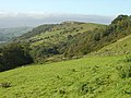
 The view from Tegg's Nose - geograph.org.uk - 4967121.jpg 800 × 600; 164 KB
-
 Track round the top of Tegg's Nose - geograph.org.uk - 3703797.jpg 3,689 × 2,459; 2.82 MB
-
 View across Bottoms Reservoir towards Teggs Nose - geograph.org.uk - 5217471.jpg 5,184 × 2,920; 5.4 MB
-

-
 View from Higher Hardings - geograph.org.uk - 1943792.jpg 1,280 × 854; 277 KB
-


