Category:Teshio, Hokkaido
Zur Navigation springen
Zur Suche springen

Ort in der Präfektur Hokkaidō, Japan     | |||||
| Medium hochladen | |||||
| Ist ein(e) | |||||
|---|---|---|---|---|---|
| Ort | Teshio district, Unterpräfektur Rumoi, Hokkaidō, Japan | ||||
| Rechtsform |
| ||||
| Datum der Gründung, Erstellung, Entstehung, Erbauung |
| ||||
| Einwohnerzahl |
| ||||
| Fläche |
| ||||
| offizielle Website | |||||
 | |||||
Unterkategorien
Es werden 7 von insgesamt 7 Unterkategorien in dieser Kategorie angezeigt:
In Klammern die Anzahl der enthaltenen Kategorien (K), Seiten (S), Dateien (D)
F
- Furaoi Station (1 D)
K
- Kantaku Station (1 D)
- Kita-Kawaguchi Station (1 D)
N
- Naka-Kawaguchi Station (1 D)
S
- Sakukaeshi Station (1 D)
- Sarakishi Station (1 D)
T
- Teshio Station (4 D)
Medien in der Kategorie „Teshio, Hokkaido“
Folgende 21 Dateien sind in dieser Kategorie, von 21 insgesamt.
-
 Emblem of Teshio, Hokkaido.svg 512 × 512; 4 KB
-
 Estuary of Teshio river Aerial photograph.1977.jpg 2.955 × 6.380; 13,2 MB
-
 Flag of Teshio Hokkaido.png 320 × 198; 6 KB
-
 Flag of Teshio, Hokkaido.svg 324 × 216; 5 KB
-
 Haborosen teshi.jpg 3.303 × 2.205; 745 KB
-
 Hokkaido Teshio High School.jpg 5.386 × 2.693; 8,5 MB
-
 Hokkaido Teshio-town.png 300 × 152; 14 KB
-
 Kawaguchi Ruins of Teshio Town.jpg 2.400 × 1.800; 2,15 MB
-
 Michinoeki teshio.jpg 1.024 × 768; 79 KB
-
 Ororon 20201007123542 (50862355378).jpg 4.032 × 3.024; 3,65 MB
-
 Population distribution of Teshio, Hokkaido, Japan.svg 512 × 256; 22 KB
-
 Teshio Hokkaido chapter.JPG 145 × 145; 10 KB
-
 Teshio in Hokkaido Prefecture Ja.svg 800 × 872; 46 KB
-
 Teshio in Rumoi Subprefecture.gif 616 × 816; 51 KB
-
 Teshio town hall.JPG 4.000 × 2.001; 2,56 MB
-
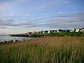 Teshio-coast-jun2006.jpg 2.048 × 1.536; 1,02 MB
-
 基礎自治体位置図 01487.svg 400 × 604; 13 KB
-
 天塩町『天塩國(てしおのくに)』眠れる食資源活用プロジェクト (32843605434).jpg 3.015 × 2.010; 2,4 MB
-
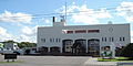
 天塩警察署.jpeg 1.920 × 1.080; 853 KB
-
 鏡沼海浜公園 - panoramio.jpg 4.896 × 2.752; 5,57 MB
-
 鏡沼海浜公園キャンプ場 - panoramio.jpg 4.896 × 2.752; 5,6 MB


.jpg)


.jpg)


