Category:Tibberton, Worcestershire
Naar navigatie springen
Naar zoeken springen
English: Tibberton is a village in Worcestershire, England. It is located around 4 miles north-east of Worcester and less than a mile from junction 6 of the M5 motorway. The Worcester and Birmingham Canal passes just to the north of the village.
Nederlands: Tibberton is een plaats en civil parish in het bestuurlijke gebied Wychavon, in het Engelse graafschap Worcestershire met 482 inwoners.
Polski: Tibberton – wieś w Anglii, w hrabstwie Worcestershire, w dystrykcie Wychavon. Leży 6 km na północny wschód od miasta Worcester i 160 km na północny zachód od Londynu. W 2001 miejscowość liczyła 482 mieszkańców.

Worcestershire  | |||||
| Media uploaden | |||||
| Is een | |||||
|---|---|---|---|---|---|
| Locatie | Wychavon, Worcestershire, West Midlands, Engeland | ||||
| Inwonertal |
| ||||
| Oppervlakte |
| ||||
 | |||||
Ondercategorieën
Deze categorie bevat alleen de volgende subcategorie.
Media in categorie "Tibberton, Worcestershire"
Deze categorie bevat de volgende 200 bestanden, van in totaal 243.
(vorige pagina) (volgende pagina)-
 A wheat field beside Pershore Road - geograph.org.uk - 4976544.jpg 800 × 600; 143 kB
-

-
 A4538 Pershore Lane and Worcester 6 development - geograph.org.uk - 5014528.jpg 1.600 × 1.200; 466 kB
-

-
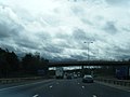
 Approaching junction 6 on the M5 - geograph.org.uk - 3759903.jpg 3.867 × 1.983; 1,8 MB
-
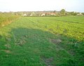
 Arable farmland near Tibberton - geograph.org.uk - 4976540.jpg 800 × 600; 161 kB
-
 Arable land near Tibberton - geograph.org.uk - 1303546.jpg 640 × 480; 118 kB
-
 B4636 approaching roundabout - geograph.org.uk - 5345640.jpg 640 × 480; 52 kB
-

-
 B4636 towards Crowle - geograph.org.uk - 5345634.jpg 640 × 480; 63 kB
-
 Back of Rectory farm house and barn conversions - geograph.org.uk - 4636734.jpg 1.600 × 1.200; 352 kB
-

-
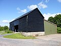 Barn at Moorend Farm, Tibberton, Worcestershire - geograph.org.uk - 6196365.jpg 1.600 × 1.200; 409 kB
-
 Barn Conversion For Sale - geograph.org.uk - 1015475.jpg 640 × 480; 95 kB
-
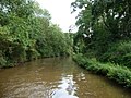 Bend on the Worcester and Birmingham Canal - geograph.org.uk - 3177201.jpg 1.024 × 768; 182 kB
-
 Between the roads - geograph.org.uk - 856708.jpg 640 × 480; 103 kB
-
 Bridge 25, Tibberton Bridge, from the west - geograph.org.uk - 3177181.jpg 1.024 × 768; 156 kB
-
 Bridge 25, Worcester and Birmingham Canal - geograph.org.uk - 3435878.jpg 1.024 × 680; 183 kB
-

-
 Canal bridge at Tibberton - geograph.org.uk - 1303561.jpg 640 × 480; 86 kB
-
 Canal Bridge at Tibberton - geograph.org.uk - 1303564.jpg 640 × 480; 79 kB
-
 Canal bridge at Tibberton - geograph.org.uk - 1708972.jpg 640 × 426; 83 kB
-

-
 Canal near Tibberton, Worcestershire - geograph.org.uk - 5680389.jpg 1.280 × 805; 1,35 MB
-
 Canal near Tibberton, Worcestershire - geograph.org.uk - 5680392.jpg 1.280 × 869; 1,36 MB
-
 Canal near Tibberton, Worcestershire - geograph.org.uk - 5680394.jpg 960 × 1.280; 1,56 MB
-
 Canal near Tibberton, Worcestershire - geograph.org.uk - 5680396.jpg 1.280 × 960; 1,64 MB
-
 Canal north of Tibberton in Worcestershire - geograph.org.uk - 5680399.jpg 1.280 × 960; 1,91 MB
-
 Canal north of Tibberton in Worcestershire - geograph.org.uk - 5680401.jpg 1.280 × 854; 1,73 MB
-
 Canal north of Tibberton in Worcestershire - geograph.org.uk - 5680507.jpg 1.280 × 803; 1,25 MB
-
 Clover Path - geograph.org.uk - 2584910.jpg 600 × 800; 244 kB
-
 Completely oblivious - geograph.org.uk - 1015481.jpg 640 × 480; 84 kB
-
 Construction of Worcester 6 Development - geograph.org.uk - 5258858.jpg 1.024 × 768; 227 kB
-
 Could you run this pub^ - geograph.org.uk - 5563121.jpg 1.600 × 1.200; 282 kB
-
 Crop field off Plough Road - geograph.org.uk - 5345645.jpg 640 × 480; 68 kB
-
 Crop field off the B4636 - geograph.org.uk - 5345627.jpg 640 × 480; 63 kB
-
 Distant view of Ravenshill Farm and Tibberton - geograph.org.uk - 5153893.jpg 1.600 × 1.164; 242 kB
-
 Eatons Farm and Tibberton Church - geograph.org.uk - 6066098.jpg 1.600 × 1.200; 270 kB
-
 Eco-friendly transport, Tibberton - geograph.org.uk - 2873581.jpg 640 × 430; 76 kB
-
 Entering Oddingley - geograph.org.uk - 5472487.jpg 640 × 480; 80 kB
-
 Evelench Farm - geograph.org.uk - 4372511.jpg 640 × 404; 71 kB
-
 Farm Buildings at Eatons Farm, Tibberton, Worcestershire - geograph.org.uk - 6196476.jpg 1.600 × 1.200; 506 kB
-
 Farm buildings at Ravenshill Farm, Tibberton - geograph.org.uk - 4636708.jpg 1.600 × 1.200; 360 kB
-
 Farm land north of Tibberton in Worcestershire - geograph.org.uk - 5680550.jpg 1.280 × 886; 1,58 MB
-
 Farmland near Tibberton - geograph.org.uk - 4976537.jpg 1.024 × 768; 273 kB
-
 Fence post driving machine - geograph.org.uk - 6196591.jpg 1.200 × 1.600; 650 kB
-
 Field boundary near Bredicot - geograph.org.uk - 2986483.jpg 640 × 326; 32 kB
-
 Field near Ravenshill Farm - geograph.org.uk - 4376542.jpg 640 × 436; 69 kB
-
 Field off Plough Road - geograph.org.uk - 5345637.jpg 640 × 480; 63 kB
-

-
 Fields north of Bredicot - geograph.org.uk - 4372513.jpg 640 × 484; 72 kB
-
 Footbridge near Trotshill - geograph.org.uk - 4741255.jpg 640 × 416; 105 kB
-
 Footbridge over the M5 - geograph.org.uk - 3760114.jpg 4.596 × 2.521; 2,12 MB
-

-

-
 Footpath to Tibberton - geograph.org.uk - 1709468.jpg 426 × 640; 95 kB
-
 Footpath to Tibberton - geograph.org.uk - 2918902.jpg 1.382 × 1.082; 552 kB
-
 Foredraught Lane-Plough Road Junction - geograph.org.uk - 4499370.jpg 1.600 × 1.141; 243 kB
-
 Full barn between Netherwood Lane and Tibberton - geograph.org.uk - 6016627.jpg 1.600 × 1.200; 261 kB
-
 Gordon's Farmhouse, Tibberton, Worcestershire - geograph.org.uk - 6196629.jpg 1.600 × 1.200; 502 kB
-
 Grazing, Cowle Green - geograph.org.uk - 5345657.jpg 640 × 480; 75 kB
-
 Hay bales, Tibberton - geograph.org.uk - 2111531.jpg 640 × 480; 93 kB
-
 Hidden motorway from Bredicot railway bridge - geograph.org.uk - 5153920.jpg 1.600 × 1.081; 403 kB
-
 House in Foredraught Lane, Tibberton - geograph.org.uk - 3177192.jpg 1.024 × 768; 203 kB
-
 House on Church Lane, Tibberton - geograph.org.uk - 6016632.jpg 1.600 × 1.200; 469 kB
-

-

-

-

-

-
 Interior of the church at Tibberton, Worcestershire - geograph.org.uk - 6196582.jpg 1.200 × 1.600; 416 kB
-
 Interior of Tibberton Church - geograph.org.uk - 4636744.jpg 1.600 × 1.200; 444 kB
-
 Junction 6 of the M5 - geograph.org.uk - 2668317.jpg 800 × 600; 298 kB
-
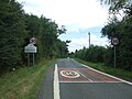
 Keep left sign - geograph.org.uk - 4976861.jpg 800 × 600; 119 kB
-
 Looking across Old House Farm to Thrift Wood near Crowle - geograph.org.uk - 6196703.jpg 1.600 × 1.200; 336 kB
-

-
 M5 from Trotshill footbridge - geograph.org.uk - 6079950.jpg 1.600 × 1.200; 396 kB
-
 M5 half a mile to junction 6 - geograph.org.uk - 4621762.jpg 2.004 × 1.280; 917 kB
-
 M5 looking northbound - geograph.org.uk - 6244018.jpg 640 × 480; 64 kB
-
 M5 Motorway - Junction 6 Northbound - geograph.org.uk - 2629853.jpg 640 × 480; 82 kB
-
 M5 Motorway, north of Junction 6 - geograph.org.uk - 6119950.jpg 800 × 600; 631 kB
-
 M5 northbound at Junction 6 - geograph.org.uk - 4357340.jpg 1.600 × 1.200; 443 kB
-
 M5 northbound near Offerton Farm - geograph.org.uk - 2752066.jpg 640 × 452; 45 kB
-
 M5 south of junction 6 - geograph.org.uk - 4624227.jpg 2.256 × 1.496; 881 kB
-
 M5 south towards Junction 6 - geograph.org.uk - 4621771.jpg 2.019 × 1.278; 788 kB
-
 M5 Southbound - geograph.org.uk - 3759907.jpg 3.827 × 1.538; 1,39 MB
-
 M5 southbound approaching Junction 6 - geograph.org.uk - 2611461.jpg 640 × 480; 42 kB
-
 M5 southbound at Junction 6 on-slip - geograph.org.uk - 4784349.jpg 640 × 480; 35 kB
-
 M5 southbound near Oddingley - geograph.org.uk - 2611441.jpg 640 × 480; 41 kB
-
 M5 southbound near Trotshill - geograph.org.uk - 2611469.jpg 640 × 480; 39 kB
-
 Maize crop near the M5 Motorway - geograph.org.uk - 5472483.jpg 640 × 480; 67 kB
-
 Materials Solutions entrance, Worcester 6 Business Park - geograph.org.uk - 6066095.jpg 1.600 × 1.200; 315 kB
-
 Minor road from Tibberton to Droitwich - geograph.org.uk - 1871292.jpg 800 × 592; 139 kB
-
 Minor road, Cowle Green - geograph.org.uk - 5345658.jpg 640 × 480; 68 kB
-
 Moat Farmhouse, Moor End, Tibberton, Worcestershire - geograph.org.uk - 6196309.jpg 1.600 × 1.200; 542 kB
-
 Moor End Farm, Tibberton (New House) - geograph.org.uk - 6196366.jpg 1.600 × 1.200; 455 kB
-
 Moor End Farmhouse (1), Tibberton, Worcester - geograph.org.uk - 6196349.jpg 1.600 × 1.200; 425 kB
-

-
 Moor End Footbridge - geograph.org.uk - 2584933.jpg 800 × 600; 205 kB
-
 Motorway underpass at Offerton - geograph.org.uk - 1708943.jpg 640 × 426; 73 kB
-

-
 Narrowboat, Tibberton - geograph.org.uk - 2111536.jpg 480 × 640; 96 kB
-
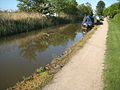
 Narrowboats at Tibberton - geograph.org.uk - 84440.jpg 640 × 479; 102 kB
-

-
 Narrowboats at Tibberton. - geograph.org.uk - 709129.jpg 640 × 480; 62 kB
-
 New houses under construction - geograph.org.uk - 1015495.jpg 640 × 480; 81 kB
-
 New industrial units off the B4636 - geograph.org.uk - 5345632.jpg 640 × 480; 71 kB
-
 New road spur - geograph.org.uk - 4976841.jpg 800 × 600; 104 kB
-
 New road spur - geograph.org.uk - 4976856.jpg 1.024 × 768; 166 kB
-
 New roundabout for Worcester Six Technology Park - geograph.org.uk - 5014515.jpg 1.600 × 1.200; 360 kB
-
 Next stop Pershore - geograph.org.uk - 856713.jpg 640 × 480; 100 kB
-
 Northbound M5, Flyover at Junction 6 - geograph.org.uk - 3809085.jpg 640 × 427; 220 kB
-
 Offerton Bridge - geograph.org.uk - 77700.jpg 640 × 479; 80 kB
-
 Offerton, motorway bridge - geograph.org.uk - 4193146.jpg 1.024 × 768; 234 kB
-
 Oilseed rape crop, Cowle Green - geograph.org.uk - 5345654.jpg 640 × 480; 106 kB
-
 Old House Farm (1), Tibberton, Worcestershire - geograph.org.uk - 6196551.jpg 1.600 × 1.200; 551 kB
-
 Old House Farm (2), Tibberton, Worcestershire - geograph.org.uk - 6196563.jpg 1.600 × 1.200; 481 kB
-
 Old Turnpike Road Near Crowle Green - geograph.org.uk - 4941180.jpg 640 × 480; 53 kB
-
 Old Turnpike Road, Moor End - geograph.org.uk - 2076735.jpg 640 × 480; 59 kB
-
 Path to the Rails - geograph.org.uk - 2584953.jpg 800 × 600; 149 kB
-

-
 Pershore Lane roundabout from A4538 - geograph.org.uk - 3274674.jpg 640 × 465; 58 kB
-
 Pershore Lane, the A4538 - geograph.org.uk - 5258853.jpg 800 × 600; 110 kB
-
 Pershore Lane, the A4538 - geograph.org.uk - 5258862.jpg 800 × 600; 102 kB
-
 Peter ad Vincula, Tibberton, altar - geograph.org.uk - 4879299.jpg 640 × 480; 82 kB
-

-
 Peter ad Vincula, Tibberton, font - geograph.org.uk - 4879296.jpg 640 × 480; 73 kB
-

-

-
 Plough Road - geograph.org.uk - 5345643.jpg 640 × 480; 68 kB
-

-

-
 Plough Road Tibberton - geograph.org.uk - 4941129.jpg 640 × 472; 46 kB
-
 Plough Road towards Crowle - geograph.org.uk - 5345646.jpg 640 × 480; 105 kB
-
 Railway line near Tibberton - geograph.org.uk - 64353.jpg 640 × 466; 151 kB
-
 Railway towards Birmingham - geograph.org.uk - 5345651.jpg 640 × 480; 57 kB
-
 Rape and ridge - geograph.org.uk - 779563.jpg 640 × 387; 42 kB
-
 Ravenhills Farm - geograph.org.uk - 5345648.jpg 640 × 480; 48 kB
-
 Ravenshill Farm, Crowle - geograph.org.uk - 4544321.jpg 640 × 480; 65 kB
-
 Rectory Farm House, Tibberton, Worcestershire - geograph.org.uk - 4636726.jpg 1.600 × 1.200; 449 kB
-
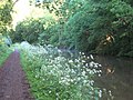
 Reed Bed, Worcester and Birmingham Canal - geograph.org.uk - 1352473.jpg 640 × 455; 127 kB
-
 Reeds on the Worcester ^ Birmingham Canal - geograph.org.uk - 2918908.jpg 1.632 × 1.224; 817 kB
-
 Road through Tibberton - geograph.org.uk - 1303957.jpg 640 × 480; 99 kB
-
 Roundabout on Pershore Road - geograph.org.uk - 4976558.jpg 800 × 600; 104 kB
-
 Roundabout on Pershore Road - geograph.org.uk - 4976559.jpg 800 × 600; 122 kB
-
 Rushy field near Tibberton - geograph.org.uk - 3405420.jpg 640 × 315; 44 kB
-
 Sheds at Eatons Farm, Tibberton, Worcestershire - geograph.org.uk - 6196482.jpg 1.600 × 1.200; 625 kB
-
 Southbound M5 near Oddingley - geograph.org.uk - 3407154.jpg 640 × 480; 342 kB
-
 Speed the Plough - geograph.org.uk - 1303557.jpg 640 × 480; 57 kB
-
 Speed The Plough pub - geograph.org.uk - 1015504.jpg 640 × 480; 76 kB
-
 Speed the Plough, Tibberton - geograph.org.uk - 1303946.jpg 640 × 480; 109 kB
-
 Speed the Plough, Tibberton - geograph.org.uk - 4727601.jpg 1.280 × 851; 366 kB
-
 St Peter ad Vincula Church, Tibberton, Worcestershire - geograph.org.uk - 6196568.jpg 1.600 × 1.200; 512 kB
-

-

-

-

-

-
 St Peter ad Vincula, Tibberton, seat - geograph.org.uk - 4879034.jpg 640 × 480; 97 kB
-
 The A4636 approaching the A4538 - geograph.org.uk - 4976837.jpg 800 × 600; 92 kB
-
 The A4636 approaching the A4538 - geograph.org.uk - 4976874.jpg 800 × 600; 95 kB
-

-

-

-
 The Bridge Inn, Plough Road - geograph.org.uk - 1871274.jpg 1.024 × 757; 164 kB
-
 The Bridge Inn, Plough Road - geograph.org.uk - 1871285.jpg 1.024 × 732; 160 kB
-
 The Bridge pub - geograph.org.uk - 1015511.jpg 640 × 480; 64 kB
-
 The Bridge, Tibberton - geograph.org.uk - 1303558.jpg 640 × 480; 97 kB
-
 The Bridge, Tibberton - geograph.org.uk - 4727598.jpg 1.280 × 851; 263 kB
-
 The M5 crossing the WandB Canal - geograph.org.uk - 1373353.jpg 640 × 425; 109 kB
-

-
 The view from Tibberton churchyard - geograph.org.uk - 1015458.jpg 640 × 480; 78 kB
-
 The Worcester and Birmingham Canal - geograph.org.uk - 1303560.jpg 640 × 480; 101 kB
-
-
 Threshing barn at Moorend Farm, Tibberton, Worcester - geograph.org.uk - 6196316.jpg 1.600 × 1.200; 438 kB
-
 Tibberton - ribbon development - geograph.org.uk - 1015500.jpg 640 × 480; 78 kB
-
 Tibberton across the fields - geograph.org.uk - 6066096.jpg 1.600 × 1.200; 432 kB
-

-
 Tibberton Bridge - geograph.org.uk - 1871301.jpg 800 × 590; 108 kB
-
 Tibberton Bridge - geograph.org.uk - 4193314.jpg 1.024 × 768; 162 kB
-
 Tibberton Bridge - geograph.org.uk - 4727594.jpg 1.280 × 851; 287 kB
-
 Tibberton Bridge - geograph.org.uk - 84138.jpg 640 × 479; 113 kB
-

-

-
 Tibberton Church of St Peter ad Vincula - geograph.org.uk - 4636739.jpg 1.600 × 1.200; 406 kB
-
 Tibberton Church, alternative view - geograph.org.uk - 4636749.jpg 1.600 × 1.200; 581 kB
-
 Tibberton on the Worcester and Birmingham Canal - geograph.org.uk - 3382646.jpg 3.628 × 2.721; 4,14 MB
-
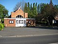
 Tibberton Post Office - geograph.org.uk - 5563114.jpg 1.600 × 1.200; 458 kB
-
 Tibberton Rectory Farmhouse - geograph.org.uk - 6196692.jpg 1.600 × 1.200; 368 kB
-
 Tibberton Village Hall - geograph.org.uk - 1303954.jpg 640 × 480; 88 kB
-
 Tibberton Village Hall - geograph.org.uk - 4727611.jpg 1.280 × 851; 467 kB
-
 Tibberton, angling - geograph.org.uk - 4193302.jpg 1.024 × 768; 237 kB
-
 Tibberton, Black ^ White Cottage - geograph.org.uk - 4193159.jpg 1.024 × 768; 141 kB
-
 Tibberton, canal - geograph.org.uk - 4193322.jpg 1.024 × 768; 148 kB
-
 Tibberton, towpath - geograph.org.uk - 4193294.jpg 1.024 × 768; 265 kB
-
 Towards Tibberton - geograph.org.uk - 2986474.jpg 640 × 400; 53 kB
-
 Tree trunks beside the A4538 - geograph.org.uk - 4976515.jpg 800 × 600; 149 kB
-
 Trees and footpath sign - geograph.org.uk - 6079958.jpg 1.600 × 1.200; 486 kB
-
 Under the Rails - geograph.org.uk - 2584226.jpg 800 × 600; 235 kB
-
 View from near Ravenshill Farm - geograph.org.uk - 6526.jpg 640 × 480; 85 kB


_-_geograph.org.uk_-_4879025.jpg)
_-_geograph.org.uk_-_4879028.jpg)
_-_geograph.org.uk_-_4879036.jpg)
_-_geograph.org.uk_-_4879289.jpg)
_-_geograph.org.uk_-_4879291.jpg)


_-_geograph.org.uk_-_6196366.jpg)
,_Tibberton,_Worcester_-_geograph.org.uk_-_6196349.jpg)


,_Tibberton,_Worcestershire_-_geograph.org.uk_-_6196551.jpg)
,_Tibberton,_Worcestershire_-_geograph.org.uk_-_6196563.jpg)


_-_geograph.org.uk_-_4879042.jpg)
_-_geograph.org.uk_-_4879046.jpg)
_-_geograph.org.uk_-_4879038.jpg)


