Category:Tioga County, Pennsylvania
Zur Navigation springen
Zur Suche springen
Grafschaften von Pennsylvania : Adams · Allegheny · Armstrong · Beaver · Bedford · Berks · Blair · Bradford · Bucks · Butler · Cambria · Cameron · Carbon · Centre · Chester · Clarion · Clearfield · Clinton · Columbia · Crawford · Cumberland · Dauphin · Delaware · Elk · Erie · Fayette · Forest · Franklin · Fulton · Greene · Huntingdon · Indiana · Jefferson · Juniata · Lackawanna · Lancaster · Lawrence · Lebanon · Lehigh · Luzerne · Lycoming · McKean · Mercer · Mifflin · Monroe · Montgomery · Montour · Northampton · Northumberland · Perry · Philadelphia · Pike · Potter · Schuylkill · Snyder · Somerset · Sullivan · Susquehanna · Tioga · Union · Venango · Warren · Washington · Wayne · Westmoreland · Wyoming · York
county in Pennsylvania, United States   | |||||
| Medium hochladen | |||||
| Ist ein(e) | |||||
|---|---|---|---|---|---|
| Benannt nach |
| ||||
| Ort | Pennsylvania | ||||
| Hauptstadt | |||||
| Datum der Gründung, Erstellung, Entstehung, Erbauung |
| ||||
| Einwohnerzahl |
| ||||
| Fläche |
| ||||
| Verschieden von | |||||
| offizielle Website | |||||
 | |||||
Tioga County is located in north central Pennsylvania in the United States. The county seat is Wellsboro.
Unterkategorien
Es werden 16 von insgesamt 16 Unterkategorien in dieser Kategorie angezeigt:
In Klammern die Anzahl der enthaltenen Kategorien (K), Seiten (S), Dateien (D)
B
E
H
N
P
S
T
Medien in der Kategorie „Tioga County, Pennsylvania“
Folgende 62 Dateien sind in dieser Kategorie, von 62 insgesamt.
-

-
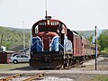 506 ENGINE.JPG 1.559 × 1.169; 599 KB
-
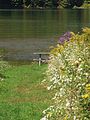 A Table by the Water (10064182003).jpg 2.736 × 3.648; 5,65 MB
-
 Apple Tree (10115718135).jpg 3.417 × 2.471; 6,41 MB
-
 Babb Creek, east from PA 287.JPG 2.048 × 1.536; 1.007 KB
-
 Babb Creek, west from PA 287.JPG 1.536 × 2.048; 1,26 MB
-
 Cedar run at mine hole run.jpg 4.288 × 2.848; 11,12 MB
-
 Cowanesque and Antrim Railway Plaque.jpg 1.536 × 2.048; 1,27 MB
-
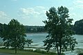
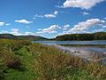 Cowanesque Lake (10064039604).jpg 3.648 × 2.736; 5,15 MB
-
 Cowanesque Lake (2) (10064126666).jpg 3.648 × 2.736; 3,96 MB
-
 Cowanesque Lake (3) (10064068015).jpg 3.648 × 2.736; 3,49 MB
-
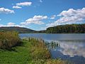
 Cowanesque Lake edited.jpg 2.560 × 1.920; 1,2 MB
-
 Cumulus Clouds (10064038154).jpg 3.648 × 2.736; 5,26 MB
-
 Daggett, PA Keystone Marker.jpg 834 × 626; 465 KB
-
 Doud Road (6255415586).jpg 2.430 × 1.732; 1,95 MB
-
 Doud Road bales (6255416944).jpg 2.560 × 1.920; 1,79 MB
-
 Doud Road farm (6254888225).jpg 2.560 × 1.920; 2,2 MB
-
 Fall Brook Coal Company Plaque.jpg 1.536 × 2.048; 1,31 MB
-
 Farmington Township McCollum Road.jpg 640 × 480; 110 KB
-
 Flickr - Nicholas T - Rise (1).jpg 3.735 × 2.149; 6,55 MB
-
 Gaines Township Afar.jpg 3.755 × 2.812; 9,41 MB
-
 Hall-As Equipment Co (6254889231).jpg 1.920 × 2.560; 1,24 MB
-
 Hills Creek State Park.jpg 3.008 × 2.000; 2,82 MB
-
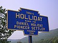 Holliday, PA Keystone Marker crop.jpg 688 × 516; 256 KB
-
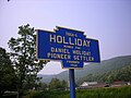 Holliday, PA Keystone Marker.jpg 1.024 × 768; 164 KB
-
 July 2016 Crooked Creek adventure - panoramio - Ron Shawley (37).jpg 3.936 × 5.248; 7,63 MB
-
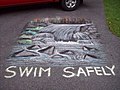 Lake visitors showcase their artistic talents (9369624835).jpg 960 × 720; 181 KB
-
 Lake visitors showcase their artistic talents (9369624997).jpg 960 × 720; 118 KB
-
 Lake visitors showcase their artistic talents (9372403754).jpg 960 × 720; 194 KB
-
 LHSP Pine Creek.JPG 2.000 × 3.008; 979 KB
-
 Lone tree 2 (5910125160).jpg 1.876 × 2.528; 2 MB
-
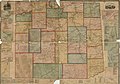 Map of Tioga County, Pennsylvania LOC 2012592021.jpg 18.766 × 13.115; 26,45 MB
-
 Map of Tioga County, Pennsylvania LOC 2012592021.tif 18.766 × 13.115; 704,14 MB
-
 Nessmuk Lake.jpg 500 × 375; 53 KB
-
 On a bench near Pine Creek - panoramio.jpg 2.048 × 1.536; 1,11 MB
-
 Original northern end of PA 287.jpg 1.024 × 768; 148 KB
-
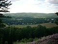 Overlooking Tioga (5909572101).jpg 2.560 × 1.920; 1,88 MB
-
 PA Cowanesque Lake US Corps of Enginners IMG 1869 Tioga County.JPG 3.456 × 4.802; 11,46 MB
-
 PA Cowanesque Lake US Corps of Enginners IMG 1870.JPG 3.456 × 5.081; 10,37 MB
-
 PA Cowanesque Lake US Corps of Enginners IMG 1871 Tioga County.JPG 5.184 × 3.456; 11,62 MB
-
 PA Cowanesque Lake US Corps of Enginners IMG 1872 Tioga County.JPG 5.184 × 3.456; 10,05 MB
-
 PA Cowanesque river and Lake NY Corning city IMG 1867 Tioga County.JPG 3.456 × 4.214; 8,43 MB
-
 PA Cowanesque river and Lake NY Corning city IMG 1868 Tioga County.JPG 3.456 × 4.190; 8,12 MB
-
 PA Cowanesque river Knoxville Elkland IMG 1865 Tioga County.JPG 5.184 × 3.456; 9,28 MB
-
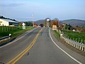 Pennsylvania Route 49 West (6264824550).jpg 2.560 × 1.918; 1,85 MB
-
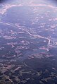
 Pennsylvania-Grand-Canyon-aerial-view.jpg 2.592 × 1.728; 1,04 MB
-
 Pine Creek Gorge Panorama Crop.JPG 775 × 550; 67 KB
-
 Pine Creek Gorge Panorama.jpg 2.261 × 550; 198 KB
-
 Pine Creek in yellow.jpg 2.592 × 1.944; 1,95 MB
-
 Reeds (10078813423).jpg 3.648 × 2.736; 6,04 MB
-
 Reflection (10078809393).jpg 2.736 × 3.648; 4,74 MB
-
 Roaring Branch, PA keystone marker.jpg 1.024 × 768; 302 KB
-
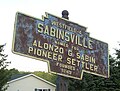 Sabinsville, PA Keystone Marker crop.jpg 668 × 506; 305 KB
-
 Sabinsville, PA Keystone Marker.jpg 768 × 1.024; 308 KB
-
 Signage along PA 287 and PA 414.jpg 640 × 480; 61 KB
-
 State Line (10093308444).jpg 2.736 × 3.648; 4,49 MB
-
 Tioga river.jpg 1.800 × 1.168; 2,1 MB
-
 USA Tioga County, Pennsylvania age pyramid.svg 520 × 600; 7 KB
-
 Winding road and landscape, Shippen, Pennsylvania, U.S.A.jpg 3.072 × 2.304; 5,91 MB
-

-
 School house, Tioga Co., Pa, by A. B. Stebbins.jpg 760 × 394; 39 KB
-
 Tioga Co, from Robert N. Dennis collection of stereoscopic views.jpg 760 × 388; 46 KB


.jpg)
.jpg)


.jpg)
_(10064126666).jpg)
_(10064068015).jpg)

.jpg)

.jpg)
.jpg)
.jpg)


.jpg)

.jpg)


.jpg)
.jpg)
.jpg)
.jpg)

.jpg)


.jpg)


.jpg)


.jpg)
.jpg)


.jpg)


