Category:Treshnish Isles
Aller à la navigation
Aller à la recherche
île britannique   | |||||
| Téléverser des médias | |||||
| Nature de l’élément | |||||
|---|---|---|---|---|---|
| Partie de | |||||
| Lieu | Argyll and Bute, Écosse | ||||
| Baigné par |
| ||||
| Propriétaire |
| ||||
| Comprend | |||||
| Point culminant |
| ||||
| Population |
| ||||
| site officiel | |||||
 | |||||
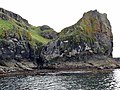
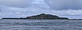
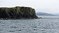
The Treshnish Isles is an archipelago of small islands and skerries, lying west of the Isle of Mull.
Sous-catégories
Cette catégorie comprend 9 sous-catégories, dont les 9 ci-dessous.
C
- Cairn na Burgh Beg (8 F)
- Cairn na Burgh More (14 F)
- Coll and Tiree (1903) (78 F)
F
- Fladda, Treshnish Isles (9 F)
L
S
- Sgeir an Eirionnaich (1 F)
- Sgeir an Fheòir, Argyll (1 F)
Média dans la catégorie « Treshnish Isles »
Cette catégorie comprend 37 fichiers, dont les 37 ci-dessous.
-
 Admiralty Chart No 2652 Loch Tuath Scotland (8209X5405), Published 1959.jpg 8 209 × 5 405 ; 5,31 Mio
-
 Beacon, Cairn na Burgh More - geograph.org.uk - 2455409.jpg 640 × 456 ; 163 kio
-
 Cairn na Burgh Beg (Beag) - Eastern tip - geograph.org.uk - 5834067.jpg 1 755 × 1 000 ; 1,22 Mio
-
 Cairn na Burgh More (Mòr) - geograph.org.uk - 5840644.jpg 1 500 × 1 000 ; 1,08 Mio
-
 Cairn na Burgh More ^ Cairn na Burgh Beg - geograph.org.uk - 5840610.jpg 3 034 × 1 000 ; 2,3 Mio
-
 Cairnburgh Castle - geograph.org.uk - 5840681.jpg 1 144 × 1 000 ; 885 kio
-
 Dùn Cruit - geograph.org.uk - 2586321.jpg 640 × 480 ; 105 kio
-
 Isle of Lunga.jpg 2 716 × 995 ; 660 kio
-
 Lunga - geograph.org.uk - 1456548.jpg 640 × 480 ; 65 kio
-
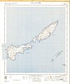 Ordnance Survey One-Inch Sheet 44 Coll & Tiree, Published 1955.jpg 8 897 × 10 702 ; 14,29 Mio
-
 Ordnance Survey One-Inch Sheet 52 Coll & Tiree, Published 1947.jpg 12 164 × 9 298 ; 7,81 Mio
-
 Oystercatchers, Sgeir an Fheòir - geograph.org.uk - 2454011.jpg 640 × 359 ; 215 kio
-
 Rocks off Cairn na Burgh Beg - geograph.org.uk - 2455393.jpg 640 × 359 ; 217 kio
-
 Ruins on Lunga, Treshnish Isles - geograph.org.uk - 3993109.jpg 427 × 640 ; 53 kio
-
 Sea canoes at Corran Lunga - geograph.org.uk - 2586417.jpg 640 × 480 ; 57 kio
-
 Sea cliffs near Haunn - geograph.org.uk - 270325.jpg 640 × 480 ; 92 kio
-
 Sgeir an Eirionnaich - geograph.org.uk - 2452769.jpg 640 × 359 ; 209 kio
-
 Sgeir an Eirionnaich - geograph.org.uk - 2452774.jpg 640 × 359 ; 205 kio
-
 Sgeir an Eirionnaich - geograph.org.uk - 2454009.jpg 640 × 359 ; 232 kio
-
 Sgeir na h-Iolaire - geograph.org.uk - 2454022.jpg 640 × 359 ; 203 kio
-
 Sgeirean Mòr - geograph.org.uk - 2453319.jpg 640 × 480 ; 290 kio
-
 Sgeirean na Giusaich - geograph.org.uk - 2452778.jpg 640 × 263 ; 131 kio
-
 Skerry, Cairn na Burgh islands - geograph.org.uk - 2455456.jpg 640 × 359 ; 206 kio
-
 Skerry, Treshnish Islands - geograph.org.uk - 2454014.jpg 640 × 359 ; 205 kio
-
 Sound between the Cairn na Burgh islands - geograph.org.uk - 2455450.jpg 640 × 300 ; 151 kio
-
 Southern end of Sgeir an Eirionnaich - geograph.org.uk - 2586423.jpg 640 × 480 ; 65 kio
-
 Sròn Urraidh - geograph.org.uk - 2454018.jpg 640 × 359 ; 191 kio
-
 Swell breaking over Tighchoie - geograph.org.uk - 2453781.jpg 640 × 343 ; 148 kio
-
 The Burghs, Treshnish Isles - geograph.org.uk - 6239760.jpg 1 024 × 768 ; 156 kio
-
 Tighcoie - geograph.org.uk - 2452763.jpg 640 × 359 ; 204 kio
-
 Treshnish Isles (31107985657).jpg 5 184 × 3 888 ; 9,05 Mio
-
 Treshnish Isles (32175945718).jpg 5 184 × 3 888 ; 9,17 Mio
-
 Treshnish Isles - Unnamed islets NW of Bogha Ruadh - geograph.org.uk - 5834106.jpg 3 183 × 1 000 ; 2,03 Mio
-
 Treshnish Isles from above Port Haunn - geograph.org.uk - 270321.jpg 640 × 333 ; 50 kio
-
 Treshnish Isles from above Port Haunn.jpg 610 × 294 ; 27 kio
-
 Treshnisheast.JPG 1 024 × 768 ; 419 kio
-
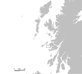 UK Treshnish.PNG 648 × 584 ; 20 kio
,_Published_1959.jpg)
_-_Eastern_tip_-_geograph.org.uk_-_5834067.jpg)
_-_geograph.org.uk_-_5840644.jpg)


.jpg)
.jpg)

