Category:Tsuchiura, Ibaraki
Zur Navigation springen
Zur Suche springen
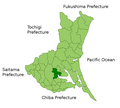
- English: Tsuchiura is a city in the Ibaraki prefecture, Japan. The population in 2005 is 134,974.
- Español: Tsuchiura es un municipio en la prefectura de Ibaraki, Japón. La población en 2005 es 134.974.
- 日本語: 土浦市(つちうらし)は日本の茨城県にある市である。2005年の人口は13万4974人。
Stadt in Japan   %E3%81%A8%E6%A1%9C%E7%94%BA%E4%BA%8C%E4%B8%81%E7%9B%AE(%E5%B0%86%E9%96%80%E5%9B%83%E5%AD%90%E4%B9%97%E6%BC%94)%E3%81%AE%E7%AB%B6%E6%BC%94.jpg)      | |||||
| Medium hochladen | |||||
| Ist ein(e) | |||||
|---|---|---|---|---|---|
| Ort | Präfektur Ibaraki, Japan | ||||
| Rechtsform |
| ||||
| Datum der Gründung, Erstellung, Entstehung, Erbauung |
| ||||
| Einwohnerzahl |
| ||||
| Fläche |
| ||||
| Höhe über dem Meeresspiegel |
| ||||
| Ersetzt |
| ||||
| offizielle Website | |||||
 | |||||
Unterkategorien
Es werden 12 von insgesamt 12 Unterkategorien in dieser Kategorie angezeigt:
In Klammern die Anzahl der enthaltenen Kategorien (K), Seiten (S), Dateien (D)
B
- Buses in Tsuchiura, Ibaraki (16 D)
C
- Camp Kasumigaura (61 D)
H
K
- Kamitakatsu Shell Mound (4 D)
L
P
S
- Shibanuma Soy Sauce (5 D)
- Shishitsuka-ōike (8 D)
T
Medien in der Kategorie „Tsuchiura, Ibaraki“
Folgende 176 Dateien sind in dieser Kategorie, von 176 insgesamt.
-
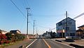
 197号線 - panoramio.jpg 1.994 × 1.122; 1,19 MB
-

-
 All-weather tennis court at Kawaguchi Sports Park (Tsuchiura City, Ibaraki Prefecture).jpg 6.016 × 4.016; 7,99 MB
-
 Asahi Pass - panoramio.jpg 1.600 × 1.200; 281 KB
-
 Asahi Pass Parking Lot at Ibaraki, Japan 01.jpg 5.568 × 3.712; 10,93 MB
-
 Asahi Pass Parking Lot at Ibaraki, Japan 02.jpg 5.568 × 3.712; 10,36 MB
-
 Asahi Tunnel Tsuchiura side, Dec 2012.jpg 3.264 × 2.448; 4,11 MB
-
 Atago-Jinja (Tsuchiura).JPG 2.048 × 1.536; 1,62 MB
-
 Busstop tsuchiurasyako.jpg 1.172 × 1.875; 682 KB
-
 Cherry Blossoms of River Sakura Bank.jpg 4.608 × 3.456; 3,91 MB
-
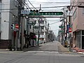
 Chuo 2 Tsuchiura-city.jpg 3.264 × 1.836; 2,06 MB
-
 Chuo 3 Tsuchiura-city.jpg 3.264 × 1.836; 1,71 MB
-
 Chuo Tsuchiura-city.jpg 3.264 × 1.836; 1,71 MB
-
 Chuo1 1 Tsuchiura-city.jpg 3.264 × 1.836; 1,83 MB
-
 Chuo1 2 Tsuchiura-city.jpg 3.264 × 1.836; 1,96 MB
-
 Clay tennis court at Kawaguchi Sports Park (Tsuchiura City, Ibaraki Prefecture).jpg 6.016 × 4.016; 8,46 MB
-
 Emblem of Tsuchiura, Ibaraki.svg 640 × 640; 2 KB
-
 End of Tsukuba-rinrin.jpg 1.280 × 960; 455 KB
-
 End point of Ibaraki prefectural rord Route 275 (Tsuchiura teisyajo line).JPG 2.272 × 1.704; 1,18 MB
-
 Flag of Tsuchiura, Ibaraki.png 900 × 600; 28 KB
-
 Flag of Tsuchiura, Ibaraki.svg 900 × 600; 2 KB
-
 Fujisaki 2 Tsuchiura-city.jpg 3.264 × 1.836; 1,68 MB
-
 Fujisaki Tsuchiura-city.JPG 2.592 × 1.944; 898 KB
-

-
 H-NAC CO.,LTD. Tsuchiura Factory.jpg 1.280 × 960; 288 KB
-
 HanaNoHasu3.jpg 4.928 × 3.264; 7,22 MB
-
 HanaNoHasu4.jpg 4.928 × 3.264; 4,78 MB
-
 HanaNoHasu5.jpg 4.928 × 3.264; 7,58 MB
-
 HanaNoHasu6.jpg 4.928 × 3.264; 6,32 MB
-
 HanaNoHasu7.jpg 3.775 × 2.715; 3,74 MB
-
 Higashi-Manabe Tsuchiura-city.jpg 3.264 × 1.836; 1,22 MB
-
 Hitachi-kenki tsuchiura.jpg 4.272 × 2.848; 3,17 MB
-
 Ibaraki Pref Road 199 in Mushikake, Tsuchiura.JPG 2.048 × 1.536; 1,17 MB
-
 Ibaraki pref road 199 in Mushikake.jpg 3.264 × 2.448; 2,02 MB
-
 Ibaraki prefectural road 55 (Higashi-odori).JPG 2.816 × 2.112; 1,72 MB
-
 Ibaraki prefectural road No.344 Manabe station line.jpg 3.184 × 2.448; 1,96 MB
-
 Ibaraki prefectural road route 199 (Ono-Tsuchiura line) in Kamisakata, Tsuchiura city.jpg 3.696 × 2.456; 6,05 MB
-
 Ibaraki prefectural road route 24 (Tsuchiura-Sakai line) in Senzoku-cho,Tsuchiura city.JPG 2.272 × 1.704; 1,25 MB
-
 Ibaraki prefectural road route 263 (Tsuchiura port line) in Chuo,Tsuchiura city.JPG 2.272 × 1.704; 1,17 MB
-
 IBS-Tsuchiura-JOYL.jpg 2.848 × 4.272; 3,29 MB
-
 Joban Line in Tsuchiura City 01.jpg 5.854 × 3.903; 5,63 MB
-
 Joban Line in Tsuchiura City 02.jpg 5.797 × 3.865; 7,31 MB
-
 Joban Line Tsuchiura Tsuchiura-city.jpg 3.264 × 1.836; 1,83 MB
-
 Jre415-1500.JPG 785 × 506; 63 KB
-
 Kantetsu green bus busstop nakanukijyujiro.jpg 1.112 × 1.858; 574 KB
-
 Kawaguchi Athletic Park Athletic Field (Tsuchiura City, Ibaraki Prefecture) 1.jpg 6.016 × 4.016; 8,83 MB
-
 Kawaguchi Athletic Park Athletic Field (Tsuchiura City, Ibaraki Prefecture) 2.jpg 6.016 × 4.016; 8,94 MB
-
 Kawaguchi Athletic Park Athletic Field (Tsuchiura City, Ibaraki Prefecture) 3.jpg 6.016 × 4.016; 9,32 MB
-
 Kita-Arakawaoki Machi Tsuchiura-city.JPG 2.592 × 1.944; 1,36 MB
-
 Koshikake-rock of Ono-no-Komachi - panoramio.jpg 1.920 × 1.280; 2,75 MB
-
 Lonely tree mound - panoramio.jpg 2.048 × 1.536; 789 KB
-
 Lotus field in Tsuchiura, Ibaraki 01.jpg 3.888 × 2.592; 3,71 MB
-
 Lotus field in Tsuchiura, Ibaraki 02.jpg 3.888 × 2.592; 3,26 MB
-
 Many Many White-cheeked Starlings on a tree.jpg 3.456 × 4.608; 2,74 MB
-
 Max-coffee-history.JPG 2.000 × 3.008; 1,23 MB
-
 Mizu Jinngu in Tsuchiura.jpg 960 × 1.280; 274 KB
-
 Nagakuni 2 Tsuchiura-city.jpg 1.280 × 720; 587 KB
-
 Nagakuni Tsuchiura-city.jpg 1.280 × 720; 521 KB
-
 Nagakuni-Dai Tsuchiura-city.jpg 3.264 × 1.836; 2,62 MB
-
 Nagakuni-Dai2 Tsuchiura.jpg 3.264 × 1.836; 3,04 MB
-
 Nagakuni-Dai3 Tsuchiura.jpg 3.264 × 1.836; 3,46 MB
-
 Nagakuni-Dai4 Tsuchiura.jpg 3.264 × 1.836; 3,82 MB
-
 Nagakuni-Higashi Machi Tsuchiura-city.jpg 3.264 × 1.836; 1,59 MB
-
 Naka 1 Tsuchiura-city.JPG 2.592 × 1.944; 479 KB
-
 Naka 2 Tsuchiura-city.jpg 3.264 × 1.836; 1,88 MB
-
 Naka 3 Tsuchiura-city.jpg 3.264 × 1.836; 1,73 MB
-
 Naka 4 Tsuchiura-city.jpg 1.280 × 720; 364 KB
-
 Nakamura-Higashi Tsuchiura-city.JPG 2.592 × 1.944; 1,17 MB
-
 Nakamura-Minami 6 Tsuchiura-city.JPG 2.592 × 1.944; 482 KB
-
 Nature of Shishitsuka.jpg 960 × 1.280; 331 KB
-
 NDL-DC 2586549-43 Kawase Hasui S0609 crd.jpg 4.370 × 6.208; 3,25 MB
-
 NDL-DC 2586549-43 Kawase Hasui S0609.jpg 7.108 × 8.560; 4,56 MB
-
 Nishine-Nishi 1 Tsuchiura-city.JPG 1.920 × 1.080; 454 KB
-
 Nishine-Nishi 2 Tsuchiura-city.JPG 1.920 × 1.080; 704 KB
-
 Nishine-Nishi 3 Tsuchiura-city.JPG 1.920 × 1.080; 272 KB
-
 Nishine-Nishi 4 Tsuchiura-city.JPG 1.920 × 1.080; 784 KB
-
 Nishine-Nishi1 1 Tsuchiura-city.JPG 1.920 × 1.080; 434 KB
-
 Ono, Tsuchiura, Ibaraki Prefecture 300-4108, Japan - panoramio (1).jpg 3.872 × 2.592; 3,13 MB
-
 Ono, Tsuchiura, Ibaraki Prefecture 300-4108, Japan - panoramio.jpg 1.920 × 1.280; 2,72 MB
-
 Oroshi-Machi 1 Tsuchiura-city.jpg 1.280 × 720; 432 KB
-
 Oroshi-Machi 2 Tsuchiura-city.jpg 1.280 × 720; 316 KB
-
 Oroshi-Machi 3 Tsuchiura-city.JPG 1.920 × 1.080; 514 KB
-
 Otto-Minami Park Tsuchiura-city.JPG 2.592 × 1.944; 1,65 MB
-
 Otto-Minami1 flat Tsuchiura-city.JPG 1.920 × 1.080; 491 KB
-
 Otto-Minami1-21 flat Tsuchiura-city.JPG 1.920 × 1.080; 548 KB
-
 Otto-Minami1-3 Tsuchiura-city.jpg 1.280 × 720; 484 KB
-
 Otto-Minami2 2 Tsuchiura-city.JPG 2.592 × 1.944; 1,25 MB
-
 Otto-Minami2 Tsuchiura-city.JPG 1.920 × 1.080; 420 KB
-
 Otto-Minami3 Tsuchiura-city.JPG 2.592 × 1.944; 565 KB
-
 Otto-Numa Park Tsuchiura-city.jpg 1.280 × 720; 385 KB
-
 R125-188.jpg 2.736 × 1.536; 1,06 MB
-
 Redtail Catfish in Kasumigaura General Park.jpg 4.608 × 3.456; 4,06 MB
-
 Route 125 (Tsutiura-Nihari Bypass) in Obatake,Tsuchiura city,Japan.JPG 3.696 × 2.456; 4,85 MB
-
 Route 199 in Tsuchiura City.png 3.024 × 4.032; 8,42 MB
-
 Sakuramachi2chome, Tsuchiura.jpg 240 × 320; 33 KB
-
 Sanoko, Tsuchiura, Ibaraki Prefecture 300-0803, Japan - panoramio.jpg 1.600 × 1.200; 346 KB
-
 South Sakuramachi in Tsuchiura.JPG 2.204 × 1.584; 1,08 MB
-
 Terminal of the table Tsukuba skyline.jpg 6.016 × 4.016; 10,16 MB
-
 The Asahi pass parking for Ibaraki prefectural road 236 (Tsukuba park-Nagai line).JPG 3.696 × 2.456; 3,38 MB
-
 TIU2ndCampus.jpg 2.048 × 1.536; 722 KB
-
 Tsuchiura Bypass Tsuchiura-city.JPG 1.920 × 1.080; 595 KB
-
 Tsuchiura city center area Aerial photograph.1990.jpg 8.618 × 5.606; 39,5 MB
-
 Tsuchiura city Ibaraki prefecture Japan.svg 534 × 688; 18 KB
-
 Tsuchiura city viewed from Tojo-ji temple - panoramio.jpg 1.920 × 1.280; 1,66 MB
-
 Tsuchiura downtown Tsuchiura-city.jpg 3.264 × 1.836; 2,17 MB
-
 Tsuchiura Gakuen Line at Boundary Area.jpg 240 × 320; 34 KB
-
 Tsuchiura in Ibaraki Prefecture Ja.svg 450 × 567; 17 KB
-
 Tsuchiura Kirara Street Entrance.JPG 2.304 × 1.728; 1,67 MB
-
 Tsuchiura montage.JPG 303 × 312; 60 KB
-
 Tsuchiura Montage2.jpg 1.024 × 1.210; 472 KB
-
 Tsuchiura newway Bus stop.JPG 794 × 1.204; 193 KB
-
 Tsuchiura newway1.JPG 1.632 × 1.224; 810 KB
-
 Tsuchiura newway2.JPG 1.632 × 1.224; 861 KB
-
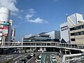 Tsuchiura Station West Tsuchiura-city.jpg 3.264 × 2.448; 1,62 MB
-
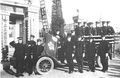 Tsuchiura Town Firefight Group.png 1.345 × 869; 1,19 MB
-
 Tsuchiura-Bypass 2.JPG 1.920 × 1.080; 525 KB
-
 Tsuchiura-city-2005-8.JPG 1.280 × 960; 167 KB
-
 Tsuchiura-Sakura-River-2018040101.jpg 2.560 × 1.920; 1,81 MB
-
 Tsuchiura-Sakura-River-2018040102.jpg 3.264 × 2.448; 3,23 MB
-
 Tsuchiura-Sakura-River-2018040103.jpg 2.560 × 1.920; 1,57 MB
-
 Tsuchiura-shuku.JPG 2.048 × 1.536; 1,58 MB
-
 Tsuchiura.png 197 × 238; 4 KB
-
 Tsuchiurakirara tanabatakazari.jpg 1.600 × 1.200; 552 KB
-
 TsuchiuraMap.PNG 1.001 × 901; 53 KB
-
 TsuchiuraSeal.jpg 200 × 197; 54 KB
-
 TsuchiuraShi2004.jpg 640 × 480; 80 KB
-
 Tsuchiurayasakajinjakeyaki.JPG 1.920 × 2.560; 1,79 MB
-
 Tsuchiurayasakajinjamukunoki1.JPG 1.920 × 2.560; 1,94 MB
-
 Tsuchiurayasakajinjamukunoki2.JPG 1.920 × 2.560; 1,79 MB
-
 Tsukuba rinrin road in Manabe 1,Tsuchiura city.JPG 2.272 × 1.704; 1,37 MB
-
 Tsukuba rinrin road in Tsuchiura.jpg 640 × 480; 63 KB
-
 Tsutiurashi.jpg 2.240 × 1.680; 207 KB
-
 Watching Starry Sky at Lake Kasumigaura at Tsuchiura, Japan (56536614).jpg 1.363 × 2.048; 906 KB
-
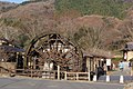
 Water-wheal of Komachi-no-sato, Tsuchiura, Japan - panoramio.jpg 1.920 × 1.280; 2,59 MB
-
 Water-wheal, Komachi-no-sato, Tsuchiura, Japan - panoramio.jpg 1.920 × 1.280; 2,63 MB
-
 Welcome Monument of Kasumigaura.jpg 960 × 1.280; 130 KB
-
 Yukiiriyama and Asahi Pass (Ibaraki, Japan).jpg 5.568 × 3.712; 10,45 MB
-
 リンリンロード - panoramio.jpg 8.192 × 1.856; 5,25 MB
-
 二尾の狐.jpg 1.655 × 2.348; 1,23 MB
-
 国道354号線 - panoramio.jpg 3.057 × 1.918; 2,39 MB
-
 国道6号-学園東大通 - panoramio.jpg 3.167 × 1.788; 2,55 MB
-
 国道6号-学園東大通1 - panoramio.jpg 1.008 × 1.433; 584 KB
-
 土浦.gif 575 × 443; 126 KB
-
 土浦バイパス - panoramio.jpg 3.135 × 1.766; 2,79 MB
-
 土浦バイパス-2 - panoramio.jpg 2.353 × 1.326; 1,58 MB
-
 土浦城 1000118.jpg 3.072 × 2.304; 3,47 MB
-
 土浦市下坂田付近の風景 - panoramio (1).jpg 5.184 × 3.456; 2,21 MB
-
 土浦市下坂田付近の風景 - panoramio (2).jpg 5.184 × 3.456; 1,85 MB
-
 土浦市下坂田付近の風景 - panoramio.jpg 5.184 × 3.456; 2,05 MB
-
 土浦市朝日峠からつくば市と富士山 - panoramio.jpg 2.736 × 1.824; 2,78 MB
-
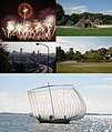
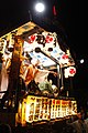
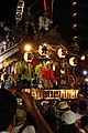 土浦市民山車~新川囃子道神組~.jpg 2.240 × 3.360; 3,66 MB
-
 土浦市街地の遠景.jpg 4.608 × 3.456; 4,13 MB
-
 地図-茨城県土浦市-2006.png 236 × 233; 6 KB
-
 安村江痴の墓.jpg 4.320 × 3.240; 4,87 MB
-
 小田治朝の墓.jpg 4.320 × 3.240; 4,61 MB
-
 小田治朝の墓所.jpg 3.888 × 2.592; 5,5 MB
-
 帰ってゆく新川囃子新城組.jpg 2.240 × 3.360; 3,79 MB
-
 新川囃子連合.jpg 1.920 × 1.080; 574 KB
-
 桜川より土浦駅方向 - panoramio.jpg 600 × 800; 325 KB
-
 桜町三丁目(大和囃子乗演)と桜町二丁目(将門囃子乗演)の競演.jpg 4.856 × 3.238; 4,45 MB
-
 江戸時代の道標.jpg 3.456 × 4.608; 5,62 MB
-
 沖宿町からの眺め.jpg 3.888 × 2.592; 2,11 MB
-
 田土部(濠跡) - panoramio.jpg 4.320 × 3.240; 2,99 MB
-
 県道197号線 - panoramio (1).jpg 3.221 × 1.814; 2,81 MB
-
 県道197号線 - panoramio.jpg 2.428 × 1.364; 1,59 MB
-
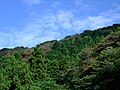 筑波山朝日峠の夏の緑 - panoramio.jpg 1.600 × 1.200; 441 KB
-
 筑波山癒しの里 - panoramio.jpg 2.736 × 1.824; 2,73 MB
-
 花室川 西根橋.jpg 1.536 × 2.048; 914 KB
-
 荒川沖駅から霞ヶ浦駐屯地までの専用線跡.jpg 1.280 × 960; 361 KB
-
 蓮田(れんこん) - panoramio.jpg 2.736 × 1.824; 3,61 MB
-
 近世は漁業・水運で栄えた沖宿港.jpg 1.600 × 1.200; 532 KB
-
 間近.jpg 4.000 × 6.000; 9,94 MB
-
 霞ヶ浦 - panoramio (2).jpg 5.184 × 3.456; 1,64 MB
-
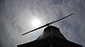 霞ヶ浦風車 - panoramio.jpg 1.920 × 1.080; 437 KB
-
 馬頭観音の石碑。.jpg 3.456 × 4.608; 5,98 MB
-
 鹿島神社(土浦市沖宿町)参道.jpg 4.608 × 3.456; 3,62 MB


.jpg)


.JPG)


.jpg)

.JPG)


_2021.jpg)


.JPG)

_in_Kamisakata,_Tsuchiura_city.jpg)
_in_Senzoku-cho,Tsuchiura_city.JPG)
_in_Chuo,Tsuchiura_city.JPG)


_1.jpg)
_2.jpg)
_3.jpg)


.jpg)


_in_Obatake,Tsuchiura_city,Japan.JPG)


.JPG)


.jpg)


.jpg)


.jpg)
.jpg)


.jpg)


_-_panoramio.jpg)


.jpg)


