Category:U.S. Route 25E in Tennessee
Jump to navigation
Jump to search
section of U.S. Numbered Highway in Tennessee, United States   | |||||
| Upload media | |||||
| Instance of | |||||
|---|---|---|---|---|---|
| Part of | |||||
| Location | Tennessee | ||||
| Transport network | |||||
| Owned by | |||||
| Maintained by | |||||
| Length |
| ||||
| Terminus | |||||
| |||||
English: Media related to U.S. Route 25E in Tennessee (US 25E), a 65.9-mile (106.1 km) section of U.S. Numbered Highway in Tennessee, United States, that connects U.S. Route 25/U.S. Route 70/Tennessee State Route 9/Tennessee State Route 32 in Newport with US 25E in Kentucky.
Subcategories
This category has the following 2 subcategories, out of 2 total.
C
- Cumberland Gap Tunnel (16 F)
Media in category "U.S. Route 25E in Tennessee"
The following 34 files are in this category, out of 34 total.
-
 11W25EJunction.jpg 3,272 × 2,304; 1.46 MB
-

-

-
-
 Appalachian Corridor S, Grainger County, TN.jpg 4,032 × 2,688; 2.85 MB
-
 Bean Station historical marker on US 25E.jpg 2,816 × 3,336; 1.07 MB
-
 Bean Station neighborhoods II.jpg 1,280 × 853; 228 KB
-
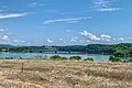
 Cherokee Lake from Clinch Mountain (1).jpg 4,000 × 3,000; 414 KB
-
 Construction on US 25E at SR 160, 1976.jpg 1,644 × 1,138; 760 KB
-
 Cornette's Motel, on U.S. 25E and Cherokee Lake, 2 mi. N. of Morristown, Tenn (83697).jpg 3,307 × 2,074; 2.65 MB
-
 Cumberland Gap, Tennessee, from Pinnacle Overlook.jpg 2,560 × 1,440; 700 KB
-
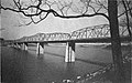 D.A. Green Bridge.jpg 1,393 × 875; 416 KB
-

-
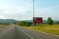
 East Tennessee Crossing Byway sign.jpg 3,264 × 2,448; 1.03 MB
-
 Harrogate-US25E-tn.jpg 4,276 × 2,840; 4.61 MB
-
 Miller Road.jpg 3,778 × 2,796; 3.93 MB
-

-
 Old 11W and New 11W-25E bypass.jpg 3,492 × 2,329; 2.82 MB
-
 Old 25E (Broadway Drive).jpg 1,280 × 853; 233 KB
-
 Old US 25E sign.jpg 768 × 1,024; 168 KB
-
 Olen R. Marshall (TN-32) Bridge.jpg 4,018 × 2,681; 3.13 MB
-
 TN-32Grainger.png 2,048 × 1,536; 4.05 MB
-
 U.S. Route 25E - Crosby, TN - 1979.jpg 1,797 × 1,223; 291 KB
-
 U.S. Route 25E - Wyatt Village, TN - 1979.jpg 1,791 × 1,241; 327 KB
-
 US 25E - Morristown - Crockett Trace.jpg 3,345 × 2,231; 2.32 MB
-
 US 25E - Morristown - Liberty Heights.jpg 4,032 × 2,687; 2.78 MB
-
 US 25E at US 11W, Bean Station, TN, 1981 - Realignment page-0001.jpg 3,058 × 2,218; 1.41 MB
-
 US 25E at Walters State, Morristown, TN.jpg 3,131 × 2,236; 1.32 MB
-
 US 25E right-of-way engineering drawing.jpg 848 × 1,257; 317 KB
-
 US 25E Tennessee 1926.svg 1,485 × 1,440; 33 KB
-
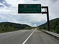
 US 25E Warning Signs near Cumberland Gap.JPG 2,608 × 1,739; 1.28 MB
-
 Veterans Overlook U.S. Route 25E.jpg 4,000 × 3,000; 1.1 MB
-
 Veterans Overlook US 25E (1).jpg 3,264 × 2,448; 1.1 MB
-
 Veterans Overlook US 25E (2).jpg 3,264 × 2,448; 962 KB


_just_southeast_of_Cumberland_Gap_in_Claiborne_County,_Tennessee.jpg)


.jpg)

.jpg)


_-_NARA_-_68886670.gif)

.jpg)

_Bridge.jpg)


.jpg)
.jpg)