Category:U.S. Route 450 in Utah
Jump to navigation
Jump to search
section of former U.S. Numbered Highway in Grand and San Juan counties in Utah, United States  | |||||
| Upload media | |||||
| Instance of | |||||
|---|---|---|---|---|---|
| Part of | |||||
| Location |
| ||||
| Transport network | |||||
| Inception |
| ||||
| Dissolved, abolished or demolished date |
| ||||
| Length |
| ||||
| Terminus | |||||
| Replaced by | |||||
 | |||||
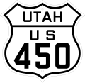
English: Media related to U.S. Route 450 in Utah (US 450), a roughly 102-mile (164 km) section of former U.S. Numbered Highway in Grand and San Juan counties in Utah, United States, that connected U.S. Route 50 in Valley City Junction, Utah with US 450 in Colorado.
In 1939 all of US 450 was added to U.S. Route 160 (US 160). However, the western end of US 160 (the north‑south section between Crescent Junction and Monticello) was later renumbered U.S. Route 163 and eventually U.S. Route 191. The section of US 160 between Monticello and Cortez, Colorado was renumbered U.S. Route 666 and then U.S. Route 491. The western end of US 160 was routed from Cortez south to end at U.S. Route 89, just east of the Tuba City Airport in Coconino County, Arizona.
In 1939 all of US 450 was added to U.S. Route 160 (US 160). However, the western end of US 160 (the north‑south section between Crescent Junction and Monticello) was later renumbered U.S. Route 163 and eventually U.S. Route 191. The section of US 160 between Monticello and Cortez, Colorado was renumbered U.S. Route 666 and then U.S. Route 491. The western end of US 160 was routed from Cortez south to end at U.S. Route 89, just east of the Tuba City Airport in Coconino County, Arizona.
Subcategories
This category has the following 3 subcategories, out of 3 total.
*
Media in category "U.S. Route 450 in Utah"
This category contains only the following file.
-
 US 450 Utah 1926.svg 1,485 × 1,440; 29 KB
