Category:U.S. Route 550 in New Mexico
Jump to navigation
Jump to search
States of the United States: Colorado · New Mexico
section of U.S. Numbered Highway in Sandoval, Rio Arriba, and San Juan counties in New Mexico, United States   | |||||
| Upload media | |||||
| Instance of | |||||
|---|---|---|---|---|---|
| Location |
| ||||
| Transport network | |||||
| Owned by | |||||
| Maintained by | |||||
| Length |
| ||||
| Terminus | |||||
| |||||
English: Media related to U.S. Route 550 in New Mexico, a 174.885-mile (281.450 km) section of U.S. Numbered Highway in Sandoval, Rio Arriba, and San Juan counties in New Mexico, United States, that connects Interstate 25/U.S. Route 85 and New Mexico State Road 165 in Bernalillo with U.S. Route 550 in Colorado.
Subcategories
This category has only the following subcategory.
Media in category "U.S. Route 550 in New Mexico"
The following 9 files are in this category, out of 9 total.
-
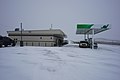 44 Store on U.S. Route 550 near Nageezi, New Mexico, February 2019.jpg 6,000 × 4,000; 10.19 MB
-
 Continential Divide sign, near La Jara, NM.JPG 3,296 × 2,472; 1.03 MB
-
 Cuba, New Mexico.JPG 3,456 × 2,304; 3.23 MB
-
 Int25nRoad-Exit242-US550nNM165e (35942044444).jpg 2,400 × 1,600; 1.71 MB
-
 US 550 New Mexico 1926.svg 1,485 × 1,440; 34 KB
-
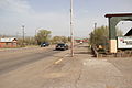
 US Route 550 at New Mexico State Road 197.jpg 3,264 × 2,448; 2.05 MB
-
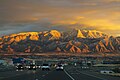 US Route 550 with Sandia Mountains (32133362550).jpg 2,400 × 1,600; 1.71 MB
-
 US550 MM111.JPG 2,576 × 1,932; 751 KB
-
 Water Tank (4334460673).jpg 680 × 900; 259 KB


.jpg)


.jpg)

.jpg)