Category:Uckfield
Zur Navigation springen
Zur Suche springen
Kleinstadt im Vereinigten Königreich  | |||||
| Medium hochladen | |||||
| Ist ein(e) | |||||
|---|---|---|---|---|---|
| Ort | Wealden, East Sussex, Südostengland, England | ||||
| Fläche |
| ||||
| offizielle Website | |||||
 | |||||
Български: мини|300п|Главната улица в Ъкфийлд
English: Uckfield is a town in the Wealden district of East Sussex, in southern England. It is located on the southern edge of the Weald and on the River Uck, one of the tributaries of the River Ouse.
Nederlands: Uckfield is een plaats in het bestuurlijke gebied Wealden, in het Engelse graafschap East Sussex. De plaats telt 15.000 inwoners.
Polski: Uckfield to miasto leżące w hrabstwie East Sussex na południu Anglii w pobliżu Brighton. Populacja miasteczka wynosi 15 000.
Română: Uckfield este un oraş în comitatul East Sussex, regiunea South East, Anglia. Oraşul se află în districtul Wealden.
Unterkategorien
Es werden 9 von insgesamt 9 Unterkategorien in dieser Kategorie angezeigt:
In Klammern die Anzahl der enthaltenen Kategorien (K), Seiten (S), Dateien (D)
B
- Buses in Uckfield (2 D)
H
- Hooke Hall (3 D)
M
- Milestone in Uckfield (2 D)
O
- Oasts in Uckfield (16 D)
R
- River Uck (24 D)
U
- Uckfield railway station (35 D)
- Uckfield War Memorial (2 D)
Medien in der Kategorie „Uckfield“
Folgende 200 Dateien sind in dieser Kategorie, von 428 insgesamt.
(vorherige Seite) (nächste Seite)-
 "Maidens Head" public house, Uckfield - geograph.org.uk - 4143048.jpg 921 × 1.200; 297 KB
-
 "The Station" public house, Uckfield - geograph.org.uk - 4142023.jpg 1.600 × 997; 395 KB
-
 125-129 High Street, Uckfield - geograph.org.uk - 4427097.jpg 640 × 463; 157 KB
-
 194-198 High Street, Uckfield - geograph.org.uk - 3659927.jpg 490 × 640; 158 KB
-
 2016, a year on Geograph (Day 155) - geograph.org.uk - 4979465.jpg 640 × 480; 47 KB
-
 224-226 High Street (geograph 5776151).jpg 3.578 × 2.683; 1,33 MB
-
 43 miles to London - geograph.org.uk - 3474542.jpg 2.666 × 4.000; 3,12 MB
-
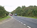 A22 Uckfield bypass road - geograph.org.uk - 59199.jpg 640 × 480; 212 KB
-
 A22, Uckfield bypass - geograph.org.uk - 4016775.jpg 640 × 430; 61 KB
-

-

-

-
 A26, Uckfield bypass, northbound - geograph.org.uk - 1839054.jpg 640 × 430; 59 KB
-
 A272 off the A26 - geograph.org.uk - 4012890.jpg 640 × 430; 77 KB
-
 Acres, Uckfield - geograph.org.uk - 4979469.jpg 640 × 480; 90 KB
-
 Allotment by New Road - geograph.org.uk - 2540108.jpg 640 × 480; 176 KB
-
 Alma Arms, Framfield Road - geograph.org.uk - 5365736.jpg 5.202 × 3.465; 2,76 MB
-

-
 Ardingly Sandstone crags, Lake Wood - geograph.org.uk - 5800246.jpg 1.024 × 768; 472 KB
-
 Ardingly Sandstone crags, Lake Wood - geograph.org.uk - 5800254.jpg 1.024 × 768; 444 KB
-
 Ardingly Sandstone crags, Lake Wood - geograph.org.uk - 5800271.jpg 1.024 × 768; 465 KB
-
 Ardingly Sandstone outcrop and path, Lake Wood - geograph.org.uk - 5799306.jpg 1.024 × 768; 539 KB
-
 Ardingly Sandstone outcrop, Lake Wood - geograph.org.uk - 5799478.jpg 1.024 × 768; 535 KB
-
 Ardingly Sandstone outcrop, Lake Wood - geograph.org.uk - 5799595.jpg 1.024 × 768; 470 KB
-
 B2101 - geograph.org.uk - 3003737.jpg 640 × 430; 36 KB
-
 B2102 - geograph.org.uk - 4016752.jpg 640 × 430; 60 KB
-
 Bank (4037176099).jpg 2.592 × 1.944; 2,06 MB
-

-

-
 Baxendale Way, Fernley Park, Uckfield - geograph.org.uk - 2830124.jpg 4.320 × 3.240; 4,05 MB
-
 Bedford Place - geograph.org.uk - 4852213.jpg 640 × 426; 62 KB
-
 Bell lane - geograph.org.uk - 4852226.jpg 640 × 426; 48 KB
-
 Bell Lane Roundabout, Uckfield - geograph.org.uk - 4067814.jpg 1.024 × 768; 146 KB
-
 Bell Lane, Uckfield - geograph.org.uk - 5560803.jpg 4.896 × 3.672; 5,74 MB
-
 Bellbrook Business Park - geograph.org.uk - 3010133.jpg 640 × 430; 49 KB
-
 Belmont Centre, Uckfield - geograph.org.uk - 4142430.jpg 1.600 × 1.050; 547 KB
-
 Blocked underpass at Lake Wood - geograph.org.uk - 5362092.jpg 4.896 × 3.672; 5,21 MB
-
 Bluauto - geograph.org.uk - 4852209.jpg 640 × 392; 50 KB
-
 Board walk in West Park Local Nature Reserve, Uckfield - geograph.org.uk - 5619638.jpg 2.816 × 2.112; 2,52 MB
-
 Bridge Cottage - geograph.org.uk - 3003740.jpg 640 × 430; 45 KB
-
 Bridge Cottage - geograph.org.uk - 3010100.jpg 640 × 430; 69 KB
-
 Bridge Cottage, High Street - geograph.org.uk - 5776141.jpg 4.000 × 3.000; 2,44 MB
-
 Bridge Cottage, High Street - geograph.org.uk - 5776142.jpg 3.776 × 2.832; 1,72 MB
-
 Bridge Cottage, Uckfield - geograph.org.uk - 3302428.jpg 4.320 × 3.240; 5,31 MB
-
 Bridge Cottage, Uckfield - geograph.org.uk - 4142143.jpg 1.600 × 1.113; 654 KB
-
 Bridge Farm Rd - geograph.org.uk - 3010084.jpg 640 × 430; 59 KB
-
 Bridge over the A22 - geograph.org.uk - 4012894.jpg 640 × 430; 88 KB
-
 Bridge over the A22, Uckfield bypass - geograph.org.uk - 3497776.jpg 640 × 430; 62 KB
-
 Bridge over the A26, Uckfield bypass - geograph.org.uk - 2871074.jpg 640 × 430; 43 KB
-
 Brown Lane, Uckfield, Sussex - geograph.org.uk - 2390944.jpg 2.715 × 1.818; 3,15 MB
-
 Brown's Lane - geograph.org.uk - 2998737.jpg 640 × 430; 60 KB
-
 Browns Lane - geograph.org.uk - 4852210.jpg 640 × 426; 50 KB
-
 Car Dealer, Uckfield - geograph.org.uk - 1376112.jpg 640 × 480; 69 KB
-
 Car dealer, Uckfield - geograph.org.uk - 1376128.jpg 640 × 480; 60 KB
-
 Car Dealer, Uckfield - geograph.org.uk - 1376144.jpg 640 × 480; 61 KB
-
 Cessation of Hostilities (3656648031).jpg 1.280 × 1.024; 317 KB
-
 Chilli Pepper @ The Hop Barn - geograph.org.uk - 2632328.jpg 640 × 480; 77 KB
-
 Church - panoramio (62).jpg 1.397 × 572; 1,17 MB
-
 Church House, Uckfield - geograph.org.uk - 4142064.jpg 1.299 × 1.600; 646 KB
-
 Church House, Uckfield - geograph.org.uk - 4427214.jpg 545 × 640; 182 KB
-
 Church of The Holy Cross, Uckfield - geograph.org.uk - 4143009.jpg 839 × 1.200; 274 KB
-
 Church Street junction with Belmont Road - geograph.org.uk - 3491460.jpg 3.526 × 2.667; 1,44 MB
-
 Church Street, Uckfield - geograph.org.uk - 3004561.jpg 970 × 727; 175 KB
-
 Church Street, Uckfield - geograph.org.uk - 3007498.jpg 1.130 × 821; 170 KB
-
 Church Street, Uckfield in 1967 - geograph.org.uk - 2510391.jpg 969 × 666; 102 KB
-
 Church, Framfield Rd - geograph.org.uk - 3003773.jpg 640 × 430; 63 KB
-
 Churchyard entrance and lamp, Uckfield - geograph.org.uk - 4142965.jpg 798 × 1.200; 345 KB
-
 Churchyard, Holy Cross church, Uckfield - geograph.org.uk - 4142970.jpg 1.024 × 675; 196 KB
-
 Churchyard, Holy Cross church, Uckfield - geograph.org.uk - 4142989.jpg 1.024 × 681; 213 KB
-
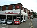
 Citroen garage, Uckfield - geograph.org.uk - 2756356.jpg 1.600 × 1.226; 336 KB
-
 Civic Approach - geograph.org.uk - 4857562.jpg 640 × 426; 63 KB
-
 Clock tower, Tesco, Uckfield - geograph.org.uk - 3361568.jpg 1.600 × 1.181; 180 KB
-
 Cock and Bull - geograph.org.uk - 58874.jpg 640 × 480; 239 KB
-
 Copping Hall, Church St (geograph 6764925).jpg 1.024 × 684; 253 KB
-
 Coppinghall, Uckfield - geograph.org.uk - 4427069.jpg 640 × 561; 320 KB
-
 Copwood Roundabout - geograph.org.uk - 1839048.jpg 640 × 386; 48 KB
-
 Cottages from churchyard - geograph.org.uk - 3183912.jpg 1.000 × 667; 184 KB
-
 Cottages, New Road, Ridgewood - geograph.org.uk - 4105306.jpg 640 × 428; 108 KB
-
 Crag by lake, Lake Wood - geograph.org.uk - 5800033.jpg 1.024 × 768; 441 KB
-

-
 Culinary street name, Uckfield - geograph.org.uk - 4142117.jpg 1.146 × 475; 452 KB
-
 Date stone for old Uckfield Bridge - geograph.org.uk - 3302426.jpg 2.104 × 3.238; 1,96 MB
-
 Date stone, Belmont Centre, Uckfield - geograph.org.uk - 4142374.jpg 1.432 × 1.169; 496 KB
-
 Derelict units, Hempstead Lane - geograph.org.uk - 2998719.jpg 640 × 430; 73 KB
-
 Detail of 103 High Street, Uckfield - geograph.org.uk - 4427092.jpg 460 × 640; 174 KB
-
 Detail of Church House, Uckfield - geograph.org.uk - 4427218.jpg 559 × 640; 195 KB
-
 Detail of Picture House, Uckfield - geograph.org.uk - 4427119.jpg 640 × 533; 162 KB
-
 Dixon Vince, High St - geograph.org.uk - 3001372.jpg 640 × 430; 55 KB
-
 Downlands Farm, Uckfield looking north west - geograph.org.uk - 5607310.jpg 1.600 × 1.200; 1,07 MB
-
 East Sussex Motor Centre on London Road, Budlett's Common - geograph.org.uk - 5612786.jpg 2.816 × 2.112; 1,76 MB
-
 Eastbourne Rd - geograph.org.uk - 4857573.jpg 640 × 426; 36 KB
-

-
 End of the line at Uckfield - geograph.org.uk - 5365751.jpg 5.202 × 3.465; 4,34 MB
-
 Entrance to Snatt's Road cemetery, Uckfield - geograph.org.uk - 5540253.jpg 2.700 × 1.980; 1,6 MB
-
 Entrance to West Park Local Nature Reserve - geograph.org.uk - 5362157.jpg 4.896 × 3.672; 5,41 MB
-
 Field at Ridgewood Farm - geograph.org.uk - 1741111.jpg 640 × 480; 62 KB
-
 Field by the A22, Uckfield - geograph.org.uk - 4913744.jpg 2.026 × 1.506; 888 KB
-
 Field edge north of Lake Wood - geograph.org.uk - 5800310.jpg 1.024 × 768; 404 KB
-
 Field edge, Uckfield - geograph.org.uk - 1748698.jpg 640 × 428; 111 KB
-
 Following the fence - geograph.org.uk - 3001339.jpg 640 × 430; 98 KB
-
 Foot tunnel under Rocks Road - geograph.org.uk - 5799293.jpg 768 × 1.024; 389 KB
-
 Foot tunnel, Lake Wood, Uckfield - geograph.org.uk - 5800173.jpg 1.024 × 768; 487 KB
-
 Foot tunnel, Lake Wood, Uckfield - geograph.org.uk - 5800184.jpg 1.024 × 768; 382 KB
-
 Footbridge on the Wealdway - geograph.org.uk - 2995859.jpg 640 × 430; 126 KB
-
 Footpath around the college grounds - geograph.org.uk - 3001332.jpg 640 × 430; 88 KB
-
 Footpath by the fence - geograph.org.uk - 3001337.jpg 640 × 430; 100 KB
-
 Footpath into Uckfield - geograph.org.uk - 3001331.jpg 640 × 430; 96 KB
-
 Footpath parallel to Hempstead Lane - geograph.org.uk - 2998757.jpg 640 × 430; 117 KB
-
 Footpath parallel to Hempstead Lane - geograph.org.uk - 2998772.jpg 640 × 430; 125 KB
-
 Footpath parallel to Hempstead Lane - geograph.org.uk - 2998778.jpg 640 × 430; 132 KB
-
 Ford's Green, Sussex (8602014610).jpg 1.652 × 1.927; 1,55 MB
-
 Former car dealership, Ringles Cross, Uckfield - geograph.org.uk - 2830086.jpg 4.320 × 3.240; 3,85 MB
-
 Former post office, Uckfield - geograph.org.uk - 4142217.jpg 1.271 × 1.600; 595 KB
-
 Former Roller Mill - geograph.org.uk - 383550.jpg 479 × 640; 165 KB
-
 Former signal box, Uckfield - geograph.org.uk - 4239450.jpg 640 × 480; 95 KB
-
 Former Uckfield National School house (dated 1850) - geograph.org.uk - 4142414.jpg 1.351 × 1.600; 608 KB
-
 Forward defensive stroke, Uckfield - geograph.org.uk - 2526701.jpg 1.600 × 881; 314 KB
-
 Framfield Rd - geograph.org.uk - 3010079.jpg 640 × 430; 37 KB
-
 Framfield Rd, B2102 - geograph.org.uk - 4857571.jpg 640 × 426; 70 KB
-
 Framfield Road - geograph.org.uk - 2632316.jpg 640 × 480; 109 KB
-
 Framfield Road in Uckfield New Town - geograph.org.uk - 3491448.jpg 3.648 × 2.736; 1,38 MB
-
 Framfield Road, Uckfield - geograph.org.uk - 2750520.jpg 1.600 × 1.153; 382 KB
-
 Framfield Road, Uckfield - geograph.org.uk - 3004544.jpg 1.011 × 758; 166 KB
-
 Fross, Uckfield (15541609125).jpg 3.332 × 1.982; 3,71 MB
-
 Game over, Victoria Pleasure Ground, Uckfield - geograph.org.uk - 2526716.jpg 1.600 × 1.200; 474 KB
-
 Garden shed among massive sandrocks, Uckfield - geograph.org.uk - 5625021.jpg 2.108 × 1.597; 1,33 MB
-
 Grange Rd - geograph.org.uk - 3001393.jpg 640 × 430; 68 KB
-
 Grange Rd - geograph.org.uk - 4852214.jpg 640 × 426; 66 KB
-
 Grassland near Uckfield - geograph.org.uk - 5362059.jpg 4.896 × 3.672; 6,11 MB
-
 Gravestones marked as dangerous (of toppling), Uckfield - geograph.org.uk - 5541190.jpg 1.831 × 1.266; 1,06 MB
-
 Green and Gold Raqs Position.png 1.236 × 1.731; 3,6 MB
-
 Halford, Bell Lane - geograph.org.uk - 3010141.jpg 640 × 430; 40 KB
-
 Halfords, Uckfield - geograph.org.uk - 4857560.jpg 640 × 426; 44 KB
-
 Halfords, Uckfield - geograph.org.uk - 5027253.jpg 640 × 426; 58 KB
-
 Hall ^ Woodhouse sign - geograph.org.uk - 2540107.jpg 480 × 640; 107 KB
-
 Harcourt Rd - geograph.org.uk - 3003776.jpg 640 × 430; 57 KB
-
 Harlands Farm - panoramio.jpg 1.897 × 808; 493 KB
-
 Hempstead Gardens - geograph.org.uk - 3001349.jpg 640 × 430; 45 KB
-
 Hempstead Lane - geograph.org.uk - 2998709.jpg 640 × 430; 121 KB
-
 Hempstead Lane - geograph.org.uk - 2998721.jpg 640 × 430; 75 KB
-
 Hempstead Lane - geograph.org.uk - 3001330.jpg 640 × 430; 97 KB
-
 Hempstead Mill (former mill house) - geograph.org.uk - 2998703.jpg 640 × 430; 82 KB
-
 Hempstead Mill - geograph.org.uk - 2998689.jpg 640 × 430; 63 KB
-
 Hempstead Rise - geograph.org.uk - 3001358.jpg 640 × 430; 78 KB
-
 Hempstead Water Mill house - geograph.org.uk - 59170.jpg 640 × 480; 290 KB
-
 Hempsted Mill - geograph.org.uk - 2998694.jpg 640 × 430; 84 KB
-
 High St - geograph.org.uk - 4852219.jpg 640 × 426; 56 KB
-
 High St - geograph.org.uk - 4857563.jpg 640 × 426; 63 KB
-
 High St. - panoramio (1).jpg 1.741 × 808; 436 KB
-
 High St. - panoramio.jpg 1.678 × 808; 486 KB
-
 High Street - geograph.org.uk - 2632331.jpg 640 × 480; 94 KB
-
 High Street - geograph.org.uk - 2632348.jpg 640 × 480; 90 KB
-
 High Street - geograph.org.uk - 5776117.jpg 4.000 × 3.000; 1,59 MB
-
 High Street - geograph.org.uk - 5776127.jpg 4.000 × 3.000; 1,65 MB
-
 High Street - geograph.org.uk - 5776130.jpg 4.000 × 3.000; 1,46 MB
-
 High Street shops, Uckfield - geograph.org.uk - 4142097.jpg 1.600 × 1.084; 413 KB
-
 High Street, Uckfield - geograph.org.uk - 1376120.jpg 640 × 480; 61 KB
-
 High Street, Uckfield - geograph.org.uk - 1981632.jpg 1.024 × 768; 197 KB
-
 High Street, Uckfield - geograph.org.uk - 2113525.jpg 1.600 × 1.200; 338 KB
-
 High Street, Uckfield - geograph.org.uk - 3004515.jpg 1.044 × 783; 154 KB
-
 High Street, Uckfield - geograph.org.uk - 3007531.jpg 959 × 708; 178 KB
-
 High Street, Uckfield - geograph.org.uk - 3659923.jpg 640 × 405; 111 KB
-
 Highview Lane - geograph.org.uk - 4857575.jpg 640 × 426; 87 KB
-

-
 Houses and bollards, Lashbrooks Road, Rocks Park - geograph.org.uk - 5619620.jpg 2.102 × 1.513; 1,09 MB
-

-
 Houses in Uckfield, Sussex - geograph.org.uk - 2390969.jpg 3.872 × 2.592; 5,13 MB
-
 Houses, Framfield Rd - geograph.org.uk - 3003767.jpg 640 × 430; 60 KB
-
 Houses, Manor Park, Uckfield - geograph.org.uk - 3147716.jpg 640 × 428; 122 KB
-
 HSBC, High St - geograph.org.uk - 3003726.jpg 640 × 430; 59 KB
-
 Hunter's Way, Uckfield with sandrock cliffs - geograph.org.uk - 5625030.jpg 2.489 × 1.809; 1,37 MB
-
 Hunters Way from Hunters Shaw by Snatt's Road, Uckfield - geograph.org.uk - 5625302.jpg 2.816 × 2.112; 2,02 MB
-
 Industrial units on Bell Lane Uckfield - geograph.org.uk - 3116215.jpg 3.264 × 2.448; 3,67 MB
-

-
 Inside Longwood Gill, Downlands Farm, Uckfield - geograph.org.uk - 5612815.jpg 1.600 × 1.200; 1,4 MB
-
 Junction of Framfield Road and High St, Uckfield - geograph.org.uk - 5365744.jpg 5.202 × 3.465; 3,39 MB
-
 Lake and sandrock exposures at Lake Wood near Uckfield - geograph.org.uk - 5613244.jpg 2.816 × 2.112; 3,26 MB
-
 Lake and sandstone outcrop, Lake Wood - geograph.org.uk - 5799505.jpg 1.024 × 768; 396 KB
-
 Lake and sandstone outcrop, Lake Wood - geograph.org.uk - 5799608.jpg 1.024 × 768; 337 KB
-
 Lake Wood - geograph.org.uk - 3294156.jpg 3.456 × 2.304; 4,32 MB
-
 Lake Wood - geograph.org.uk - 3294236.jpg 3.456 × 2.304; 7,3 MB
-
 Lake Wood - geograph.org.uk - 5799996.jpg 1.024 × 768; 566 KB
-
 Lake, Lake Wood, Uckfield - geograph.org.uk - 5793763.jpg 1.024 × 768; 315 KB
-
 Lavička u jezírka - panoramio.jpg 1.770 × 808; 831 KB
-
 Layby, A22 - geograph.org.uk - 3497778.jpg 640 × 430; 70 KB
-
 Layby, A22, Uckfield bypass - geograph.org.uk - 3497780.jpg 640 × 404; 68 KB
-
 Lealands Drive Extra Care Scheme - geograph.org.uk - 1748747.jpg 640 × 428; 80 KB
-
 Lewes - Uckfield 1858 - 2008 (3562675583).jpg 2.592 × 1.944; 2,06 MB
-
 Lewes District , Uckfield Scenery - geograph.org.uk - 3107489.jpg 3.216 × 2.136; 2,32 MB
-
 Lewes Rd - geograph.org.uk - 4016768.jpg 640 × 430; 63 KB
-
 Lewes Road, Uckfield - geograph.org.uk - 1376177.jpg 640 × 480; 59 KB
-
 Lewes Road, Uckfield - geograph.org.uk - 4242153.jpg 640 × 480; 80 KB
-
 Lewes Road, Uckfield - geograph.org.uk - 4242157.jpg 640 × 480; 67 KB
-
 Uckfield Library.jpg 2.560 × 1.920; 2,12 MB
-
 Lime Tree Avenue - geograph.org.uk - 3001351.jpg 640 × 430; 88 KB
-
 Linden Chase - geograph.org.uk - 3001357.jpg 640 × 430; 66 KB
-
 LloydsTSB bank, High Street, Uckfield - geograph.org.uk - 2750533.jpg 1.600 × 1.094; 374 KB
-
 London Rd - geograph.org.uk - 5027246.jpg 640 × 426; 57 KB
-
 London Rd - geograph.org.uk - 5027248.jpg 640 × 426; 63 KB
-
 London Road, Budlett's Common, Sussex - geograph.org.uk - 2390918.jpg 3.872 × 2.592; 5,11 MB


_-_geograph.org.uk_-_4979465.jpg)
.jpg)


.jpg)


.jpg)


.jpg)


.jpg)


_-_geograph.org.uk_-_4142414.jpg)


.jpg)


,_Uckfield_-_geograph.org.uk_-_5541190.jpg)


_-_geograph.org.uk_-_2998703.jpg)


.jpg)


.jpg)


.jpg)