Category:Valleys
Sari la navigare
Sari la căutare
low area between hills, often with a river running through it  | |||||
| Încarcă multimedia | |||||
| Subclasă a |
| ||||
|---|---|---|---|---|---|
| Diferit(ă) de | |||||
| Considerat identic cu | dene | ||||
| |||||
Deutsch: Täler sind langgestreckte Hohlformen des Erdreliefs.
English: Valleys are depressions with predominant extent in one direction, usually with running water. Valleys are not canyons
Français : Une vallée est une dépression géologique tout en longueur façonnée dans le relief par un cours d'eau ou un glacier.
Slovenščina: Doline so geografska površinska oblike, ki je ponavadi nižina, obkrožena z višjimi površinami.
- See also:
- Category:Rivers, as nearly all valleys are run through by rivers
Subcategorii
Această categorie conține următoarele 23 de subcategorii, dintr-un total de 23.
!
'
*
- Paleovalleys (8 F)
+
?
- Unidentified valleys (15 F)
B
E
G
- Glaciers cutting off valleys (3 F)
H
I
V
~
Fișiere media din categoria „Valleys”
Următoarele 200 fișiere se află în această categorie, dintr-un total de 574.
(pagina anterioară) (pagina următoare)-
 'Hure valley.jpg 5.472x3.648; 13,84 MB
-
 030111-GhahanValley-IMG 0939-2.jpg 3.000x2.000; 920 KB
-
 A guest house in Pahalgam.jpg 1.504x3.264; 1,98 MB
-
 A panoramic view of Betab valley in Gulmarg.jpg 1.596x492; 183 KB
-
 A valley with a river at Njiro Arusha.jpg 6.000x4.000; 3,74 MB
-
 Across the Wide Valley.jpg 8.064x6.476; 10,81 MB
-
 Akosombo landscape view.jpg 6.000x4.000; 19,39 MB
-
 Ales Krivec 2014-11-10 (Unsplash hsAUHYxJGDA).jpg 7.360x4.912; 17,88 MB
-
 Arma Konda trek 05.jpg 4.928x3.264; 2,56 MB
-
 Arma Konda trek 06.jpg 4.928x3.264; 1,78 MB
-
 Ashcombe bottom entrance.jpg 2.146x3.816; 2,51 MB
-
-

-
-
-

-

-
-

-
-

-

-

-

-
-

-

-

-
-

-

-

-

-
-
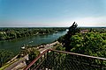
 Avignon - Jardin des Doms (Rocher des Doms) - View East along Rhône river.jpg 3.978x5.969; 17,06 MB
-
-
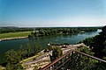
 Avignon - Jardin des Doms (Rocher des Doms) - View NE on Rhône river valley.jpg 5.969x3.978; 17,78 MB
-
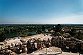
 Avignon - Jardin des Doms (Rocher des Doms) - View NW on Rhône river.jpg 5.837x3.891; 15,28 MB
-
-

-

-

-

-
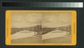
 Bird's-eye view of the valley (NYPL b11707252-G89F310 002F).tiff 3.072x1.664; 14,63 MB
-
 City and Valley of Hot Springs, looking south (NYPL b11707252-G89F310 005F).tiff 3.072x1.708; 15,01 MB
-
 At the Hacienda, New Almaden (NYPL b11707278-G89F341 012F).tiff 3.072x1.771; 15,57 MB
-
 At the Hacienda, New Almaden (NYPL b11707278-G89F341 013F).tiff 3.072x1.796; 15,79 MB
-

-
 Bear Valley and Yuba Canyon from Emigrant Gap (NYPL b11707292-G89F367 053F).tiff 3.072x1.815; 15,95 MB
-

-
-

-

-
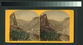
 In Yosemite Valley, California (NYPL b11707299-G89F375 016F).tiff 3.072x1.726; 15,17 MB
-
 Yosemite Valley from Inspiration Point (NYPL b11707300-G89F376 005F).tiff 3.072x1.768; 15,54 MB
-
 Panorama of Yosemite Valley, California (NYPL b11707300-G89F376 024F).tiff 3.072x1.888; 16,6 MB
-
 Yosemite from above (NYPL b11707301-G89F377 017F).tiff 3.072x1.674; 14,72 MB
-
 Yosemite Valley, California (NYPL b11707301-G89F377 043ZF).tiff 3.072x1.951; 17,15 MB
-
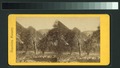
 Tuolumne Valley (NYPL b11707302-G89F378 049F).tiff 3.072x1.767; 15,53 MB
-
 Mt. Lyell, Tuolumne Valley (NYPL b11707302-G89F378 006F).tiff 3.072x1.742; 15,31 MB
-
 The Valley, from Moonlight Rock (NYPL b11707308-G89F384 028F).tiff 3.072x1.753; 15,41 MB
-
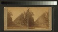
 Valley from Lookout Rock (NYPL b11707308-G89F384 030F).tiff 3.072x1.747; 15,36 MB
-
 Early morning in the Mariposa Trail (NYPL b11707308-G89F384 046ZF).tiff 3.072x1.949; 17,13 MB
-
 From the base of the Third Fall of the Yosemite (NYPL b11707308-G89F384 055ZF).tiff 3.072x1.944; 17,09 MB
-
 The Valley from Panorama Rock (NYPL b11707308-G89F384 077ZF).tiff 3.072x1.986; 17,46 MB
-

-
 Princeville plantaion, Hanalei, Kauai (NYPL b11707436-G90F159 015F).tiff 3.072x1.705; 14,99 MB
-
 A sugar-cane mill, Hawaii. (Geo. Unit no. 19A) (NYPL b11707436-G90F159 024F).tiff 3.072x1.788; 15,72 MB
-
-

-
 View of a lake or river from a farm (NYPL b11707504-G90F226 007F).tiff 3.072x1.673; 14,71 MB
-
 General view of Winchendon, stone fence in foreground (NYPL b11707551-G90F288 004F).tiff 3.072x1.687; 14,83 MB
-
 Long's Park, from Mt. Olympus (NYPL b11707577-G90F034 012ZF).tiff 3.072x1.898; 16,68 MB
-
 From top Old Man Mountain, looking east (NYPL b11707577-G90F034 014ZF).tiff 3.072x1.926; 16,93 MB
-
 Middle Park (Blue River) (NYPL b11707577-G90F034 015ZF).tiff 3.072x1.839; 16,17 MB
-
 A ranch from a high rocky vantage (NYPL b11707605-G90F004 007F).tiff 3.072x1.784; 15,68 MB
-
 Valley of the Merrimac (NYPL b11707963-G91F011 059F).tiff 3.072x1.636; 14,38 MB
-
 Valley of the Connecticut (NYPL b11707963-G91F011 019F).tiff 3.072x1.740; 15,3 MB
-
 Valley of the Saco (NYPL b11707963-G91F011 043F).tiff 3.072x1.628; 14,31 MB
-
 Valley of the Saco (NYPL b11707963-G91F011 044F).tiff 3.072x1.686; 14,82 MB
-
 Valley of the Merrimac (NYPL b11707963-G91F011 060B).tiff 3.072x1.676; 14,73 MB
-
 Valley of the Saco (NYPL b11707963-G91F011 077ZF).tiff 3.072x2.042; 17,95 MB
-

-
 North Conway Valley and Ledges, from Artist's Ledge (NYPL b11708087-G91F028 081F).tiff 3.072x1.683; 14,79 MB
-
 Valley of the Merrimack, Hookset, N.H (NYPL b11708173-G91F042 009F).tiff 3.072x1.656; 14,56 MB
-
 Valley of the Catskill Creek, with Mountains (NYPL b11708210-G91F086 048ZF).tiff 2.956x2.085; 17,63 MB
-
 View from Laurel House, Catskill Mts., N.Y (NYPL b11708210-G91F086 050ZF).tiff 2.964x2.019; 17,12 MB
-
 Rock formations (NYPL b11708947-G92F130 015ZF).tiff 3.072x1.935; 17,01 MB
-

-
 Down Bow Valley, Banff, Alta (NYPL b12647398-62649).tiff 2.388x1.482; 10,13 MB
-
 Winooski Valley and Mt. Mansfield, Burlington, Vt (NYPL b12647398-62841).tiff 2.408x1.458; 10,05 MB
-
 La haute vallée (NYPL b13472277-483437).jpg 4.482x4.400; 4,31 MB
-
 La haute vallée (NYPL b13472277-483437).tiff 4.482x4.111; 52,72 MB
-
-

-
 Bagram Valley in 2010 -a.jpg 1.600x956; 1,61 MB
-
 Bancales Villarejo del Valle.JPG 2.560x1.440; 782 KB
-
 Barah .gif 1.920x1.064; 874 KB
-
 Beauty3.jpg 3.264x1.840; 1,71 MB
-
 Berwick, NS B0P, Canada - panoramio - wolfvilleian.jpg 2.304x1.728; 1.013 KB
-
 Berwick, NS B0P, Canada - panoramio.jpg 2.304x1.728; 1.007 KB
-
 Betab Valley123.jpg 3.264x2.448; 3,47 MB
-
 Bicher.jpg 1.792x1.200; 513 KB
-
 Bike trail closed sign - panoramio.jpg 3.472x2.604; 1,24 MB
-
 Binghamton, NY Overlook (7121728113) (2).jpg 22.487x5.000; 15,14 MB
-
 Bird Rock (Craig-y-Deryn) in Dysynni Valley (6802249457).jpg 1.600x1.200; 255 KB
-
 Black Forest Trail Vista (1) (9540213785).jpg 5.184x2.775; 9,36 MB
-
 Blackcap's meadow above Ashcombe Bottom East.jpg 3.827x2.168; 2,5 MB
-
 Blick auf die Umgebung.jpg 5.184x3.456; 1,84 MB
-
 Boen dass Goherabad.jpg 3.264x2.448; 3,95 MB
-
 Brahmagiri Valley.jpg 2.048x1.536; 1,05 MB
-
 Browned (8177486291).jpg 5.153x3.456; 15,41 MB
-
 Buzul vadi.webp 1.024x1.024; 79 KB
-

-
-

-
 Chama Valley.jpg 7.118x3.056; 2,43 MB
-
 Chilum valley.JPG 4.000x2.660; 4,04 MB
-
 Chilum, Astore.JPG 2.592x1.944; 2,28 MB
-
 Chitlang Village.jpg 4.000x3.000; 3,31 MB
-
 Chuchiñi, Salamanca.JPG 3.648x2.736; 2,46 MB
-
 Chuchiñi.JPG 3.648x2.736; 2,34 MB
-
 Cilgarron Castle, Pembrokeshire 13 April 1776.jpeg 649x800; 188 KB
-
 Ciurlionis-Raigardas.jpeg 1.989x567; 202 KB
-
 Cloudy Sajek Valley.jpg 4.160x3.120; 3,54 MB
-
 Corno Scale Balzo Ora Scaffaiolo 2019 (35).jpg 3.264x2.448; 2,93 MB
-
 Corno Scale Balzo Ora Scaffaiolo 2019 (36).jpg 3.264x2.448; 6,5 MB
-
 Corno Scale Balzo Ora Scaffaiolo 2019 (37).jpg 3.264x2.448; 4,05 MB
-
 Corno Scale Balzo Ora Scaffaiolo 2019 (39).jpg 3.264x2.448; 5,38 MB
-
 Corno Scale Balzo Ora Scaffaiolo 2019 (6).jpg 3.264x2.448; 7,1 MB
-

-
 Crack on the edge.jpg 720x511; 122 KB
-
 Cwmafan Landscape - panoramio.jpg 5.184x3.456; 5,81 MB
-
 Cwmavon from Ynysygwas - panoramio.jpg 6.705x2.999; 11,94 MB
-
 Cwmavon Panorama from Mynydd Dinas - panoramio.jpg 11.786x3.328; 23,78 MB
-
 Cânion Barbosa.jpg 960x720; 79 KB
-
 Dades Gorge (4989115091).jpg 2.048x1.365; 836 KB
-
 Dades Gorge (4989115699).jpg 1.365x2.048; 771 KB
-
 Dades Gorge (4989116051).jpg 2.048x1.365; 1,34 MB
-
 Dades Gorge (4989117711).jpg 2.048x1.365; 1,1 MB
-
 Dades Gorge (4989118105).jpg 1.365x2.048; 1,26 MB
-
 Dades Gorge (4989721934).jpg 1.365x2.048; 1,5 MB
-
 Dades Gorge (4989722700).jpg 2.048x1.365; 1,39 MB
-
 Daintree Lerderderg.jpg 4.870x3.917; 12,67 MB
-
 Dead Sea - panoramio (1).jpg 999x666; 257 KB
-
 Deep Valley Of Shimla.jpg 3.264x2.448; 2,43 MB
-
 Dense brush surrounding St. Thomas (2a398d15-d4c1-4f04-8256-16c502f6b990).jpg 5.228x3.485; 6,43 MB
-
 Descending to Princess Louisa Inlet (6444793191).jpg 1.584x2.376; 1,44 MB
-
 Değirmen Dere Vadisi.jpg 480x270; 49 KB
-
 Di Lembah Kaki Gunung Sago.jpg 4.160x1.968; 2,36 MB
-
-
 Divine Valley.jpg 1.280x721; 95 KB
-
 Down to Entwhistle Barn from the Blackburn road - panoramio.jpg 3.072x2.304; 3,33 MB
-
 Driving sheep through the valley (5127907229).jpg 1.862x1.330; 932 KB
-

-
 El paraiso entre Cachiy Salta..JPG 2.560x1.920; 2,32 MB
-
 El valle del Clamores (Segovia).jpg 2.048x1.232; 1,23 MB
-
 Eliphant point mahabaleshwar.jpg 720x540; 46 KB
-
 Entwhistle Bottoms - panoramio.jpg 3.072x2.304; 3,07 MB
-
 Erosion i floddal i Anderna. Sydamerika - SMVK - 002439.tif 2.213x2.725; 34,53 MB
-
 ESTIVA2017OUTONO1.jpg 4.608x3.072; 5,6 MB
-
 ESTIVA2017OUTONO2.jpg 4.608x3.072; 6,55 MB
-
 Evergreen mountains of Volta region Ghana.jpg 4.000x6.000; 18,83 MB
-
-
 Fabian Schneiter 2017 (Unsplash).jpg 3.946x2.081; 8,57 MB
-
 Ferrocarril Mexicano locomotive overlooking valley (21658529509).jpg 1.000x727; 484 KB
-
 Flowing water in the valley.jpg 2.048x1.536; 458 KB
-
 Flying along sun-lit mountains (6444804435).jpg 2.376x1.584; 1,04 MB
-
 Window, view, valley Fortepan 8734.jpg 3.362x2.530; 4,46 MB
-
 1914 Fortepan 86532.jpg 3.098x3.382; 5,07 MB
-

-
 Foundation Remains at St. Thomas (075f43a0-53cd-437a-a303-e4703e16961f).jpg 8.324x5.549; 14,38 MB
-
 Foundation Remains at St. Thomas (10d3045e-7bde-4a34-a4e2-c24f4e423e59).jpg 5.472x3.648; 7,18 MB
-
 Foundation Remains at St. Thomas (604190cd-20be-48c7-af7f-947123997f58).jpg 5.184x3.456; 10,24 MB
-
 Foundation Remains at St. Thomas (6f8661e2-4fc4-482c-b076-1a724bc99fb8).jpg 3.738x4.984; 6,73 MB
-
 Foundation Remains at St. Thomas (743f1e8d-7832-4869-97c5-e10eaad99845).jpg 5.442x3.628; 5,18 MB
-

-
 Foundation Remains at St. Thomas (ddab7d19-e89d-493e-aaad-d9554f6555a8).jpg 5.184x3.456; 7,39 MB
-
 Foundation Remains at St. Thomas (e311f147-bbfb-4c44-af45-b0cbabae894e).jpg 5.159x3.439; 10,5 MB
-
 Fourmile Vista (1) (29448547356).jpg 3.874x3.456; 12,52 MB
-
 Frys Chocolate Factory in the Mist - panoramio.jpg 1.200x800; 631 KB
-
 Ghor Province (4208191461).jpg 2.816x2.112; 1,15 MB
-
 Glacial Valley (3735730413).jpg 2.592x3.888; 4,06 MB
-
 Gorce Jaworzynka panorama.jpg 7.160x1.735; 8,2 MB
-
 Gory Sowie 01.jpg 3.648x2.736; 6,15 MB
-

-
 Grand View Trail (Revisited) (4) (8464053586).jpg 5.184x3.456; 8,22 MB
-
 Grassy valley near Woodland, WA.jpg 1.836x3.264; 3,7 MB
-
 Grays Peak Trail viewed from high on Grays Peak.jpg 3.264x1.836; 1,87 MB
-
 Great view from plane.jpg 4.000x3.000; 4,07 MB
-
 Green Valley (4208020515).jpg 403x604; 87 KB
-
 Green valley 03.jpg 3.200x2.400; 2,18 MB
-
 Greenery in valley.jpg 3.264x1.836; 1,37 MB
-
 Greetings from Boudes Ferry, O. (12840909724).jpg 3.242x2.065; 1,47 MB
-
 Greetings from Boudes Ferry, O. (14091414164).jpg 3.242x2.065; 2,59 MB
-
 Greetings from Boudes Ferry, O. (14111034233).jpg 3.258x2.065; 2,67 MB
-
 Greetings from Boudes Ferry, O. (2) (12659969785).jpg 3.258x2.065; 8,53 MB
-
 Grižnik.jpg 4.032x3.024; 9,7 MB
-
 Grose Valley from Govett's Leap. - panoramio.jpg 2.560x1.920; 2,07 MB
-
 Gudamaqari.jpg 3.984x2.656; 2,02 MB


.jpg)


_-_Belv%C3%A9d%C3%A8re_Panoramique_du_Rh%C3%B4ne_-_Panorama_View_over_Rh%C3%B4ne_valley_02.jpg)
_-_Belv%C3%A9d%C3%A8re_Panoramique_du_Rh%C3%B4ne_-_Panorama_View_over_Rh%C3%B4ne_valley_03.jpg)
_-_Belv%C3%A9d%C3%A8re_Panoramique_du_Rh%C3%B4ne_-_Panorama_View_over_Rh%C3%B4ne_valley_04.jpg)
_-_Belv%C3%A9d%C3%A8re_Panoramique_du_Rh%C3%B4ne_-_Panorama_View_over_Rh%C3%B4ne_valley_05.jpg)
_-_Belv%C3%A9d%C3%A8re_Panoramique_du_Rh%C3%B4ne_-_Panorama_View_over_Rh%C3%B4ne_valley_06.jpg)
_-_Panorama_View_from_the_top_of_the_rocks_on_the_Rh%C3%B4ne_river_valley_01.jpg)
_-_Panorama_View_from_the_top_of_the_rocks_on_the_Rh%C3%B4ne_river_valley_02.jpg)
_-_Panorama_View_from_the_top_of_the_rocks_on_the_Rh%C3%B4ne_river_valley_03.jpg)
_-_Panorama_View_from_the_top_of_the_rocks_on_the_Rh%C3%B4ne_river_valley_04.jpg)
_-_Panorama_View_from_the_top_of_the_rocks_on_the_Rh%C3%B4ne_river_valley_05.jpg)
_-_Panorama_View_on_Ramparts_of_Avignon,_Pont_Saint-B%C3%A9n%C3%A9zet_(Pont_d%27Avignon)_1177-85_%26_Rh%C3%B4ne_valley_02.jpg)
_-_Panorama_View_on_Ramparts_of_Avignon,_Pont_Saint-B%C3%A9n%C3%A9zet_(Pont_d%27Avignon)_1177-85_%26_Rh%C3%B4ne_valley_03.jpg)
_-_Panorama_View_on_Ramparts_of_Avignon,_Pont_Saint-B%C3%A9n%C3%A9zet_(Pont_d%27Avignon)_1177-85_%26_Rh%C3%B4ne_valley_04.jpg)
_-_Panorama_View_on_Ramparts_of_Avignon,_Pont_Saint-B%C3%A9n%C3%A9zet_(Pont_d%27Avignon)_1177-85_%26_Rh%C3%B4ne_valley_05.jpg)
_-_Panorama_View_on_Ramparts_of_Avignon,_Pont_Saint-B%C3%A9n%C3%A9zet_(Pont_d%27Avignon)_1177-85_%26_Rh%C3%B4ne_valley_06.jpg)
_-_Panorama_View_on_Ramparts_of_Avignon,_Pont_Saint-B%C3%A9n%C3%A9zet_(Pont_d%27Avignon)_1177-85_%26_Rh%C3%B4ne_valley_07.jpg)
_-_Panorama_View_towards_Rh%C3%B4ne_valley_%26_Fort_Saint-Andr%C3%A9_02.jpg)
_-_Panorama_View_towards_Rh%C3%B4ne_valley_%26_Fort_Saint-Andr%C3%A9_03.jpg)
_-_Panorama_View_towards_Rh%C3%B4ne_valley_%26_Fort_Saint-Andr%C3%A9_04.jpg)
_-_View_East_along_Rh%C3%B4ne_river.jpg)
_-_View_East_towards_Panorama_View_over_the_Rh%C3%B4ne_valley.jpg)
_-_View_NE_on_Rh%C3%B4ne_river_valley.jpg)
_-_View_NW_on_Rh%C3%B4ne_river.jpg)

.jpg)
.jpg)
.jpg)
.jpg)


_in_Dysynni_Valley_(6802249457).jpg)
_(9540213785).jpg)


.jpg)

.jpeg)

.jpeg)


.jpg)
.jpg)
.jpg)
.jpg)
.jpg)
.jpeg)


.jpg)
.jpg)
.jpg)
.jpg)
.jpg)
.jpg)
.jpg)

.jpg)
.jpg)
.jpg)


_ahead.jpg)


.jpg)

.jpg)


.jpg)
.jpg)

.jpg)


.jpg)
.jpg)
.jpg)
.jpg)
.jpg)
.jpg)
.jpg)
.jpg)
.jpg)
_(29448547356).jpg)

.jpg)
.jpg)

.jpg)
_(4)_(8464053586).jpg)


.jpg)


.jpg)
.jpg)
.jpg)
_(12659969785).jpg)


_-_Belv%C3%A9d%C3%A8re_Panoramique_du_Rh%C3%B4ne_-_Panorama_View_over_Rh%C3%B4ne_valley_01.jpg)
_-_Panorama_View_on_Ramparts_of_Avignon,_Pont_Saint-B%C3%A9n%C3%A9zet_(Pont_d%27Avignon)_1177-85_%26_Rh%C3%B4ne_valley_01.jpg)
_-_Panorama_View_over_the_river_Rh%C3%B4ne_valley_01.jpg)
_-_Panorama_View_towards_Rh%C3%B4ne_valley_%26_Fort_Saint-Andr%C3%A9_01.jpg)
_(2).jpg)