Category:Vorderweidenthal
Salti al navigilo
Salti al serĉilo
komunumo en Rejnlando-Palatinato, Germanio    | |||||
| Alŝuti plurmedion | |||||
| Estas |
| ||||
|---|---|---|---|---|---|
| Loko | Verbandsgemeinde Bad Bergzabern, distrikto Südliche Weinstraße, Rejnlando-Palatinato, Germanio | ||||
| Loĝantaro |
| ||||
| Areo |
| ||||
| Supermara alteco |
| ||||
| oficiala retejo | |||||
 | |||||
Dosieroj en kategorio “Vorderweidenthal”
La jenaj 14 dosieroj estas en ĉi tiu kategorio, el 14 entute.
-
 DEU Vorderweidenthal COA.svg 466 × 562; 177 KB
-
 Wappen von Vorderweidenthal.png 197 × 239; 100 KB
-
 20211025 Vorderweidenthal forgeron 073.jpg 1 536 × 2 048; 2,25 MB
-
 Forsthaus Lindelbrunn 1.JPG 2 048 × 1 536; 601 KB
-
 Forsthaus Lindelbrunn 2.JPG 2 048 × 1 536; 633 KB
-
 KAS-Vorderweidenthal-Bild-31804-2.jpg 782 × 1 111; 96 KB
-
 Vorderweidenthal Grabmale.jpg 3 072 × 2 304; 1,72 MB
-
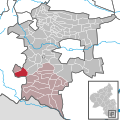 Vorderweidenthal in SÜW.svg 254 × 254; 483 KB
-
 Vorderweidenthal Winter.JPG 2 848 × 2 136; 2,95 MB
-
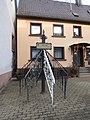
 Vorderweidenthal-10-Lindelbrunnstr-2019-gje.jpg 5 184 × 2 980; 2,69 MB
-
 Vorderweidenthal-12-Lindelbrunnstr-2019-gje.jpg 3 456 × 3 176; 1,86 MB
-
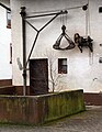
 Vorderweidenthal-16-Schmiede Rudi Hoff-2019-gje.jpg 3 456 × 4 290; 2 MB
-
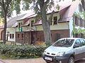
 Vorderweidenthal-18-Hauptstr-Bauernhof-2019-gje.jpg 5 184 × 3 456; 3,6 MB
-
 Vorderweidenthal-20-Hauptstr-Bauernhof-2019-gje.jpg 3 456 × 4 446; 3,33 MB


